As we drove north, we approached Stanley, the northern gateway to the Sawtooths and, as we’ve found out by reading the weather page of the U.S. Today, sometimes the coldest place in the lower 48. But before we got there, we reached the Redfish Lake area, which had a visitors center. We decided to stop in to see if the ranger there had any more information about our planned hike that might be useful to us. There are so many trails through the Sawtooths that it took us a few minutes to clear up what we were planning to do. (“Oh, wow, you want to do that loop!”) But once we got it straightened out, the ranger informed us that the Cramer Divide, which we’d have to traverse, was still under heavy snow and that it had taken one of their expert wilderness rangers a whole day just to get over that pass. Other passes would have several hundred feet of snow to traverse and might be quite difficult – she didn’t know the status of all the passes. But she knew the Cramer Divide was extremely tough.
Hmm. Given that we’d reserved a bed & breakfast in Boise, we probably didn’t have a day to spare to get over Cramer Divide, let alone potentially more hours trudging over other difficult passes. Besides, we don’t have ice axes, which would probably be a requirement. So we set about planning a new trip. The ranger recommended a shorter loop that went by Farley Lake, Toxaway Lake, and Alice Lake. Depending on snow conditions, we might be able to extend it and visit some other lakes, or we could do a separate short backpacking trip out to Sawtooth Lake. This wasn’t the epic Sawtooths loop that we had envisioned, but it would have to do, given the conditions. We had an awesome winter of skiing and snowboarding, but we’re paying for it now as our hiking options are limited due to considerable snowpack remaining well into summer.
One good thing about the new plan was that the trailhead was much closer, and after 10-15 minutes of backtracking south, we were there. Our bags were already packed, so it didn’t take us long to hit the trail.
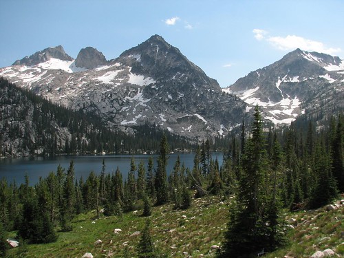
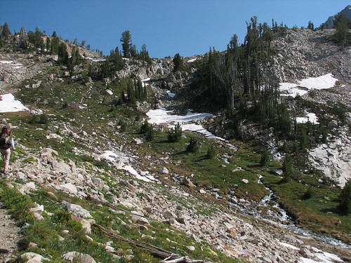
Saturday’s hike was four miles from the trailhead at Pettit Lake to Farley Lake, where we would set up camp. Pettit Lake was quite pretty, but as it turned out, that was just an appetizer.

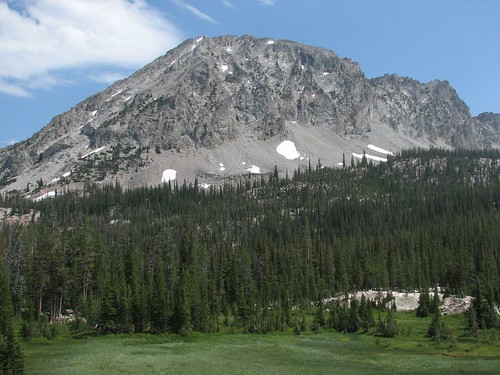
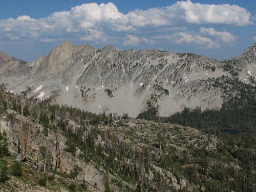
As we hiked up, we got some great mountain views.

Looking back down the valley, we saw the next range of mountains to the east – the White Cloud Mountains, perhaps, also renowned as a fantastic backpacking destination.

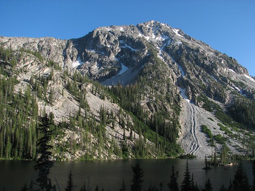
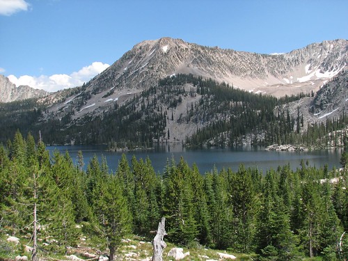
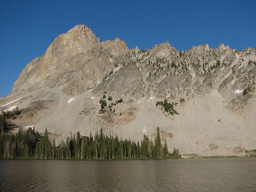
We set up camp above Farley Lake, which had some lovely treed islands and a gorgeous mountain backdrop.
The rest of the evening was one mishap after another. Our spaghetti dinner got dropped, and much of it had to be scraped into our garbage bag to be carried out. We had limited options for where to hang our bear bags, and the dead branch that we chose turned out not to be up to the task of holding our six days of food – it broke off as we were hefting the bag, and Sarah went flying as the resistance to her hoisting suddenly disappeared. She was OK, so we chose a new branch and started again. This time, our rope broke, and our bear bags dropped and ripped. All the while, we were swatting mosquitoes, which had been furiously pestering us all evening. It was mosquito heaven and hiker hell. Finally, we got the bag hoisted and rushed into our tent to hide from the bugs. Not exactly the birthday Sarah had planned – hopefully, the bed & breakfast would make for a nice “Sarah’s birthday observed” in a few days.
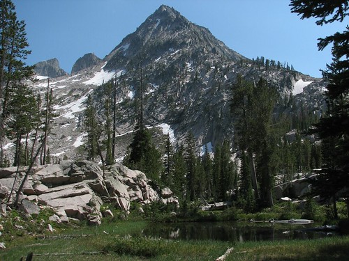
Our original plan (well, the original plan after choosing our revised hiking loop) was to continue to Edith, Edna, and Spangle Lakes if snow on the passes permitted. However, the next day, we got a slow start as Brian’s knee was bothering him. Eventually, we got moving though we decided to stick to the loop with no detours. As we continued to hike, we were treated to more mountain and lake views.
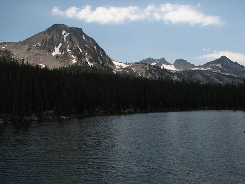
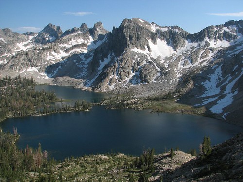
Today’s revised destination was Alice Lake, eight miles away and recommended by the ranger as a great place to camp. But before that, we reached Toxaway Lake, yet another gorgeous mountain lake.
Here’s Sarah, happy that Brian’s knee has held up well enough that we’ve made it this far, even though it’s almost three in the afternoon already.

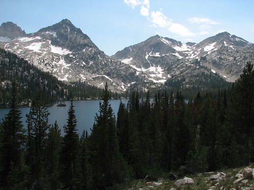
We got more pretty views of Toxaway as we hiked around the lake.
In addition to the lakes, there were lots of little marshy areas, which were quite pretty but also helped account for the unfortunate abundance of mosquitoes.
At the end of the lake, the trail crossed some rocks that afforded a nice view looking back at Toxaway, with the next mountain range to the east down the valley.
Shortly after we left the lake, we found a bunch of goat or sheep fur.
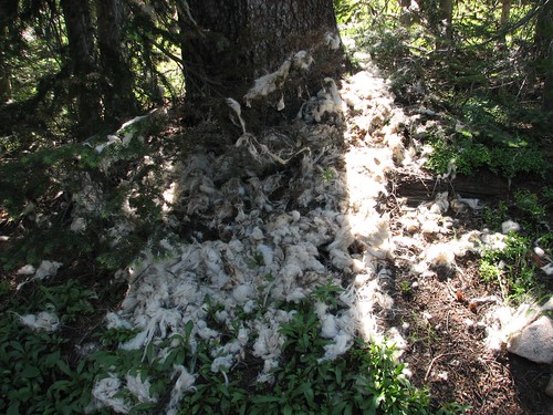
At first, we thought that an animal had shed its coat, but then we saw a few scattered bones and realized that this animal had lost more than its coat.
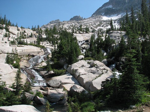
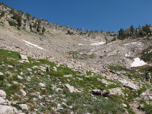
From Toxaway Lake, the trail began a steady climb of just over 1000 feet to a pass at 9390 feet. On the way up, we were treated to some nice views of meltwater cascading down the rocks.
At 8779 feet, we hit yet another pretty lake.
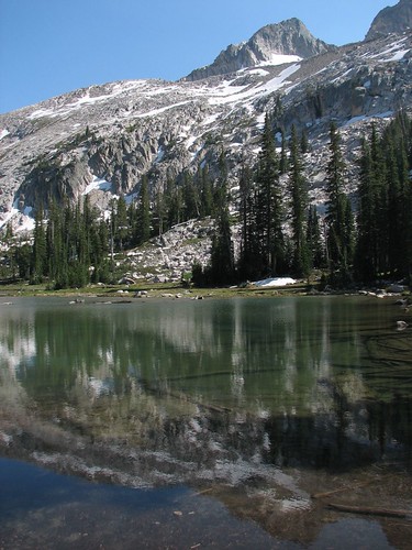
It’s a testament to the enormous number of amazing lakes in this area that this one wasn’t even named on our map. The only place that we’ve experienced that’s comparable it in terms of sheer number and beauty of mountain lakes is the Enchantment Lakes near Leavenworth, Washington. And that’s high praise – the Enchantments are one of our absolute favorite places in the world to backpack.
From the lake, we turned our sights upward and found more pretty cascades.
And the pass was in sight – it didn’t look so far away now. It also didn’t look especially snow-covered, so it should be an easy traverse.
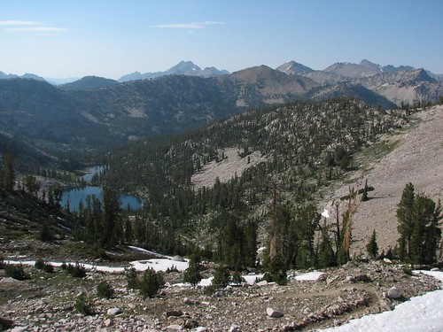
Near the top, we got a good overview of the nameless lake and some of the Sawtooths beyond.
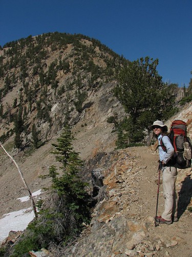
Here’s Sarah, happy to finally be nearing the pass.
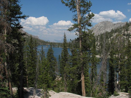
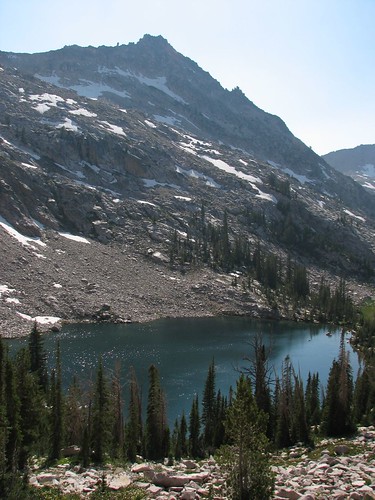
And then, suddenly, we were at the top. Starting down the other side of the pass, we got a fabulous view of Twin Lakes.

We took a break for a snack. Here’s Sarah, very happy that the rest of the route would be all downhill.

We kept the break short, though, as the mosquitoes were vicious even atop the mountain pass.
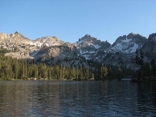
We hiked down toward Twin Lakes and took a few more mountain and lake photos.
When we got down to the elevation of Twin Lakes, we reached a junction. One fork of the trail went to Twin Lakes while the other went to Alice Lake, our night’s destination. We left the main trail and found a trail that went right along the lakeshore, where we discovered that quite a few backpackers were already camped. But a bit of looking around yielded one of the most amazing campsites we’ve ever stayed in, with our tent right next to the lake and a great rocky outcrop nearby for our cooking. Here’s the view from the cooking area.

Looking out from the shore by our campsite, we had more amazing views.
Unfortunately, as the sun went down, the mosquitoes were almost as bad here as they’d been at Farley Lake, so we headed to the tent after cooking, eating, and hanging the bear bag, which, thankfully, were uneventful tonight.
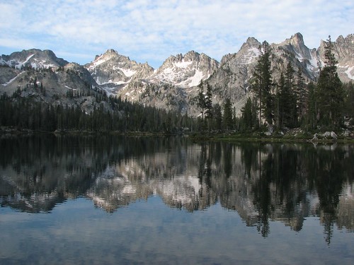
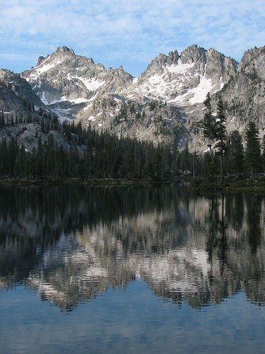
The next morning, we awoke to some clouds and a very calm lake that reflected the mountains.
Our campsite was so pretty that we decided to just hang out in our tent and read for a while. Around mid-morning, when we decided to pack up, the clouds were looking somewhat more foreboding.

We were glad that we had a short hike out to the trailhead today, since afternoons storms looked possible. Given Brian’s knee pain combined with the infuriating mosquitoes, we were glad we had decided against extending our trip.
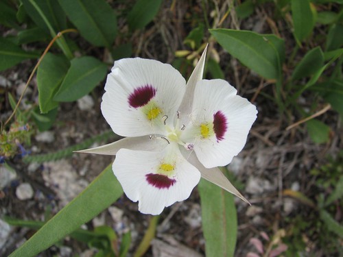
The hike out was mosquito-ridden but otherwise uneventful. We saw some pretty flowers that we’d never seen before, and Brian stopped for a picture.
After a couple hours of hiking, we were back at the trailhead. We agreed that the Sawtooths were one of the most beautiful places we’d ever hiked – the mountain and lake views were just constantly amazing. But the mosquitoes had done their best to drive us out of our minds, and now, even more than after Grand Teton, we needed a night indoors.
We headed to the public library in Stanley for internet access and found a Hotwire deal on a room at the Boise airport Holiday Inn. Air conditioning, cable TV, a pool and hot tub … perfect! On to Boise!
2 comments:
That beautiful flower is a sego lily, which is very common in the Sawtooths. It's what used in my wedding, actually! (I got married
in the Sawtooths).
A wedding in the Sawtooths?! Awesome! Thanks for the ID on the flower!
Post a Comment