We stopped in at the ranger station in McCloud to inquire about hiking and camping. The ranger told us that climbing Shasta is really difficult in August due to crumbly rock – May and June are better because you can hike on snow. There are a lot of different routes up the mountain, varying in difficulty, but the easiest routes on the southwest side of the mountain probably wouldn’t require ice axes or crampons, although a helmet to protect us from falling rock could be useful. It’s also an extremely strenuous hike – it’s a 7000’ climb from the trailhead to the summit. We decided to pass.
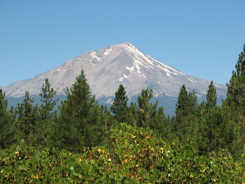
Instead, we decided hiked up Black Butte, a little volcanic butte to the west of Lassen. We drove through Mt. Shasta on the way, a cute little touristy town with amazing views, and then made our way to the trailhead. We were glad we’d stopped at the ranger station – we’d never have found our way to the trailhead without the one-page hike description that the ranger had given us. We arrived to find that we were the only ones there. We loaded up our backpacks and set out.
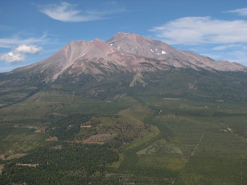
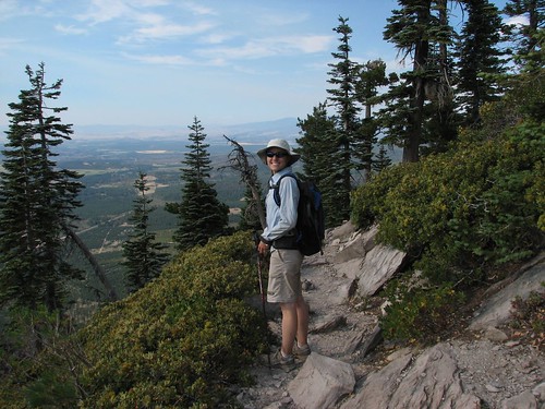
Before too long, we got a really nice view of Shasta, and Shastina, just to the left of the main mountain. The mountain looked totally different from this side, with almost no snow clinging to it.
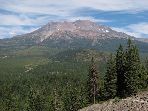
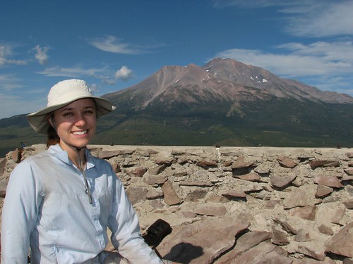
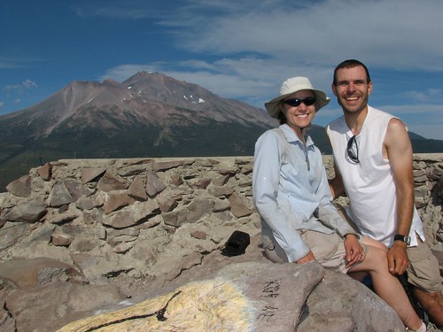
The hike was only about 2.5 miles one-way, so before we knew it, we were at the summit. We carefully hopped across some rocks at the top to reach a square stone shelter that protected us from the howling wind while we snacked and enjoyed the views.
Then we headed back down.
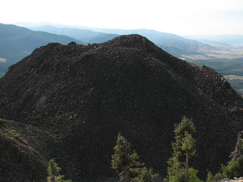
As we hiked down, we were walking along this huge mound of volcanic rock.
Back at the trailhead, we headed to Castle Crags State Park, where we camped for the evening. The campground was right next to I-5 and therefore extremely noisy. But it did have coin-operated showers ($0.50 for five minutes), so we gratefully washed off the sweat and dirt before heading to bed.
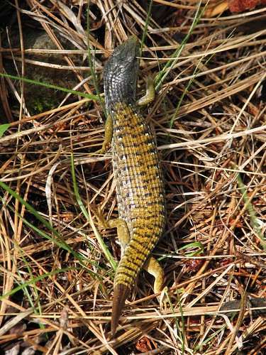
The next day, we hiked some of the trails in the park. We started by hiking out on the Flume Trail, meeting a large lizard along the way.
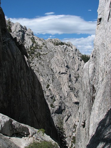
Then we joined up with the Pacific Crest Trail and left Castle Crags State Park for the Castle Crags Wilderness. We started to get some views of the granite formations that the area is known for.
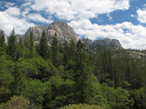
The PCT took us back near the trailhead, but rather than ending our hike, we decided to hike out on the Crags Trail. We’d seen very few people on the Flume Trail or the PCT, but now we started to see quite a few – apparently, this trail was more popular. As we neared the Indian Spring, the views of the Crags started to open up.
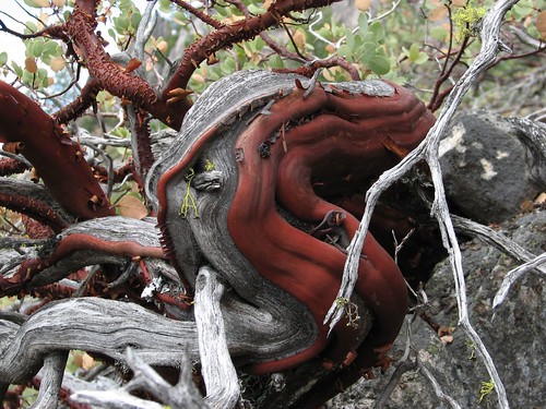
The area was full of manzanita, this neat shrub where new red bark grows right over the gray dead bark.
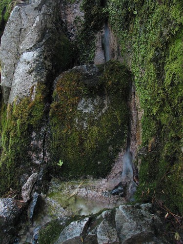
Then we reached the spring. The only water source around, it really looks like water is pouring straight out from cracks in the rock.
The spring seemed to be a natural place to turn around, but we met a kind of crazy-seeming hiker who said he had been camping out in the wilderness for a week and his ride had ditched him and he needed a ride back to some town we’d never heard of in Oregon. We told him we weren’t headed that way, and he accepted that. But he did say that we had to hike up the trail to Castle Dome, another 1.5 miles up. You can climb up on top of the dome, he said, without any special equipment, and the 360-degree views are incredible. But don’t do it if it’s wet – that would be pretty crazy.
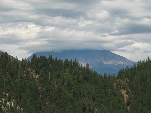
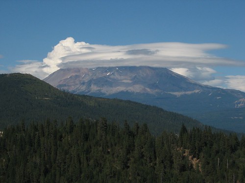
So we took his advice and continued hiking. As we gained elevation, we would have gotten good views of Shasta, except for the clouds that dominated the sky in that direction.
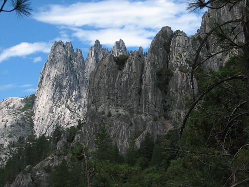
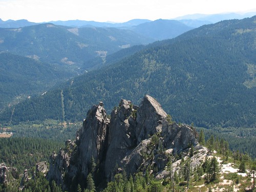
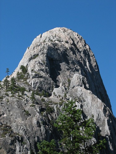
After a bit more climbing, we got our first good view of the dome.
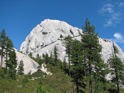
It looked awfully steep to climb without ropes, but we wouldn’t be able to tell for sure until we got closer. We switchbacked up through some vegetation right up to the base of the dome, where we got more good craggy views.
Brian saw a route that switchbacked up cracks in the granite to about halfway up the dome, to a knob adjacent to the main dome. It turned out to be a bit sketchy in places, but the rough granite made for good traction, and he made it safely up to the knob, which afforded even better views of the Crags.
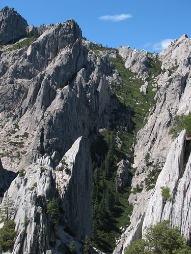
After taking a few photos, Brian searched for a route to go the rest of the way to the top of the dome. But the dome turned out to be comprised of these sheer fins that didn’t seem at all safe to climb, so he headed back down. Maybe the crazed hiker had meant 270-degree views, rather than 360 – the views from the knob were still pretty great.
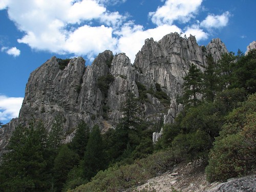
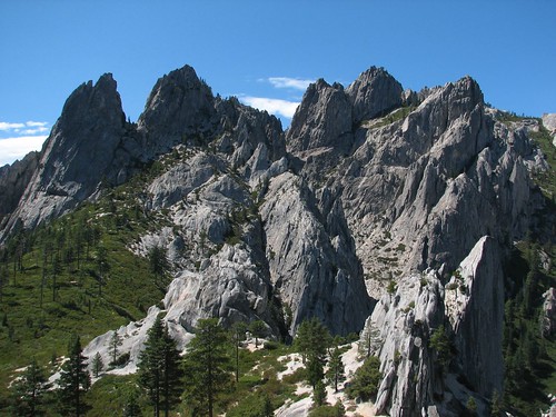
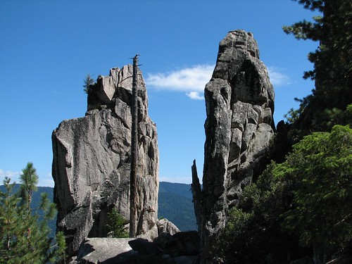
On the way back down the trail, we passed these two impressive side-by-side granite monoliths.
The clouds cleared up a bit and Mt. Shasta almost came out for us, but she kept a cluster of clouds gathered around her summit.
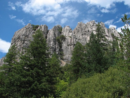
We took one last look back at Castle Dome before heading back down.
Next we would head to Lassen Volcanic National Park!
No comments:
Post a Comment