It was getting late by the time we left Redding, and we weren’t sure if there would be any campsites in Lassen, so we found a campground at MacCumber Reservoir, just outside the park. We set up camp in the dark and went to bed.
The next morning, we drove into Lassen. As it turns out, Lassen is a pretty remote, undeveloped park, even though much of the minimal development – the entire road, some campgrounds and picnic areas – seemed to be under construction this summer. We wanted to camp at Summit Lake, which is centrally located, so we headed out there. After driving around for a while, we finally found the E loop in the South Campground, which is for tents only. It was pretty full, and many of the unoccupied sites were pretty unappealing because they were so small and close to neighbors. But after searching for a while, we found a spacious site whose occupants were leaving soon, so we took that. When they left, we set up camp and hung out for a while, reading and playing two or three games of Scrabble.
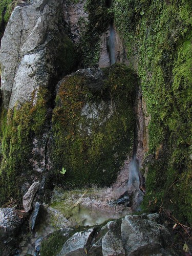
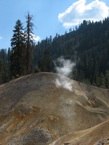
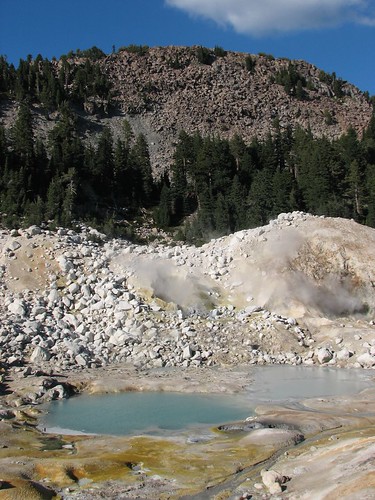
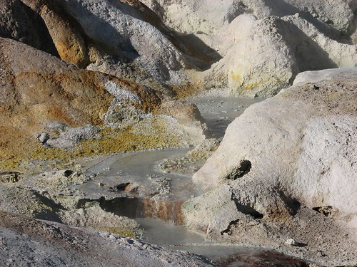
Later in the afternoon, we set out on a scenic drive toward the southwest corner of the park. Lassen has some geothermal areas similar to Yellowstone’s, although generally on a smaller scale. Sulphur Works is the most accessible of these, right at the side of the road. It doesn’t photograph especially well, partly because a chain link fence separates visitors from the main thermal feature, this mud pot that makes an impressive whomping sound.
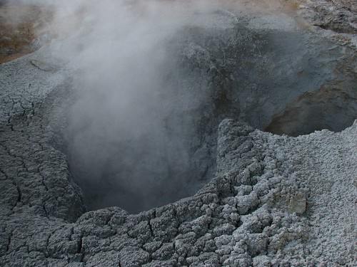
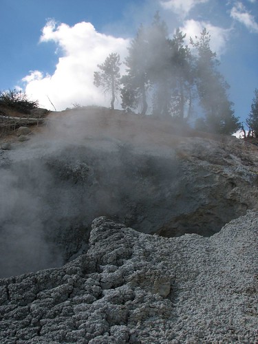
Something else nearby was smoking.
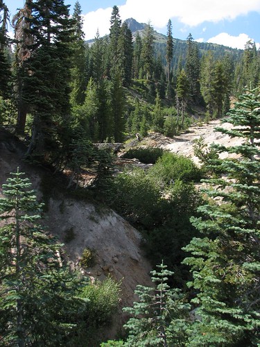
And there were some pretty forested areas, too, where Sarah saw deer. She kept trying to point them out to Brian, but every time Brian would look, they’d be gone. We still debate whether they were just a hallucination.
Next, we stopped at the park’s main visitors center, but like much else in the park, it was under construction and closed. So we headed back toward the campground, stopping at scenic pullouts along the way.
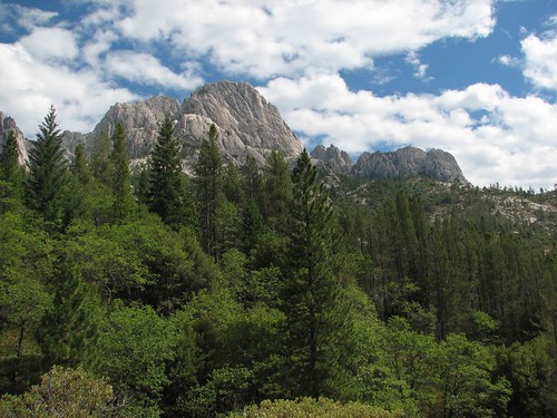
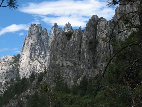
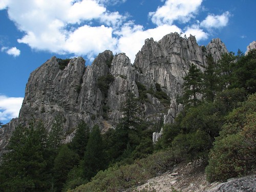
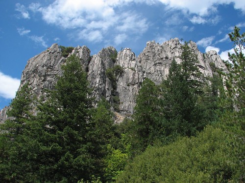
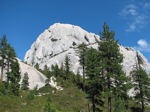
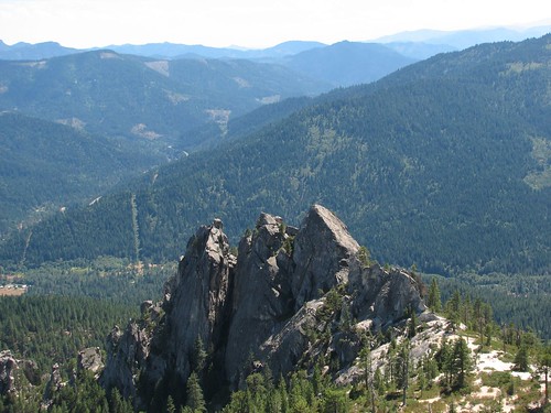
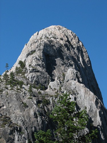
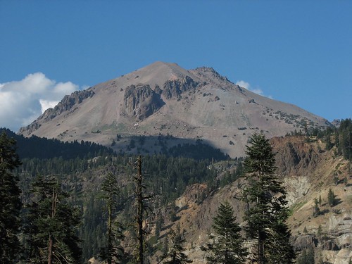
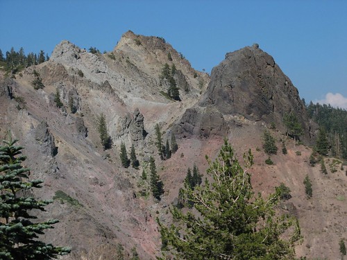
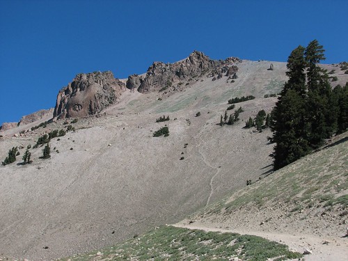
Here’s Lassen Peak.
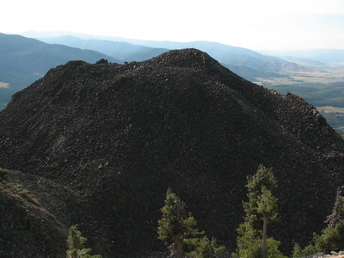
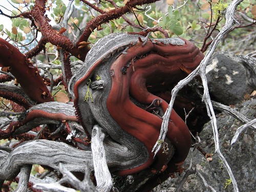
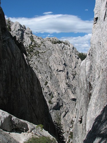
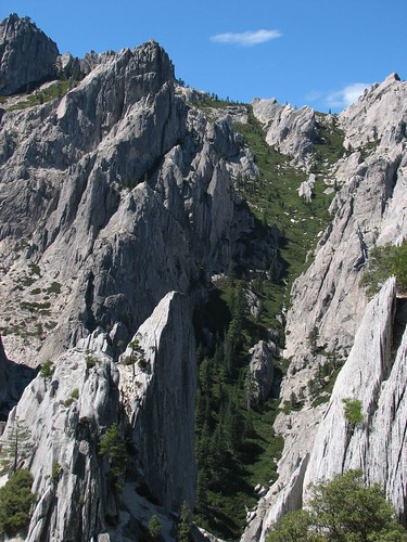
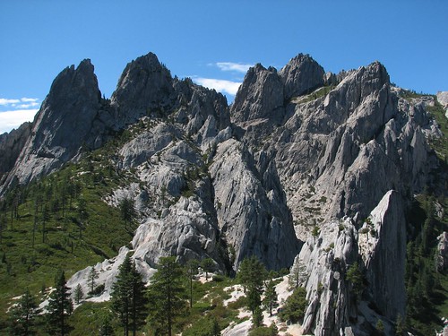
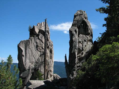
And some other interesting volcanic rock formations.

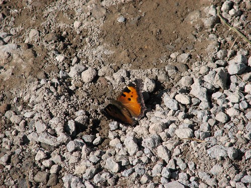
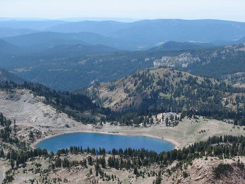
We stopped at Emerald Lake.

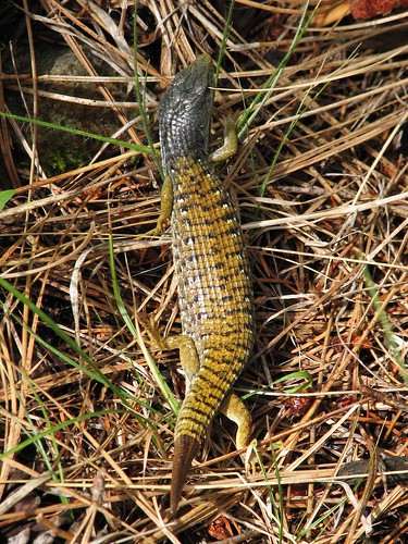
A butterfly posed for us beside the lake.
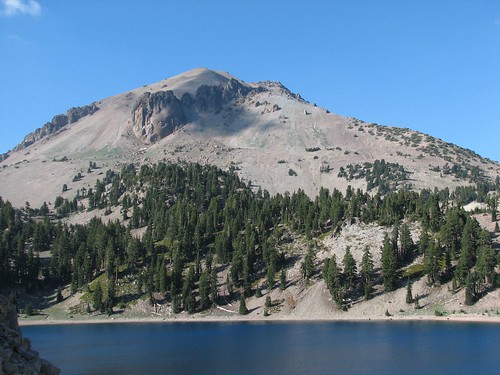
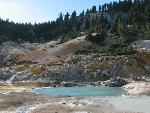
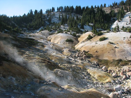
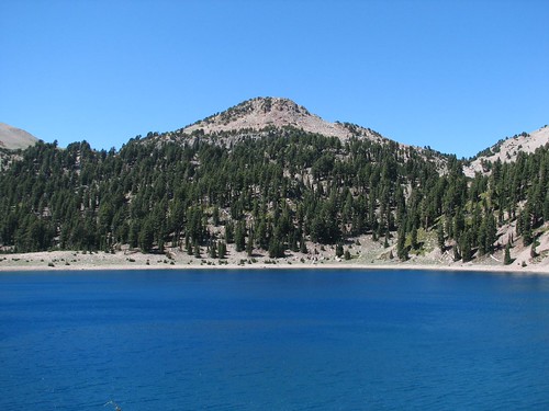
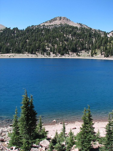
Then we decided to hike to Bumpass Hell, considered the most spectacular of the park’s geothermal areas. As we hiked up, we got a nice view of Lassen Peak with Lake Helen in the foreground.
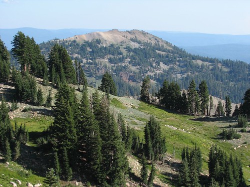
The trail took us up to a ridge top.
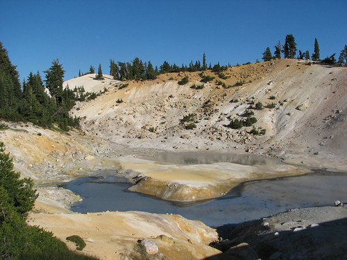
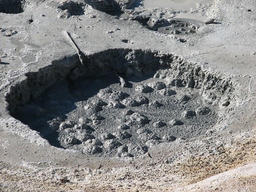
Then we descended into Bumpass Hell. Bumpass Hell, believe it or not is named after a person, Mr. Bumpass. Bumpass was a cowboy working in the Lassen area who discovered the thermal area that now bears his name. There were no park boardwalks or chain-link fences at that time to protect the visitors, so Bumpass walked right out into the thermal area, broke through the thin crust, and scalded his leg in a mud pot. He did it again on a later visit, and this time his leg had to be amputated. He had described the area as “hell” to his friends, so now it’s called Bumpass Hell.
The area has beautiful pools in blue and green…
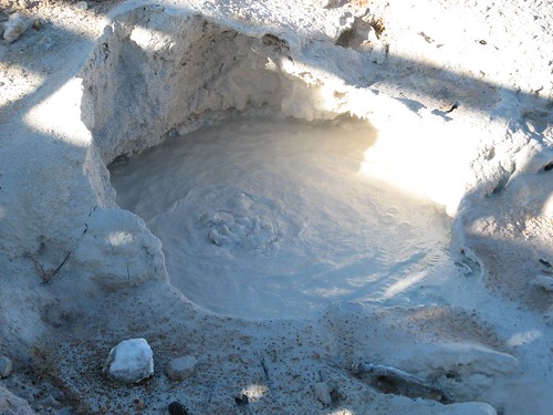
Bubbling mud pots…
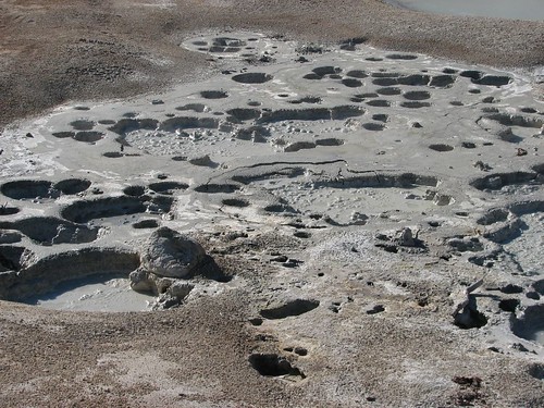
And steam everywhere…
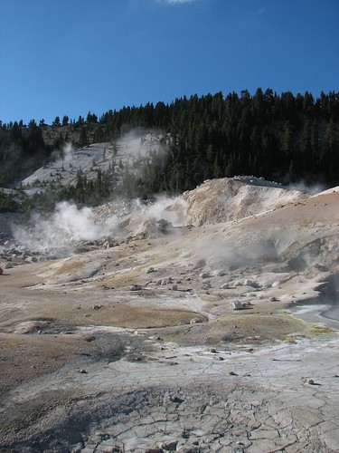
Sulfurous and sulfuric acid have turned the rock yellow and orange.
After exploring Bumpass Hell, we retraced our steps back to the trailhead. Brian ran into a protruding tree branch on the way and got a nasty gash over his rib cage, but it was just a flesh wound.
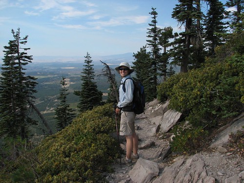
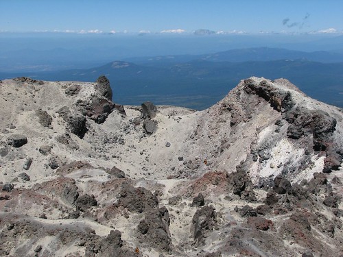
The next day, we planned to hike to the top of Lassen Peak. It’s not an especially difficult hike – 2.5 miles each way, with 2000 feet of elevation gain. Still, it looked daunting from the bottom.
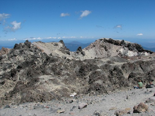
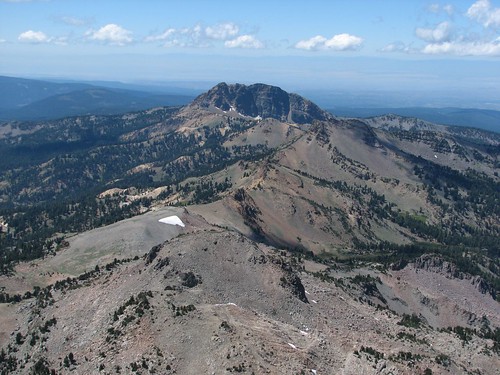
We reached the top without much difficulty, though, and enjoyed views of the crater.
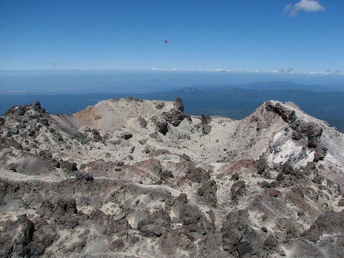
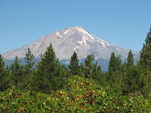
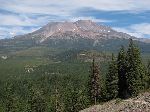
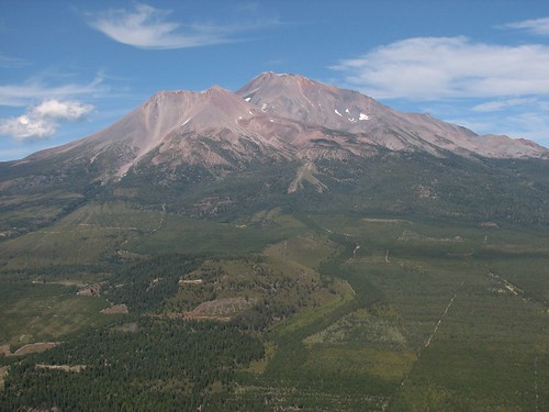
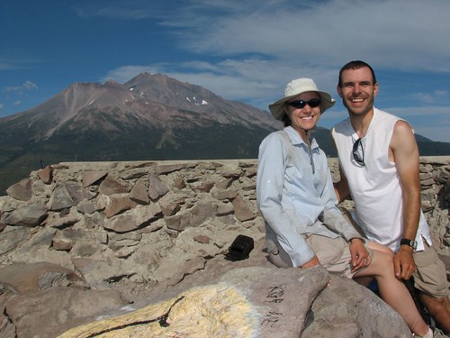
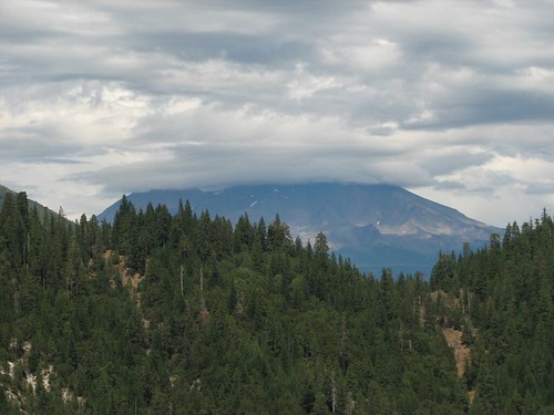
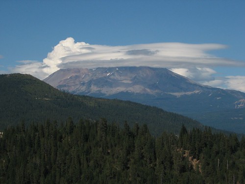
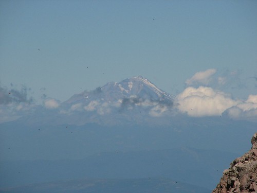
There’s Mt. Shasta.
All the little specks in the picture are butterflies, similar to the one pictured earlier. There were hundreds, maybe even thousands of butterflies flittering around the summit, which was all the more amazing given that the wind was about enough to blow us over – it didn’t seem especially hospitable for butterflies.
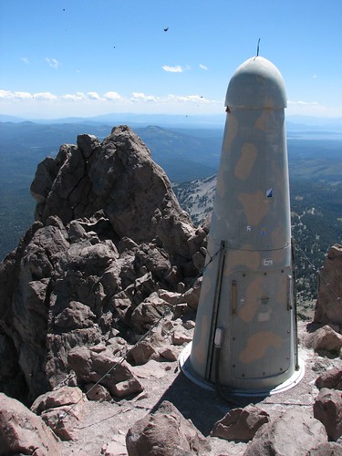
This odd Cold War-looking thing was also at the summit. We’re still not sure what it was.
It was early afternoon when we headed down and the wind had really picked up. On the hike down, it was sometimes all we could do to keep our balance. We took a few pictures on the way down, but mostly hustled to get out of the wind.
By now it was time to eat, so we drove a short distance to Lake Helen, where we cooked lunch at a picnic table on the lakeshore.

On Saturday, we just kind of lazed around camp. We listened to baseball on the satellite radio (go Cubs!), played some more Scrabble, and did a lot of reading. We had discovered back in Lava Beds that the fluid in Caroline’s coolant reservoir seemed to be low and that it seemed to be leaking out – green fluid under the hood and below the car is a pretty telltale sign. But it didn’t seem to be a fast leak, so we weren’t especially concerned. When we checked today, though, the reservoir was completely empty, and the coolant in the radiator itself seemed to be low, too. Uh oh.
We’d be heading to Reno the next day, so we could get Caroline an appointment with a mechanic, but now we were concerned that we might not even make it that far without the engine overheating. So we read the owner’s manual, which told us to only use genuine Honda coolant, but in a pinch, a mixture of half antifreeze and half water will work, too, so long as the antifreeze is high-quality, made for aluminum engines. We had no idea where we’d get antifreeze in the middle of Lassen Volcanic National Park, but surely we couldn’t be the first ones to have had this problem, so we went to the campground host’s campsite. When we asked where we might find coolant, she said sternly, “Well, no one’s going to go out and get coolant for you.” That wasn’t what we asked – we asked where we’d get coolant. She didn’t seem to want to help us with that, though – she said that if an aluminum engine overheats, it’s fried, so all she could do was call AAA to tow us to Redding. Well, that was in the opposite direction from Reno, and we hadn’t had any problems with the engine temperature, so we thought we’d take our chances. Later we found out from Sarah’s dad that using plain water is fine, as long as it’s not going to have a chance to freeze.
So the next morning, we filled up all of our water bottles, crossed our fingers, and headed toward Reno. Our plan was to hike near Lake Tahoe and then check into a casino hotel for a few days.