
Next was a quick walk to Clearwater Falls.
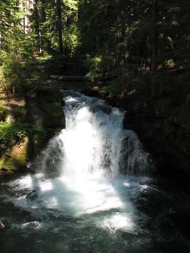
And Whitehorse Falls:
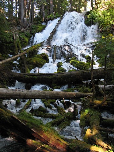
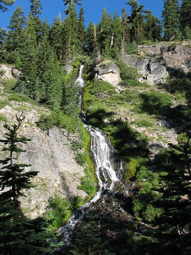
After Whitehorse Falls, we drove to Watson Falls. We parked and tromped a pretty steep half mile uphill before we finally found the falls. It was the most scenic yet and definitely worth the hike.
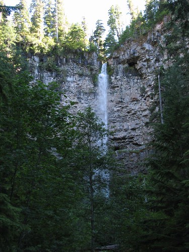
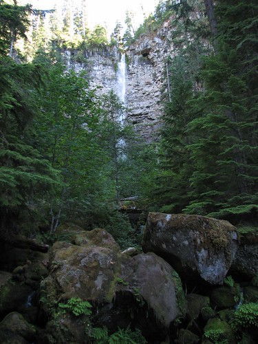
Our last stop was for Toketee Falls, which was touted as the most scenic waterfall in Oregon by a guidebook we’d read recently. Sadly, when we got there, we found the entrance to the parking lot barricaded. Apparently, winter storms had damaged the trail to the falls.
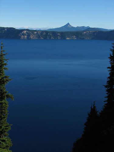
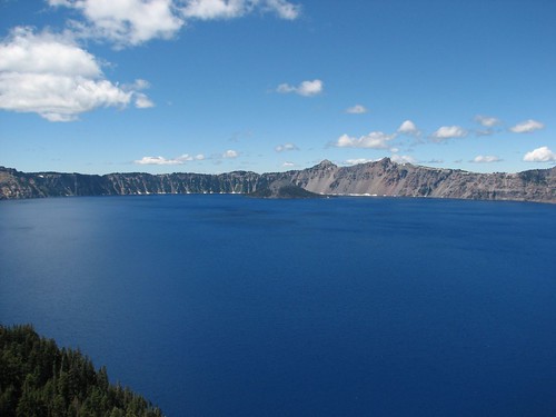
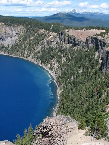
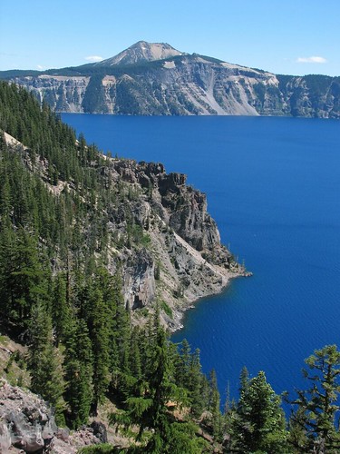
After the failed attempt to see Toketee Falls, we backtracked to the northern Crater Lake National Park entrance. The route to the park’s campgrounds included the western section of the Rim Drive, a 33-mile loop around the lake, so we stopped at a couple of scenic overlooks on the way for photos. The lake is stunning!
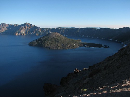
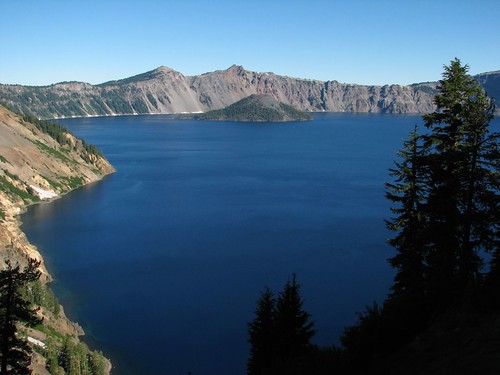
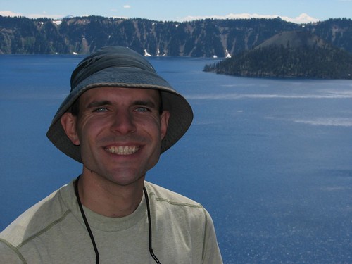
Here’s Sarah posing at Rim Village in front of the lake and Wizard Island.

We took a couple more photos before going into the lodge to inquire about campgrounds and boat tours.
There are two campgrounds in the park – Mazama (named after the volcano whose eruption created Crater Lake) and Lost Creek. Mazama is a large campground operated by concessionaire Xanterra whereas Lost Creek is a small tent-only campground. Lost Creek sounded more appealing, but a park operator told us that all but four sites were occupied as of a couple hours ago. She assured us that Lost Creek rarely fills, though, so we decided to drive out there anyway. That turned out to be a bad idea, as Lost Creek was indeed full by the time we arrived and we were forced to turn around and drive all the way back to Mazama. Bah! That’ll teach us – we should have just stayed at one of the nice campgrounds near the waterfalls on the Umpqua Scenic Highway. After the long wait that’s typical of Xanterra-operated campgrounds, we got a site at Mazama.
On Thursday morning, we were slow to move after our late evening into camp the night before and spent the morning just hanging out at camp. Eventually, we decided to do some sightseeing between Mazama and Rim Village and leave the full Rim Drive for Friday.
We spent a while at the Steel Visitor Center learning about the lake and the park. Crater Lake is an average of five miles in diameter and 1700 feet deep! That makes it the deepest lake in the US and the seventh-deepest in the world (the deepest lake in the world is in Russia and is almost three times as deep as Crater Lake). Because the caldera walls are so steep, Crater Lake has no inlets or outlets. All of the water in the lake is the result of precipitation.
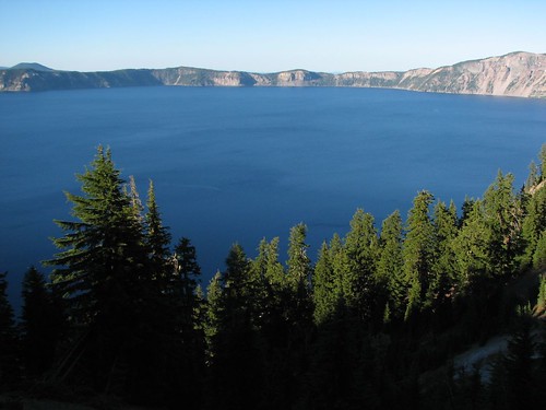
After the visitors center, we went back to the Rim Village area, where we walked around and enjoyed the views some more. Then we set up in the picnic area there to cook dinner.
Friday morning, we woke up at 6 AM to start the Rim Drive so that we’d get the best light for viewing the lake. In reality, it was a little after 7 AM before we’d had breakfast and left the campsite.
Our first stop was Videa Falls.
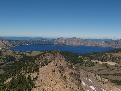
Next, we stopped at the Sun Notch Trail. The end of the short trail had views of Garfield Peak and the lake.
The next stop was the Phantom Ship Overlook.
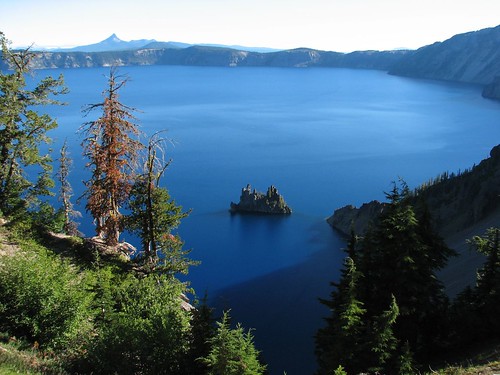
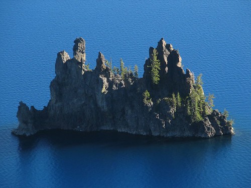
The “Phantom Ship” is actually the oldest exposed rock in the caldera. Though it looks small from the rim, it stands 16 stories high!
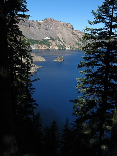
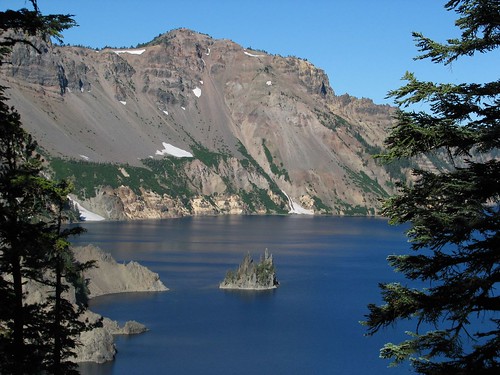
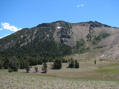
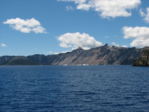
There were more nice views as we continued along to the east side of the lake.
This unusual formation is called the Pumice Castle.
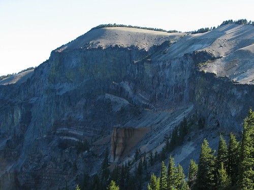
At this point, we reached the trailhead for the hike to Mt. Scott, the highest peak in the park. At the top of the mountain was a small fire lookout.
The hike itself was unremarkable, but the views from the top were unbeatable.
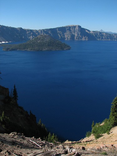
Back at the car, we continued our counter-clockwise tour of the lake, with more stops at more viewpoints.
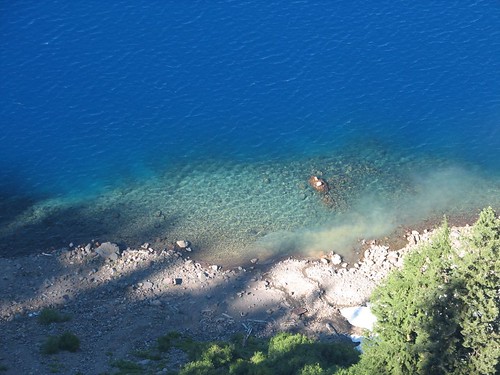
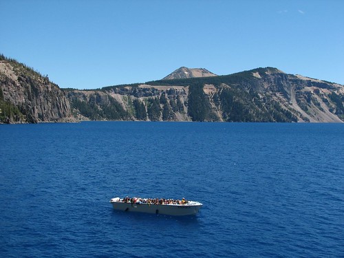
The sides of the crater are so steep that it’s generally not safe to hike down to the lake. In fact, hiking to the lakeshore is only legal in one place, Cleetwood Cove. We decided to hike that trail and found that it was way more crowded than the Mt. Scott trail, since everyone who takes a Crater Lake boat cruise has to hike the Cleetwood Cove trail. The trail isn’t a cakewalk. It descends 700’ in about a mile, and many of the people hiking back up the trail after their boat cruises looked like they hadn’t quite known what they were getting themselves into.
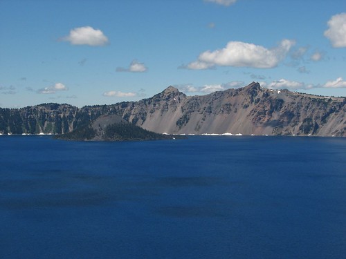
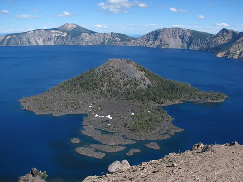
Here are views of Wizard Island from within the caldera:
Here’s the tour boat full of passengers:
After our hike to Cleetwood Cove, we took yet more photos at various overlooks.
Finally, in the afternoon we settled down at a picnic area overlooking Wizard Island and hung out for a while. It was the best view of the island we’d had yet.
Back at the campground that evening, Sarah ran into a couple of backpackers. It turns out that they were thru-hiking the Pacific Crest Trail – the 2600-mile trail that runs from the Mexico-California border up to the Washington-Canada. It was Friday evening and the campground was full, so we invited them to share our site. They entertained us with stories of their trips and tips on how to save weight while backpacking. As you might expect, they were both quite thin from so much walking, though one of the guys said he’d been hanging out at Crater Lake for a day and a half now and eaten at the all-you-can-eat buffet four times already!
Saturday morning, we packed up early because finding a campsite on the weekend during the summer has been a pain. We were driving just a bit south to the Sky Lakes Wilderness area. After some driving in circles checking campsite tags to find out what was available and talking to a grouchy campground host, we found a site at Sunset Campground on Lake of the Woods.
With a campsite secured for the night, we drove to the Coldwater Trailhead to hike the Sky Lakes Trail. The PCT hikers had warned us that the bugs in the area were bad, but we had no idea how bad they’d be. When we parked and opened the car doors, an enormous cloud of mosquitoes swarmed into the car. Ugh! After about five minutes of hiking in the swarm, we conceded this battle to the mosquitoes and turned around. The Sky Lakes are supposed to be beautiful but they’d had to wait for another, less buggy day.
Back at the campground, we had a relaxing day hanging out and resting before heading back to California on Sunday morning.
No comments:
Post a Comment