Monday, August 27, 2007

Indian Bar at Mt. Rainier

Indian Bar is our favorite of all the backcountry campgrounds we've stayed at. It's a gorgeous setting, right on the Ohanapecosh River, with countless waterfalls streaming down the mountainside upriver, creating a stunning backdrop. Because it's a popular and small campground, we make our reservation each year in the spring to make sure we get a spot.

We'd been there two or three times already, always on an in-and-out weekend trip – hike in to Indian Bar, spend the afternoon and evening enjoying the amazing scenery, hike out and drive home. This time we were going to see more – we were going to start on a Friday and do a loop hike, taking the Wonderland Trail down to Indian Bar for one night, and then continuing to hike south to the southeast entrance to the park (Stevens Canyon), then back up the Eastside Trail to Deer Creek Camp for a night, and then out.

Because of the flood damage to Mt. Rainier last November, I called the Ohanapecosh Ranger Station on Thursday to make sure our hike was doable. The ranger told me that two bridges were out, one on either side of Deer Creek Camp, and both rivers were unfordable. Deer Creek Camp was inaccessible – how had I managed to get a reservation to stay there anyway? So much for that plan. So I improvised and asked if we could change the second night of our reservation to Indian Bar. I didn't have much hope, knowing how popular the campground is, but lo and behold, she was able to reserve it for me for Saturday. So instead of the loop hike, we'd do our standard in-and-out hike, with an extra day to spend at Indian Bar. As fallback plans go, this was a pretty fantastic one – there aren't too many places in the world I'd rather spend an idle day than at Indian Bar.

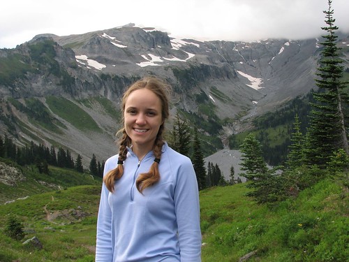
Friday morning, we packed up our stuff and headed out. I decided to try out my new hiking boots – Hi-Tec Altitude IVs to replace my worn out REI Monarch IIIs. It's never a wise choice to break in a brand-new pair of boots on a 20-mile backpacking trip, but excitement about trying out new gear won out over better judgment.

We picked up our permit close to 1:00, figuring this would leave us just enough time to get to Indian Bar, set up camp, and eat dinner before dark. At the wilderness center, the ranger mentioned a hairy creek crossing – a bridge was out, and while the creek was crossable most of the time, late in the afternoon on a hot day, the water tended to run high, making the crossing dangerous. He recommended crossing early in the day. Well, so much for that idea – it was already afternoon, and we wouldn't be hitting the creek until about 4:00. We'd just have to see what it looked like when we got there.

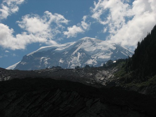
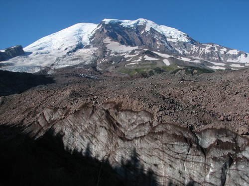
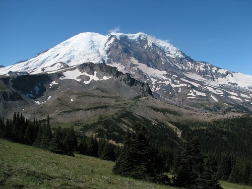
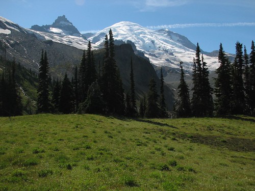
The first few miles of the trail are a superhighway – wide and smooth, and well-traveled with dayhikers. After a couple of miles of forested trail along Fryingpan Creek, the views started to open up, and then at Summerland, a popular dayhike destination, the views were stunning. It was a beautiful day – bright blue sky with just a few wispy clouds, jets leaving trails that stayed in the sky for ages, indicating perfect stillness in the stratosphere. Mt. Rainier was in full view:

IMG_8981

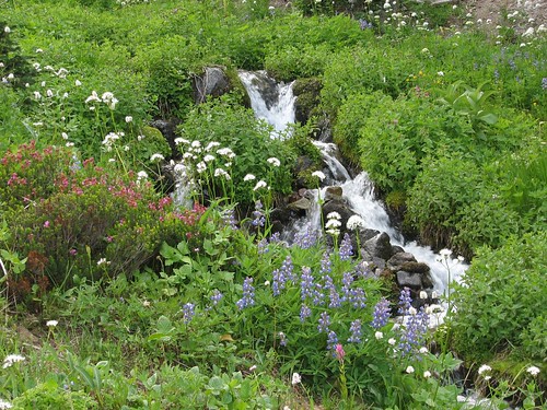
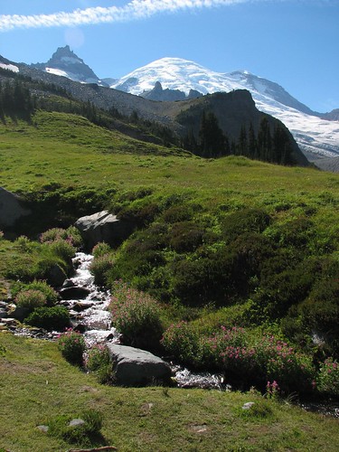
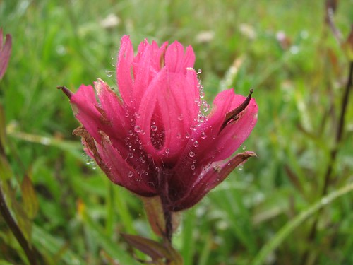
Past Summerland, we traveled up a creek with pink wildflowers on either side. Our wildflower guide says they're Lewis monkeyflowers:

IMG_8984

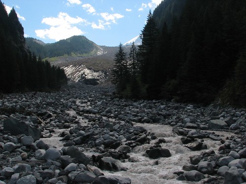
As we got past Summerland, we ran into several groups of hikers on their way back down. Two of them warned us about the creek crossing – one group, in fact, had backcountry permits for Indian Bar for that night, but had turned back because they couldn't get across the creek. How sad to cut short a trip to Indian Bar! Now we started to get a little worried. A few minutes further along the trail, we saw the creek. It wasn't wide, but too wide to jump across, and there just weren't any obvious places to rock-hop across. It seemed fordable, but the water was running awfully fast. We spent a few minutes walking around, trying to find the best place to rock-hop across, hoping we wouldn't have to try to ford.

Fortunately for us, a dayhiking family of four was stuck at the crossing and had been for some time – they'd crossed in one direction in the morning, and now were trying to get back across with the water running much higher in the afternoon. The two kids had made it across just fine, but the parents were stuck on the far side. The trail seemed to lead to an obvious rock path through the creek, but right in the middle, the water was tumbling over the rocks with such force that it didn't seem safe to cross using the path.

We asked the younger of the kids where he had gotten across, and he said he didn't know – he'd just jumped. Not very helpful. The older of the kids then came up to me. She said that she'd found an easier spot to cross just a bit downriver and walked me to it. The creek forked there, and the first fork was easy to cross. The second fork had two rocks spaced pretty far apart, but we made it across and thanked the girl for her help.

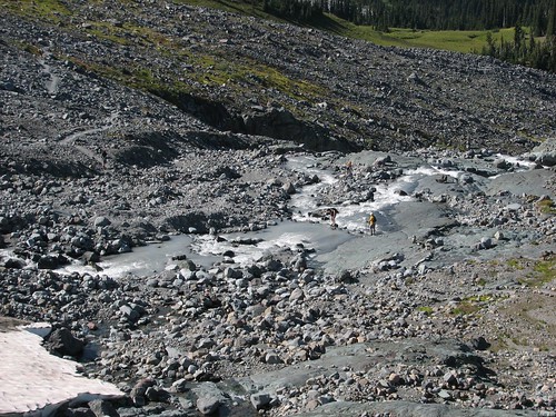
As we hiked out, we took a picture looking back – the parents eventually made it across, using the main rock path:

IMG_8987

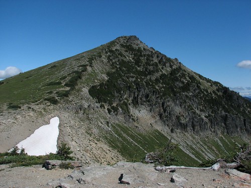
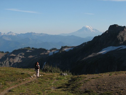
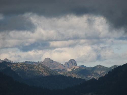
Next came the climb to Panhandle Gap and beyond that, more stunning views to the south. As Sarah hiked ahead, I took this picture, with Mt. Adams off in the distance:

IMG_9021

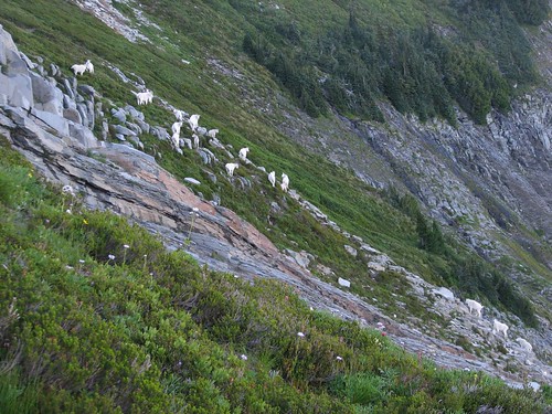
The last 1.5 miles or so are straight down into Indian Bar. You'd think this might be a relief after the 3000 feet of elevation gain from the trailhead to Panhandle Gap, but it's not – the steep descent only serves to make already tired legs even more wobbly. We got a nice break, though, when I heard some rocks clattering to my left. I turned quickly and saw three white shapes walking in the opposite direction, soon blocked from view by a rise. We walked back up the trail a bit to get over the rise and waited, and very soon we were rewarded. The three white shapes multiplied to nearly two dozen – mountain goats, far more sure-footed than we, eschewing the steep trail for the even steeper mountainside:

IMG_9024

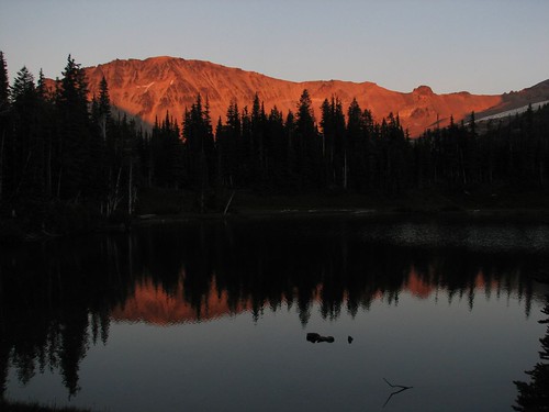
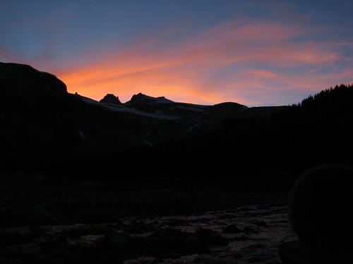
At long last, we made it to the campground. The first and second sites were taken, so we set up camp in #3, then walked down to the river to make dinner. The dinner – soup and some prepackaged Indian food – was delicious after a long day of hiking, and as we were finishing up, the sun went down. We weren't expecting much of a sunset with hardly a cloud in the sky, but some wispy clouds appeared above the mountains up Ohanapecosh River just in time:

IMG_9037

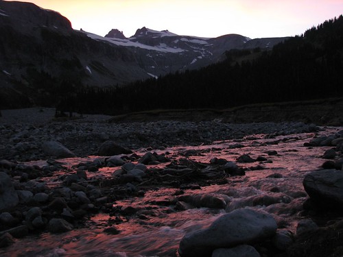
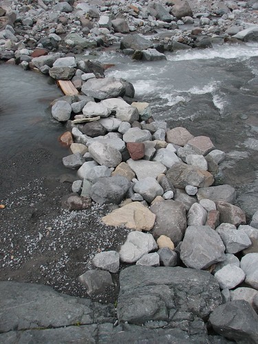
At the same time as the clouds were turning orange, the water turned red:

IMG_9046

As the colors faded, we hung up our food bags on the bear pole and crawled into the tent. After reading a few pages of our books, we fell asleep, tired and content.

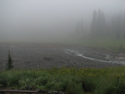
The next morning, we awoke to find the tent soaking wet. When we unzipped, we found that it was raining. After digging out our rain gear and putting it on, we got out of the tent and realized that it wasn't really raining – rather, we were in a cloud. We were completely fogged in and water droplets just seemed to be floating in the air. As we walked, they collected on our clothing, and as we brushed plants on the trail, our pants and boots got soaked.

With another night scheduled at Indian Bar, we didn't have anywhere that we had to go, though. We each had a book to read, and we'd brought a deck of cards. We had plenty of food, and an assortment of hot beverages – coffee, cocoa, cider, and a wide variety of tea bags. And Indian Bar has a great stone shelter, right across the river from the campground – it serves as the group campsite and was unoccupied. What a great day to spend lazing around camp!

We gathered up our stuff and headed to the shelter to make breakfast. From the shelter, we could just barely see the other side of the river:

IMG_9054

And we did what we planned – mostly, we read. I had Nevada Barr's “Blood Lure” with me, about a grizzly bear attack and murder in a national park – Glacier, not Rainier, but still, maybe a little close to home. Good book, though – as a ranger turned mystery writer, Nevada Barr fills her books with details of the wilderness. Sarah had a Carl Hiaasen book – goofy, hilarious, and sans bears.

Whenever we got a little chilly, we'd dip a pot in the creek, boil water, and make another round of beverages. We played a few hands of rummy, chatted, made lunch. Every so often, the fog would tease us, seeming to lift, and then it would roll right back in. But we were content.

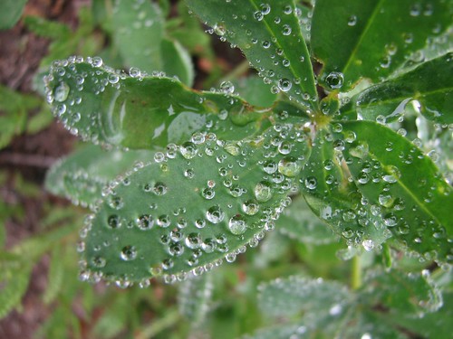
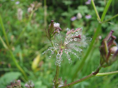
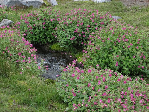
At one point I walked around and took a few pictures. Just as the water clung to our clothes, it clung to the flowers and plants in the meadow around the shelter:

IMG_9066

IMG_9073

IMG_9085

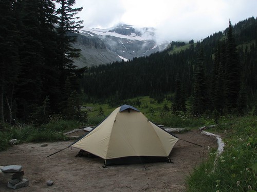
Our one big activity of the day was to move our tent. While all the campsites at Indian Bar are beautiful, #2 is the best – the tent pad is in a clearing, with open views up the river. So we picked up our wet tent, with our stuff still inside, and walked it down the campground trail to site #2. When we were done, this is how it looked:

IMG_9081

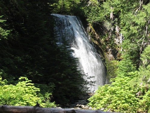
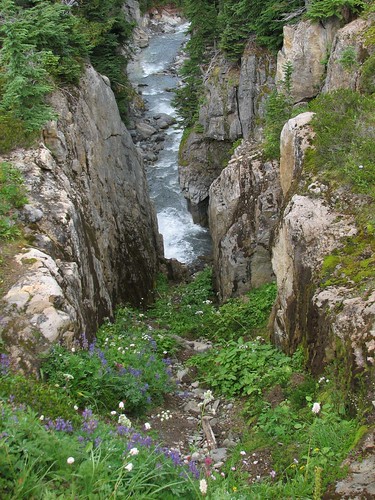
Eventually, around 4:30, it cleared up a bit, and we decided to go for a walk. We walked past Wauhaukaupauken Falls and looked through a field of wildflowers down the narrow gorge at the base of the falls:

IMG_9105

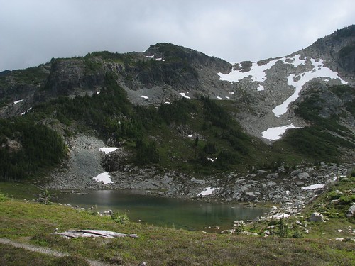
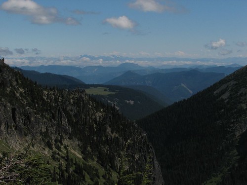
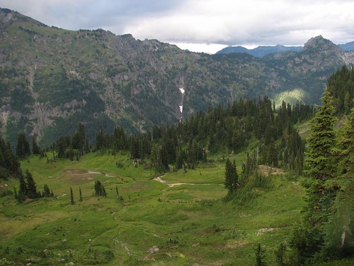
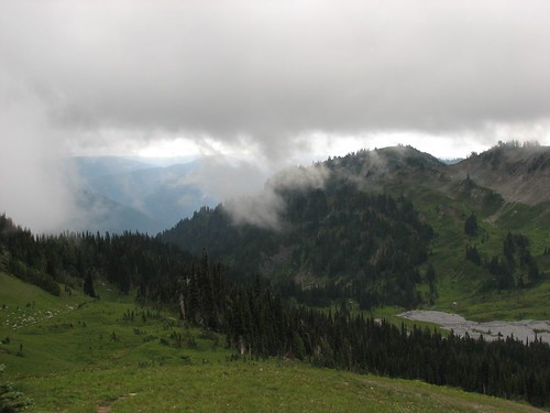
Then we continued on the Wonderland Trail south, up and out of the river valley. The sky was still cloudy, preventing views of Rainier, but the views of surrounding mountains and valleys were unblocked:

IMG_9123

IMG_9131

IMG_9142

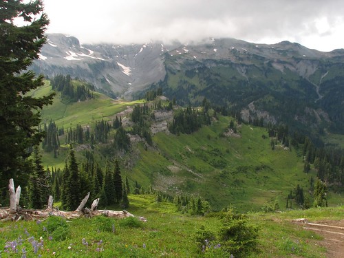
As we headed back, we got some beautiful views down into Indian Bar:

IMG_9148

The next day, we woke again to fog – we weren't actually in a cloud this time, so we'd be able to see the trail ahead of us as we hiked out, but there were no distant views to speak of. It was actually perfect hiking weather – cool and crisp – so the hike out of Indian Bar, which is normally a hot, sweaty, steep slog, 1000 feet straight up, was enjoyable. The brand-new boots were working out well, too – they were waterproof and very comfortable. At one point, well on our way out, we looked back – you can just see Indian Bar and the shelter in the lower right:

IMG_9162

After about two hours, we reached Panhandle Gap and stopped for a snack. We quickly put on our hats, gloves, and multiple layers of fleece – the Gap was completely fogged in, with a stiff breeze blowing. A ranger walked by and we chatted briefly, and after wolfing down snacks, we were quickly on our way.

On the other side of the Gap, the fog wasn't as thick. When we got to the dreaded creek crossing, we found that the stone path across was actually a man-made walkway, several feet wide. It looked entirely different now – it was amazing to think that this had been nearly unpassable just two days earlier:

IMG_9177

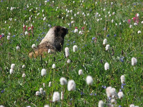
Back at Summerland, we enjoyed the monkeyflowers again:

IMG_9182

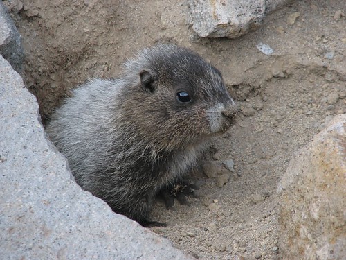
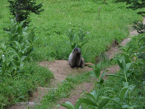
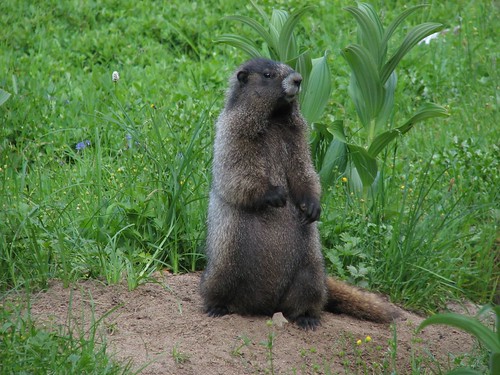
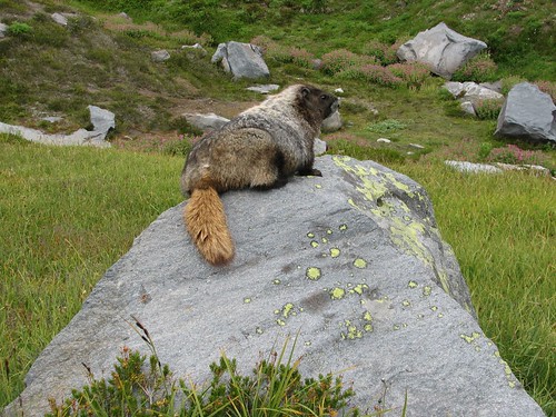
And so did a marmot:

IMG_9189

After another snack break at Summerland, we continued on our way down the trail. We took off some layers – we were out of the clouds now, and the air was warmer. We made good time on the superhighway part of the trail. The whole 9.6-mile hike took us six hours on the way out to Indian Bar on Friday, but only 4.5 on the way back.

As we left, we reflected on the trip. The conditions weren't optimal by most measures, but after seeing Indian Bar several times before in bright sunshine, it was fun to see another side of it, and the foggy Saturday made for a great lazing-around-camp day. It was another wonderful trip to our favorite backcountry campground.

Sunday, August 12, 2007

Northern Loop at Mt. Rainier

Every year when Mt. Rainier backpacking reservations become available in March, we reserve a couple of trips. This is our first one this summer, a route called the Northern Loop.

Most summers, we'll have done a few overnight trips by the time prime Rainier backpacking season rolls around in August, but this year I injured my heel in June playing Ultimate, so it remained to be seen how painful it would be to hike 36 miles in four days, with 9000 feet of elevation gain and loss.

We started the trip on Friday, August 3. There was no rush getting down to Rainier since our first day was the easy one – eight miles, nearly all downhill. So we rolled out of the house around 10 AM and got to the wilderness center by the Sunrise entrance around noon.

On one of our prior trips, to Devil's Dream campground, the ranger said, “Why on earth are you going THERE?”, proceeded to tell us how mosquito-ridden the campground was, and tried to talk us into changing our plans. We persisted, though, and wound up cooking dinner in full rain gear and head nets because the bugs were mauling us otherwise. Ever since then, we pick up our permits with some trepidation for what the rangers will say.

This year there was special reason for concern, since flooding last November had knocked out most of the backcountry bridges and repairs were expected to proceed for most of the summer. But it was all good news at the wilderness center. One of the two rangers on duty had done the same trip the previous weekend and said the trail was in great condition. It's a loop hike and he had done it clockwise – he even commended us for choosing to do it counter-clockwise, saying that the steep switchbacks on the northwest corner of the loop were murder going uphill.

Furthermore, the last bridge on the Wonderland Trail had also just been replaced a day or two before, so now the Wonderland Trail is finally back open for business! Some day, we'll do that one, too...

Having gotten our permits, we proceeded up to the Sunrise Visitor Center, where the hike starts. We got there, took our boots out of the car, and ... mine had no insoles. I've been trying on various pairs of boots, swapping insoles in and out, and hadn't replaced them in this pair. Doh! I put the boots on anyway and tried walking around in them – naturally, I had to lace them up tighter than usual, but they seemed OK. Sarah convinced me, though, that with my recent heel problems, I really should have insoles for a 36-mile hike. So off we went, on a search for insoles.

Now, when you're at Mt. Rainier, you're pretty far away from facilities. Sure, you can get ice cream and flush toilets at the Sunrise Visitor Center, but Superfeet insoles? Uh, no. Sarah said there was a snowboard shop near where the road splits off for the Crystal Mountain ski area, outside the park and a ways back, so we started driving.

It was getting close to 2:00 now, so I started driving faster than I should, passing cars on the two-lane road out of Rainier. I passed a car and then a camper, both of which were doing the speed limit, and then the camper started flashing blue and red lights! It was a cop camper! That was a new one. I pulled over, bummed because I hadn't gotten a ticket in the entire time that I've lived in Washington – almost five years now. The cop came up and gave me a hard time, asking me how old I was, and talking about what an idiot I must be for not knowing that you can't cross on a solid line (I didn't) and you shouldn't pass five cars at once (didn't do that either). By now I was pretty scared – not only was I getting a ticket, but I was getting a brutal expletive-laced harangue in the process! Then the cop said something about me probably not knowing I was passing a sheriff – he'd give me credit for that. Finally, he told me to slow down – here is about where I realized that I might not be getting a ticket. But don't go the speed limit, he told me – he hates it when people go the speed limit in front of him when he's trying to get home. Keep it at 60. And that's what I did. Whew.

To make a long story short, Greenwater, the gateway town to Rainier on this side of the park, had no insoles. We had to go all the way back to Enumclaw, roughly 1.5 hours from the trailhead, where we found some Spenco insoles (no Superfeet) that seemed adequate. After buying those and driving back, it was 4:00 when we were ready to start the hike.

The Sunrise Visitor Center is around 6400 feet, so it's up in the alpine – although it may not be as well known as the Paradise Visitor Center, it's just as beautiful. And there were quite a few visitors today – day hikers going a mile out and back to walk among the wildflowers and catch the views of Rainier. Three rangers were on the trail within a quarter mile of the trailhead, doing a good job guarding the wildflowers from careless trampling. We said hi and passed quickly – we had eight miles to do in four hours.

A bit of orientation to the trail. You hike 2.4 miles out to where the loop starts. At that point, you reach a junction where the Northern Loop trail heads north, and the Wonderland Trail heads west. We were going counterclockwise, so we'd be taking the Northern Loop trail out to the Carbon Glacier area, and then taking the Wonderland Trail back to this junction.

The junction, as it turns out, is just into Berkeley Park, a gorgeous alpine park with views of Rainier, amazing wildflowers, rushing streams running through, and marmots everywhere. As we hiked, I got a little ahead of Sarah and saw a baby marmot at the side of the trail! I stopped to look, Sarah caught up, and the marmot freaked out, dashing across the trail right between us and scurrying into a marmot hole. Its curiosity got the best of it, though, because within seconds, it was poking its head out to check us out. Within a few more seconds, it seemed a bit edgy but more comfortable, so it moved around its hole more freely. I took some pictures:

IMG_8663

As we stood watching this guy, we gradually became aware that he wasn't alone – we saw at least three other babies, all zipping around. We'd never seen baby marmots before – they sure move a lot quicker than the fat adult marmots that you see around Rainier! We also didn't see any adult supervision around, although surely the mother was nearby.

We continued on through Berkeley Park, enjoying the views of wildflowers. The paintbrush and lupine were out in force – I took plenty of pictures, even though we were still in a hurry to reach camp before dark:

IMG_8670

We hiked through another park called Grand Park, which was a wide open alpine green space but didn't have the great wildflowers of Berkeley Park. And after a little less than four hours, we finally made it to the 0.4-mile side trail to the campground, Fire Creek Camp. It wasn't especially scenic – just a few campsites deep in the forest. We didn't care, though – we were just grateful to make it before dark. There were three campsites and we were the only campers, so we chose quickly and got dinner cooking – some prepackaged Indian food from Trader Joe's that tasted great. Then we hung our bear bag by headlamp light, finished setting up camp, and got into the tent to read for a few minutes before bed.

We didn't wake up until 8:00 the next morning. We had both slept fantastically well, getting a better night's sleep on the ground than we had gotten in our bed at home the previous week. Today's hike was harder – 9.5 miles with perhaps 2700 feet of elevation gain – but our boots had insoles now, so we had all day to do it. After a leisurely breakfast, we got on the trail at 9:45.

From Fire Creek, the trail continued down through forest to the White River – by the time we got there, our legs were already a bit wobbly from the steep downhill switchbacks. We saw a man by the river who would turn out to be the only person we'd see on the trail all day! While he filtered water, we sat down for a snack by Van Horn Falls:

IMG_8685

After the river, it was back up, up, up – past Lake James to a place called Windy Gap, around 5800 feet. This was seven miles into the day's hike and by now we were beat, but we were grateful to be at the high point of the day's hike – it was all downhill to our next campsite. We sat down for a good long break to eat and rest our weary legs, and I took a few pictures:

IMG_8720

The flowers leading up to Windy Gap had been pretty, but as we started heading down the other side, they became simply amazing. We reached the Yellowstone Cliffs – some imposing cliffs on the north side of the trail of yellow and red rock. But more impressive than the cliffs themselves were the wildflowers below them! The trail switchbacked through a steep meadow below the cliffs, and the meadow was full of lupine, tiger lilies, paintbrush, columbine, beargrass, and others whose names we didn't know. The meadow led right down to our campsite – here's the view as we were entering the campground:

IMG_8741

We got into camp shortly after 4:00 this time, so we had plenty of time to set up camp and relax, which was perfect since the campground was incredibly scenic. There were only two campsites, one facing the cliffs and meadows and the other right over a rushing creek. We were the first campers, so we chose the cliff view and set up our tent. Here we are in our campsite, happy to be out of our hiking boots and into our sandals:

IMG_8757

We proceeded to grab our books and our Thermarest chairs and veg out for a couple of hours just reading. A little after 6:00 another pair of hikers arrived, a man and a woman. After they set up camp, we chatted with them – they were doing the same hike that we were but in the other direction. And in two days. Two days! They couldn't get time off work, so they were just doing it over the weekend. Unbelievable! I asked the guy how the switchbacks had gone (the ones that the ranger had warned us about) – he joked that we had probably heard him swearing loudly toward the end. He said they had been backpacking every weekend this summer – I guess they'd have to, to be able to do 18 miles with 4500 feet of elevation gain in one day! Our hardest day of backpacking was the Na Pali Coast on Kauai – 11 miles with 5000 feet of elevation gain that just about killed us. They had done comparable elevation, and seven more miles!

We awoke a little earlier the next morning but were even more leisurely about breakfast, so we wound up starting to hike around 9:15 again. The other couple was just starting breakfast at that time – for having nearly 18 miles to go again, they sure didn't seem to be in a hurry! Maybe next summer I'll be in that kind of shape...

Yellowstone Cliffs was around 5200 feet, and we were descending to about 2900 feet this morning, with most of that on the steep switchbacks. I stopped to lace up my boots a bit more tightly, and we got going, turning switchback after switchback, through deep forest. Finally we reached the Carbon River, with a massive suspension bridge spanning it:

IMG_8768

We took some time to walk out on the bridge (only one at a time) and enjoy the views up the river, looking at Carbon Glacier:

IMG_8780

As we hiked further up the trail, we got our first good view of Mt. Rainier! Friday had been too cloudy, and on Saturday we were in the forest in the morning and out of view of the mountain in the afternoon. But now, walking up the river toward the glacier, we saw the glacier-covered mountain:

IMG_8796

We continued hiking up along the east side of the glacier, taking frequent breaks as the elevation gain slowed us down. We stopped at Dick Creek, a campground where we stayed in October 2002 on our first Mt. Rainier backpacking trip. We weren't staying the night but we needed to filter water, and this was a good place to do it. While I filtered water, Sarah rested against her pack, and when I came back, she was out like a light. Eventually, she came to, refreshed after her ten-minute nap.

With our Platypus (water container) reloaded, we continued on up the trail, following Moraine Creek most of the way. This was the hardest part of the whole hike – we started the day a bit tired after the previous day's exertion, and the downhill switchbacks earlier in the day had sapped a lot of leg strength. Now I just didn't have a lot left. Footsteps became slower and slower – it was all I could do to put one foot in front of the other. Finally we stopped, took off our packs, dug out the Gatorade powder and made cup after cup of it in our plastic mugs. After drinking well over a quart, we continued on. We crossed a small relatively flat stretch before reaching the final steep uphill to a high point at 6100 feet. Here we rejoiced – it was now all downhill to Mystic Lake and Mystic Camp, where we were spending the night.

As we neared Mystic Lake, we saw a marmot on the trail in front of us:

IMG_8818

He seemed to think it was his job to guard the trail because as we got closer, he got up on his hind legs as if he was going to fight us off:

IMG_8821

We were undeterred, though, and after watching him for a minute or two, we continued towards him, driving him into his marmot hole, which, we saw as we got closer, was actually right on the trail.

The lake was a beautiful sight, and we stopped for a few minutes before it started drizzling – then we decided we should get to camp. A sign told us that the campground was only 0.2 mile away, and soon we were there. This campground was enormous compared to the previous two – seven campsites! It's on the Wonderland Trail, so it probably gets much heavier use. We were the first campers, so we had our pick of the sites – we chose #6, on the far end of the campground within earshot of the creek that was the campground's water source.

Pretty quickly, more campers arrived, occupying three of the other sites. For an uncomfortable 10-15 minutes, we heard quite a bit of thunder, a rarity in the Pacific Northwest. But it didn't amount to anything, and we stayed dry. We ate dinner and then walked back up to the lake to see the view.

There was a ranger cabin just above the lake, so we walked up to it and were rewarded by our best view of Mt. Rainier yet. We chatted with a couple of women who were also staying at Mystic Camp and enjoying the view from the ranger station – the husband and daughter of one of the women had just climbed Rainier view the northeast route, so we talked about that. After they left, we stayed and played a few hands of rummy as sunset approached and the light got softer. Right before we headed back, we put the camera on a timer and took a picture:

IMG_8857

Then, walking down from the ranger cabin back to the lake, we were stunned by the sunset light on this rock – the view across Mystic Lake had been pretty during the day but at sunset it was breathtaking:

IMG_8860

The next morning was Monday, August 6, our last day. We got up shortly after 6:00 – we wanted to start hiking early so we could start driving back early and have some time at home to wash our clothes, put away gear, etc. We actually sat up in the tent at 6:11 and after a quick breakfast of bagels and chocolate-covered espresso beans and teardown of camp, we were hiking at 6:49 – this might have been a new record for us.

Similar to the previous day, the trail started down to a glacier, but this time the glacier was Winthrop, the next major glacier east of Carbon. Winthrop was a noisy one – it was constantly rumbling, as rocks slid down the toe of the glacier. We stopped a few times to look and listen. The skies were perfectly clear, so the views of Rainier over the glacier were fantastic:

IMG_8874

As we continued to hike up, we saw a baby black bear. It clearly saw us first because we only saw it dashing away through the forest. We looked around for its mom, but never saw her. Then we passed Granite Creek and finally reached the alpine meadow below Skyscraper Mountain, where we got the best views yet. In one direction was Mt. Rainier:

IMG_8883

In the opposite direction, off in the distance, we could see Grand Park and beyond that, Mt. Baker, at the far left side of this picture:

IMG_8888

And looming above us was Skyscraper Mountain. We saw the trail leading up – it was only maybe another 300 feet of elevation gain – but we passed for today:

IMG_8889

After a long time munching on trail mix and enjoying the incredible 360-degree views, we reluctantly started heading down. We re-entered Berkeley Park and knew we were on the home stretch. Once again, we saw marmots, including one who was eating all the lupine in the area, to the point where the area around its marmot hole was devoid of any purple, forcing it to go farther afield for tasty flowers:

IMG_8909

Then we climbed out of Berkeley Park and hiked back down to Sunrise. We took advantage of the soap and running water in the bathroom to wash our hands and faces and headed off. A pizza craving led to a long stop in the Enumclaw Pizza Hut where we gorged on breadsticks and a large pizza, and then we continued on our way home, exhausted but happy. We hadn't been sure how we'd handle this trip – after all, we'd only done one backpacking trip this summer and that was back in May at Denali. But while it was hard at times, it was well worth it – we couldn't wait to get back in three weeks for our next Rainier backpack of the summer.