In a bizarre coincidence, Maksim, a friend from Seattle who now lives in New York City, was planning to be at the John Day Fossil Beds the same day and happened to mention it in an email. How strange. We agreed to try to meet up during the day, but as it turns out, the fossil beds are pretty much in the middle of nowhere and there was no cell reception to be found.
The John Day Fossil Beds National Monument is unique for the time span and diversity of fossils found there. The fossils span almost 40 million years and are relatively recent in geological terms, starting soon after the extinction of the dinosaurs and running up to just a few million years ago. They encompass a variety of plant and animal species. The completeness of the fossil record is a treasure for paleontological study.
Based on the name of the place, we originally assumed that Mr. John Day was responsible for the discovery or preservation of the area. In fact, Mr. Day was merely an early trader who was ambushed by Indians and had a nearby river named after him. The monument was named after the river. Thomas Condon, a frontier preacher, was the man with the foresight to preserve the land. The visitors center bearing his name was our first stop, in the Sheep Rock Unit of the park.
The visitors center was fascinating, with displays of various time periods that included fossils, murals depicting what life might have looked like in each time period, and descriptions of the animals, plants, and climate of the time. We saw fossils of horned rodents, “mice deer,” “bear dogs,” and assorted other mammals that are now extinct but have varying degrees of genetic similarity to modern mammals. The center also contained a paleontology research area.
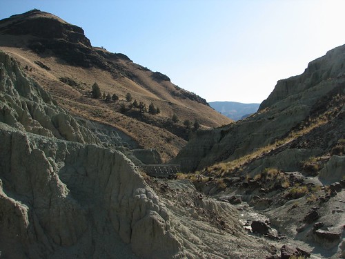
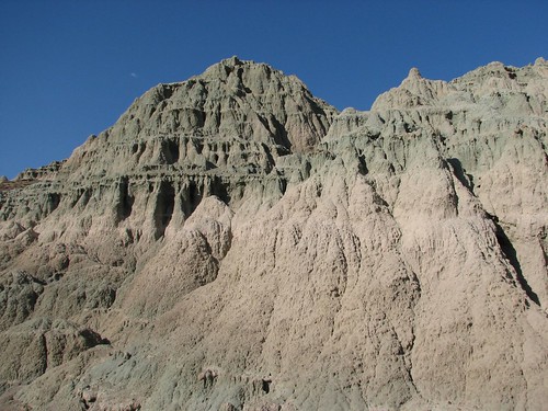
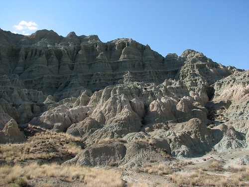
After about an hour at the visitors center, we decided to check out some of the monument’s trails. The monument is split into three non-contiguous chunks of land – the Sheep Rock Unit, the Painted Hills Unit, and the Clarno Unit. Since we were at the Sheep Rock Unit already, we started with the Island in Time Trail into Blue Basin. This two-mile stroll on an oddly overdeveloped trail – full of bridges spanning dry washes that looked like they could easily support the weight of an elephant – took us into a basin of badlands tinted blue-green.
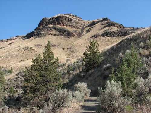
Here’s the start of the trail:
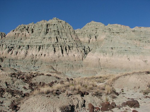
Before too long, we were surrounded by the colorful badlands.

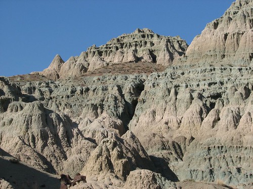
Shortly, we hit the end of the trail and had to turn around to retrace our steps back to the car. There more nice views along the way back.
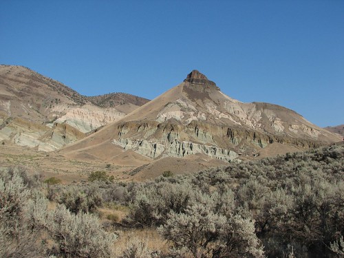
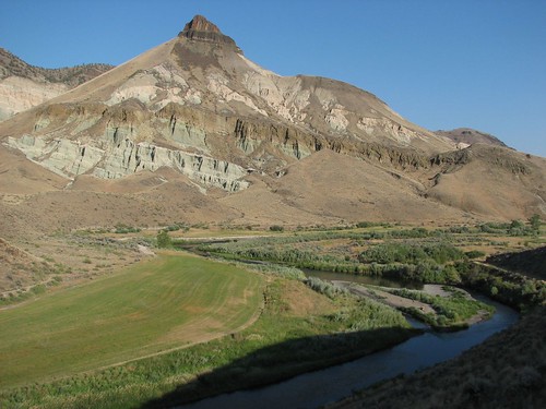
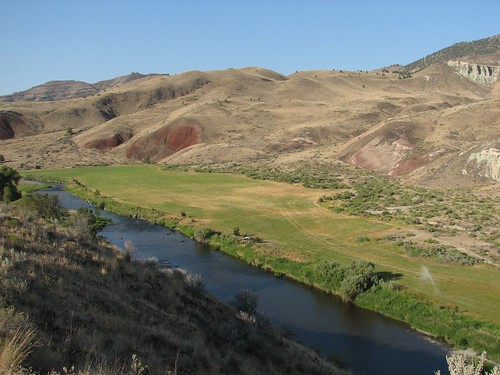
Our next stop was the Sheep Rock Overlook Trail. Since it was now about dinnertime, the gates to the ranch house where the trail starts were closed. After some looking around and dodging sprinklers watering the lawn, we found the start of the trail. Another easy stroll took us to vistas of Sheep Rock and the John Day River valley.
There were several other trails in the Sheep Rock Unit, but since it was getting late, we decided to move along to the Painted Hills Unit. Along the way, we stopped in Mitchell to get gas. Mitchell was the only town we’d seen in miles, as well as the only town on the main roads into the monument, so we were sure they’d have gas. As it turns out, we weren’t entirely right in that assumption.
Mitchell was tiny, with only a couple of small businesses constituting the “business” section of town. There was a gas pump, but it was closed. We figured it was closed for the day, and self service wasn’t an option because of Oregon’s silly law that you can’t pump your own gas. The next town was still about 60 miles away, though, so with the gas light already blinking, we’d be cutting it awfully close if we didn’t get gas. After a couple minutes of contemplating our options, an older man walked by and directed us into the general store to talk to the owner.
It turns out that the state had shut down the consumer pumps because, as the owner told us, they were old pumps that couldn’t handle prices of more than $4 a gallon of gas. The owner had tried to order new parts that would let the pump register $4 gas, but the parts were on backorder, and he’d been waiting several months already. So for over 100 miles east of Prineville, which is just outside the population center of Bend, there’s nowhere to buy gas. Doh!
The town did have a commercial farm pump, though, so the general store owner took us out to that pump, inserted his special card, and pumped us a gallon of gas for the bargain price of $5.25 a gallon. That was a new record for us in terms of price paid per gallon, but we only needed a gallon, and we got a funny story for our money.
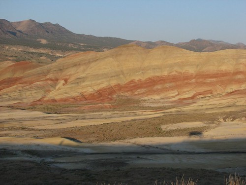
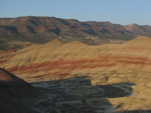
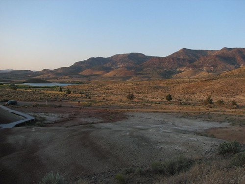
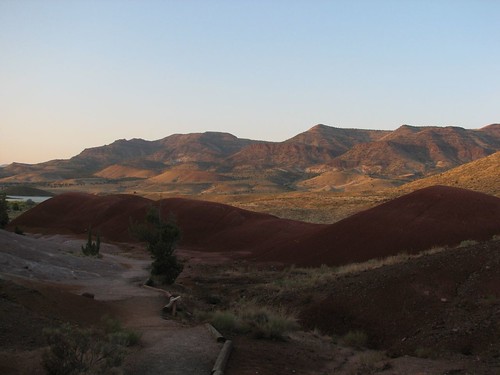
With the gas dilemma solved, we drove to the Painted Hills Unit of John Day Fossil Beds where we took another two short hikes. The first was the Painted Hills Overlook trail. The hills were richly colored in the late-day light.
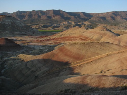

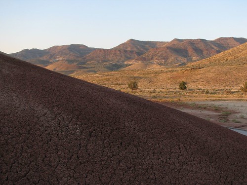
From there, we went to the Painted Cove trail. By this point, we had the place to ourselves. The short walk took us by more red clay hills.
By now, we were tired and hungry after a long day of driving and sight seeing. We drove another 40 minutes or so to the Ochoco Divide Campground where we set up for the night before continuing across Oregon.
No comments:
Post a Comment