Our original plan for the time between our visit to Texas and Thanksgiving was to hike part of the 165-mile Ozark Highlands Trail in Arkansas. Brian did lots of investigation and we were thinking of hiking an 80-mile section. Then I started calling around for shuttles and we found out that the week we’d be there was the first week of rifle hunting season for deer. Suddenly, hiking for a week in the Ozarks didn’t seem like such a good idea… Since hunting is not allowed in national parks, we decided to go to Great Smoky Mountains National Park instead.
Monday (November 12) was mostly spent driving from Nashville to the park. We were slow to get going in the morning and made several stops along the way. One of the stops was the Russell Stover Factory Outlet where we got four 12-ounce boxes of assorted chocolates. Yum! We also scored a free Backpacker magazine at the Coleman factory outlet and did some grocery shopping for our backpacking trip. We even bought some milk and other cold food and used our cooler for the first time on our trip.
The only really interesting part of the drive was the last bit through Pigeon Forge and Gatlinburg. Pigeon Forge is the home of Dollywood. It reminds me of a miniature version of what I imagine Vegas to be like. There are neon lights everywhere. It also has an abundance of touristy shops, more miniature golf courses than I’ve ever seen in one place before (and they were all really elaborate too), a pancake house every few blocks, and lots of amusement rides. In addition to the lights from the year-round places, the Christmas lights were already up. There were lights on the light posts, fancy lit-up scenes in the medians, and a huge display on the hilltop driving out of town. It was quite impressive. We didn’t get any photos because we thought there would be plenty of time to do it later, but various distractions eventually prevented us from taking any. Gatlinburg is the main entry point to Great Smoky Mountains National Park from the Tennessee side (the park also extends into North Carolina). It is a small version of Pigeon Forge, with lots of lights and touristy activities. It even had a mini Space Needle. It was nowhere near as impressive as the real thing! If you are wondering what supports all this build up of businesses, it’s the national park. The Great Smoky Mountains National Park is the most visited national park with around 9 million visitors annually.
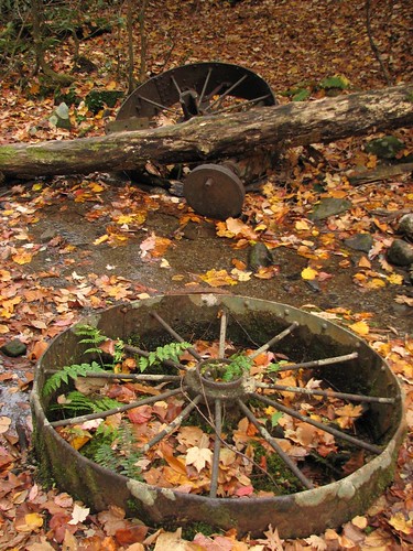
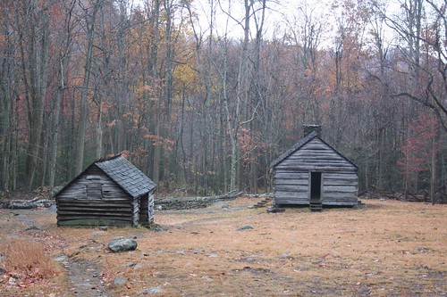
Tuesday, we spent most of the morning packing for our backpacking trip. Packing up food for a six-day trip is no small task. It was drizzling when we got up, so we put up our new screen house for the first time. It’s quite big and gave us plenty of dry space to pack up. In the afternoon, we drove the Cades Cove scenic loop. The park has a number of historic buildings from the 1800s and this loop has one of the largest concentrations of those buildings in the park. The term “cove” is used to indicate a flat region in the valleys between the mountains. The loop is about 11 miles long and took us most of the afternoon to drive including stops. At points, the traffic was bumper-to-bumper. I can’t imagine what it’s like in the summer, or in October, which is prime leaf viewing season.
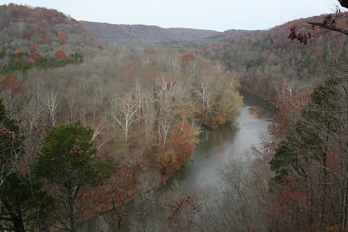
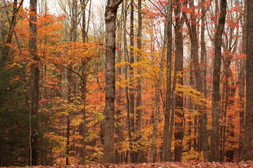
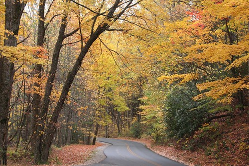
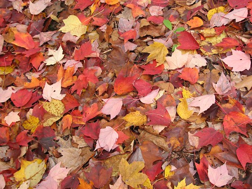
Though past peak season, the remaining leaves were colorful and we got some nice shots along the loop until the rain started about halfway through. Here are some of the sites along the way.
Stops along the road to Cades Cove to view the leaves:
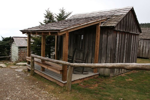
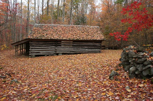
John Oliver Cabin:
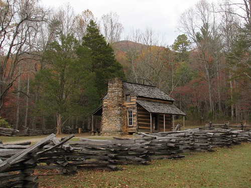
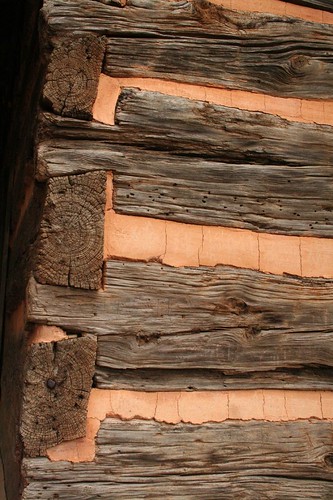
John and his wife were the first permanent white settlers in the cove. This is one of the oldest cabins in the park. The cabin was made with no pegs or nails. Gravity holds the logs together and mud is used to chink the spaces between the logs.
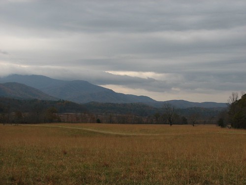
Looking out across the cove:
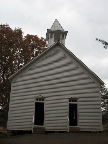
Cades Cove Primitive Baptist Church:
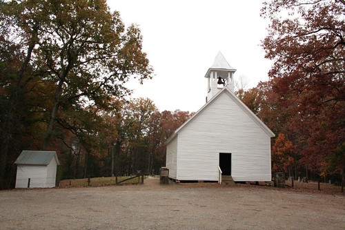
This building replaced the original church in 1887. An interesting note about this church is that it was closed during the Civil War because the church supported the Union and felt it was dangerous to meet in an area that supported the confederacy.
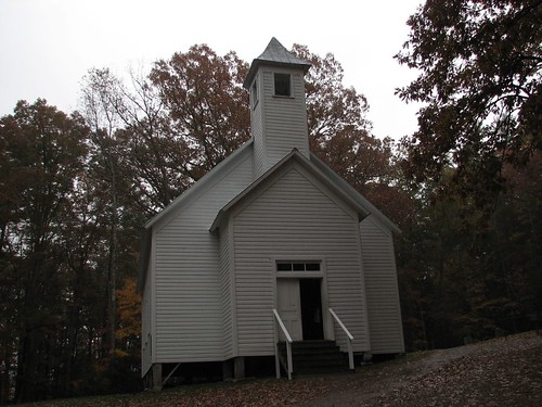
Cades Cove Methodist Church:
Note the two doors on the church. It was traditional at the time in some places for men to enter and sit on one side and women to enter on the other side. The congregation at this church didn’t follow that practice, but the building plan was taken from a church that did.
Cades Cove Missionary Baptist Church:
Like the Primitive Baptist Church, this church also did not hold services during the Civil War due to divided loyalties.
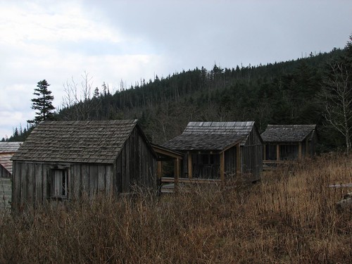
The most interesting area of the loop, and the one with the highest concentration of buildings, was near the Cade’s Cove Visitors Center in the Cable Mill area. The complex included a sorghum mill, smokehouse, the Gregg-Cable house, a cantilever barn, a blacksmith shop, and a grist mill with a flume carrying water from a nearby stream. The majority of the buildings were not originally located here, but were moved from other places in the park. We wandered around the buildings, but didn’t take any photos because it was raining heavily at this point.
The rest of the loop was similar to the first half of the loop, with a couple more homesteads, and lots of bumper-to-bumper traffic while people stopped in the road to gawk at deer in the fields. We made fewer stops during the second half because it was raining pretty hard. The evening was spent doing some errands and finishing our food prep for the backpacking trip.
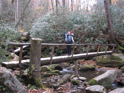
A little about the backpacking trip: The trip was about 64 miles long and made a big loop. It was recommended to us by a nice lady at the backcountry office because it has a little bit of everything – high ridgelines, forest, historic areas. We started and ended at the Rainbow Falls trailhead off the Roaring Fork Motor Nature Trail (yes, “motor nature trail” does seem like a bit of a contradiction).
Backpacking Day 1 -- Mt. LeConte Shelter, Elevation: 6440’, 6.7 miles hikedThis was our shortest day of backpacking, though it involved the most elevation gain (somewhere around 4000’). Despite the seemingly large amount of uphill, the trail gained elevation at a moderate pace and was a pleasant hike through the woods. It was a good thing the trail wasn’t too difficult because our packs were very heavy. Food weight really adds up for a six-day trip. Some estimates say that you should carry 2 to 2 ½ pounds per person per day on average. We also had a lot of extra warm clothes because the forecast was calling for some frigid weather. We got a little bit later start than I wanted (around 8:30 am) given that there were afternoon thunderstorms in the forecast, but the trail was sheltered and the thunderstorms didn’t materialize until much later.
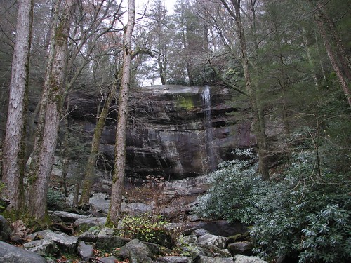
Along the way, we got to see Rainbow Falls, which apparently has two falls earlier in the year when the water flow is higher. It was much smaller when we saw it:
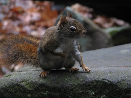
Brian also took a photo of this cute little guy while we were stopped at the falls:
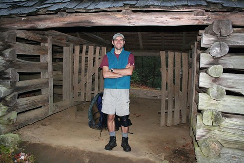
At the top of the trail near the backpacking shelter where we would be staying is the Mt. LeConte lodge. The lodge is really a collection of cabins, with larger log buildings for the dining room and office. All the cabins have propane heat and oil lamps and meals are served family-style in the dining room. It’s a rustic but really pleasant place and after dropping our packs at the shelter, we spent a while wandering around the lodge and chatting with people staying there. The lodge holds about 60 people, requires reservations that fill up months in advance, and is apparently nearly always full. Here are some photos of the lodge:
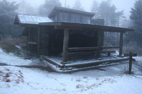
We were staying in one of the backpacker shelters. This particular shelter was located just above the Mt. LeConte lodge. The shelters are three-sided log structures with metal roofs and a few skylight windows. They have two platforms forming wall-to-wall bunks with each level having room for six people to sleep. The front of the shelter has a long counter and benches. This one also had a tarp to cover the front of the shelter and provide some additional protection against rain, wind, and snow. As it turned out, we’d need it.
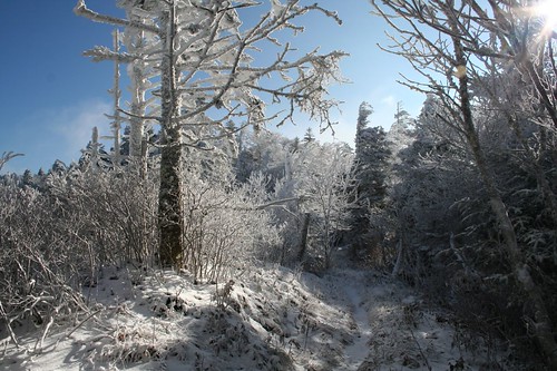
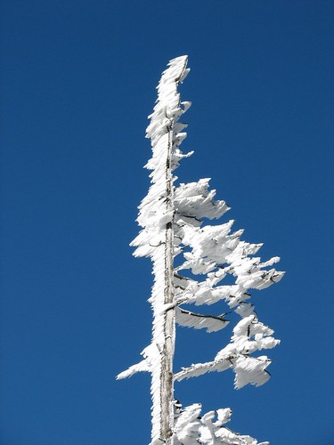
Overnight, a thunderstorm swept through the area. Brian was excited about the lightning; I was more or less terrified. I don’t enjoy being in unenclosed buildings during thunderstorms. The thunderstorm started fairly far away, got really close, then backed away. We thought that was going to be the end of it, but the wind shifted and the thunderstorm came back. All the while, the wind howled and there was a torrential downpour outside. I can’t imagine what would have happened if we’d been in our tent. I think we would have floated away. At some point, the warm air turned cold and the rain changed to snow. The thunder quieted down and we got back to sleep. When we woke in the morning, the ground was covered in snow and ice:
 Backpacking Day 2 -- Peck’s Corner Shelter, Elevation: 5280’, 13.3 miles hiked
Thursday got off to a rough start. It was really cold when we woke up, and it wasn’t projected to get any warmer throughout the day. We were a little slower than we should have been getting started given how far we had to hike and the fact that there are only about 10 hours of daylight these days. Shortly after we started hiking, Brian discovered that his Platypus (a large water bladder carried in his pack) was leaking all over his pack. This was very annoying but luckily, his sleeping bag and most of his clothes were in a dry bag in his pack so the stuff that got wet was non-essential. The trail was snowy and very icy in spots, making the prospect of a long day of hiking even more daunting. We considered turning back, but decided to continue on. Then, during our first pack break, I slipped trying to take my pack off and smacked into my hiking pole, splitting my lip open. It was a rough morning… After that, the trail got somewhat better for the most part, though there were some more icy patches and it snowed all day. It was hard to get enough food and water since the drinking tubes for our Platypuses had completely frozen up (note for next time – Platypuses are basically useless in freezing weather), and stopping for more than a couple of minutes would induce shivering. There was a shelter along the way where we were able to get out of the wind and regroup at lunchtime.
We arrived at the shelter where we were staying for the night around 4 pm, exhausted and very ready to be done hiking for the day. It was a pretty fast day of hiking given the conditions, probably because stopping in the cold was so unpleasant. We’d seen very few people all day and the forecast was for temperatures in the teens overnight, so we were quite surprised that there were people at the shelter when we arrived.
Our shelter companions for the night were in their sleeping bags shivering. They were wildly and frighteningly unprepared and unknowledgeable. They had hiked 10 miles in and underestimated (or not checked) the amount of elevation gain, so the older guy was complaining of major leg cramps – we gave him some Gatorade to help. The younger guy finally got out of his sleeping bag to help prepare dinner and put on a pair of soaked blue jeans and a cotton sweatshirt. One of them had a sleeping bag rated to 20 degrees (though generally, sleeping bag ratings are on the optimistic side); the other didn’t know what temperature his sleeping bag was rated for. Who goes out when the overnight temperatures are predicted to be in the teens without this information? Then again, it’s not clear whether they had even looked at the forecast ahead of time. Despite having carried 40-pound packs (by their own estimations), they didn’t have extra warm clothes and their food supply was limited to some dehydrated backpacking meals. Again – not a great idea for the weather. Backpacking meals tend to be low in calories and fat and you need both to stay warm when the temperatures are that low. They didn’t realize that they needed to hang their food and trash on the bear wires outside the shelter. When they followed our lead to do so, they didn’t have a trash bag for the trash. This begs the question how where they planning to pack their trash out. I gave them an extra Ziploc bag and the younger guy hung their food and trash. Oh, and to top it off, they had been smoking in the shelter. How rude!
They seemed amazed as Brian and I pulled layer upon layer out of our backpacks as well as two substantial bags of food. We each had long underwear, fleece pants and jackets, a vest, a down coat, rain pants and jacket, neckups, hats, balaclavas, and gloves, and we proceeded to put all of that on. Walking around camp, it was still chilly even with all those clothes on. After dinner, we snuggled into 20-degree sleeping bags with fleece liners that add an extra 10 degrees of comfort range, so we were nice and toasty. I felt really bad for the other two, and really hoped that we wouldn’t have a case of hypothermia on our hands or a frozen body above us in the morning, but I wasn’t sure what else to do for them.
There are no photos today. Despite having hiked 6 miles of the Appalachian Trail, which is on a high ridge in the park, there were no views as we were in a snow cloud all day.
Backpacking Day 3 -- Campsite 29 Otter Creek, Elevation: 4550’, 12.6 miles hikedWe arose to find our shelter mates doing better than the previous night. They were still cold, but the cramps had been slept off and nobody had hypothermia. The guy who was shivering in the temperature-rating-unknown sleeping bag the night before in only a tank top was now wearing reasonably warm-looking clothes and a full balaclava. Makes me wonder why he wasn’t wearing those in his sleeping bag…
Continuing to show their lack of experience, the bear bag that they had strung was hanging a couple of feet off the ground. The guy who hung it to the bear wire didn’t clip the wire to the tree, and naturally the bags don’t just magically stay 12 feet up in the air by themselves. Luckily, marauding bears seemed to have been kept at bay by the unpleasant weather. The other guy asked what we do with extra food, suggesting that he would bury it. Brian politely informed him that wasn’t appropriate – you have to pack it out.
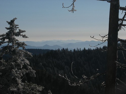
After breakfast, we went our separate ways. They had decided, wisely, to cut their trip short and were heading back to the trailhead. We were continuing on the Appalachian Trail and then down a bit to our next camp. The day was bright and clear, though still cold. The sun made a huge difference in comfort level though, allowing us to stop more comfortably and take pictures at some pretty viewpoints.
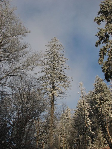
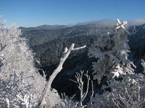
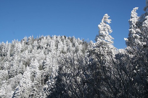
As a result of the soaking rain, wind, and then snow, there were some really amazing sideways ice patterns on the trees:
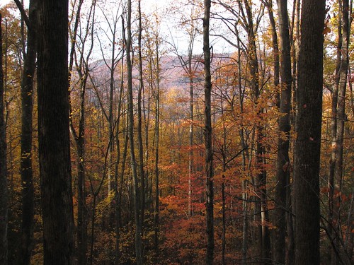
Although we were hiking along a ridge, there weren’t as many expansive views as we’d expected because there were a number of trees and brush along the trail. This wasn’t an above-treeline hike like we’re used to doing in the west.
Towards the end of the day, we split off from the Appalachian Trail and headed down Snake Den Ridge to the Maddron Bald Trail. Today had been another long day of hiking and it was nearly dark by the time we reached our campground. Tonight we’d be sleeping in our tent. The ground was still covered in snow but we set up our tent and hastily made dinner. One other backpacker wandered in after we did, though this guy, thankfully, appear quite well prepared.
Backpacking Day 4 -- Campsite 33 Settlers, Elevation: 1990’, 13.8 miles hikedWe set the alarm for 6:30 am so we could get an early start. This would be our longest day of hiking and we were both pretty worn out from the past couple of days so we wanted to make sure we had ample time to get to our next campsite.
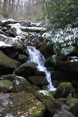
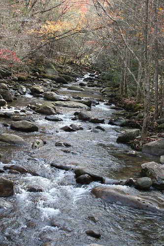
The weather was mostly sunny and we were heading downhill for the first four and a half miles, so we soon walked out of the snow. There were some nice forest views and pretty streams along the way:
Around lunchtime, we came to a junction with an old building off to the side. It was the Tyson McCarter Place and was built in 1879.
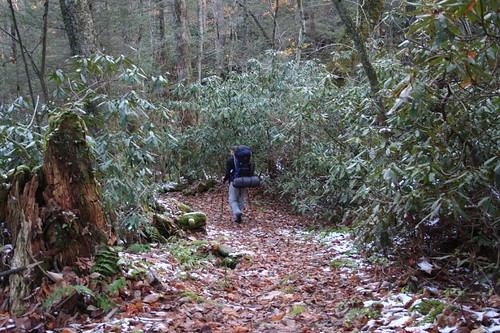
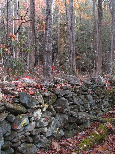
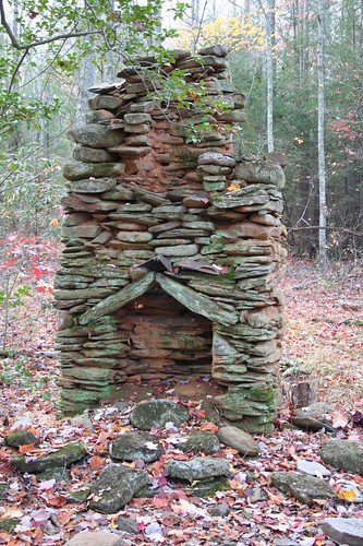
The rest of the day was 9.2 miles along the Old Settlers Trail. The trail was wooded, with lots of fallen leaves, and had the remains of old stone walls and chimneys along the way.
Though today’s hike was easier than the past couple of days, I was tired and kept thinking of the Robert Frost poem that I had to memorize at some point in grade school:
Whose woods these are I think I know.
His house is in the village thought;
He will not see me stopping here
To watch his woods fill up with snow.
My little horse must think it queer
To stop without a farmhouse near
Between the woods and frozen lake
The darkest evening of the year.
He gives his harness bells a shake
To ask if there is some mistake.
The only other sound’s the sweep
Of easy wind and downy flake.
The woods are lovely, dark and deep
But I have promises to keep,
And miles to go before I sleep,
And miles to go before I sleep.It’s funny that I remember it after all these years. I think it was the “and miles to go before I sleep” part that was resonating with me.
We made it to camp surprisingly early – around 3 pm – and for once had a little time to relax before dark. The campsite was next to an old chimney. We took out our Therm-a-rest chairs and read for awhile. We were looking forward to having time to make dessert after dinner, but dinner turned out to be way more couscous than we had counted on, so we decided to save the dessert for another night.
Day 5 -- Campsite 32 Injun Creek, Elevation: 2240’, 10.3 miles hikedToday’s hike was practically short compared to other days on this hike. We hiked more along the Old Settlers Trail into Greenbriar Cove, then continued on another trail to our camp for the night. It was an uneventful day of hiking, but again the weather was pleasant and we got some nice photos.
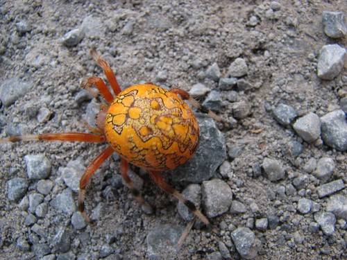
Here’s a really cool bug we saw on the road in Greenbriar Cove:
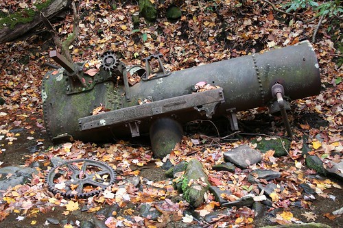
Steam engine that was wrecked in a stream near our campsite:
The campsite was a lovely flat spot in a break in the trees. Our campmates for the evening turned out to be a man and his young son (I’d guess he was around 8- to 10-years old) and an enthusiastic but not very knowledgeable first-time backpacker. He also didn’t know anything about hanging food on the bear wires or not burying leftovers. Hiking in the northwest, we never seemed to come across as many unprepared backpackers as we did here. Maybe part of it is that at the main national parks in the northwest, you need to pick up a backpacking permit from a ranger. When you get the permit, the ranger goes over a dozen or so seemingly obvious points (hang your food, pack it in/pack it out, don’t bury toilet paper, etc.). In the Smokies, you need a permit but you can self-register for it. Maybe the info provided by the ranger isn’t really as obvious as it seems.
After a good amount of effort, we got a small fire going. Everything was really wet from the rain and snow, so there was very little for dry kindling. We finally tore a few pages out of the book I was reading since Brian had already read it anyway, and used that to start the fire.
We actually got around to cooking dessert, which was supposed to be carrot cake. You can boil cakes and breads in an oven bag. Unfortunately, after boiling for much longer than instructed, the cake was still really goopy. The texture was definitely off, but the flavor wasn’t bad. It was an interesting experiment anyway.
We sat by the fire for quite a while after dinner – with the combination of the warmer temperatures and the toasty campfire, it was nice to be able to stay out later after having gone to bed shortly after sunset on previous days. At one point, a burning piece of wood broke off and flew through the air. Brian didn’t notice it until he felt his arm burning – the wood had burned through his thick fleece and the base layer that he was wearing underneath. He couldn’t shake it out because it was trapped between the fleece and the base layer, so Sarah had to pour a little bit of water on it to put it out. Now his fleece has a large hole in it. Oh well, we knew when we planned this journey, it would be hard on our clothes!
Brian stayed up, reading “Catch-22” by the campfire until about 8:30, two or three hours later than we’d stayed up on previous nights.
Day 6 -- 7.2 miles hikedOur last day of hiking started out soggy. It rained just before dawn and was still drizzling when we got up. We opted for pitas and a bagel for breakfast instead of cooking the last of the oatmeal. We packed up and were on our way shortly after sunrise.
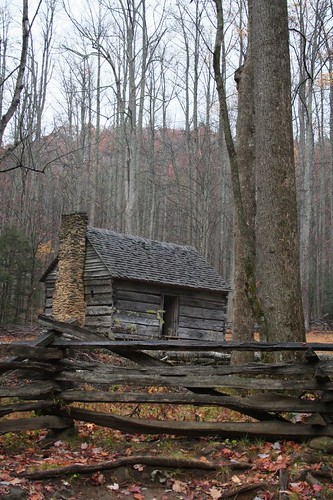
Just before reaching the Roaring Fork Motor Nature Trail, we came to the Jim Bales Cabin where we stopped for a snack and some photos:
From there, we had 3.3 miles to go back to the car. Unfortunately, this involved one seemingly unending uphill. Boy, was I ready to be done hiking.
When we got back to the car, it was readily apparent that we had acquired a mouse during our time away. Paper towels were shredded, there were mouse droppings everywhere, and our food bags had been chewed into. Ugh! This was not how we were imaging our hike ending. We actually saw the mouse peeking out at us and darting around the car. !@$(@#)$. Because the car was so tightly packed with stuff, it was hard to tell exactly what the mouse had gotten into. We also didn’t have much to clean up the mess with.
This had happened to us once before, while backpacking in the Canadian Rockies last year. That time, we ended up spending multiple days trying to catch the mouse and never did trap it until we made it home a week later.
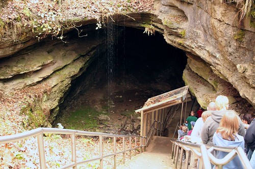
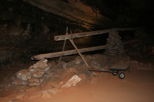
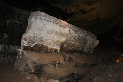
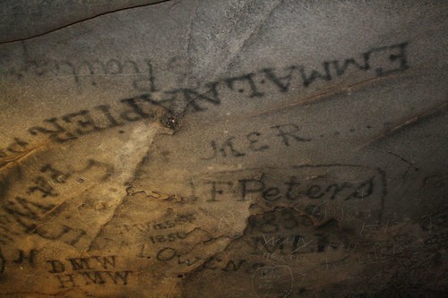
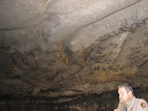
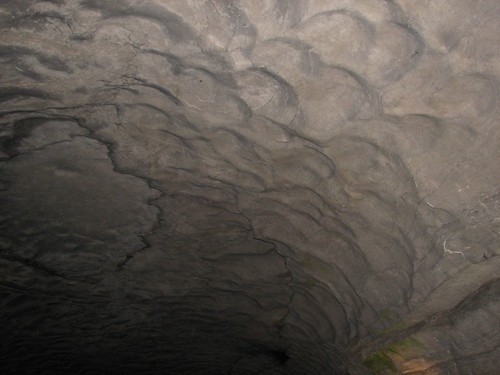
After what little bit of cleaning we could do, we got into the car and headed into town. We decided to stop at a pancake house for lunch and to contemplate our next move. After butterscotch chip pancakes, scrambled eggs, biscuits, and sausage, our moods were improved and we decided to buy some mouse traps, clean the car as best we could, and head to Mammoth Cave National Park for the night. We’d tour Mammoth Cave the next day and then head to the Chicago area where we’d spend Thanksgiving with Brian’s family.
The Smokies are beautiful and have a rich human history. I’d definitely like to visit again someday because there were tons of things that we didn’t get a chance to see. Next time, I think I’d choose my backpacking trip a bit more wisely. Given the short days, the challenging weather, and our current physical conditions, we bit off more than we could comfortably chew with the backpacking trip we choose. For Brian, though, it just whetted his appetite for doing an even longer hike at some point – maybe a 500-mile section of the Pacific Crest Trail!