After that, we started out on the hike. There were posted numbers along the trail, as if there was supposed to be an interpretive guide to the trail, but we hadn’t seen it. As we would learn later, the Lava Beds area was part of the territory of the Modoc tribe. When the American government forced them onto a reservation with two other rival tribes, the Modocs weren’t happy about it, and a group of them left the reservation and went back to the Lava Beds area. Naturally, the American government couldn’t let this stand and dispatched forces to California to drive the Modocs back to the reservation. The Modoc War ensued. “Captain Jack” was the name given by the white folks to the leader of a group of the Modocs who holed up in the unwelcoming area now known as Captain Jack’s Stronghold.
The area is full of volcanic rock formations, including narrow alleyways and caves, that made for good protection for the Modocs. On top of that, the rock itself is rough and jagged. The combination of the hostile terrain and the determination of a small group of Modocs (60 or so warriors along with women and children) managed to fight off the American intruders for several months. But then the inevitable happened – the Modocs were overwhelmed, and Captain Jack was hanged.
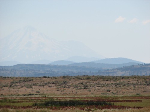
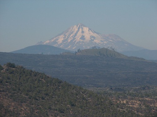
From the stronghold, we could see the ghostly, snow-covered peak of Mt. Shasta off in the distance.
At a junction in the trail, we found a display of seemingly random flotsam on a pole.

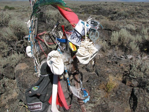
As we found out later from a ranger, this was actually a medicine stick. The area has spiritual meaning for the Modocs, and they come each spring to put up the stick with things of value to them. The other random trash on the stick, like granola bar wrappers and soda can tabs, was likely added by later visitors who didn’t understand the idea of the medicine stick.
After our hike, we headed to the visitors center toward the south end of the park. It turned out to be quite a nice visitors center – very new, with comfortable couches and interesting displays on volcanoes. We learned about the different types of lava, how they flow, and the types of rock that result.
Then we went to the campground, which had plenty of open sites, including one that was nicely spaced from other sites and had a great big juniper that would provide shade for our picnic table and tent. Score! We relaxed and played Scrabble, enjoying the shade, comfortable temperature, and absence of mosquitoes. The campground did have these strange bugs that looked like sesame seeds on legs, and they frequently landed on us or tried to wreak havoc with our Scrabble game, but we’ll take them over mosquitoes any day.
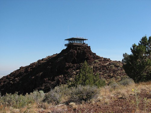
We started the next day by hiking up Shonchin Butte, a short hike to a fire lookout.
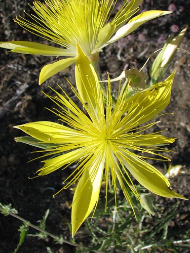
Along the way, we enjoyed the blazing star – a huge yellow flower that we’d never seen before.
Mt. Shasta was easier to see in the morning light than it had been the night before.
Lava Beds is most famous for its over 300 caves. The caves are actually lava tubes, formed when the outside of a thick lava flow cools and hardens due to exposure to the air. The hardened shell then acts as insulation for the interior lava, which continues to flow. When the flow stops and the lava drains, a lava tube cave remains. Unlike other types of caves that have intricate networks of passageways, lava tubes are generally one-way routes, making exploration safer. Many lava tubes are open to visitors at Lava Beds, and they even lend flashlights for free at the visitors center.
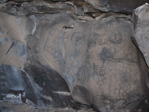
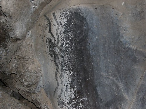
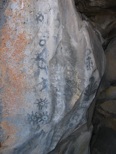
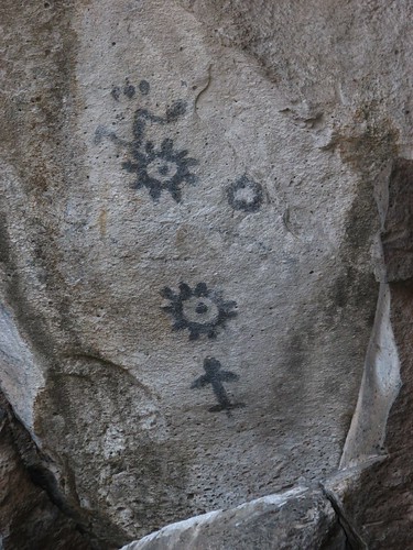
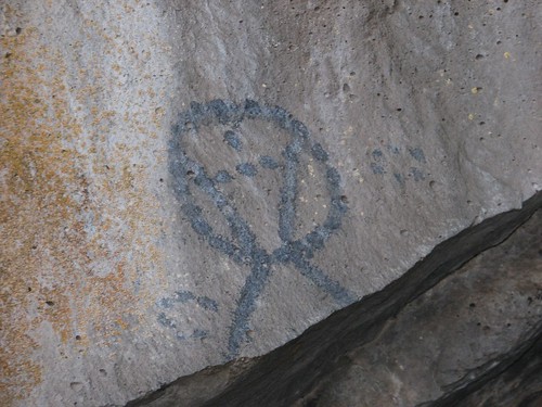
So after Shonchin Butte, we hiked out to Big Painted Cave and Symbol Bridge Cave, which were both supposed to contain Native American pictographs. We didn’t see any in Big Painted Cave, but we found a bunch in Symbol Bridge Cave.
Then we walked into Skull Cave, so named because of the human and animal skulls found there. Skull Cave was interesting because the bottom of the cave is covered in a thick layer of ice that never melts due to the cold ambient temperature of the cave. Finally, we hiked through Mushpot Cave, the one developed cave with lights and interpretive signs.
The next morning, we drove out the southwest corner of the park on a dirt forest road. We visited Mammoth Crater and then Medicine Lake, a large lake in a crater that’s part of the same volcanic system that created Lava Beds.
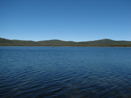
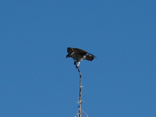
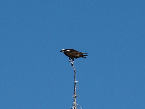
Today, Medicine Lake is popular with both fishermen and birds. We saw this osprey perched on top of a tree.
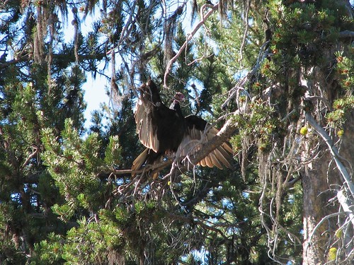
Several turkey vultures were circling overhead and periodically landing in trees.

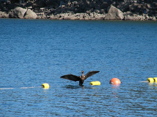
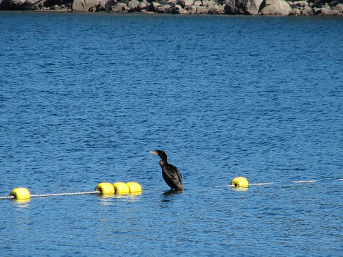
Finally, this cormorant stood on the rope that defined the swimming area.
After watching birds for a while, we left, aiming for Mt. Shasta, which had been beckoning us from Tule Lake and Lava Beds.
No comments:
Post a Comment