Wednesday, October 31, 2007

White Sands

After a restful night at Valley of Fire, where we were the only tent in an almost full campground of RVs, we took luxurious, untimed showers, but then a crisis hit! Brian opened up his bag of clean underwear and socks and found … only socks. With nothing else to do, we packed up and continued on toward White Sands National Monument. After stopping at the first possible opportunity at the Alamogordo Kmart to procure underwear, we arrived at White Sands around noon.

White Sands National Monument is located adjacent to an enormous swath of New Mexico that is reserved for a missile testing range. The area, which is as big as Rhode Island and Delaware combined, includes the Trinity site, where the first atomic bomb was testing in July of 1945. The monument closes periodically during missile tests so that visitors aren’t in danger if a test goes awry. The dunes at White Sands are gypsum, the mineral that is used to make plaster of Paris, which makes them white. They were smaller than the dunes we’d seen previously at Great Sand Dunes National Park but stunningly beautiful.

At the visitor center, we talked to a ranger and decided to go backcountry camping for the night. There is only one backcountry camping area, with sites that are a half mile to a little over a mile from the parking area. Hiking over the dunes is more work than hiking on a normal trail, but .7 mile to our campsite would make for a short trip. We filled up on water at the visitor center since there is no water available in the park, and headed into the park on the scenic drive. As it was still early in the day, we stopped and cooked a leisurely lunch at the picnic area and watched families with kids sledding down the dunes.

IMG_0411
We packed up our backpacks, which were incredibly heavy due to the gallon of water we were each carrying, plus a bottle of wine, tripod, and even the latest Harry Potter book. Good thing it was a short hike! Following the posts in the sand, we made it to our site and set up camp in a bowl of the dunes.

IMG_0426
The rest of the day was spent relaxing, reading, and taking photos.

IMG_0416
IMG_0427
IMG_0435
IMG_0598
We set up at the top of a dune to make our dinner and sip wine, while we enjoyed sunset. Sunset over the dunes was beautiful, as was the rising almost-full moon.

IMG_0458
IMG_0474
IMG_0483
IMG_0619
IMG_0653
With the large moon, the moonlight reflecting on the dunes seemed to make everything glow.

Sunrise also afforded a great time to take more photos.

IMG_0565
IMG_0585
IMG_0680
IMG_0688
After sunrise, we packed up and headed out so we’d have time to make it to Carlsbad Caverns for the afternoon tour.

Tent rocks

We had planned to spend some time in Albuquerque, but the next morning was Monday, October 22, and we needed to be in Houston on Saturday for a wedding, so time was running out. We still wanted to see White Sands National Monument, Carlsbad Caverns, and the Guadalupe Mountains, too. We also discovered that these places were a lot farther apart than we originally thought. So we decided to blow quickly through Albuquerque and camp close to White Sands so that we could spend most of the next day there. We looked on the map and found a place on called Valley of Fire Recreation Area. It was managed by the BLM just like the luxurious Orilla Verde Recreation Area near Taos with its coin-operated showers, and it was well beyond Albuquerque toward White Sands. So we’d spend just a few hours in Albuquerque and then move on to Valley of Fire.

As we drove south toward Albuquerque, we stopped in at Kasha-Katuwe Tent Rocks National Monument. It was a bit off the beaten path, but recommended as a “must” by our Lonely Planet guidebook to New Mexico, so we checked it out. Turns out that the place is almost entirely undeveloped – no visitors center, just a single trailhead on a dirt road. There are two trails, the Cave Loop Trail that starts at the trailhead and the Canyon Trail that splits off from the Cave Loop. The total was something like three miles, so we did them both.

The scenery was absolutely amazing – this was our favorite hike so far. We had no idea what “tent rocks” were beforehand – turns out they’re rock formations sort of like hoodoos, but they’re conical (cone-shaped like tents – hence the name – or maybe like teepees) and oftentimes have boulders on top. From what we could figure out, the boulders are harder rock that’s more resistant to erosion, so the softer rock below eroded away but the boulder on top provided enough protection to prevent further erosion of the soft rock, so these cones of soft rock remained.

Here’s one of the first views we got as we started the hike – you can see some tent rocks along the ridgeline:

IMG_0364
Then we went through this incredibly narrow canyon – at times, we could touch the walls on both sides:

IMG_0390
IMG_0566
As we climbed, we were soon virtually surrounded by tent rocks:

IMG_0581
IMG_0379
IMG_0576
When we reached the end of the hike, we were out on a high ledge, with steep drop-offs on three sides and great views of the tent rocks:

IMG_0381
IMG_0385
Way off in the distance, we could see some snow-capped peaks:

IMG_0380
It was just a fantastic hike – so much amazing scenery in just three miles!

After we drove back east to I-25, it was lunchtime so we briefly visited the Coronado State Monument to look for a scenic picnic table to make our lunch. We had bought the New Mexico Culture Pass in Santa Fe, which cost $20 and got us into the museums in Santa Fe and a bunch of other museums and monuments across New Mexico, including Coronado. The monument is best-known for its kiva, but that was closed for restoration. Still, we had nice views from our lunch spot:

IMG_0582
After that, we continued further east past the interstate because we wanted to drive up to the top of Sandia Peak, the mountain that overlooks Albuquerque. There are two approaches – from the west and from the south. Both of our guidebooks recommended the route from the south, but when we got directions from Streets & Trips on our laptop, we found out that the route from the west was 10 miles shorter. So we decided to take that one.

Bad idea! Very soon, the road changed from pavement to dirt, with many potholes and large rocks to dodge. It was no more than 10 or 15 miles of this, but because the road was so bad, it took us well over an hour of extremely attentive driving to make it to the top while preserving all of our tires. I guess we should have trusted the guidebooks!

From the top, we got some good views of the nearby mountains:

IMG_0406
And of the city of Albuquerque:

IMG_0407
Also at the top of Sandia Crest is what they call a “steel forest” – a set of broadcast towers placed atop the mountain for maximal range:

IMG_0408
There was no way we were getting back on that rocky road, so we drove south to I-40 and then into Albuquerque from there. We blew the fuse for our cigarette lighter on the way down, so we stopped in Albuquerque at an auto parts store to buy some replacement fuses, and then we went to Sadie’s for some authentic New Mexico food. The place is huge – they must have 100s of tables. We ordered these delicious green chile chicken enchiladas that came with chips and some really spicy salsa, sopapillas, beans, and potatoes. According to the menu, it was a dinner for one, but we split it and couldn’t have eaten another bite afterwards. The service there is great, too – we were drinking a lot of water to cut the spice, and our water glasses were refilled as soon as we emptied them! Sadie’s is a great place – we’d highly recommend it. Apparently it’s an Albuquerque institution, too – it’s been around for decades and moved several times into larger digs as its popularity grew quickly.

We finished up dinner around dusk, and then drove the 150 miles or so to the Valley of Fire Recreation Area. Like Orilla Verde, it’s managed by the BLM, and also like Orilla Verde, we found that it has showers, and they weren’t even coin-operated! We would definitely be taking showers the next morning!

Saturday, October 27, 2007

Santa Fe

We got up bright and early, thinking we’d spend a lot of the day in Santa Fe. We failed to account for all the cool things to do along the way from Taos!

First we stopped at Bandelier National Monument. Not knowing what to expect, we were astounded by the gorgeous light-colored canyon walls against a deep blue sky. Even better, the walls are naturally swiss-cheesy, and hundreds of years ago, Pueblo Indians enlarged many of the holes, building homes right into the cliffs. Over time, as they cultivated crops, they migrated from the cliffs into the bottom of Frijoles Canyon and built villages there as well.

There’s a short two-mile hike right from the visitors center. The rangers say it takes 1.5 hours, which seemed really slow to us. We wound up taking 2.5 hours! There was just so much to see! Like the gorgeous bright yellow of the fall colors in Frijoles Canyon:

IMG_0313
And the beautiful cliffs on the side of the canyon:

IMG_0315
IMG_0321
IMG_0550
Here’s the living area in the middle of the canyon:

IMG_0328
And this is looking over a partially rebuilt kiva – an underground hut used for ceremonial purposes:

IMG_0533
Here’s Brian inside a cliff house called the Long House. All of the rooms had smoke-covered ceilings. Apparently, smoking the ceilings stabilizes them, making them less likely to cave in. The Park Service still regularly smokes the ceilings of the cliff rooms along the hiking trails.

IMG_0545
The last section of the hike led to the Alcove House. The ascent to the Alcove House required climbing four ladders and wasn’t recommended for people prone to vertigo or with heart or respiratory problems, and indeed we saw a few people who had chosen to stay at the bottom. It really was a bit frightening – one slip would mean a long fall. Here’s one of the ladders:

IMG_0336
And here’s Brian, pretending to look brave:

IMG_0554
Inside the Alcove House was another kiva that you could climb down into, via yet another ladder, so Brian took a picture of Sarah from inside the kiva:

IMG_0333
IMG_0334
When we got back to the visitors center, the parking lot was entirely full and people were using the picnic area as overflow parking. This was one popular place! Apparently, 350,000 people visit annually – respectable for a national park, let alone a national monument.

There were several other great-sounding trails in the park, and we briefly considered staying longer as we ate lunch at a picnic table in the campground, but decided to move on because there was still so much to see.

Next stop was Los Alamos. We visited the Los Alamos Historical Museum and got sucked in for a long time, looking over the displays of prehistoric people, the ranch / boys school that occupied the area in the 1930s, and finally the secret city that replaced the ranch where the atomic bomb was developed. An inscription referred to New Mexico as the home of the earliest recorded human life in North America (the artifacts of the Clovis people have been dated back to around 12,000 B.C.) and the breeding ground for technology that could be the end of human life.

After reading a recommendation in our “Let’s Go U.S.A.” travel guide, we visited the Black Hole, a place that could legitimately be described as a store, a museum, or a junkyard – it’s all of these. It’s where equipment from Los Alamos National Labs goes to rest – everything from oscillopes to monstrous hard drives that hold kilobytes of data to computer monitors with images of software programs permanently burned onto their screens. The junk fills the store, which is really a large warehouse-like building, along with a large swath of pavement out in front. When we marveled at the sheer volume of junk, a helpful employee informed us that junk also filled an additional warehouse, the owner’s house, the employee’s house, the church next door, and more. Wow!

Just like in the Black Canyon of the Gunnison, photos can’t do justice to the sheer enormity of the place, but here’s a sampling anyway:

IMG_0337
IMG_0338
IMG_0343
Just as we were leaving, an old man came up to us and started chatting. His name was Ed Grothus, and he was wearing purple camo pants, a white button-down shirt with Native American jewelry, and a Lacoste button-down cardigan. He said that he was the owner of the place, and when we complimented him on what he calls his “atomic waste” that populates every nook and cranny of his store, he told us we hadn’t seen anything yet. He took us outside to one of two side-by-side shipping containers. The shipping container was filled, end to end, by a single, massive block of marble. As he described it to us, we learned that it was a white marble obelisk, over 30 feet long and weighing 22 tons. There was an identical obelisk in the adjacent shipping container. Both obelisks were inscribed, in 16 languages, with a message commemorating the atomic bomb and warning against the dangers of nuclear power. “No one is safe unless everyone is safe,” he says, calling Bush’s homeland security platform, securing the U.S. against the evils outside our borders, shortsighted.

On top of each of the obelisks would sit a large black marble ball, and each obelisk would stand on and be surrounded by black marble cubes that Ed called Doomsday Stones. As he continued talking, we learned that he had worked for 20 years contributing to the advancement of nuclear weaponry – although he didn’t say it, you could surmise that the Doomsday Stones and obelisks were his attempt at atonement for the sins he perceived.

He took a trip to China and found out that he could have the monument built for just $150,000 delivered, which seemed like an amazing bargain to him. So he sold a property that he owned and had been renting out, commissioned the monument and had it built. Now the obelisks are in Los Alamos in the shipping container outside the Black Hole, and the balls and Doomsday Stones are still being constructed in China. He’s been lobbying for years to have the monument prominently displayed in Los Alamos or perhaps even in the state capital of Santa Fe, but so far, no luck. So the obelisks continue to sit in their shipping containers, and Ed tells his story to interested tourists several times a day.

A 22-ton piece of marble inside a shipping container is another thing that’s hard to capture in a photo, but here it is:

IMG_0347
And here’s Ed with the balls that will top the obelisks:

IMG_0349
After this strange and wonderful encounter, we continued on to Santa Fe. We tried to watch Game 6 of the Red Sox and Indians series, but by the time we found a sports bar it was the third inning and the Red Sox were already winning 10-1. We stocked up on groceries at Trader Joe’s – the last Trader Joe’s we would see for a while, since there are none in Texas – and headed back to our campground. We were camped in a Forest Service campground called Black Canyon, eight miles outside town. We found a site with a driveway that was so steep that it had a sign indicating it wasn’t recommended for RVs, so we took it and had a very nice spot atop a hill.

The next day we toured Santa Fe’s museums. We got a fantastic parking spot, right outside the St. Francis Cathedral that looks over the historic district:

IMG_0361
Then we visited the Palace of the Governors, the oldest public building in the U.S. It was built in 1610 and has been the home of dozens of governors during New Mexico’s history, most of them Spanish. Now it’s a history and culture museum. It included a display of Hispanic religious art that ranged from displays in people’s homes to spray-painted religious scenes on the hoods of low-rider cars.

Then we visited the Museum of Fine Arts, which included a display of Georgia O’Keefe’s art. We were curious to see it, but decided that we didn’t really like it – a bit too abstract.

We ended with the Museum of International Folk Art, which was holding a Day of the Dead celebration. Kids could decorate sugar skulls, so we did. It’s a skull made of sugar that you decorate with multiple colors of frosting, putting eyes on it, a mustache, a pirate’s cap, and so on. It was lots of fun. You’re supposed to eat them afterwards, but we weren’t so confident in the cleanliness of the frosting, so we passed. A mariachi band was playing, too, and we sat and listened to them for a while.

The centerpiece of the museum is an international collection of toys donated by a man named Girard, who collected them over many years during his travels. The collection that he donated numbers over 100,000 items, and roughly 10,000 are on display in a busy, wild room that places items everywhere from well below eye level to the ceiling and might whimsically juxtapose dolls from, say, Poland and Nigeria in the same display case – you could spend days in this one room and not see it all. As it was, we spent several hours right up until closing and as a result, missed the rest of the museum. Photos aren’t allowed in the museums, so we don’t have any pictures to show, except for this mailbox dressed up as R2-D2 that we found on the street:

IMG_0360
We found a public park to cook our dinner and then went to the Catamount bar to watch Game 7 of the American League Championship Series. Unfortunately, Sunday night football was on at the same time, a game between the Broncos and Steelers that was of more interest to the crowd of mostly locals than the baseball game. But after we sat down in front of the big screen with our beer and water, folks gradually trickled in, most rooting for the Indians, it seemed. So it was satisfying when the Red Sox won 11-2 to make it to the World Series.

Afterwards, we returned to our RV-proof site in the Black Canyon campground to find a layer of snow on our tent! It had been chilly all day, a good day for museum hopping, baseball watching and beer drinking, but we didn’t expect snow. Fortunately, we’d eaten dinner much earlier, so we didn’t have to do anything but bundle up, snuggle up in our sleeping bags, and go to sleep.

Next, Albuquerque!

Into New Mexico

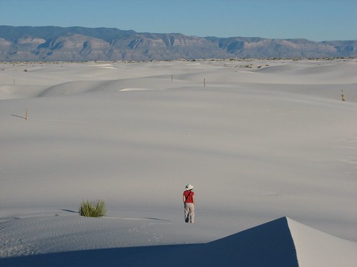
Wednesday morning, we woke up in our room in the Silverpick Lodge, looked out the window, and saw snow! An inch or so was on the ground, and it was still snowing – and hard!

IMG_0380
We’d definitely chosen the right night to take a break from camping and be pampered in a lodge. We stayed late in bed, both took showers (our second showers in 12 hours!), ate the lodge’s continental breakfast, got back in bed, blogged for a while, asked if we could stay past the 10:00 checkout time, got back in bed, and eventually left a little after noon, refreshed and ready to drive to New Mexico!

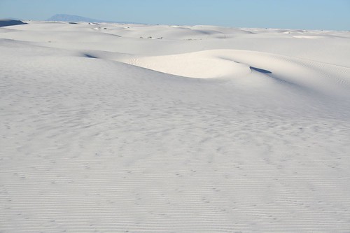
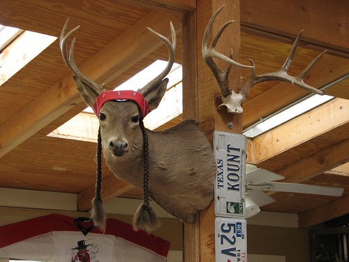
We had planned to be in New Mexico on Saturday but got sidetracked by the beauty of southern Colorado. Today, though, we were going to make it. We continued down the highway to Durango for a stop at Serious Texas Barbecue, where we got a half pound of brisket to split. We’d missed real barbecue – yum! The place was all decked out in Texas memorabilia – the best part was the Willie Nelson deer:

IMG_0185
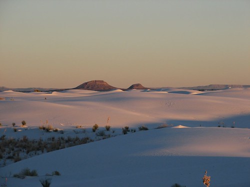
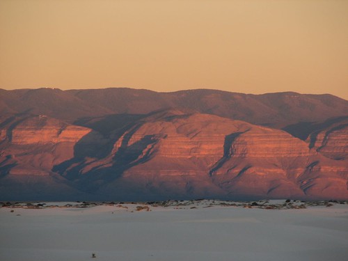
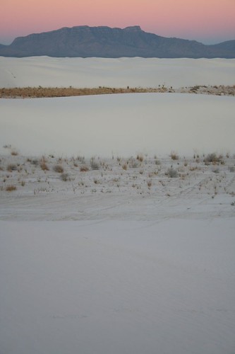
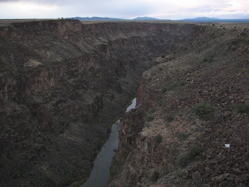
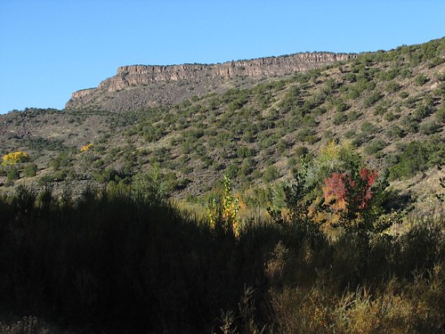
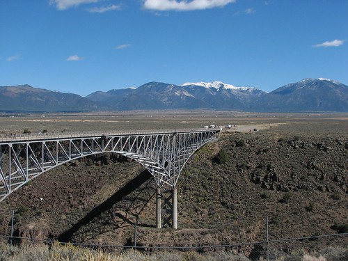
The drive to New Mexico started uneventfully, until somewhere along US-64 it started to blizzard. There was snow on the road, we couldn’t see very far ahead of the car, and what was normally a 60+ MPH road became 30. After a while of driving through that, the skies gradually started to clear, and sunset was pretty. We reached the bridge over the Rio Grande Gorge, on the way into Taos, shortly after sunset. It’s the second-highest suspension bridge in the US – here’s the view down into the gorge from the bridge:

IMG_0192
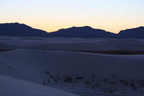
After a quick drive through Taos, we set up camp in the dark at the Rio Bravo Campground in the Orilla Verde Recreation Area south of town, right along the Rio Grande at the bottom of the gorge. We sat up for a little while to make dinner and read – although it was windy and raining, this was a luxurious campground, with covered picnic tables and a sink with hot water to do dishes! It had been a quiet day, but hanging out in the lodge was awfully nice, and tomorrow we’d see Taos!

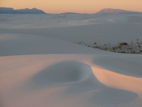
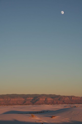
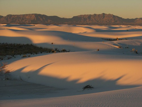
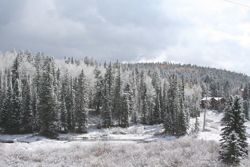
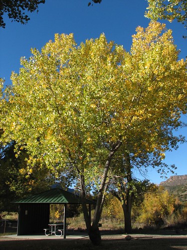
We woke up the next morning to beautiful morning light in the gorge:

IMG_0200
IMG_0201
The first stop of the morning was Taos Pueblo. A bit of background here: The Pueblo are a group of Native Americans who populated present-day New Mexico and share some common culture and beliefs but are also divided into 19 separate groups, also called “pueblos”. The word “pueblo” refers to the group of Native Americans as a whole, an individual sub-group, or a town where a sub-group lives. Taos Pueblo is particularly significant because it was a center for resistance to white settlement. In the Pueblo Revolt of 1680, the Pueblo Indians, using Taos Pueblo as their control center, successfully drove the Spanish out of the New Mexico area and back to El Paso – a rare victory in the history of North America’s colonization. Because different Pueblo groups spoke different languages, they learned and used Spanish to communicate amongst themselves. The Spanish stayed away for 12 years but returned in 1692.

Today, the Taos Pueblo village is home to roughly 100 people. Inside the pueblo itself, there’s no running water or electricity, and the adobe buildings are heated with wood fires. The vast majority of the Taos Pueblo tribe, numbering in the thousands, chooses to live outside the pueblo, where there are more modern amenities. But the adobe homes in the pueblo are still passed on from generation to generation and used during ceremonies.

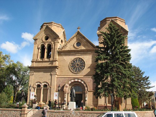
Over 90% of Taos Pueblo people are Catholic, displaying the enduring Spanish influence. Here’s their church, San Geronimo:

IMG_0393
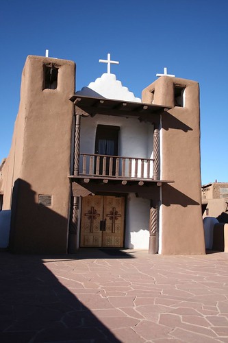
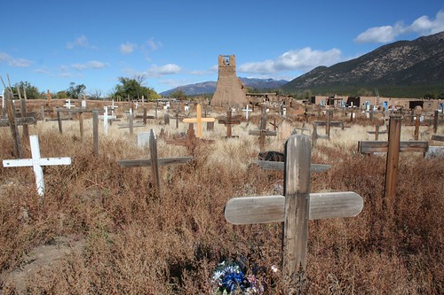
The church was rebuilt after the Americans burned it down around 1850. The U.S. acquired New Mexico, along with much of the Southwest, in the Mexican-American War, and sent a guy named Charles Bent to govern the new territory. Folks in New Mexico weren’t happy about it, and Bent was killed. Taos Pueblo got blamed for the death, and the church was burned with 150 people inside. Here’s what’s left – it was turned into a cemetery after the massacre:

IMG_0465
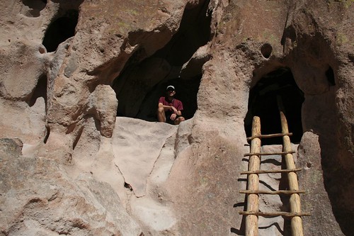
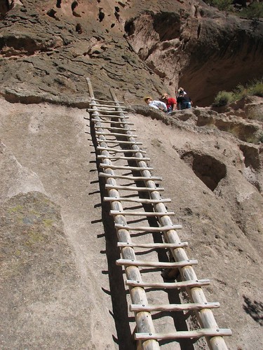
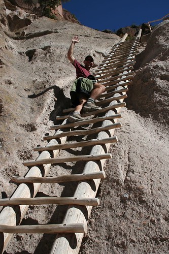
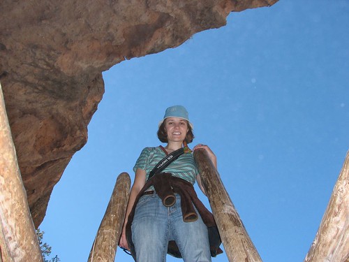
On the north and south sides of the pueblo are two five-story buildings, with smaller homes scattered throughout the rest of the pueblo. The doors and windows are recent additions – in pre-colonial times, for defense reasons, the only entry was through the roof. Ladders would have stood against the walls, all the way up to the top of the fifth story.

IMG_0410
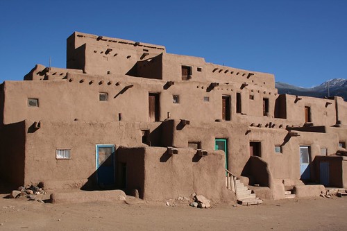
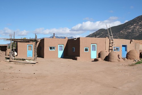
Adobe is a great material for keeping a home cool in the summer and warm in the winter. But it’s high-maintenance – the walls need to be replastered twice a year. Even if they don’t live in the pueblo, the families who own the adobe homes return regularly to perform maintenance on the homes that have been passed down through the generations. Here’s a smaller cluster of homes:

IMG_0458
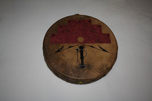
Today, a major source of revenue is the Native American crafts and jewelry industry. Many of the pueblo homes have been converted into galleries selling Pueblo-made products. We especially liked the painted drums:

IMG_0440
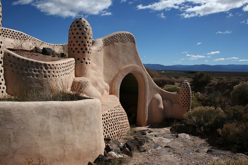
After Taos Pueblo, we did something entirely different. Driving into Taos from the west the previous evening, we had seen mile after mile of orange dirt and sagebrush, and then as we approached Taos we suddenly saw these buildings that looked like they came from outer space. Turns out they’re called Earthships, and they have a visitors center:

IMG_0468
The visitors center offered a video and self-guided tour. So we checked it out. Here’s what we learned…

Earthships are self-sustaining houses – “off the grid” was a phrase that was repeatedly used. They generate their own power via solar and wind, and they collect and purify their own water. The water is actually used four times – water used for washing is then used to water in-house greenhouses. After being filtered through the plants in the greenhouse, the water is then used to fill the toilet, and after going through a septic system, that water is then used to water (and fertilize) plants outside.

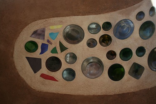
The buildings are made of used tires packed and surrounded with mud, often with empty cans and bottles. Here’s a case where bottles were used for decoration:

IMG_0478
And here’s a photo from the “systems room,” where the home’s high-tech systems are housed. Here the cans are clearly just used for filler:

IMG_0475
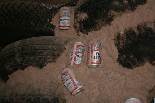
From this picture, you might think that Earthship owners have poor taste in beer. I prefer the more charitable explanation that they’re rabid recyclers and will use whatever materials they can get.

What was most striking about the Earthships was the combination of high-tech and low-tech. The systems room, converting sun and wind to power, is pretty high-tech, but the homes also make use of low-tech environmentally friendly design practices that have been known for centuries but seem to have been all but forgotten these days. For example, the south side of each Earthship features slanted floor-to-ceiling windows, which maximize the light allowed in during the winter and minimize light during the summer, helping maintain a constant temperature. Earth is apparently a great building material, too – it stays at a constant 58 degrees, and the walls of each home are packed very thick with earth, so even in the winter, the indoor temperature doesn’t drop below 58.

An Earthship is more than a home – it’s a way of life. We talked to the woman working in the visitors center for a while. She lives in the community – she worked on building her home from scratch on nights and weekends for six long years. When it still wasn’t anywhere near finished, she hired a couple of people to work with her on it, and two years later it was done. Clearly a labor of love for someone who believes passionately in setting an example for environmental sustainability.

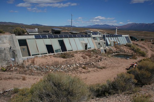
Here’s one more Earthship:

IMG_0485
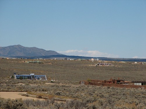
And here’s a photo surveying the community. This particular community has lots for 130 Earthships, and about 50 of those have been purchased:

IMG_0218
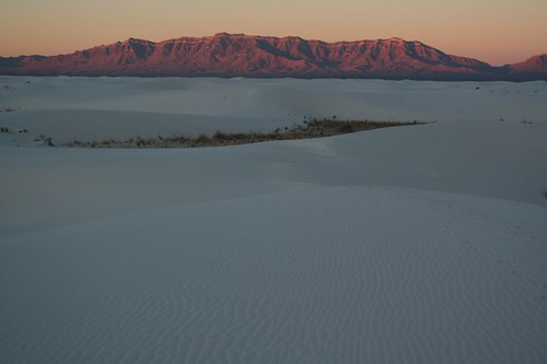
We drove back over the Rio Grande Gorge bridge, this time during the day:

IMG_0220
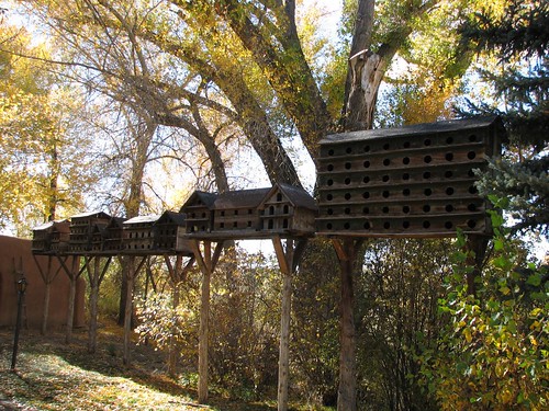
Back in Taos, we did a walking tour of the historic downtown area. Our first stop was the Mabel Dodge Luhan house. She was a wealthy woman from New York who came to New Mexico, fell in love with the area, and attracted artists to Taos.

IMG_0493
The architecture was an interesting mix of New Mexican and Mediterranean, reflecting Luhan’s varied tastes. And the doors were ridiculously short:

IMG_0496
In addition to art and architecture, I guess she liked birds a little bit:

IMG_0232
Next we walked down Ledoux Street, home of Taos’s art galleries. We randomly chose Inger Jirby’s gallery and stopped in. The woman working the gallery told us all about the artist, who was born in Sweden but fell in love with New Mexico and settled in Pilar, just south of Taos and coincidentally right next to the campground we were staying at. Jirby did traditional paintings on canvas as well as furniture, walls, and ceilings – in fact, a little hotel next door to the gallery features Jirby’s art in all the rooms.

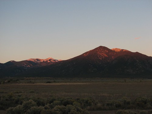
Just before sunset, we drove a ways up the road to Taos ski area and took some pictures of the dusk light on the mountains:

IMG_0235
We finished the day with a dinner at Orlando’s called los colores – “the colors” – which was three enchiladas, each topped in a different color of chile.

The next day we drove around the Enchanted Circle, a loop drive starting in Taos that circles Wheeler Peak, at 13,161 feet the highest peak in New Mexico. Our first stop was the D.H. Lawrence Ranch. Lawrence, the author of “Lady Chatterley’s Lover” but also a painter of some really raunchy paintings, tried to start a utopian society in New Mexico. When he sent a call out to all his friends to join him, only an artist named Dorothy Brett signed up. So Lawrence, his wife Frida, and Brett set out for Taos. Mabel Dodge Luhan gave Frida a 160-acre ranch, and the Lawrences and Brett started building their houses on the property.

We were the first visitors that day and saw a large display outside about a disease called hantavirus – apparently, you get it just by breathing in the vicinity of mouse droppings. Then a woman in a nightgown, jeans, and bare feet came out of a building next to the parking lot. She told us that the hantavirus display was a load of crap and that as long as we weren’t crawling around on our hands and knees sniffing mouse crap, we’d be fine. The ranch is administered by the University of New Mexico now, and some overzealous students put up the display, she said scornfully.

She asked if we were fans of Lawrence, and we said no, we were just curious. We’d read about some competition between Frida, Brett, and Luhan for Lawrence’s attentions, so we asked about that. She said there was no such competition – the three women got along great, and only Brett was really enamored with Lawrence. After all, she said, Lawrence had some sexual performance problems – why would women fight over him? We thanked her for this information and headed out on the self-guided tour.

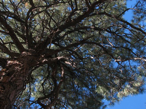
We found a tree that’s apparently famous because Georgia O’Keefe looked up at it and decided she had to paint it. Her painting is at night, with the stars shining through the branches, but we took our picture in the morning:

IMG_0238
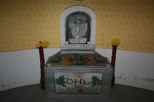
When Lawrence died, Frida had him cremated and brought his ashes back to spread at the ranch. As the story goes, Brett and Luhan showed up uninvited, and Frida threw the ashes into a wheelbarrow of wet cement, saying, “Let’s see them try to steal this!” The cement was then turned into Lawrence’s memorial:

IMG_0510
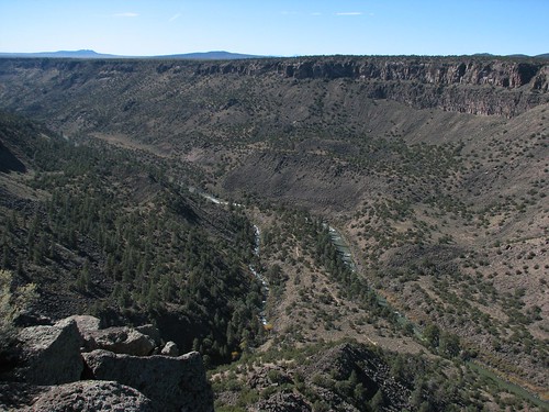
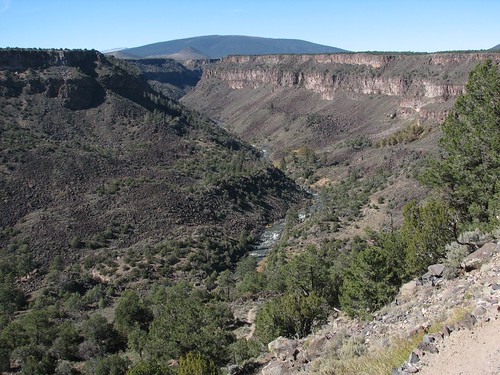
After this, we drove to the Wild Rivers Recreation Area, which contains the confluence of the Red and Rio Grande rivers. We did the hike called La Junta, a short but steep trail that leads right down to where the two rivers join.

IMG_0249
IMG_0254
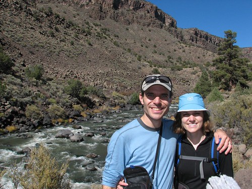
At the bottom, we stopped to take a picture with the Rio Grande as our backdrop:

IMG_0262
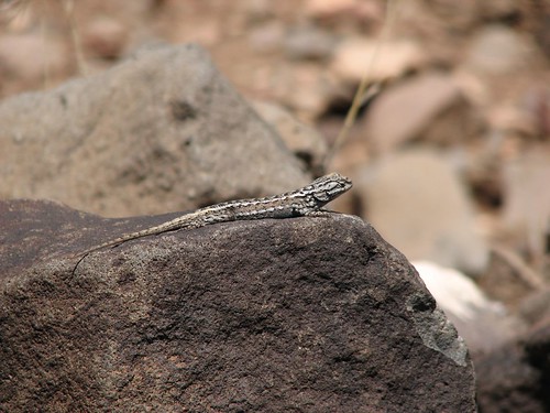
We saw several lizards along the trail:

IMG_0274
Then we did another hike called Big Arsenic, a slightly less steep path down to the Rio Grande upstream of the confluence.

IMG_0280
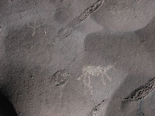
There are supposedly a lot of Native American petroglyphs and pictographs on the boulders at the bottom of the hike, along the river. We found a few:

IMG_0285
We were starting to drag a bit as we hiked up and out. The hike, while beautiful, was hot and dry – very different from hiking in the Pacific Northwest, and very different from the cold, snowy weather we’d gotten used to in Colorado. We started talking about ice cream – boy, did that sound good. Unfortunately, there was no ice cream in the car, so when we got back to the trailhead, we mixed some powdered hummus and water and had hummus on pitas and some fruit for lunch. Re-energized, we were ready to continue along the Enchanted Circle.

The drive afforded some pretty views:

IMG_0293
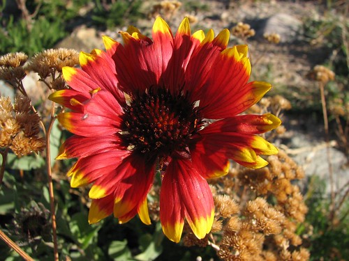
And there was this one lone flower that seemed awfully out of place:

IMG_0298
And we did buy a pint of Ben and Jerry’s ice cream at a small grocery store somewhere along the way. Triple Caramel or something like that – it hit the spot! After driving the Enchanted Circle, we headed back to our campsite at the Orilla Verde Recreation Area for the third night. The campground hosts must have thought we were weird – every day, we took down our tent and packed up, and each night, we came back. We weren’t necessarily planning to stay each day – in the morning on this day, for instance, we thought we might stay somewhere along the Enchanted Circle or we might come back to Orilla Verde, so we packed up just in case.

Rivaling the views of the Red and Rio Grande and the pint of Ben and Jerry’s for the top moment of the day: We got showers! Our first night at the Rio Bravo campground, we rejoiced when we noticed showers in the bathrooms, and on our second morning there, we dug out soap, shampoo and towels from our car and headed to the bathroom. Only then did we realize that the showers were coin-operated – four quarters for three minutes. We had only two quarters in the car. A crushing disappointment!

So when we bought the ice cream, we exchanged dollars for quarters, and that night, we took our first showers since the lodge. Brian splurged and bought six minutes of water, while Sarah set a world shower record at only three minutes – or really, more like 1.5 minutes since the first half minute was lost waiting for the water to warm up, and she finished quickly, not wanting the water to run out while she was soaped up. Even though the water started cold and our time was limited, it was extremely satisfying.

The next day, Saturday, October 20, we would drive to Santa Fe!