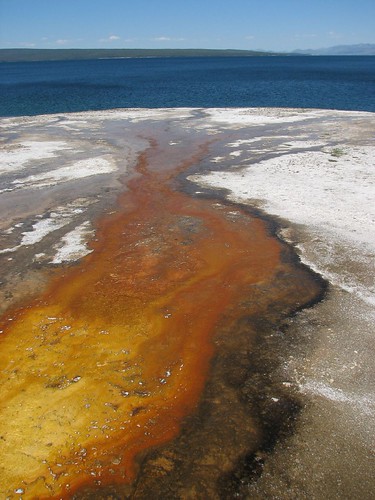
We puttered around for most of that day. We found a campsite at Signal Mountain campground, bought some fresh fruit, and inquired about a backpacking permit and were disappointed to find out that many of the Tetons’ great loop routes weren’t doable due to dangerous snowfields at the passes. That afternoon, we hung out at the Jackson Lake Lodge, whose main lounge is a veritable internet café, with dozens of people working on their laptops in front of panoramic views of the Tetons through the lodge’s huge windows.
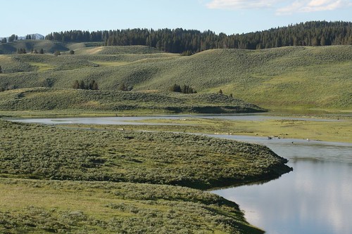
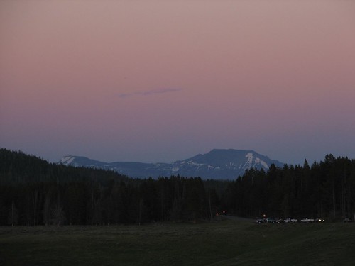
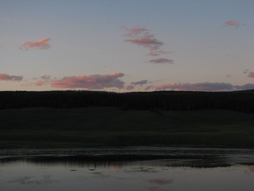
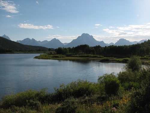
We drove out to Oxbow Bend and Willow Flats close to dusk to look for wildlife. We didn’t see anything, but the scenery sure was pretty.
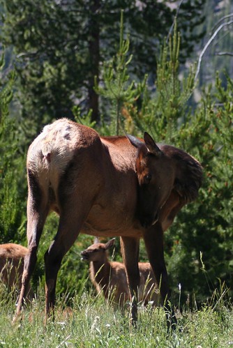
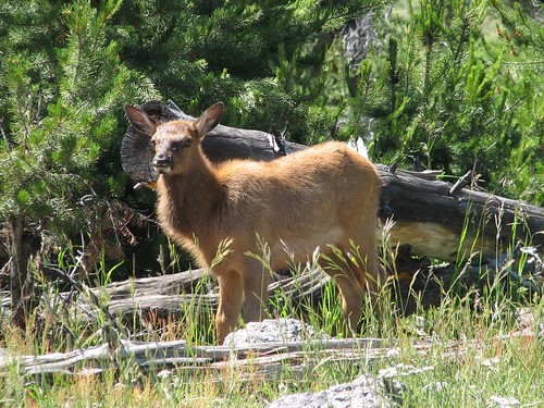
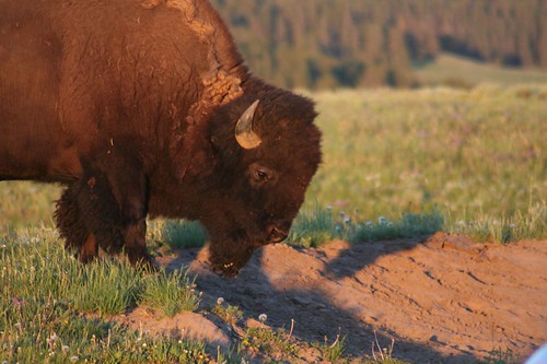
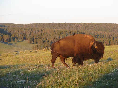
Driving back from the lodge after dark, though, we passed elk after elk grazing right beside the road. Fortunately, they were all beside the road and not in the road.
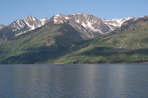
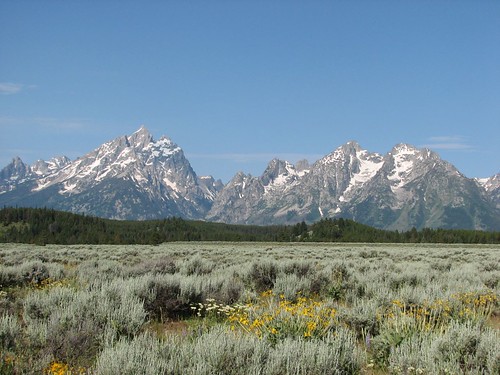
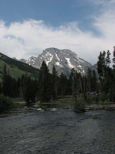
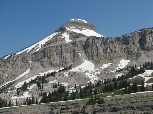
The next morning, we got up pretty early and headed toward Jenny Lake to go hiking. On the way there, we got a good look at the Grand Teton from a roadside pullout.
At the Jenny Lake Ranger Station, we looked into a backpacking permit for the next two days. We had been considering routes in the south Tetons because that area was supposed to have less snow than some of the other routes closer to the Grand Teton. Besides, we had already hiked the fabulous Paintbrush Divide / Cascade Canyon loop almost six years ago, so we wanted to try something different. We considered two canyons in the southern part of the park, Granite Canyon and Death Canyon, and the rangers that we had talked to the previous day had told us that we couldn’t even reach the camping area in Death Canyon due to a steep snowfield just a few miles from the trailhead.
Today, though, at the Jenny Lake Ranger Station, the ranger told us that we could easily hike up into Death Canyon, although we’d hit serious snow at the top of the camping zone and beyond. Since Death Canyon was supposed to be more scenic than Granite Canyon, and since this ranger seemed to know what he was talking about, we got a permit to stay in the Death Canyon camping zone for one night, planning to just do an out-and-back hike.
Grand Teton’s backcountry system is interesting, in that for the most part, they don’t have designated campsites. Instead, they have “camping zones,” which are regions of trail marked on maps and marked with signs on the trail that indicate where you enter and leave the camping zone. They have quotas for each zone, but once you get a permit, you’re free to stay anywhere in the zone, as long as you’re 100 feet from the trail and from water and you leave no trace. Some sites do have marked campsites, and in the interest of minimizing your impact, it’s best that you use one of those, but you’re not required to.
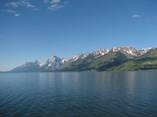
Anyway, after getting our permit, we started hiking the trail around Jenny Lake. More great mountain views were in store.
We hiked out around the Moose Ponds, which seemed like they should be chock full of mosquitoes and moose, but we saw no moose and surprisingly, very few mosquitoes.
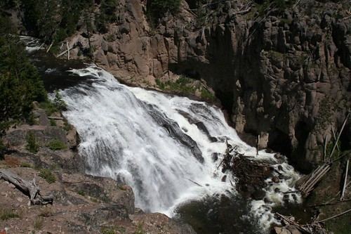
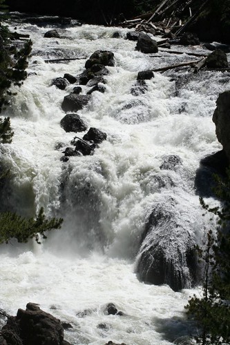
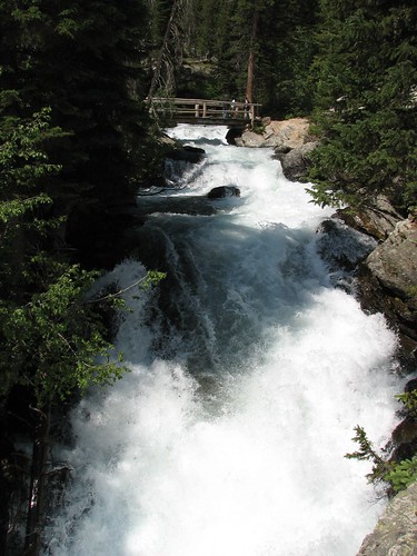
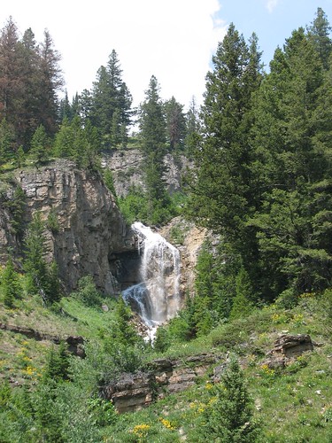
We soon reached the opposite shore of the lake, where a ferry boat deposits tourists. There, we found a massive cascade of water.
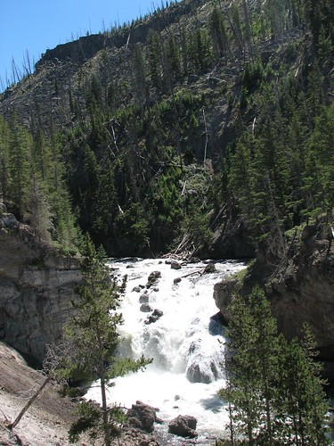
And farther up was Hidden Falls.

A couple dozen people were taking beginning rock climbing lessons on the cliff above the falls. We stopped to watch for a few minutes.
Then we hiked up to Inspiration Point, a nice overlook of Jenny Lake.

We’d done most of this hike before as part of our backpacking loop six years ago, but it’s a fabulous hike, well worth repeating.
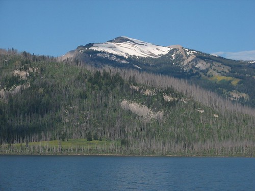
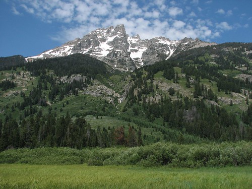
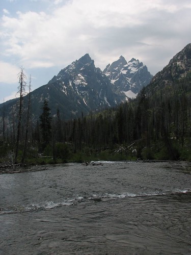
Toward the end of the hike, we got still more great mountain views.
When we finished hiking, we were famished, so Brian bought some ice cream at the general store. Sarah wanted real food, though, so we found a picnic area and make quesadillas for lunch and brownies for dessert (really, hot brownie pudding – they never really cooked through). It was a nice picnic table in the shade, so we stayed a little longer to play a game of Scrabble. Just a few turns into the game, though, it started raining, so we scurried away to find someplace indoors. The Jenny Lake Lodge let us play our game in their lobby while we watched it rain briefly outside.
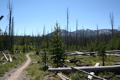
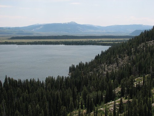
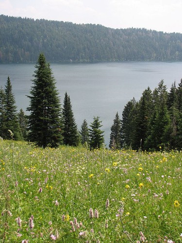
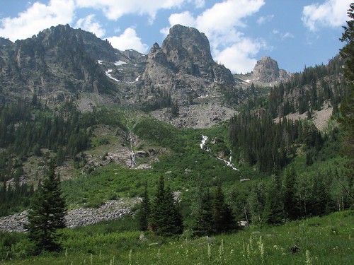
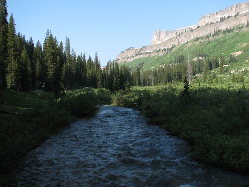
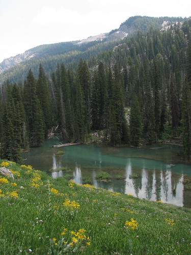
The next day, we started hiking up Death Canyon. We expected to hit snow fairly early on, so we decided to start at the Granite Canyon trailhead rather than the Death Canyon trailhead so that we could hike some extra distance. The hike through the valley to Death Canyon wasn’t very exciting, but once we reached Phelps Lake, we got some pretty views.
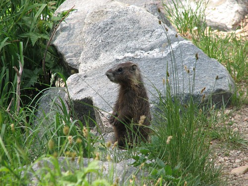
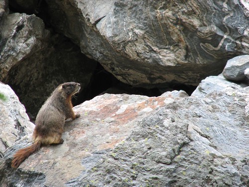
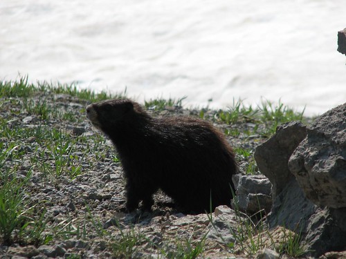
We continued on and met a yellow-bellied marmot. These guys are different from the hoary marmots that we’d met near Mt. Rainier. For one thing, they’re brown, rather than gray, and for another, they aren’t nearly as roly-poly.
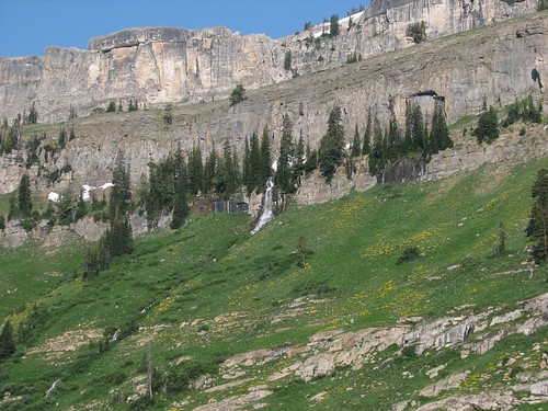
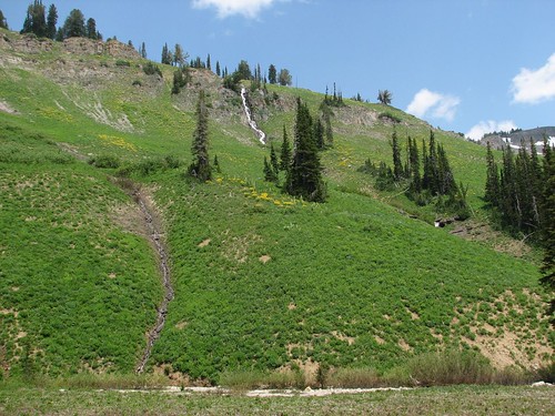
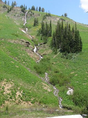
As we got higher up in the canyon, we were treated to some pretty waterfall views.
When we reached the camping zone, we found that many of the good campsites in the lower section were already taken. But after hiking about halfway up the camping zone (probably close to two miles – the camping zones are big), we found a very nice campsite, with some large rocks to cook on and a tent pad right next to the creek. A marmot thought he was invited to dinner and actually started nibbling on one of Brian’s pack straps until he shoed him away. Otherwise, dinner was uneventful, and we enjoyed sitting out and reading for quite a while in our relatively bug-free sitting area. As it finally started to get dark, we retired to the tent.
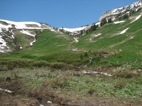
We hadn’t seen any snow on the trail so far, so the next morning, we decided to see how far we could hike up the canyon before hitting impassable snow. Maybe if we were really fortunate, we’d even be able to make it over the pass, and then we could loop around to Granite Canyon to hike out, rather than retracing our steps down Death Canyon.
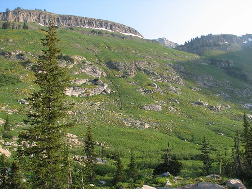
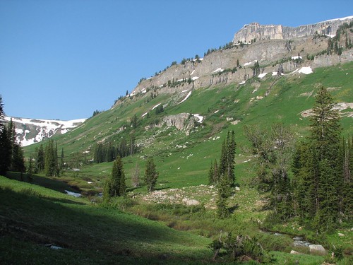
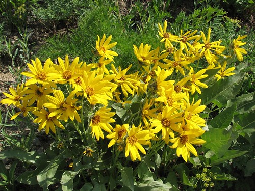
Before we left, we took a picture of the view from the cooking / reading area of our campsite. We had a gorgeous view of the side of the canyon, which was covered in yellow arrowhead balsamroot flowers.
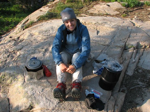
Here’s Sarah, tending our breakfast.
As we started hiking, we followed a creek up the canyon. We’d been warned of difficult river fords so we’d brought our water shoes, but so far, we’d been able to accomplish each crossing by either hopping across rocks or tiptoeing across fallen logs.
The side of the canyon was even prettier as we got higher, with occasional rushing waterfalls spaced among the wildflowers.
A few minutes later, the pass started to come into view. It looked snowy, but not nearly as snowy as we’d feared. We wouldn’t be able to tell if it was passable until we got closer.
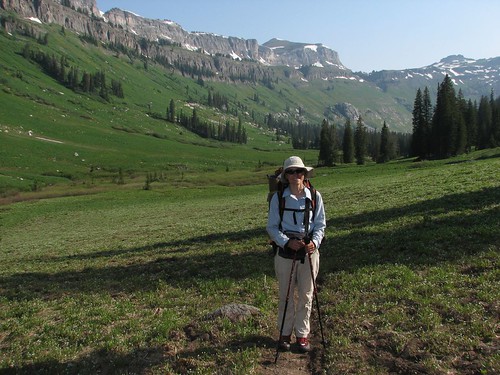
Here’s Sarah near the top of Death Canyon. Our campsite is a couple miles back at this point.
For a place with such an unattractive name, Death Canyon sure was beautiful. We kept accidentally calling it Death Valley, whose relative barrenness seemed to better deserve the name. Neither Death Canyon nor Death Valley is named after the landscape, however, but rather after people who died there. Or, rather, legends of people who died there – Death Valley, at least, has had surprisingly few deaths, given its name and perilous climate.
Anyway, as we continued hiking up, we got a better view of Fox Creek Pass, which we’d have to cross to get to Granite Canyon.
In this photo, the trail switchbacked up the green slope to the right of the pass, eventually going through the trees and to the rocks and snow. From this vantage point, it looked like just a small section of dodgy snow that we’d have to cross to attain the pass. We started to feel more confident that we might actually be able to make it over.
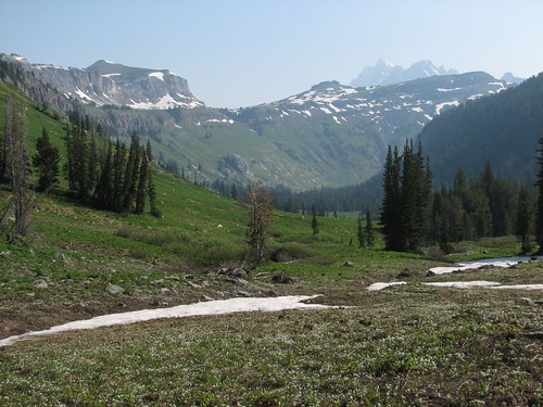
The view down the valley was pretty fantastic at this point, too, as we started to be able to see Grand Teton over the canyon walls.
We switchbacked up, up, up toward the snow. During one rest break, we got a close-up photo of the arrowhead balsamroot that we’d been admiring on the side of the canyon.
Eventually, we made it to the snowfield. It was pretty much as it had looked from below. On the one hand, it was steep enough that if you slipped, you’d slide a ways and do some damage. On the other hand, the traverse across the snowfield was short – maybe 20 paces in the steep section – and below the snowfield was some brushy vegetation that would cushion a fall. Furthermore, even though it was still relatively early in the morning, the sun was beating down on the snow, softening it up for better traction. With our hiking poles to steady us, we decided to try it.
The first few steps were a piece of cake. Then came a section where we were walking side-slope – that was a bit tougher, since we had to kick with the sides of our boots to make footholds. But after maybe 10 steps of that, we were through the steepest part, and then it was smooth sailing to the top of the pass.
At the pass, we met a large group of kids who had come up Granite Canyon without ice axes or even hiking poles. They seemed fatigued, but they were happy to hear that they wouldn’t face much snow going down Death Canyon.
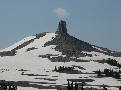
The pass afforded some new views of nearby mountains.
This monolith reminded us a bit of Devil’s Tower. It’s called Spearhead Peak.
From the pass, we hiked along the Teton Crest Trail for a couple of miles, and we were hiking on snow for most of that time. Fortunately, we were able to follow the kids’ tracks for much of that distance, and using Spearhead Peak as a reference point, we stayed mostly on course.
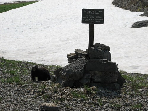
The crest is actually the boundary between Grand Teton National Park on the east and the Jedediah Smith Wilderness on the west. We came to a boundary sign and found another marmot, hanging out at the park border.
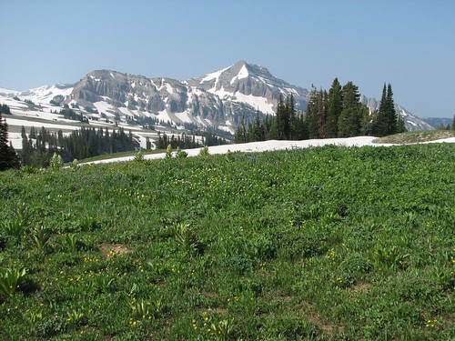
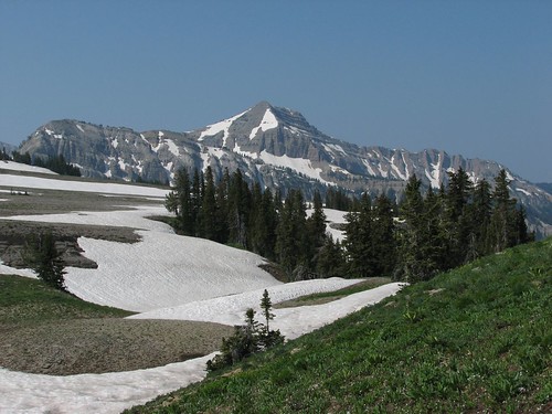
More great mountain views:
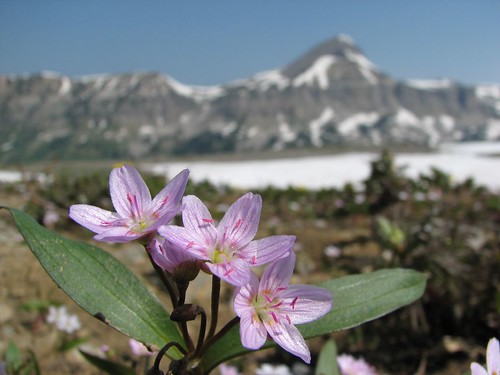
In places where the snow had melted out, delicate wildflowers had sprouted.
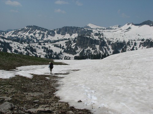
Here’s Sarah, navigating through the snow, trying to find the way down to Marion Lake, which marked the head of Granite Canyon.
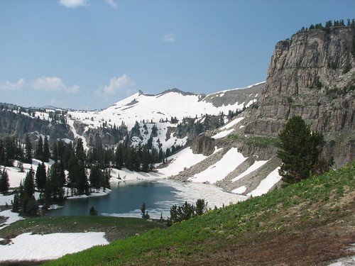
After veering a bit to the right, we found the lake.
We got down to the lake, and Sarah tried to turn her camera on to take a picture, and … nothing. The camera wouldn’t start. It didn’t seem like the battery should be dead, and as it would turn out, charging the battery didn’t fix it. We’ll need to send the camera back to Canon for repairs – fortunately, it’s still under warranty.
As we hiked back down Granite Canyon, we got some more pretty views of wildflowers and waterfalls, although we agreed that Death Canyon was more scenic.

The trail was all downhill back to the trailhead, so we made good time, stopping for the occasional photo.
Throughout the day of hiking, Brian had been having daydreams of a shower and a pizza, so when we got back to the car, we drove to Teton Village and connected to the internet to see if we could find a motel in Idaho Falls. We succeeded with a coupon on roomsaver.com – next stop, the Yellowstone Motel in Idaho Falls!