Tuesday, April 29, 2008

Viva Las Vegas

The drive west from Boulder was amazing. Some of the best features of southern Utah are preserved in the national parks, but even outside the national parks, the scenery is often jaw-dropping. We drove through the Bryce Canyon area and saw some of the hoodoos.

We also stopped at the Ruby’s complex just outside the park to use their wireless again. An Expedia search yielded a hotel room at the Gold Coast Casino for the next night for $23 plus tax. Score! That’s barely more expensive than a campsite, and we’d get showers and a king-sized bed! We looked to see if we could stay for two nights, but the next night, Friday, would be over $70 – apparently, Vegas rooms are way more expensive on the weekends than on weekdays. Nevertheless, after lying on the ground repeatedly as mock patients for WFR scenarios and being sand-blasted in the high winds, we were thrilled about the prospect of a shower.

Then, toward sunset, we arrived at Zion National Park, which seemed like a great place to spend the night. We drove a scenic road from the east entrance toward the south entrance, including a mile-plus-long tunnel blasted through the rock. There were park rangers stationed at either end to stop traffic for any larger RVs because the tunnel isn’t big enough to allow two lanes when one of those lanes is occupied by an RV.

It was getting late, so we didn’t stop much along the way through Zion, but we did take a few photos of the pretty evening light on the rocks.

IMG_3491
IMG_3052
Just after sunset, we arrived at the Watchman Campground, where we planned to sleep. Fortunately, there were a few sites left, so we set up our brand-new replacement tent for the first time and made some dinner. The campground doesn’t offer a whole lot of privacy, but the views from our campsite were quite pretty.

The next morning, we woke up and took a few pictures of the morning light from our campsite:

IMG_3054
IMG_3058
Here’s Sarah, happy to have spent a calm night in our tent, a wonderful contrast to the high winds of Boulder.

IMG_3501
After breakfast, we packed up and headed out, on our way to Vegas, baby! We decided to take a scenic route through Lake Mead National Recreation Area, but it wasn’t all that impressive. The lake has receded a lot over the past few years, and the smog in southern Nevada is pretty bad right now, so the combination of those factors made for unimpressive views. We considered going to Hoover Dam, which was just a few miles out of our way, but we were so excited about taking showers that we skipped it in favor of heading straight to our hotel.

When we got to the Gold Coast, it took us about ten minutes to park, not because finding a parking place was a problem, but because the casino was so huge that we couldn’t figure out where the front desk was or which parking area to use! It was also immediately apparent that this wasn’t the hip place to stay, not that we were expecting hipness for $23 a night. The casino is perhaps a mile away from the Strip, and it has the bright flashing lights that we associate with casinos of, say, the 1970s. After checking in, we had to walk through the casino to get to the hotel elevator, and determined that the average age of the casino clientele was probably around 50, with many people in their 70s or older. We’ve never seen a parking lot with so many handicapped spaces, and at times, they were all full!

We arrived at our room to find a monstrous bed, a powerful shower, and a 32” flat-screen TV, and we were pleased. We spent a good half hour taking showers, getting all the dirt and grit off our bodies after the WFR course. Then we headed down to the casino for the lunch buffet before lounging around for a while and running some errands. In the evening, we headed to Cashman Field for a minor-league baseball game between the Las Vegas 51s, the Los Angeles Dodgers’ AAA affiliate, and the Portland Beavers, the AAA team of the San Diego Padres. It was dollar beer night, and we noticed that the clientele here skewed way younger than at the Gold Coast. The 51s’ pitcher had some trouble in the first couple of innings, and the already rowdy beer-drinking crowd started booing him, but he settled down and the 51s’ bats heated up, and the 51s wound up winning 8-1. Beer lines and bathroom lines were both long, but Brian managed to consume and expel four beers during the game.

Afterwards, we headed to the Strip to see it lit up at night. Other than Times Square in New York, we couldn’t think of anywhere else we’d been that was so bright at night. The power lines in Vegas are a sight in themselves – never have we seen so many power lines attached to a single utility pole! We wanted to spend some time walking the Strip the next day, and there happens to be a KOA next to the Circus Circus, so we stopped in there to find out how much it would cost to pitch our tent the next night. The answer: $45! To pitch our tent in a parking lot! Everything’s expensive in Vegas on the weekends.

We headed back to the hotel and had some cocktails at the casino bar – free, with a coupon book that we received at check-in. Then we headed to the bowling alley to play a few games. Their graveyard special starts at midnight – a dollar for shoe rental, for each game, and for each beer. It had been several years since either of us had bowled, and we had fun playing a couple of games.

The next morning, we ate the breakfast buffet and hung out in our nice accommodations for a while before checking out. On our way out, we played a couple of hands of blackjack because our coupon books contained coupons for a $5 casino match on a $5 bet, stacking the odds in our favor. The dealer started with a 3 and eventually busted, so we both won. Our $20 combined winnings almost paid for the hotel room!

We hadn’t done laundry since leaving Colorado, so Brian did that while Sarah ran some other errands. The laundromat had industrial-sized washing machines – our monstrous bag of clothes fit into one washing machine that could hold up to 55 pounds of laundry and cost $5 a load! And that wasn’t even the biggest – if you had more laundry, you could use a $7, 75-pound machine! The laundry was uneventful, and there was wireless at the laundromat to keep Brian occupied.

Brian found that the weather forecast for Death Valley, our next destination, was 99-103 degrees each day through Tuesday. Yuck! It was supposed to cool off on Wednesday, to a high of about 90 degrees, so we decided that between now and then, air-conditioned Vegas was far preferable. Some searching yielded a $28 room for Sunday and Monday nights at the Gold Coast. Although there were comparably-priced rooms in other casinos, we’d been quite happy with the Gold Coast, so we decided to return. For the weekend, we’d camp in the Humboldt-Toiyabe National Forest, just northwest of the city. About the time that the laundry finished, Sarah returned, and we headed off for a weekend camping trip from our new home base of Vegas!

Becoming WFRs

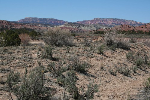
We arrived at the Boulder Outdoor Survival School (BOSS) around 5:30 on Sunday for our Wilderness First Responder (WFR) course, which started the next day. We found a couple of yurts and a trailer in front of a large swath of desert sand covered in cactus. We checked out one of the yurts, but no one was home. Then we saw signs of life in the trailer, so we introduced ourselves to two guys who were unloading a bunch of stuff into the trailer. One guy had a ZZ Top beard, and I don’t think either was wearing shoes. Apparently, they both worked at BOSS and were both taking our class. They told us where we could set up our tent, and asked us to wait a few minutes, since their vehicle was blocking the road to the camping area.

When they moved, we drove back on the sand, finding that a bunch of people had already set their tents up. We found a patch of sand that was a respectful distance from anyone else and started setting up. The only real problem was that the outhouse was a long ways away, back by the first yurt that we’d stopped at. Brian wasn’t too excited about having to wander over there in the middle of the night, especially with his Glen Canyon navigational debacle still fresh in his mind. Overall, his impression was that we were staying in Hippie Hollow – what had we gotten ourselves into?

A few of the folks staying in nearby tents introduced themselves; all were enrolled in the WFR course with us. One of the two guys that we’d met initially came by, and Brian mentioned his concern about the distance to the outhouse. The other guy said that “small ones” are fine in the sand, but “big ones” go in the outhouse. Brian wasn’t exactly sure what he meant, but he assumed this was a sanction to pee in the sand, and was grateful.

The class started the next day. The two instructors were from the Wilderness Medicine Institute (WMI) and both seemed really good. Class would run from 8 to 5 every day, except for two nights when it would go until 10 one night and whenever we finished the other night – possibly midnight, possibly 2 AM. We also got a textbook with assigned reading for each night – it sounded like we’d be busy!

The first day of class, we learned the patient assessment system, a tried-and-true methodical system for diagnosing and treating a patient in the wilderness. It all seemed quite well-thought-out, except that the first step is to immobilize the spine by taking firm hold of the patient’s head. If you didn’t see the patient’s injury, you must always suspect a method of injury (MOI) for spinal injury. In other words, you can’t quite be sure that the patient didn’t fall from a 40-foot cliff, even if you found him in the middle of an open field and he says he just has a splinter. So you have to keep firmly grasping his head until definitive care arrives. (Later, we learned how to determine that we could release spine immobilization. But the first step on a splinter patient is still to grab firm hold of that head – we just learned the criteria for eventually letting go.)

The second day of class, we learned CPR. The hardest part about CPR is getting the rhythm right – you want 100 chest compressions per minute, no more and no less. The instructors clued us in on how to do it right. Just let the song “Another One Bites the Dust” run through your head while you do the chest compressions – the song has about 100 beats per minute. We were kind of disturbed, but we sang “Another One Bites the Dust” to ourselves as we tried to save our CPR dummy’s life, and it worked.

The wind howled through our tent each of the first two nights, depositing a layer of sand on everything. On the second day of class, though, the wind really picked up. One guy went back to the camping area during the class day to check on the tents. He came back with good news – the tents looked pretty good except for two. He proceeded to tell us that all four stakes of our tent had come out and the tent had gone flying. But not to worry – the tent was pinned firm against a tree and seemed to be stable there.

This didn’t sound good, so we raced back to the camping area through the howling wind to find our tent indeed pinned against a tree. Where the stakes had gone was not obvious, but after they had given up the fight with the wind, the tent had definitely taken flight. The wind was still howling, pressing the tent against the tree, so it was all we could do to wrestle the tent out of the tree and take it apart. When we finally did, we found that the poles were bent in three places and broken in one. Our tent would not be rising again. Unhappily, we stuffed the tent back into its bag, not knowing where we’d sleep tonight.

Over the next couple of hours, we hatched a plan: We’d either sleep somewhere else at BOSS or store our stuff somewhere and sleep in the car. (Our car’s normal state is so packed that we couldn’t fit a medium-sized raccoon in the back, much less two adult bodies bundled in sleeping bags.) We talked to Jeff, the guy in charge of BOSS, and he said we could store our stuff in the yurt, which turned out to be a big shed. Then we called up REI, and the representative said that our tent shouldn’t have just flown away, so she’d send us a new tent. We’d have to pay for it, but REI would pay for overnight shipping, and the next time we made it to an REI store, we could return the tent with the broken poles. Score! REI is amazing. So, problem solved. We’d sleep in Caroline tonight and get a new tent on Thursday.

As it turns out, there were about ten of our classmates who also slept in vehicles in the parking lot that night. The wind stayed high throughout our time in Boulder, so although we got our new tent right on schedule, we never set it up, for fear that it, too, would blow away. With all of our stuff in the yurt, the back of the CR-V made for reasonably comfortable sleeping space, and it was really nice not to have the wind howling through the tent overnight and coating us in sand. Many other people decided the same thing – we had plenty of company in the BOSS parking lot overnight.

Over the course of the class, we learned all sorts of interesting things. General malaise is not only a symptom of many illnesses; General Malaise is also a South American dictator. Or so said one of our instructors, who was generally not to be believed but was very amusing. The other instructor kept prescribing a “can of toughen-up” for various illnesses and injuries that couldn’t be treated but due to low severity, didn’t require evacuation. For the rescuer, he recommended drinking a “can of calm”.

For altitude sickness, a vasodilator (something that expands the blood vessels) is helpful. Viagra would be a good choice. Apparently both male and female mountain climbers take Viagra to help them handle the altitude. I never did understand those TV commercials, where they show a man and woman in a cozy-looking house in all pastel colors, happily smiling at each other. Now I do – apparently, they just arrived home safely from a big-mountain expedition, free of altitude sickness thanks to Viagra (or Cialis, or Levitra), and they’re reflecting with satisfaction on their accomplishments.

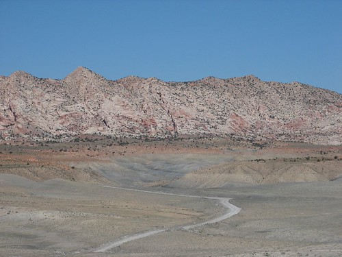
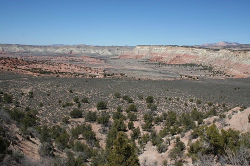
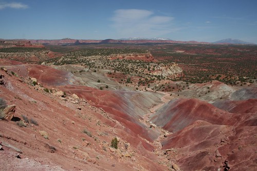
On Saturday, we got a day off from class. Unfortunately, a lot of reading had piled up from the previous days, so we’d have to spend much of the day catching up. But we decided that we should at least do it in a beautiful place, so we headed out the Burr Trail, a paved road through Grand Staircase-Escalante National Monument that eventually leads to Capitol Reef National Park.

We spent a lot of the day parked on the sand in the national monument with a beautiful view and nobody else around. We’d driven a ways off the paved road, to the point where Sarah asked whether we could find our way back. Fortunately, we realized we could see the paved road off in the distance. We set up our camp stove and chairs, made some coffee, and got started reading. We stayed there for hours, only leaving when our nemesis, the wind, picked up and started blowing sand in our faces.

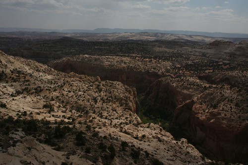
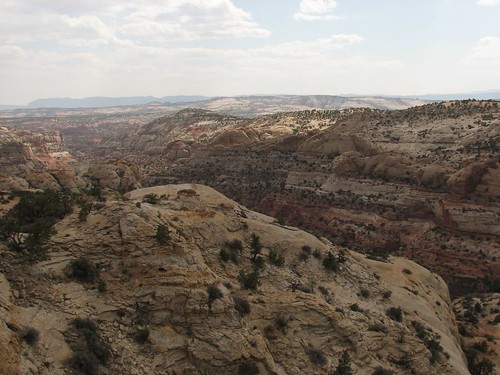
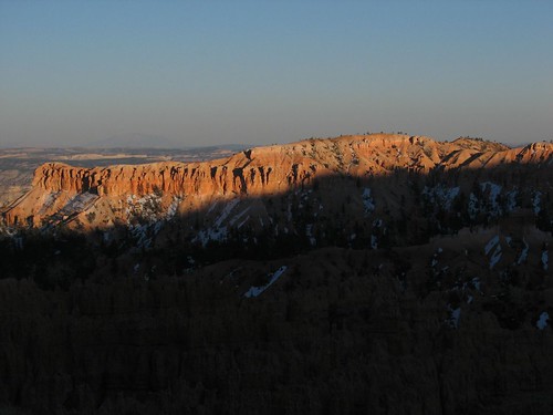
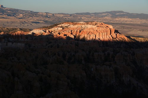
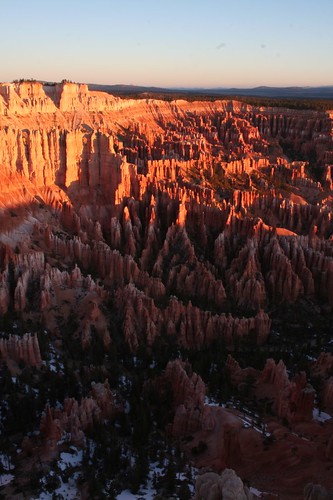
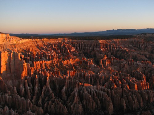
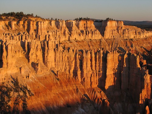
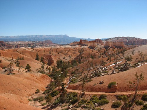
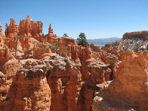
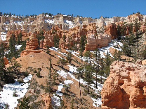
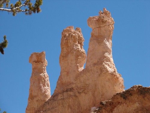
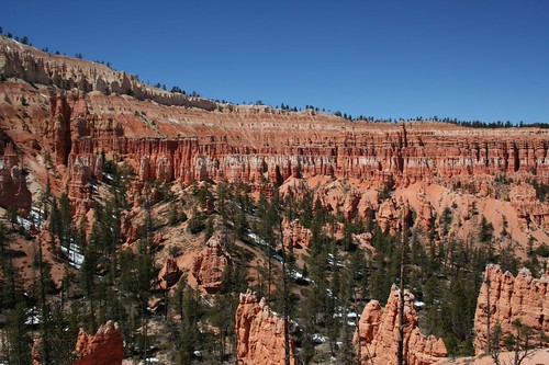
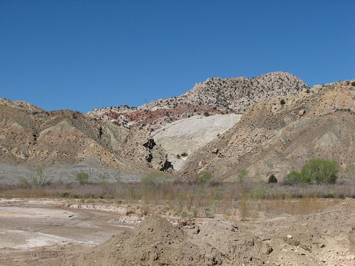
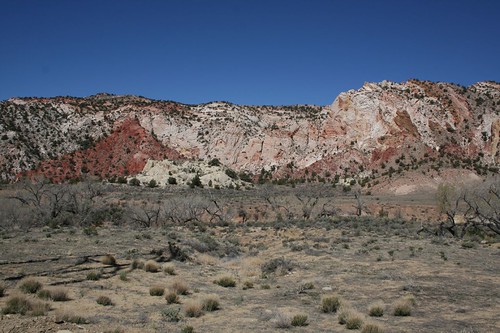
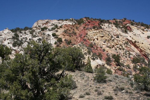
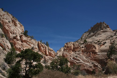
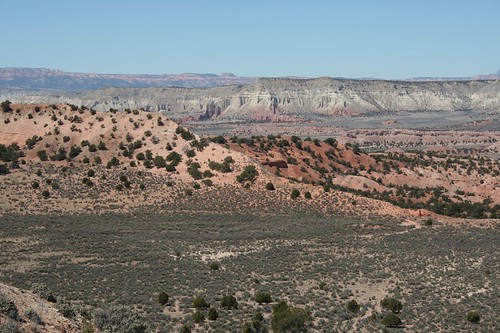
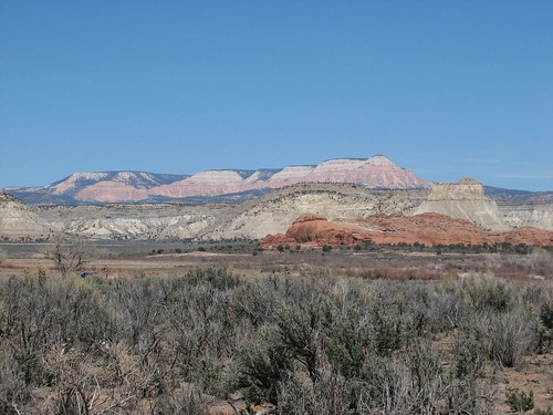
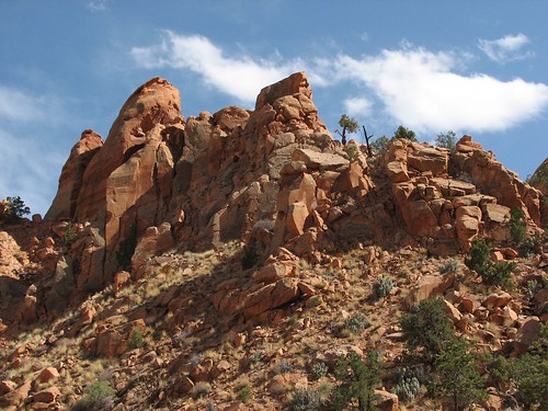
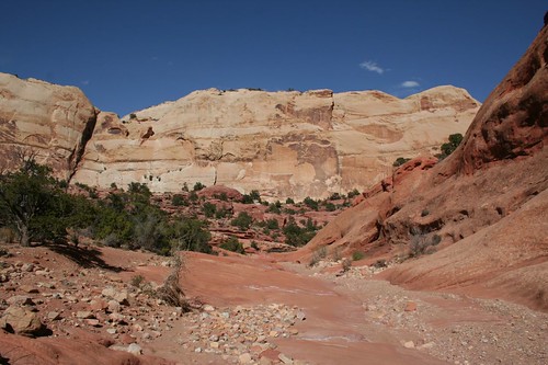
It was still pretty early and the drive was beautiful, so we kept going. Eventually, we saw a road sign that indicated we were only about 10 miles away from Capitol Reef. We hadn’t planned to drive this far, but since Capitol Reef was so close, we had to keep going. The views of uplifted pink rock were amazing.

IMG_3035
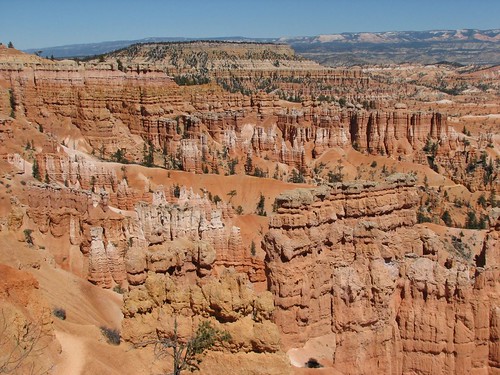
We drove a crazy steep switchbacked road down into a canyon and then took a picture looking back up:

IMG_3474
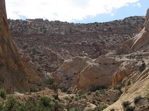
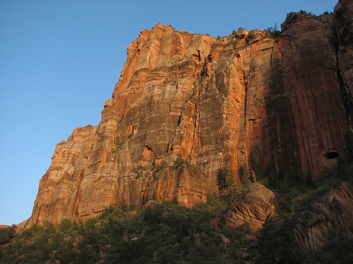
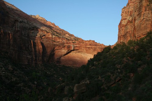
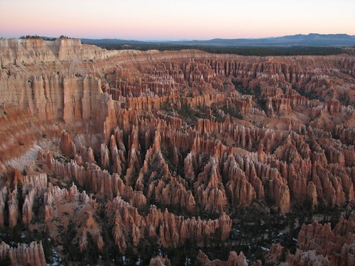
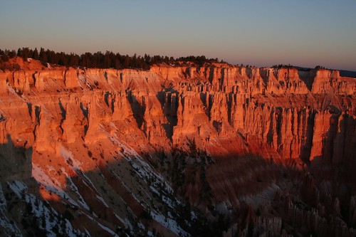
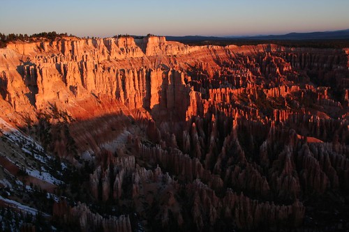
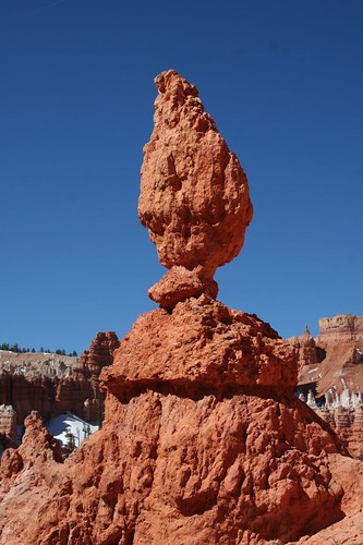
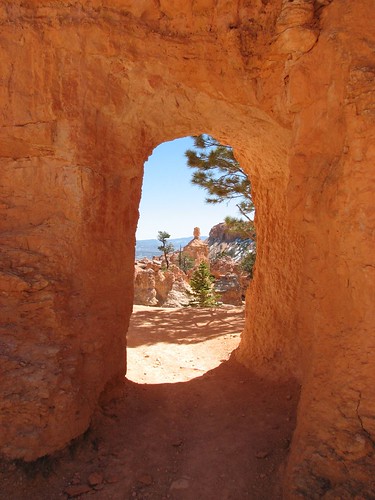
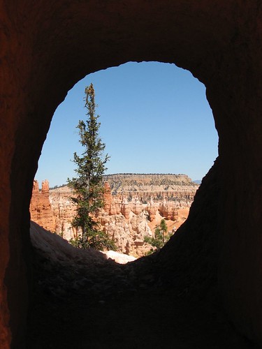
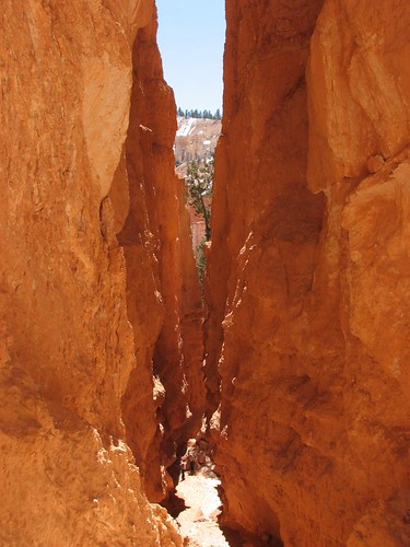
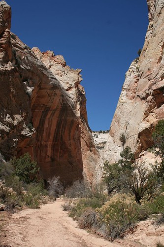
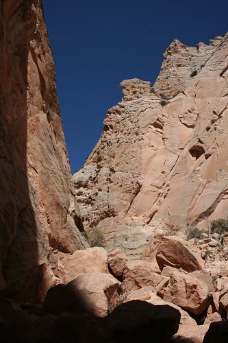
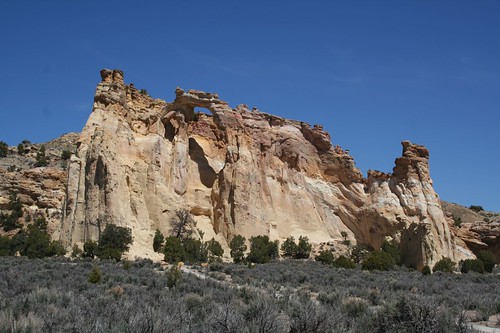
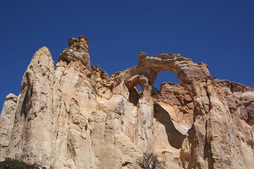
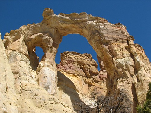
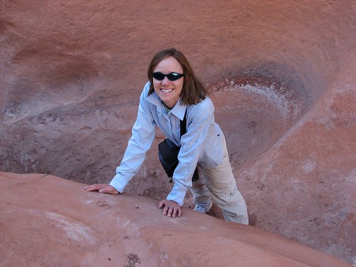
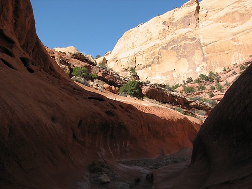
We saw a sign for the Lower Muley Twist Canyon trailhead. Brian had read that this was supposed to be a great trail, so we decided to hike out a little ways. After about a half hour, the canyon narrowed so that it was just maybe a foot wide. That foot was filled with a gooey sludge that we didn’t really want to walk through, and besides, that pesky wind had been blowing sand in our faces, so we decided this was a good spot to turn around. We’d gotten some good pictures along the way, though.

IMG_3479
IMG_3044
IMG_3481
IMG_3483
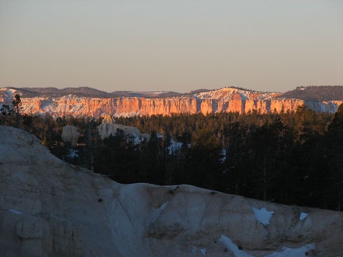
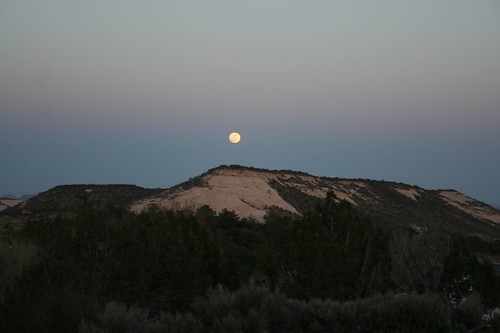
After the hike, we drove back to Boulder to do some more studying. When we returned, the moon had risen and made a pretty sight over the mesas across from our campground.

IMG_3045
Later in the class, we learned about mass casualty incidents (MCIs). One of our instructors told us about a bus wreck with 53 patients, where he had arrived on the scene as one of only five rescuers. Five rescuers for 53 patients – not good odds. So we learned how to handle such a scene and then did a scenario.

One of the best parts of this class was the scenarios, where we got to practice what we’d learned in the classroom sessions. A subset of students would become “patients” to be “treated” by other students. The instructors came up with some crazy scenarios – a unicycling Bulgarian trapeze troop of clowns was involved in one of them – but no matter how outrageous the MOI, the resulting injuries and illnesses always served to help cement what we’d learned in class.

So in the MCI, Brian was one of the patients. He was given a dislocated shoulder – basically, half a tennis ball, stuck to his shoulder with an ACE bandage, and covered in purple moulage (the instructors’ word for their makeup kit that allowed them to simulate all manner of gruesome ailments). He sat down with the other six members of his trapeze troupe, who were all roped together – did I mention that they were climbing a mountain on their unicycles and were roped off for safety?

Then the rescuers, the other 20 students in the class, arrived on the scene to save the day. One after another came by Brian to ask his name and what was wrong, as he screamed about the excruciating pain in his shoulder. And then each went away, apparently deciding that his shoulder could wait when other patients had eyes popping out and head trauma that was causing some really strange behavior. Eventually, Brian lay down, pretending to faint from the pain. One of the instructors came by and told him to vomit and choke on his vomit, so he did. Something like 30 seconds later, one of the rescuers came by and performed chest compressions to force the inhaled vomit back up, and Brian went back to being in excruciating pain. At length, after being repeatedly abandoned and then ignored, despite his obvious pain, he wandered into the accident scene, nearly stepping on the popped-out-eye patient, and yelled even more forcefully that he needed help. The rescuer in charge decided that Brian needed to be “bounced” and sent the two burliest rescuers to swiftly dispatch him from the scene. Fortunately, one of those rescuers was not only burly but had learned a bit of WFR training, and proceeded to relocate Brian’s dislocated shoulder. Finally, his pain was relieved, so now he started looking for morphine.

Getting the opportunity to use one’s over-the-top acting skills was a lot of fun. Being the rescuer, on the other hand, was stressful. There are a lot of steps to remember, and if you forget just one step, you could miss a key injury or an allergy to a drug that you’re about to help administer.

Another highlight of the class was the food. Our tuition paid for not only the course and camping (or a spot in the parking lot, as it turned out) but also three meals a day. We were expecting typical cheap, unexciting, and likely unhealthy institutional-style food (hotdogs and baked beans anyone?). As it turned out, the food was fantastic! We got fresh-made spring rolls, homemade breads and soups, fresh-baked scones, pancakes, enchiladas, and a number of other delicacies, mostly made with natural or organic ingredients. They even had home-canned sides occasionally – including an assortment of pickled items, apple butter, and jam. What a treat not to have to think about cooking for 10 days, especially when the food was so good! We also didn’t have to wash any dishes expect our own plates and cups. We were definitely spoiled.

On the last day of class, Wednesday, April 23, we had to pass a written test by answering at least 80 of 100 multiple choice questions correctly, and also a practical exam, which was yet another scenario. Brian got a 97% on his written test, and Sarah was the instructor’s first ever 100%! In reviewing her test later, though, she found one question that she’d answered wrong that the instructor had failed to mark, so her score will go into the record books with an asterisk. We both passed our practical exams as well, so now we’re full-fledged WFRs (pronounced “woofer”), ready to wield our medical training like a samurai sword against anyone brave enough to get injured or sick in the wilderness when we are in the vicinity.

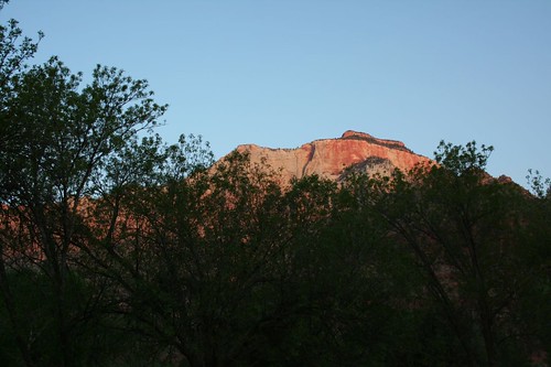
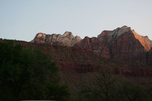
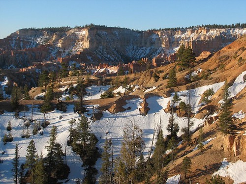
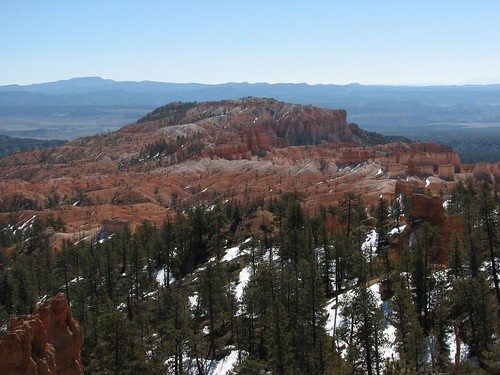
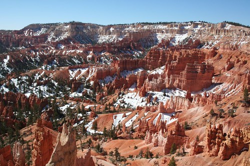
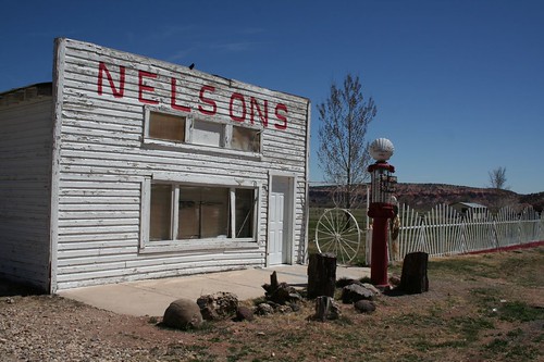
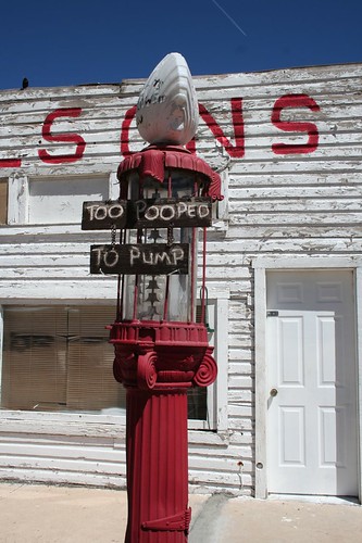
After receiving our WFR certification, we went to the corner gas station for some ice cream, then back to the BOSS yurt to reload our car. We took a few pictures of the cool scenery as we left town, and then we were off, heading west.

IMG_3048
IMG_3489

Sunday, April 27, 2008

Bryce Canyon

After leaving Grand Staircase-Escalante, we continued heading north toward Bryce Canyon. We were only spending a night there, after deciding the previous day to stay in the Glen Canyon area due to the chilly Bryce forecast.

Along the way to the vehicle entrance of Bryce, there was a short trail into the park to a waterfall and something called Mossy Cave. We decided to stop and walk out there. The waterfall turned out to be just a trickle – it seems that the flow is higher later in the season. But the cave was really cool. Apparently water seeps through the roof of the cave and then freezes. The result is a cave full of formations like stalactites, stalagmites, and columns, except they form over the course of a winter, instead of over centuries, and they’re made of ice. Here’s what it looked like:

IMG_2876
After that, we headed into the park and to the campground to set up. Loop A was for vehicles 20 feet and over, loop B was also for vehicles 20 feet and over, and loops C and D were closed. We were stumped for a minute but eventually decided that we’d just have to camp in an RV site, even though Caroline falls well short of the minimum length requirement. We found a really nice site in the A loop and set up camp. Brian was excited to try out his new speaker setup with his satellite radio, and it worked great – he listened to the Red Sox playing the Yankees as we set up camp.

We made dinner and then about half an hour before sunset headed toward an overlook, appropriately named Sunset Point. Unfortunately, half an hour before the official sunset time, the sun is already pretty close to out of sight, and most of the canyon is shrouded in shadow. We got a couple of pictures, and resolved to wake up early for sunrise.

IMG_3283
IMG_2891
Brian’s alarm went off at 6:15 the next morning, and Sarah, grumbling, followed him to the car. We were all bundled up in our down jackets, fleece hats, and gloves, and we hadn’t had our coffee yet, but seeing sunrise sometimes requires sacrifice. Fortunately, it wasn’t quite as cold as we had feared based on the weather forecast we’d see at Glen Canyon Dam.

We had decided to go to Bryce Point, which one of our guidebooks claims is a better place to see sunrise than the viewpoint called Sunrise Point, oddly enough. When we got there, the sun hadn’t quite come up yet. Since the interesting views of the canyon are just after sunrise, we’d made it in plenty of time.

IMG_3298
When the sun rose, the top of the canyon was bathed in beautiful soft light.

IMG_2902
IMG_2918
IMG_2933
The view down into the canyon was really pretty as well.

IMG_3319
Looking in a different direction, we could see a lot of snow still hanging onto the hoodoos.

IMG_3332
Finally, with the sun higher in the sky, we decided that it was time to head back to the campground to make breakfast.

IMG_3333
On the way, we stopped at Sunset Point to see what we’d missed. In the end, we agreed with the guidebook that Bryce Point was a better place to see sunrise, although Sunset Point offered a nice view of snowy hoodoos.

IMG_3359
As we got back to the turnoff for our campground, we saw a half dozen deer on the roadside. We stopped to take some deer photos, despite our grumbling stomachs.

IMG_3368
After recharging with coffee and oatmeal, we set out for the day’s activity: a hike through Bryce Amphitheater. Bryce’s hoodoos make for some of the most amazing scenery in all of southern Utah – and that’s saying a lot, because most of southern Utah is really pretty. But Bryce Amphitheater, which features the best of the hoodoos, is quite a small area, so it’s pretty easy to see the park in one day. We strung together the Queens Garden trail, the Peekaboo Loop trail, and the Navajo Loop trail for a six- or seven-mile hike that meandered through much of the amphitheater. We were a little afraid that the trail would be snow-packed, but it turned out to be quite good.

Some nice views along the Queens Garden trail:

IMG_3377
IMG_2965
IMG_3391
The “balanced rock,” an occasional curiosity throughout southern Utah:

IMG_2989
This bird was looking for handouts and wasn’t very shy at all:

IMG_3405
The Peekaboo Loop went pretty steeply uphill and was partly slush-covered. It also had unfortunate stinky signs of equine traffic, but it was nothing compared to the trails into the Grand Canyon. It afforded more pretty views:

IMG_3421
April’s a nice time to see Bryce because it’s generally not super-cold (leaving aside the previous night’s exceptional 13-degree forecast), but the snow still lingers. The contrast between the white snow and pink rocks makes for some gorgeous views.

IMG_3426
In a few places, trail builders had to blast holes through the rock. Looking through those man-made keyholes made for some interesting views.

IMG_3428
IMG_3435
We don’t spend a lot of time looking for images in the shapes of the rocks. But Scooby Doo was unmistakable:

IMG_3434
The Navajo Loop took us up and out of the canyon. Along the way, it passed by an area of hoodoos of identical size and shape, like an army of chess pieces:

IMG_3023
The section of the Navajo Loop that we hiked is called Wall Street, and part of it is a very narrow slot canyon. Here, there were some hard-to-see icy patches – at one point, Brian took a step up and then slid about three feet back, not realizing that he was stepping on melting ice.

IMG_3447
At the end of our hike, it was getting around mid-afternoon, and we needed to be two hours away in Boulder, Utah, that night for our ten-day Wilderness First Responder class. So we high-tailed it out of there, but on the way out, stopped at one last scenic viewpoint, Fairyland Point:

IMG_3455
Not knowing if Boulder would have internet access, we then made a quick stop at Ruby’s, a massive general store / gas station / inn complex right outside the park, to use their wireless for one last email check before heading east. Next stop, Boulder, Utah, to learn wilderness medicine and become certified as Wilderness First Responders!

Grand Staircase-Escalante

On Saturday, April 12, we left our beach campsite and headed toward Grand Staircase-Escalante National Monument. We were planning to drive the Cottonwood Road, a 40-mile dirt road that runs south to north through the monument. We’d heard from one person who worked at the Glen Canyon Dam visitors center that because it had rained a couple days earlier, the road would be impassable to all but four-wheel-drive high-clearance vehicles. Then we talked to a Park Service ranger, who said she’s driven the road in her Jeep Liberty with no problems at all. Furthermore, not much rain had really fallen this week, and with the dry air and high winds, the road should be in great shape for us to drive it the next day. To be sure, though, she said we could check in at a visitors center near the start of the road.

So we set out. Sure enough, when we checked in for the latest road conditions in the morning, we found out that the road was easily passable by two-wheel-drive vehicles, so Caroline should have no problems. We started driving, and the scenery was amazing. Pink rocks on one side:

IMG_3223
Nearly black rocks on the other:

IMG_3224
Apparently, grazing rights on the land are leased out because we saw several cows along the drive.

IMG_3229
We’d drive for a little while and then stop because we saw something else that warranted a photo.

IMG_3232
IMG_2841
IMG_2843
A little bit past halfway on the dirt road, we came to a trailhead for a slot canyon that we wanted to hike. Here’s Brian, excited to be out of the car for a while:

IMG_2844
The beginning of the hike:

IMG_2845
Very quickly, the canyon narrowed, and we scrambled up some rocks to continue along the trail.

IMG_2848

A nice view from the trail:

IMG_2855
It was a beautiful hike, and exceptionally quiet – we only saw four other hikers. In fact, the entire drive, we saw very few other people. When Bill Clinton dedicated Grand-Staircase Escalante as a monument, he pointed out that it was the last section of the lower 48 to be mapped. It’s a vast expanse in the middle of nowhere with few roads going through it, and most of those impassable by all but the most rugged trucks. No wonder it gets so few visitors.

Further along the drive, we came to one of the most famous sights in the monument, Grosvenor Arch. It’s actually a double arch – a big one and a small one.

IMG_2858
IMG_2861
IMG_3258
Brian just had to take a picture of Sarah standing in front of the arch.

IMG_3265
As we neared the end of the drive, the views became even more expansive, with more gorgeous pink rocks.

IMG_2865
IMG_2867
IMG_3273
IMG_2869
Finally, we came to the end of the road, left the monument, and reached a town called Cannondale. We thought the defunct Nelsons gas station was cute.

IMG_2871
IMG_2873
After leaving the monument, we were now very close to Bryce Canyon National Park, our next stop!