Monday, May 26, 2008

Northern California

On Monday, May 19, we got a slow start from San Francisco and drove to Muir Woods National Monument, planning to do a short hike there and then continue driving up the coast. After parking, we noticed that the rear left tire looked a little flat. We pulled out the tire gauge and measured it, and it had only 14 pounds of pressure, while the other tires had 30! A quick inspection turned up a nail in the tread of the tire, so apparently we had a slow leak rather than a flat. It was getting late in the day, so we skipped hiking at Muir Woods and instead drove out to find cell phone service so we could investigate getting the tire fixed. The most convenient Discount Tire location was in Santa Rosa so we would have to drive inland a ways before heading back out to the coast.

We didn’t have enough time to get to Santa Rosa before Discount Tire closed, so we found a place to camp along the way – China Camp State Park. It had mosquito-ridden walk-in sites, but we wouldn’t be there long. The next day, we got the tire patched up and were on our way back to the coast around 10 a.m.

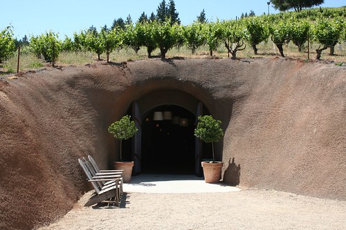
Looking through our guidebooks, we found that our drive from Santa Rosa to the coast would take us through the Dry Creek Valley, one of California’s wine-making areas. We couldn’t drive through wine country without tasting wine, so we stopped at the Bella winery. The tasting room was in a man-made cave in a hill with grapevines growing on top.

IMG_3701
IMG_3699
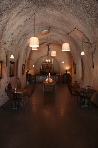
The wines were excellent. Zinfandel was their specialty, and we actually tasted three different varieties, including a deliciously sweet late-harvest zinfandel dessert wine. The man who poured our tasting gave us a coupon for a free tasting at the Peterson winery, which we’d seen just a short ways back on our drive, so we headed back there for the cabernet sauvignon that our pourer recommended.

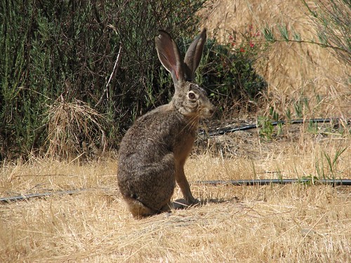
We got to the winery and asked to taste the cabernet, and the pourer there told us they didn’t make cabernet. After some mutual puzzlement, she pointed out that our coupon was for a tasting at the Peterson winery, but we were at the Preston winery. Oops. Apparently, people are mixing up the two wineries all the time. We did a tasting anyway, which was unremarkable, but we had a nice picnic lunch on the winery grounds. On the way out, a rabbit sat beside the road looking at us.

IMG_4782
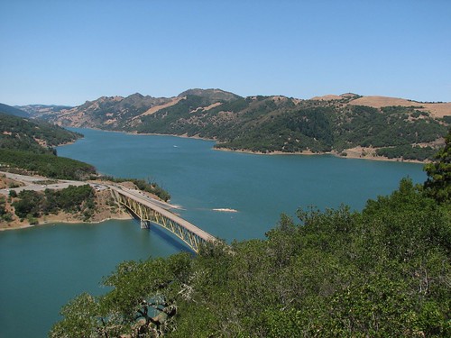
After lunch, we left wine country and continued on toward the coast. Along the way, we passed Lake Sonoma, created by the construction of the Warm Springs Dam in 1983.

IMG_4787
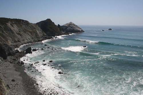
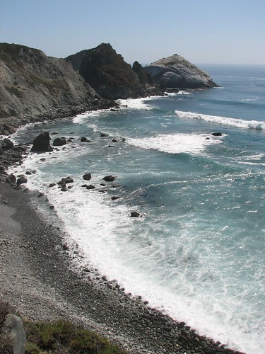
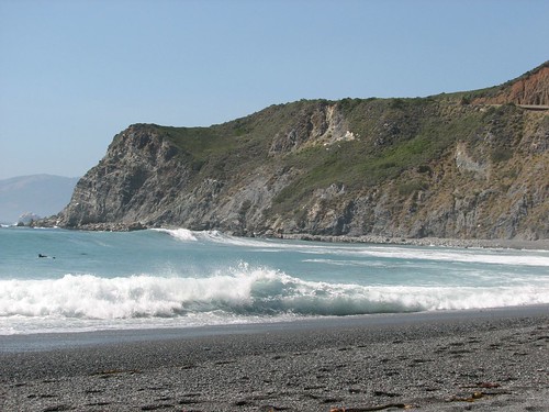
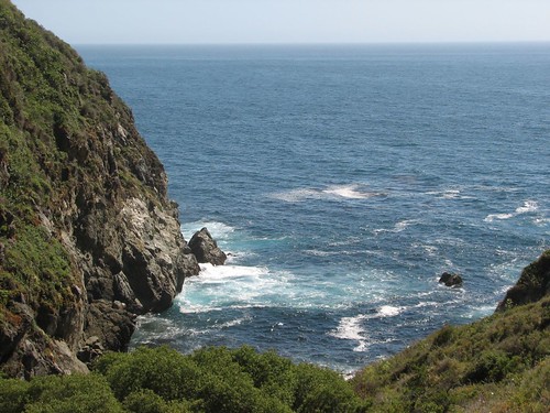
Back on the coast, we drove quickly through Kruse Rhododendron State Reserve, but only a few of the rhododendrons were blooming, so we continued on. We stopped at Point Arena to check out the lighthouse.

IMG_4790
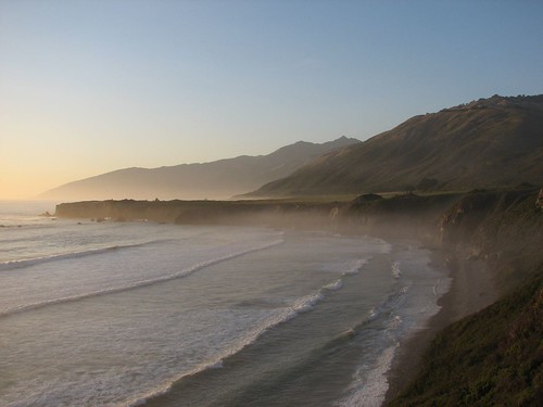
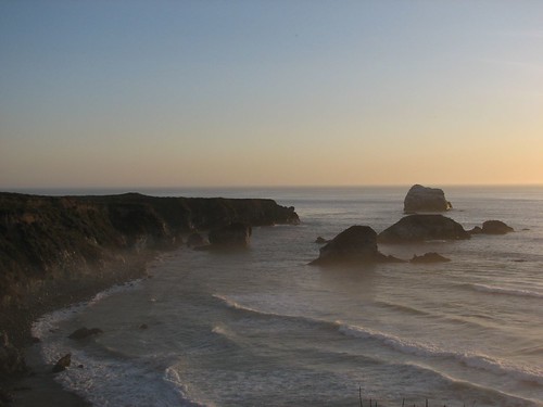
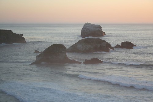
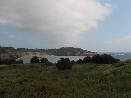
Then we continued on to Mendocino, a quaint costal town with beautiful views.

IMG_4794
Walking around town, we passed some fenced-in geese that were very friendly, clearly looking to be fed.

IMG_4798
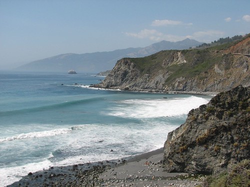
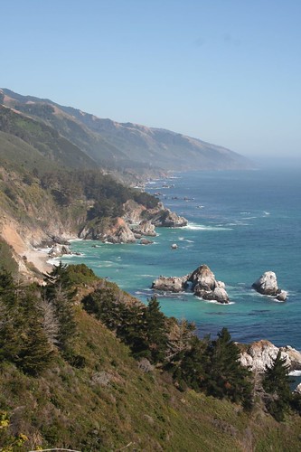
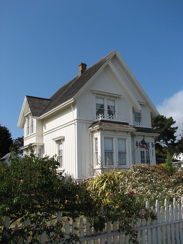
Murder, She Wrote, the Angela Lansbury detective series, was set in the fictional town of Cabot Cove, Maine, but we found out that it was actually filmed in Mendocino. Unlike Big Sur, which was a series of dramatic bluffs, the Mendocino area looked like the Maine coastline – rocky, gently sloping shores and pastoral scenes. It was a fitting setting for a fictional Maine town. After following some bad directions in vain, we eventually tracked down the house of Jessica Fletcher, the main character in the series:

IMG_4808
After Mendocino, we drove toward the redwoods in northern California. We reached the Drive-Thru Tree Park in Leggett, California, and were tempted to pay to drive through a redwood, but ultimately decided against encouraging people with our patronage to cut gaping holes in beautiful trees.

Soon we reached Humboldt Redwoods State Park and the Avenue of Giants. We drove a few miles along the road through amazingly huge trees, but it was getting late, so we stopped at the Hidden Springs Campground, which had gorgeous campsites, surrounded and separated from each other by tall trees.

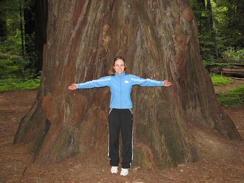
The next morning, we went to a redwood grove near the campground. Redwoods aren’t very photogenic but they are one of those things, like towering peaks and vast expanses of ocean, that have the power to make you feel incredibly small. Sarah spread her arms wide but couldn’t span the diameter of the tree.

IMG_4811
Then we hiked in Founders Grove, where we saw still more amazing trees. We passed the fallen Dyerville Giant, which was 362 feet high with a 17-foot diameter and the tallest tree in the park before it fell in 1991. We also passed the Founders Tree, 346 feet high. If anything, the fallen tree was more impressive. It’s hard to appreciate the size of the trees when you’re standing at the bottom looking up, but walking the length of a tree, you marvel at how it just keeps going and going.

We also passed a few burned-out trees that, amazingly enough, were still alive.

IMG_4816
IMG_4823
We also hiked through the Big Tree area, where we saw the Giant Tree, 363 feet high, and the fallen Flatiron Tree.

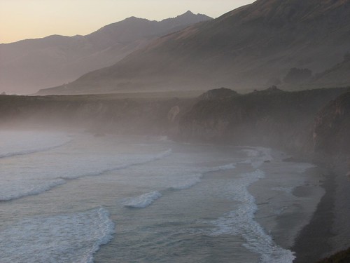
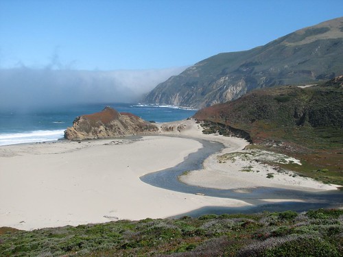
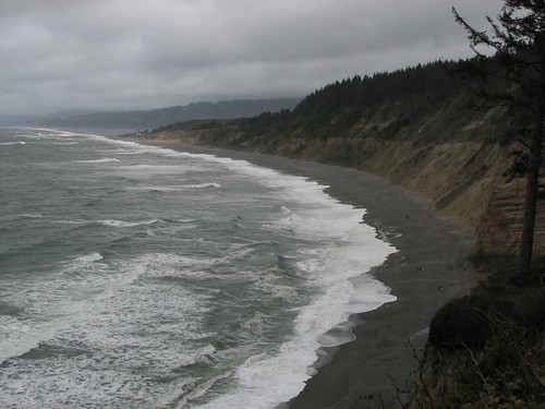
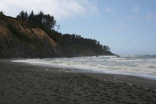
Further up the coast, we stopped at Patrick’s Point State Park and walked down to Agate Beach, where we ate our lunch.

IMG_4830
IMG_3757
IMG_3758
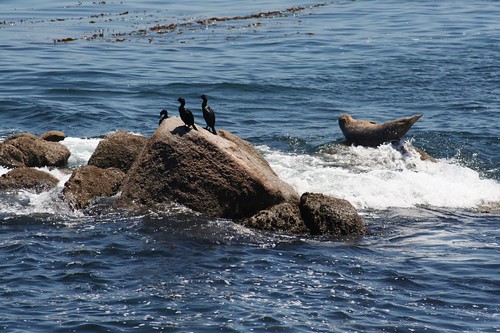
Then we stopped at the visitors center for the Redwood National and State Parks, a contiguous region of one national and three state parks. We asked the ranger about good places to see marine life, and he pointed us to a river right behind the visitors center. Sure enough, we saw ten harbor seals! Some were sitting on the beach across the river from us, and others were swimming in the river.

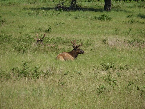
Further up the coast, Sarah was saying she wanted to see elk, and soon after that, we saw a doe elk at a distance. Then she said that was nice, but she wanted to see a bull elk. Brian thought she was being greedy, but then we saw two, pretty close.

IMG_4835
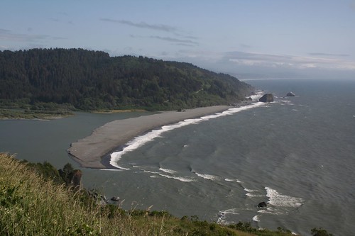
At a viewpoint, we used our binoculars to see some more seals below us on a spit. They were too far away for a good photo, but the view was still scenic.

IMG_3764
We camped at Jedediah Smith Redwoods State Park that night, in an old-growth redwood forest on the Smith River. It was another beautiful place to spend the night.

The next morning, we drove north toward the Columbia River Gorge in Oregon, where we would meet friends from Seattle for a Memorial Day weekend camping trip!

Friday, May 23, 2008

Big Sur

After the Hearst Castle tour, we bustled up the coast to the Plaskett Creek Campground in southern Big Sur. Big Sur has a number of campgrounds, but most of them are reservable. Given the proximity to San Francisco, all of the reservable campgrounds were full long before we started planning where we’d be for the weekend.

Much to our chagrin, when we arrived at Plaskett Creek, all of the sites were either reserved or already claimed for the weekend. There were only a couple of sites that were available, but only for Friday night – they were reserved for Saturday. After some scrambling around, we decided to stay in one of those sites and found a nice guy who was leaving on Saturday morning and bequeathed us his site for the next day. Now that summer is approaching, finding campsites on the weekends is becoming a pain. It takes much more planning than we’ve been doing.

Big Sur is stunning – there are gorgeous vistas and plummeting bluffs at every turn. We spent the afternoon seeing a few of these sights near our campground.

Here’s Jade Cove (where jade refers not just to the water color but the fact that people have apparently actually found jade there):

IMG_3591
IMG_4540
Next we stopped at the Willow Creek area, which was also really popular among surfers:

IMG_4542
IMG_4555
We had lots of fun just sitting and watching the waves crash.

IMG_4544
Then we went to Sand Dollar Beach, right across from our campground. There wasn’t much of a beach because it was nearing high tide. Nonetheless, we cooked dinner and enjoyed the scenery…

IMG_4575
IMG_4576
IMG_3612
IMG_4594
And the sunset…

IMG_4577
IMG_4587
Saturday, we drove up the coast to the main section of Big Sur for some scenic driving and sightseeing. Our first stop was Pfeiffer Big Sur State Park, where we took a short hike to a waterfall and an overview of the state park.

IMG_4630
Though the park wasn’t that far inland, it was surprisingly hot. The temperature variation between the coast and inland can be 20 degrees or more. Since it was hot, we headed back to the coast to Julia Pfeiffer Burns State Park.

Our first stop at that state park was an unmarked trail to Partington Cove.

IMG_3622
IMG_4640
The hike down was well worth the effort. One spur at the bottom went across a bridge and through an old tunnel that looked like a mining shaft, leading to a cove.

IMG_3625
IMG_3628
Another spur took us to a secluded beach in a second cove.

IMG_4647
A third spur took us to a forested stream.

Back on the road, we stopped at a number of scenic viewpoints.

IMG_3640
IMG_3641
Then it was on to McWay Falls, which is also in Julia Pfeiffer Burns State Park. It’s the only waterfall in California that flows directly into the ocean. As expected, it was quite photogenic.

IMG_3642
IMG_4667
IMG_4669
And here’s the quintessential California scene – palm trees, waterfalls, ocean bluffs…

IMG_3654
The next morning, we got up to drive to Carmel-by-the-Sea and Monterey. On the way, we made a couple more stops at sites that we’d missed the day before. In a guidebook, Brian found a description of a beach down an unmarked road near a ranger station. Talk about cryptic. We managed to find the road, which was marked only with a sign saying it was a one-lane road not suitable for trailers – no sign directing us to the beach. A ways down the road, there was finally a sign for Pfeiffer Beach.

It was early and there were only a few other people on the beach. It was quite peaceful.

IMG_4695
There was an interesting rock formation with waves crashing through it.

IMG_4696
IMG_4698
IMG_4699
We wandered along the beach for awhile.

IMG_3663
On the way back, we checked out some of the holes in the rock a bit more carefully.

IMG_4715
Our next stop was to photograph the Bixby Bridge, which is the world’s highest single-span bridge, at 714 feet long and 260 feet high.

IMG_4750
Another viewpoint showed a bit of the fog Big Sur is famous for.

IMG_4754
Our final stop along Big Sur was to see the Little Sur River.

IMG_4756
After Big Sur, we had breakfast and wandered around Carmel-by-the-Sea. Carmel is a very chic planned seaside community. It is near the famous Pebble Beach golf course (one of the half dozen or so golf courses on Monterey Peninsula).

Next, it was on to the Monterey Aquarium. We aren’t really aquarium people, but all the guidebooks laud this aquarium as one of the best in the country. It sits right on the bay, so you can view wildlife, as well as the creatures in the aquarium. Here’s a harbor seal trying to avoid an incoming wave.

IMG_3671
There was lots to explore in the aquarium. Some of our favorites were the onespotted fringehead fish:

IMG_3672
The playful sea otters:

IMG_4761
And the jellyfish:

IMG_3680
IMG_3682
IMG_3687
After dragging ourselves away from the aquarium, we drove north to San Francisco where we spent the evening with some of Brian’s college friends.