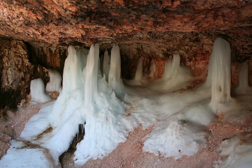
Along the way to the vehicle entrance of Bryce, there was a short trail into the park to a waterfall and something called Mossy Cave. We decided to stop and walk out there. The waterfall turned out to be just a trickle – it seems that the flow is higher later in the season. But the cave was really cool. Apparently water seeps through the roof of the cave and then freezes. The result is a cave full of formations like stalactites, stalagmites, and columns, except they form over the course of a winter, instead of over centuries, and they’re made of ice. Here’s what it looked like:
After that, we headed into the park and to the campground to set up. Loop A was for vehicles 20 feet and over, loop B was also for vehicles 20 feet and over, and loops C and D were closed. We were stumped for a minute but eventually decided that we’d just have to camp in an RV site, even though Caroline falls well short of the minimum length requirement. We found a really nice site in the A loop and set up camp. Brian was excited to try out his new speaker setup with his satellite radio, and it worked great – he listened to the Red Sox playing the Yankees as we set up camp.
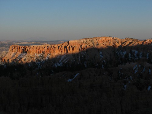
We made dinner and then about half an hour before sunset headed toward an overlook, appropriately named Sunset Point. Unfortunately, half an hour before the official sunset time, the sun is already pretty close to out of sight, and most of the canyon is shrouded in shadow. We got a couple of pictures, and resolved to wake up early for sunrise.
Brian’s alarm went off at 6:15 the next morning, and Sarah, grumbling, followed him to the car. We were all bundled up in our down jackets, fleece hats, and gloves, and we hadn’t had our coffee yet, but seeing sunrise sometimes requires sacrifice. Fortunately, it wasn’t quite as cold as we had feared based on the weather forecast we’d see at Glen Canyon Dam.
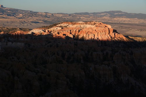
We had decided to go to Bryce Point, which one of our guidebooks claims is a better place to see sunrise than the viewpoint called Sunrise Point, oddly enough. When we got there, the sun hadn’t quite come up yet. Since the interesting views of the canyon are just after sunrise, we’d made it in plenty of time.
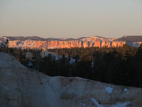
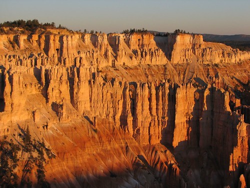
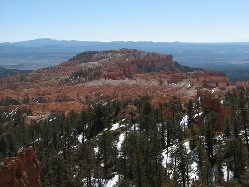
When the sun rose, the top of the canyon was bathed in beautiful soft light.
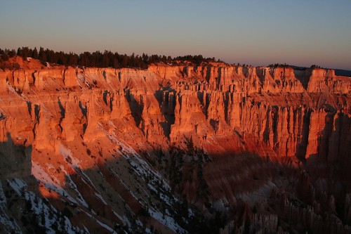
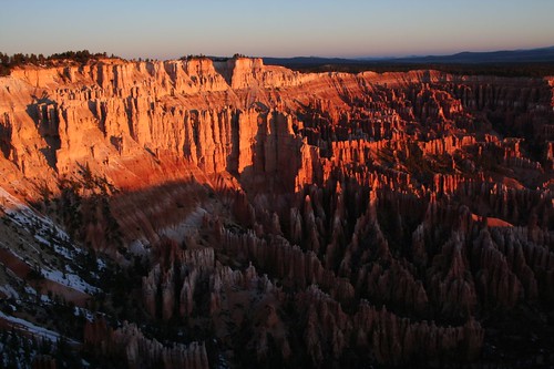
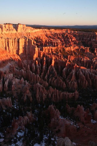
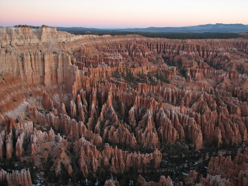
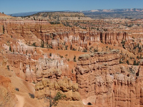
The view down into the canyon was really pretty as well.
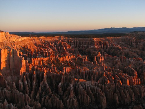
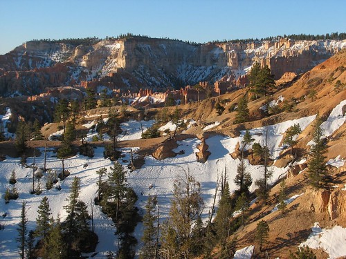
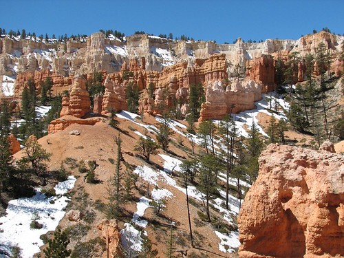
Looking in a different direction, we could see a lot of snow still hanging onto the hoodoos.
Finally, with the sun higher in the sky, we decided that it was time to head back to the campground to make breakfast.
On the way, we stopped at Sunset Point to see what we’d missed. In the end, we agreed with the guidebook that Bryce Point was a better place to see sunrise, although Sunset Point offered a nice view of snowy hoodoos.
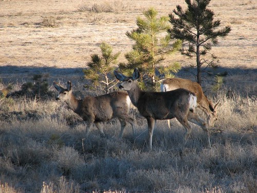
As we got back to the turnoff for our campground, we saw a half dozen deer on the roadside. We stopped to take some deer photos, despite our grumbling stomachs.
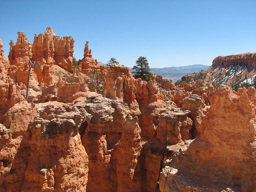
After recharging with coffee and oatmeal, we set out for the day’s activity: a hike through Bryce Amphitheater. Bryce’s hoodoos make for some of the most amazing scenery in all of southern Utah – and that’s saying a lot, because most of southern Utah is really pretty. But Bryce Amphitheater, which features the best of the hoodoos, is quite a small area, so it’s pretty easy to see the park in one day. We strung together the Queens Garden trail, the Peekaboo Loop trail, and the Navajo Loop trail for a six- or seven-mile hike that meandered through much of the amphitheater. We were a little afraid that the trail would be snow-packed, but it turned out to be quite good.
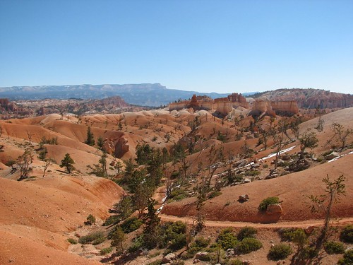
Some nice views along the Queens Garden trail:
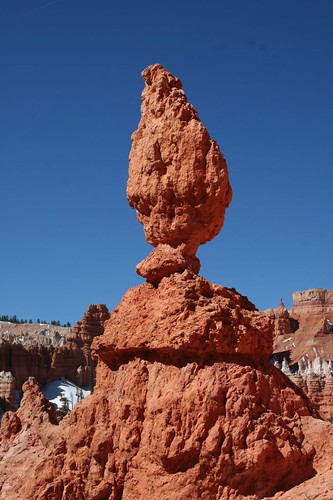
The “balanced rock,” an occasional curiosity throughout southern Utah:
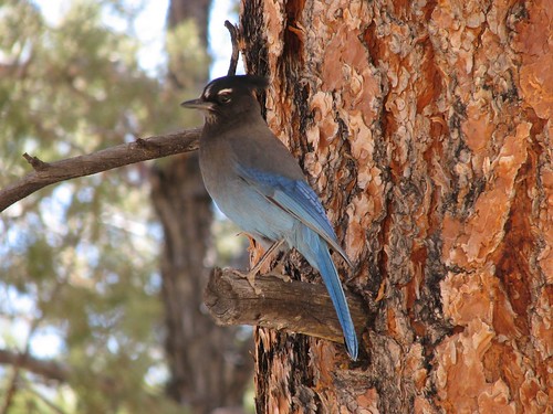
This bird was looking for handouts and wasn’t very shy at all:
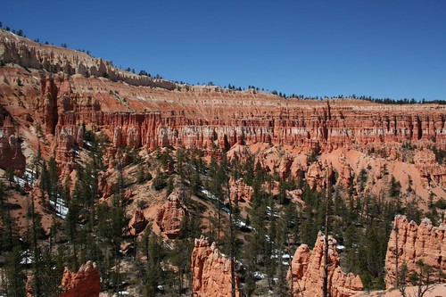
The Peekaboo Loop went pretty steeply uphill and was partly slush-covered. It also had unfortunate stinky signs of equine traffic, but it was nothing compared to the trails into the Grand Canyon. It afforded more pretty views:
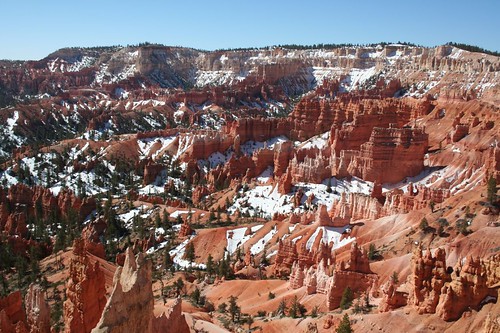
April’s a nice time to see Bryce because it’s generally not super-cold (leaving aside the previous night’s exceptional 13-degree forecast), but the snow still lingers. The contrast between the white snow and pink rocks makes for some gorgeous views.
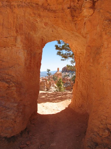
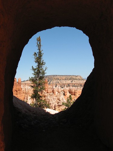
In a few places, trail builders had to blast holes through the rock. Looking through those man-made keyholes made for some interesting views.
We don’t spend a lot of time looking for images in the shapes of the rocks. But Scooby Doo was unmistakable:
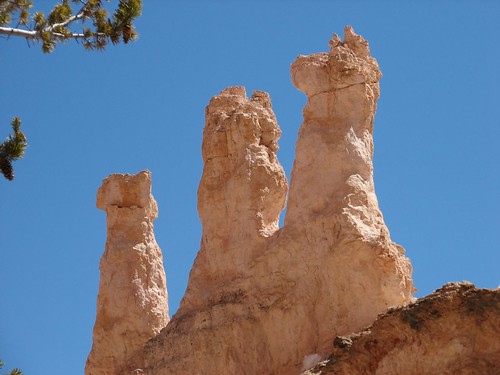
The Navajo Loop took us up and out of the canyon. Along the way, it passed by an area of hoodoos of identical size and shape, like an army of chess pieces:
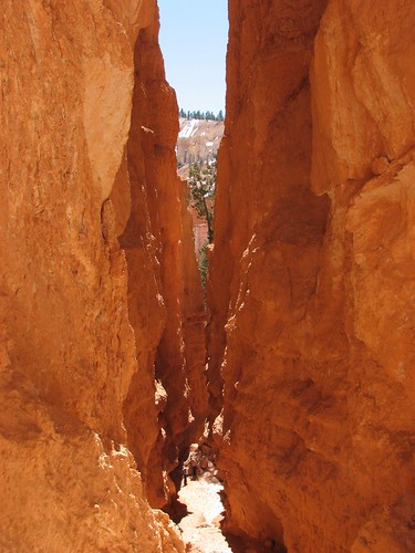
The section of the Navajo Loop that we hiked is called Wall Street, and part of it is a very narrow slot canyon. Here, there were some hard-to-see icy patches – at one point, Brian took a step up and then slid about three feet back, not realizing that he was stepping on melting ice.
At the end of our hike, it was getting around mid-afternoon, and we needed to be two hours away in Boulder, Utah, that night for our ten-day Wilderness First Responder class. So we high-tailed it out of there, but on the way out, stopped at one last scenic viewpoint, Fairyland Point:
Not knowing if Boulder would have internet access, we then made a quick stop at Ruby’s, a massive general store / gas station / inn complex right outside the park, to use their wireless for one last email check before heading east. Next stop, Boulder, Utah, to learn wilderness medicine and become certified as Wilderness First Responders!
1 comment:
Great pics as always! The WFR class sounds great too. Be interested to know how that goes.
Post a Comment