We got an early start because even at this time of the year, it gets hot in the canyon. The highs were in the 80s, which is nothing compared to the mid-summer highs in the canyon, but was significantly warmer than the weather we’d been exposed to recently. We’d been warned by the ranger that the top of the trail had some snow and ice on it, but it was barely noticeable. The little snow that was left was completely covered in dirt so it wasn’t slippery.
While the snow was barely noticeable, it was immediately apparent that this is one of the trails that mules take into the canyon. There was mule dung everywhere. Dodging mule bombs required constant attention.
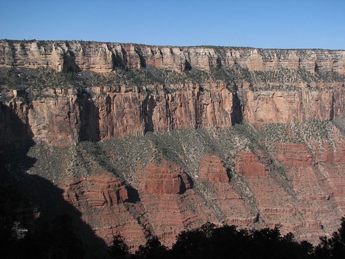
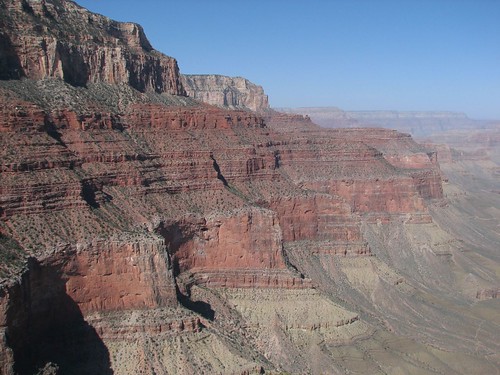
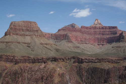
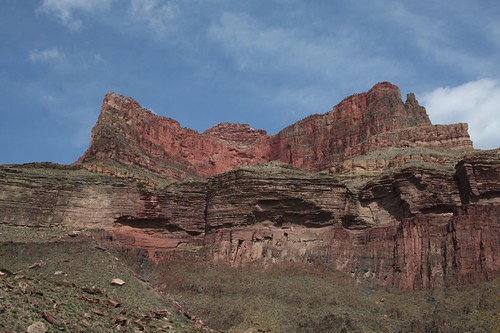
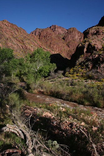
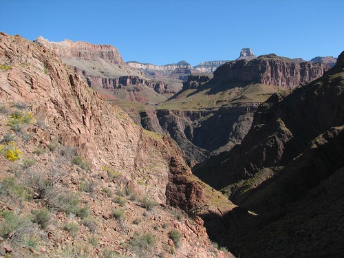
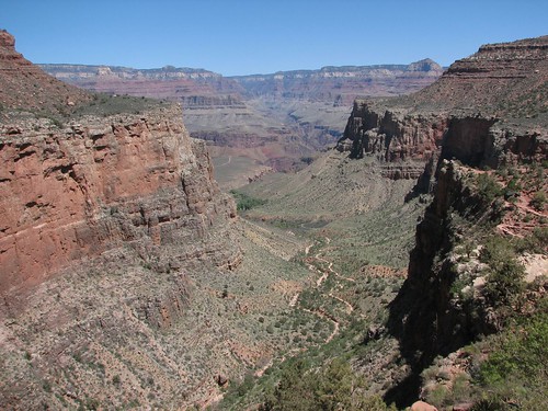
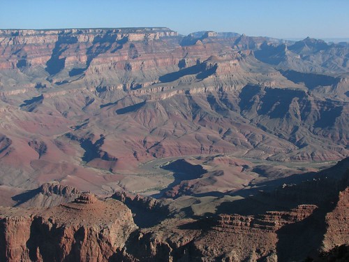
As we worked our way down the cliff, the morning light on the canyon was very pretty.
At this point, there were a lot of other people on the trail, mainly day hikers. Even so, it was a relief to be below the rim and away from the bulk of the people in the park.
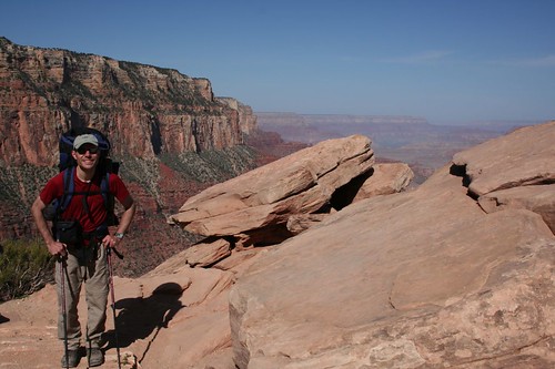
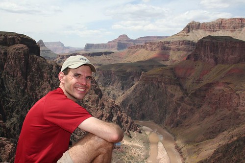
We stopped for a break and Brian posed for a photo.
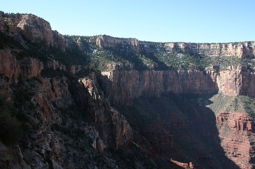
This is a nice view of the trail from above. It wasn’t nearly as narrow as it looked from the canyon rim. The trail descends about 4900’ in 7 miles but it wasn’t anywhere close to as hairy as we thought it’d be.
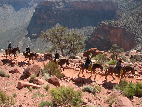
Eventually, the day hikers thinned out, but we continued to pass mule trains. We’d step to the high side of the trail for them past while trying not to inhale too much of the dust that they kicked up.
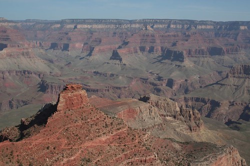
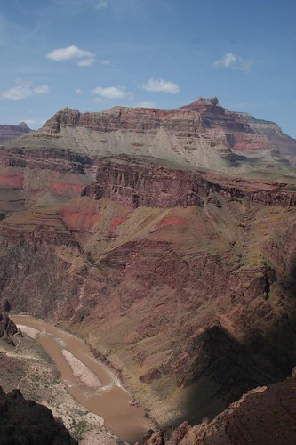
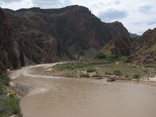
A little further along, we got our first glimpse of the Colorado River.
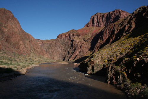
More of it was visible as we continued down the trail.
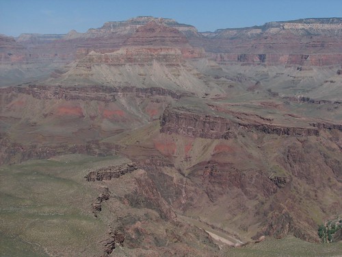
We took another break to let our knees and calves rest and enjoy the scenery.
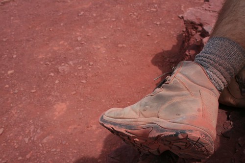
By this point, our boots were red from the dust.
Moving further along, we could see some rafters who’d pulled out on a beach.
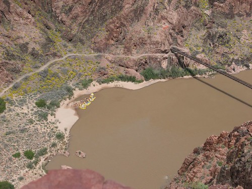
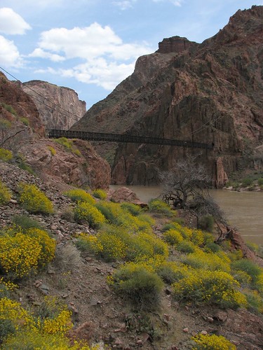
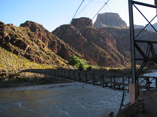
Finally, we’d made it down to the bottom. We walked through a tunnel blasted through the rock and out onto one of the suspension bridges that cross the river.
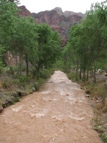
Our campground was at the side of Bright Angel Creek, just across from Phantom Ranch.
The area at the bottom of the canyon can support 200 people on any given night. Up to 90 people can stay in the campground and the rest at Phantom Ranch. There were already a number of people at camp, but we found a spot right next to the creek and pitched our tent. The spot had a very small tent pad, which is probably why it was still available. Luckily, our tent is small, so it worked out perfectly for us.
After we’d set up camp, we walked across the creek to Phantom Ranch.
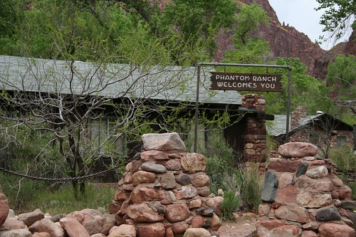
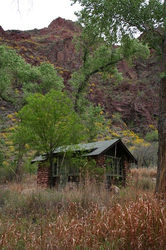
The ranch has a number of little cabins and several large bunkhouses.
We went to the Canteen, where Brian was thrilled to find that they sold cold beer. It’s not often that cold beer is waiting at the end of a long day of backpacking. The only choices were Budweiser and Tecate, and a can cost four dollars, but it was four dollars well spent.
The next morning, we decided to day hike to Ribbon Falls. This was supposed to be our rest day in the canyon before the steep ascent out, but somehow a 13-mile hike still sounded like a good idea.
As we started the hike, there were several places where yellow flowers covered the hillsides.
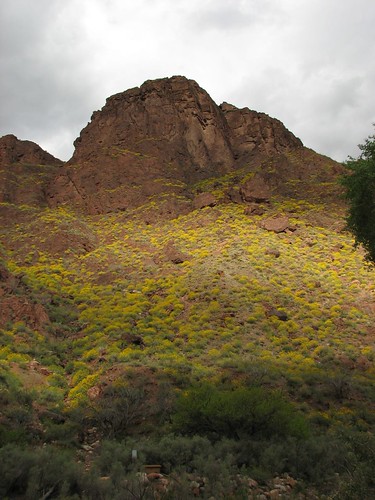
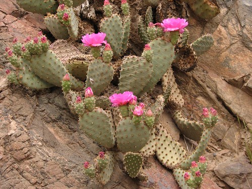
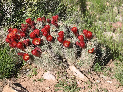
We haven’t learned many of our desert plants yet, so we weren’t sure what the flowers were. Plants in the desert are a lot different than in most areas where we’ve lived. Since it’s spring, we got to see both the prickly pear cactus and the hedgehog cactus blooming:
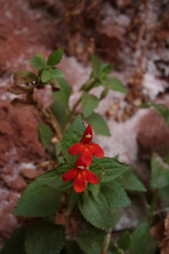
In addition to the spiny plants, there were some surprisingly delicate plants for the desert.

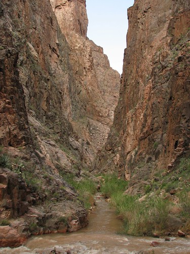
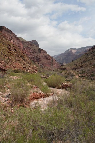
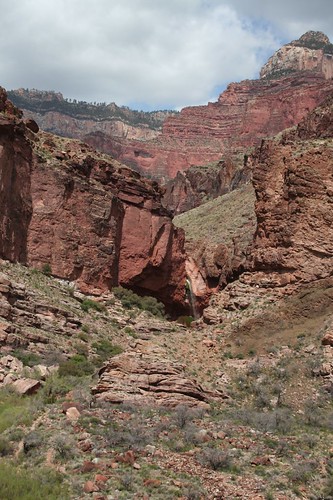
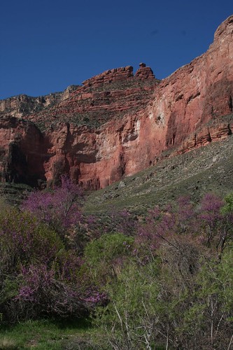
We continued up Bright Angel Creek towards Ribbon Falls along a scenic, often narrow canyon.
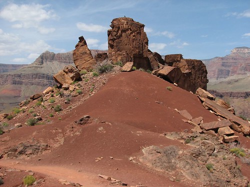
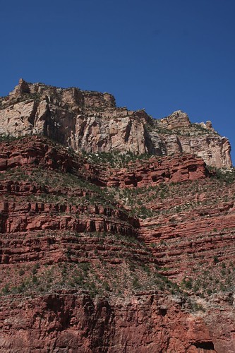
There were some interesting rock formations along the way, including Budda’s Temple.
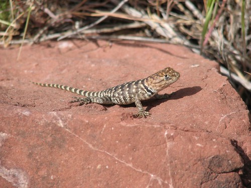
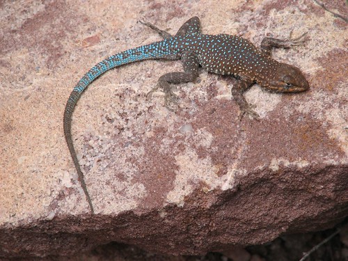
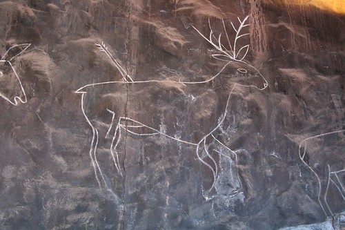
Along the way, we saw some wildlife, desert-style:
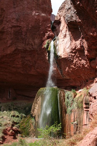
Finally, we could see Ribbon Falls off in the distance.
Later in the year, you can ford the creek to get to Ribbon Falls. Since the spring runoff was in full force, we had to walk an extra half mile or so up and around to a bridge over the creek to get to the falls.
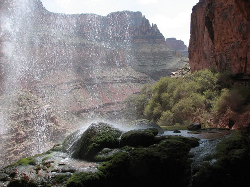
We didn’t see many people while we were hiking, but a couple of groups were lounging at the falls when we got there. The falls is actually a series of cascades, ending in a long cascade that tumbles onto a very mossy rock. It was quite picturesque.
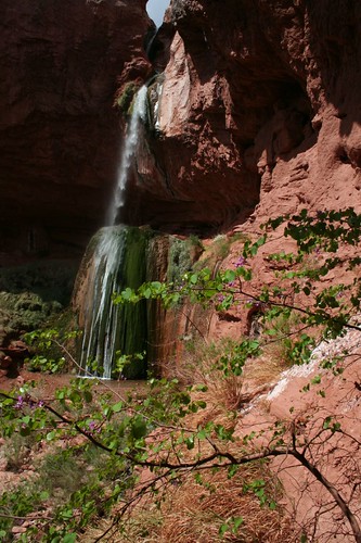
There was a small cave behind the waterfall, so you could climb up behind it.
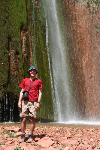
Here’s Brian at the bottom of the falls.
After a long stop at the falls, we decided it was time to start back to camp. As we got back into the main canyon, we noticed some very dark clouds approaching. Rain and thunderstorms were in the forecast, but luckily all that materialized was the clouds and a few drips.
We stopped at the Canteen on the way back to our camp and wrote a couple of postcards. They get mailed from the bottom of the canyon with a special “Mailed by Mule” stamp on them.
The next morning, we got up early to begin our ascent out of the canyon. We were taking the Bright Angel Trail back to the top. This trail was a daunting 9 miles and 4500’ up.
Before we’d gone far, we got distracted taking a few last photos at the bottom of the canyon.
We crossed over the second suspension bridge and then began the climb.
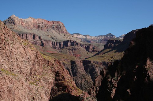
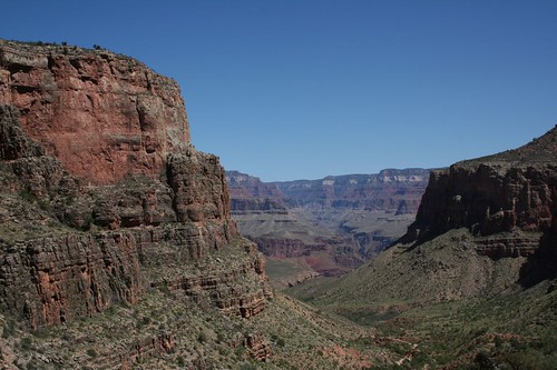
There was plenty of beautiful scenery to take our minds off the climb.
About half way up, we reached the Indian Garden area. Indian Garden is a pretty major stop, with a ranger station, campground, and day-use facilities. It’s one of the few places along the trail that afford some shade on a hot day.
After a rest at Indian Garden, we continued our journey up, up, up.
After what seemed like a million switchbacks, we eventually reached the top. It took us just over six hours, which was pretty good for our first backpacking trip of the season. We were both surprised that we weren’t more exhausted. After a winter of skiing and boarding, our wind and leg muscles are pretty good.
We returned to the car, which we were happy to find hadn’t been terrorized by mice in our absence, and drove to the general store where we both bought ice cream. These were Toll House mint brownie ice cream sandwiches – 470 calories each! If we were ever going to eat one, after a long hike was the time to do it.
Later in the afternoon, we both got much-needed showers at the camp facilities. This sparked a debate about which two dollars was better spent that day – the $2 for the ice cream sandwich or the $2 for the shower. Sarah was firmly in the shower camp, but Brian thought the ice cream won hands down.
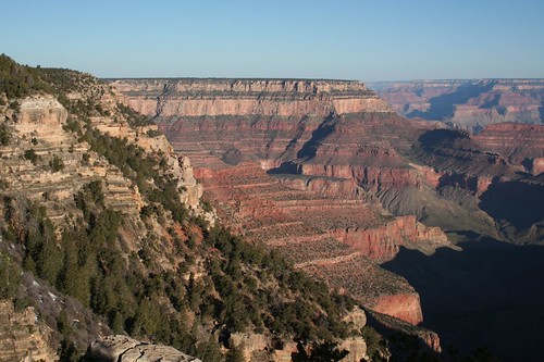
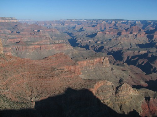
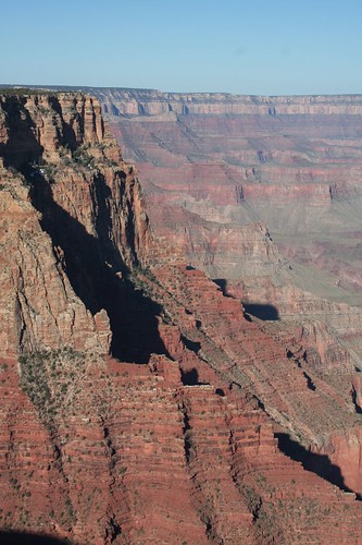
The next morning, we packed up camp and made our way out of Grand Canyon National Park along the road to the east towards Desert View (we’d driven in from Flagstaff to the south). We stopped at a number of beautiful vistas along the way.
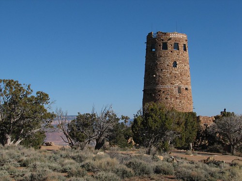
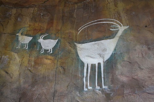
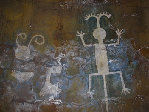
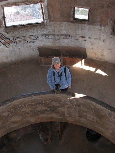
At Desert View, there was an old watch tower. The tower was built in the 1930s for tourists and is a mix of architectural styles from the area.
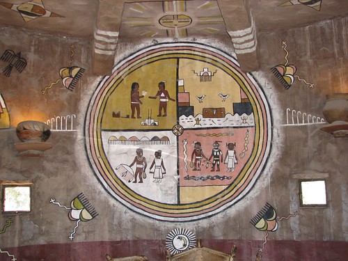
The inside of the tower was covered with representative petroglyphs (carved drawings) and pictographs (painted drawings) from native Hopi culture.
No comments:
Post a Comment