We didn’t really know what there was to do, so we drove into the preserve from the northwest corner, passing cinder cones and lava beds on our left, and arrived at the visitor center, in an old depot in the railroad town of Kelso. The exhibits inside told about the history of the railroads in the area, which provided access to early visitors. We also found out that at the extreme west end of the park was a town called Zzyzx, the last city alphabetically in the U.S. We got a park map and headed out to hike.
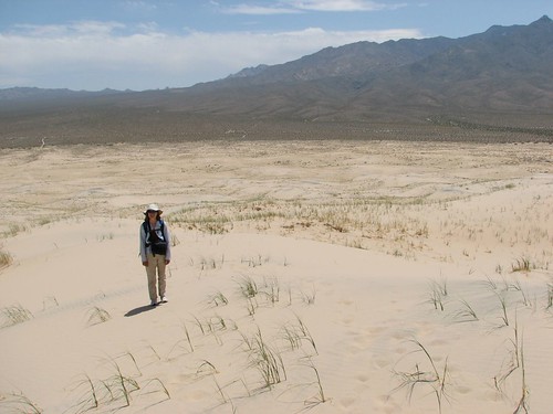
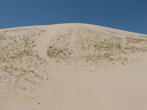
Our first stop was the Kelso Dunes. These 600-foot-high sand dunes are some of the largest in California, much larger than the dunes where we hiked in Death Valley. It was a warm, sunny afternoon, but we managed to make decent time on the two-mile trip to the top of the highest dune. Here’s Sarah, taking a break on her way up:
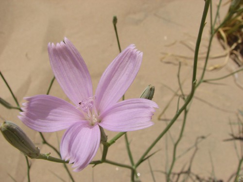
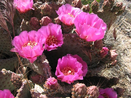
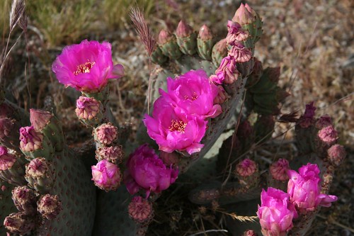
There wasn’t a whole lot of vegetation, but we did see the occasional pretty flower:
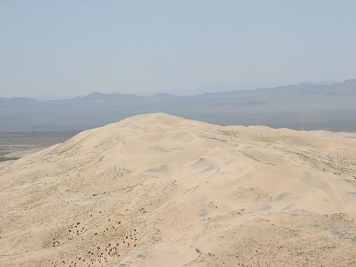
After a super-steep section, we followed a ridgeline the rest of the way up, and then we were at the top, with commanding views of other nearby dunes and distant mountains.
The dunes were supposed to make a “booming” or “singing” sound when sand slides down the surface, so we tried to get the effect going by running down the dunes to trigger a sand avalanche. We couldn’t get them to sing, but we did find that they made a “whomping” sound when we landed, so we started jumping as far as we could and then landing on both feet to see who could make the loudest whomp.
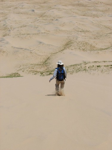
From below, we took one last picture, looking up at the path where we had whomped down the dune.
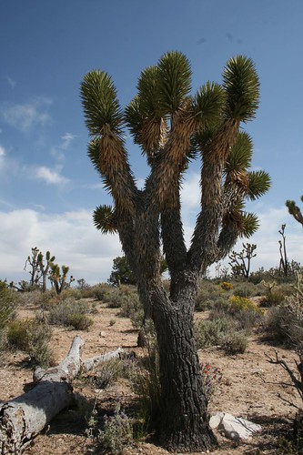
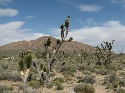
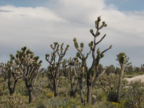
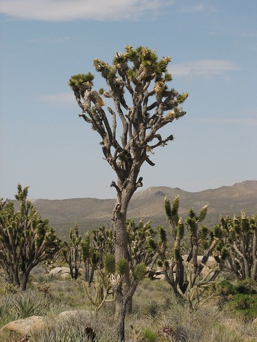
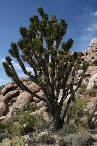
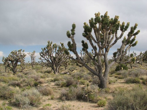
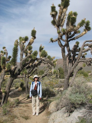
After the dune hike we dumped out the mini-dunes that had collected in our shoes and headed off to another trail for Teutonia Peak, in the world’s densest Joshua tree forest. As we drove toward the trailhead, the Joshua trees did get denser and denser, until you looked out the car and it was just Joshua trees all around, as far as the eye could see.
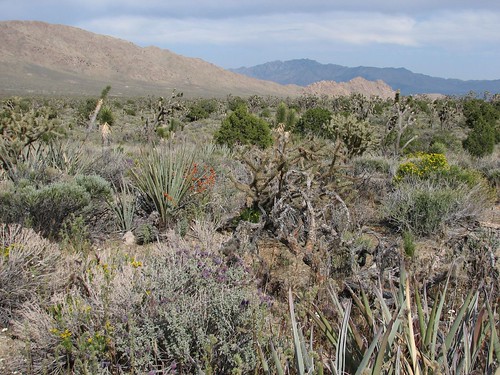
The trail traveled through the Joshua tree forest toward some rocks. The scenery was amazing – all of these Dr. Seuss-looking trees in crazy shapes, with quite a few wildflowers around to brighten the forest floor.
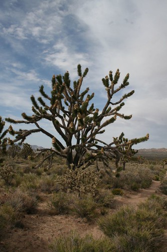
We took lots of Joshua tree photos:
Sarah likes it:
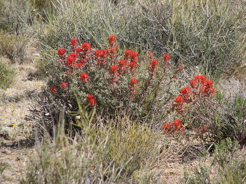
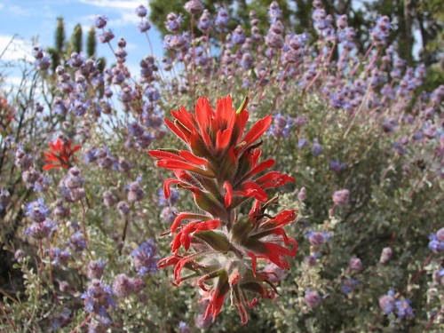
We saw some Indian paintbrush:
We think this one’s a beavertail cactus, although we’re still learning our cactus varieties:
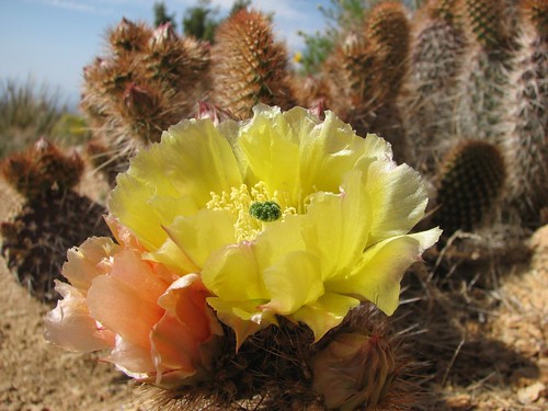
Not sure what type of cactus this is, but the yellow and peach flowers were gorgeous:
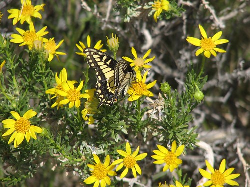
We saw quite a few butterflies fluttering around the wildflowers, too, including this one that stood still long enough for us to get a picture:
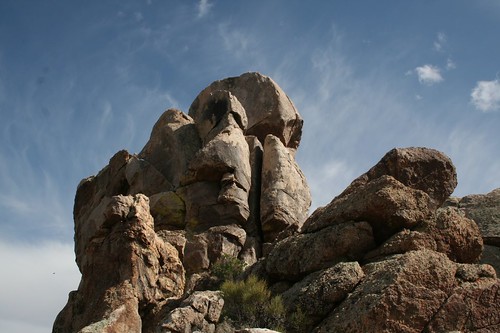
Finally, at the end of the trail, we climbed up onto some rocks, which apparently composed Teutonia Peak:
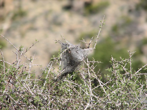
We stopped to eat a snack and saw this, which we thought might be a black widow web:
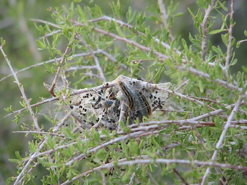
But then we saw another similar web with caterpillars tangled up in it, and then we guessed it was some sort of cocoon:
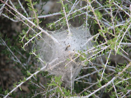
And yet another:
On our way back down, it was getting later in the day, and the softer light and building clouds made for more interesting Joshua tree shots:
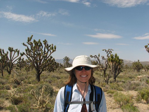
And here’s Sarah, with a Joshua tree towering over her:
A few days earlier, we had realized that the Mojave National Preserve is near Primm, Nevada, which we knew to be home to several casinos with cheap hotel rooms, so we’d booked a room for tonight at a place called Whiskey Pete’s, surely a fine upstanding establishment. We headed out there at the end of the day, intending to do some grocery shopping and then enjoy our first showers in a few days. Well, we got to town, and there were indeed three large casinos, one surrounded by a pretty impressive roller coaster! And there was a big outlet mall. But there were no groceries to be found. After talking to a few people, we gathered that there were no groceries to be had in this town, and that the locals take regular trips to Las Vegas, 40 miles away, to do their shopping! Bummer. We bought some juice at a gas station and headed to our room.
We pulled the sheets down on the bed, and found that housekeeping had short-sheeted our bed! The fitted sheet failed to cover the last foot of the bed. We called housekeeping, and Brian got to watch while they unmade and remade our bed with a new right-sized fitted sheet. The shower didn’t drain well either, but we didn’t press our luck and try to get that fixed, too. Otherwise, for a sub-$19 hotel room, it was quite acceptable, and the showers were glorious.
The next day was Brian’s birthday, so we started our celebration off by heading down to the casino for their breakfast buffet. Brian had found a two-for-one coupon, so it was $5.95 for two people. We had fresh-made omelets, which were really very good, along with the other typical breakfast fare from the buffet – scrambled eggs, hash browns, bacon, pancakes, French toast, fruit, etc. And we finished it all off with ice cream sundaes and a piece of German chocolate cake for Brian in celebration of his birthday.
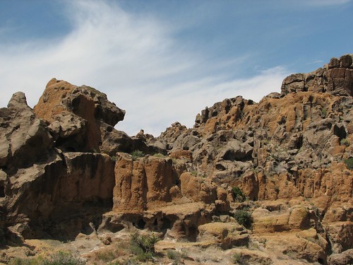
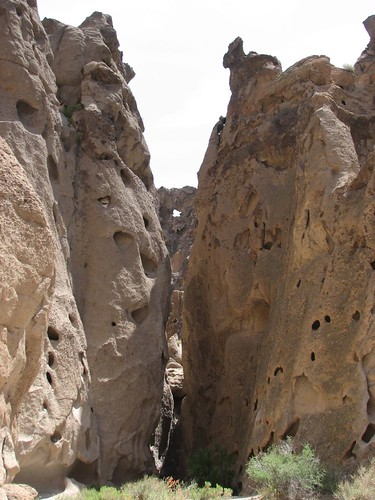
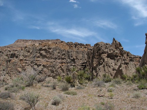
We drove back into the Mojave National Preserve to the Hole-in-the-Wall area, where we hiked the Rings Loop. It’s a hike through a narrow canyon whose walls are holey like Swiss cheese. Here’s a view of the rocks, before we entered the canyon:
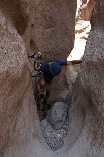
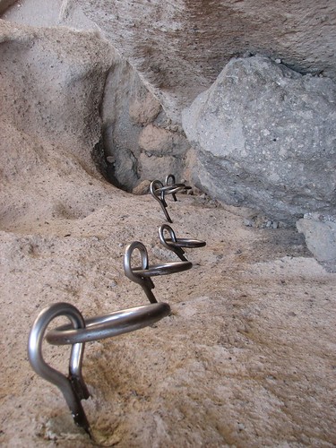
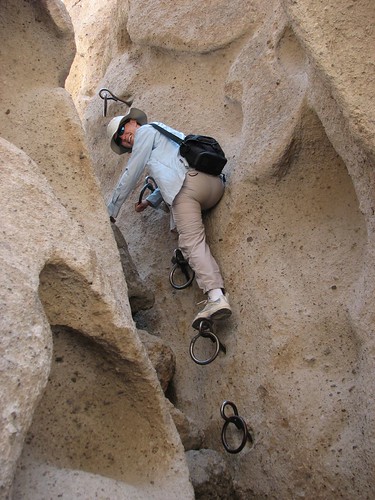
It’s called the Rings Loop because some of the sections are so steep that they drilled rings into the rock in two places to help you climb up or down. Here’s Brian, navigating the first set of rings:
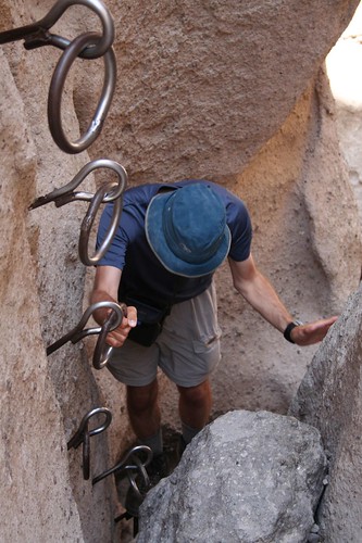
Here’s a view looking down at the second set of rings:
And here’s Sarah, posing for a picture, as she makes her way carefully down:
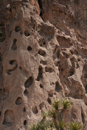
After we left the canyon, we took these pictures looking back at the rocks:
And one last view as we looped around back to the car:
After the Mojave National Preserve, we didn’t know how the Joshua trees in Joshua Tree National Park could possibly be any cooler than what we’d already seen, but we headed there anyway to give them a chance!
No comments:
Post a Comment