Now that we had new tires, we had just one more critical stop before we were on our way to Death Valley. It was Ben & Jerry’s Free Cone Day! There was a Ben & Jerry’s several miles from the tire shop, so we just had to stop. Brian had a cone of Half-Baked and Sarah had a cone of Chocolate Therapy. Delicious!
It’s about a three-hour drive from Vegas to the main visitor center at Death Valley. There isn’t much of anything along the drive. We drove back by the Humboldt-Toiyabe National Forest and after that it was desert most of the way. We stopped to get gas shortly before leaving Nevada, since gas prices are a lot higher in California. We stopped at the biggest town around, which was basically just a gas station, a forlorn-looking rest stop, and an old, shuttered general store at a road junction. There was a casino and some lodging right at the border, and then we were in California.
We drove to the Furnace Creek area, which is the main visitor area in the valley, and set up camp at the Furnace Creek campground. Even though it was 8:30 at night, it was still really warm. There weren’t that many campers and we were able to secure a nicely treed campsite, which would provide some shade the next day. It was so warm that we didn’t even bother to put the rainfly on our tent. It only rains two inches all year in Death Valley, so it seemed to be a safe bet that it wasn’t going to rain overnight. Sleeping without a rainfly on the tent was a nice treat – Sarah likes lying in the tent and being to look up at the stars. We also didn’t take out our sleeping bags, which are rated for 20 degrees and would have been way too hot. Instead, we slept under a sheet and a thin blanket.
In the morning, we got up and cooked breakfast then decided to move our tent to a quieter site. We had some noisy neighbors who came back after 10 pm and continued enjoying a bottle of vodka and a campfire well into the night. Since the sites were quite close together and their site tag indicated that they weren’t leaving anytime soon, we found another site. The new site had a great sheltered spot under some trees for the tent.
Our first stop of the day was at the Furnace Creek visitors center, where we talked to a really knowledgeable ranger. There weren’t many other people around, because it’s so hot during the day, so the ranger wasn’t busy and spent a long time telling us about not only Death Valley, but also many of the surrounding parks. He had an amazing memory for detail, telling us where to turn to get to specific places, whether or not the towns would have services, which hikes to do, etc. He gave us some great ideas of things to do after leaving Death Valley.
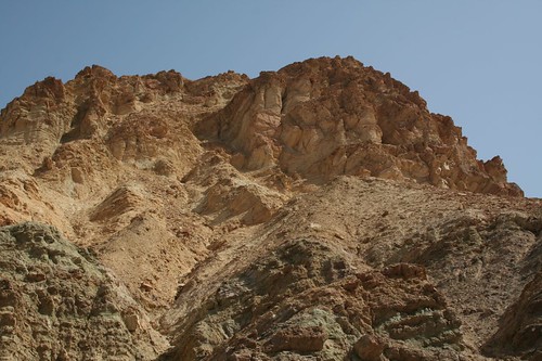
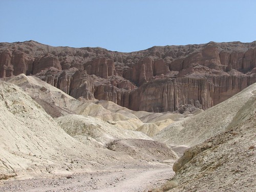
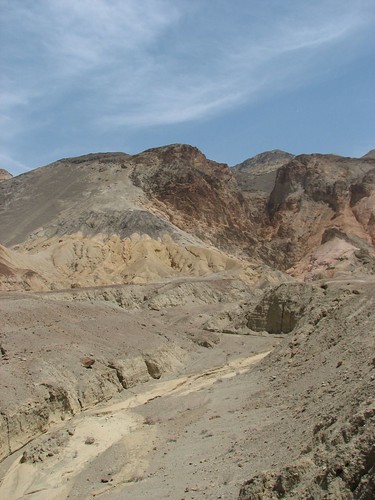
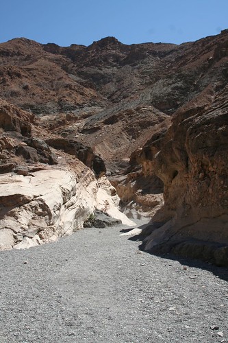
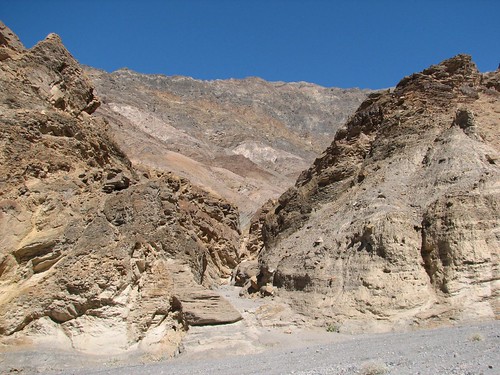
From there, we started scenic driving. First, we stopped at Golden Canyon. There, we did a several-mile hike through the canyon. Luckily, it wasn’t ridiculously hot yet. Not that it was cool – it was in the 90s and the canyon didn’t provide a lot of shade. It’s easy to see how people can quickly get in trouble hiking here.
As promised, the canyon walls were a beautiful golden color.
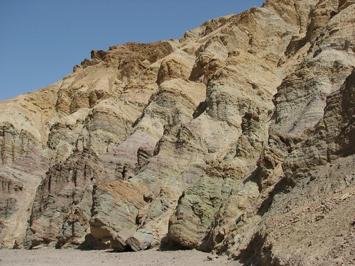
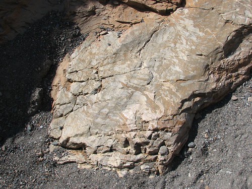
In places, the walls were multi-colored stripes.
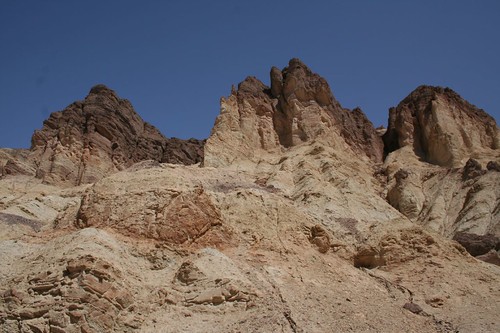
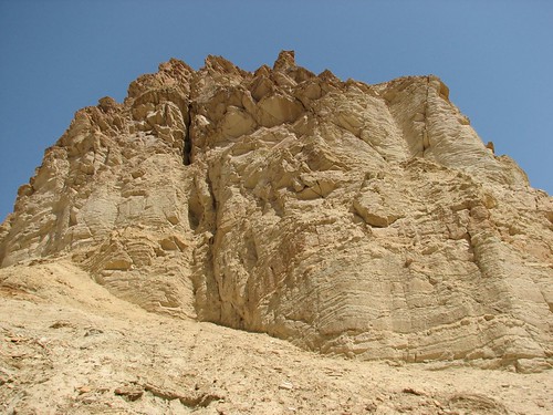
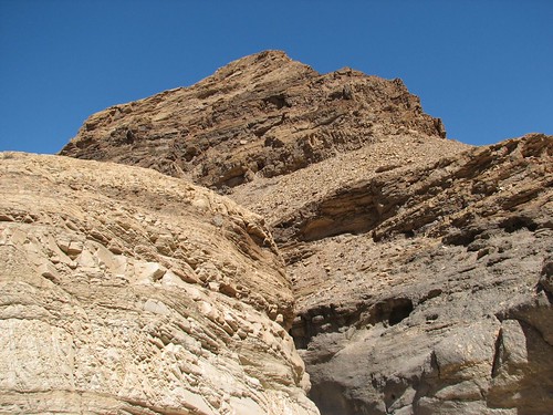
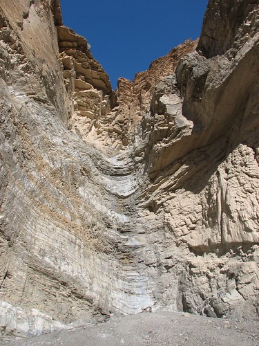
After about a mile and a half, the trail dead-ended into Red Cathedral, where there were more impressive rock formations.
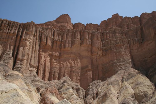
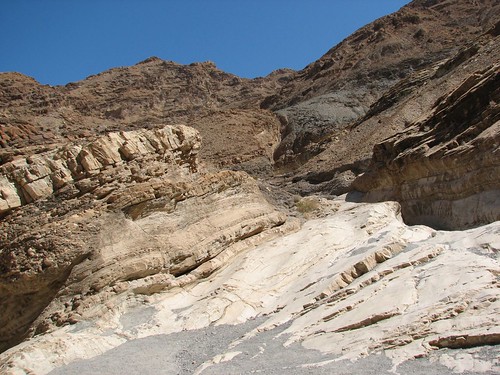
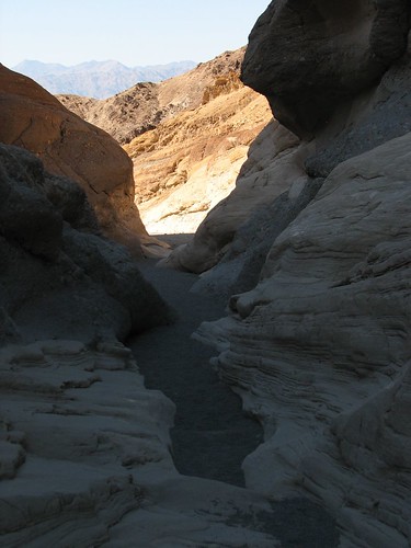
We stopped in the shadow of a rock at the base of Red Cathedral for a snack and to cool off. Then we retraced our steps back to the car. On the way, Sarah snapped this shot to show how bad the visibility was.
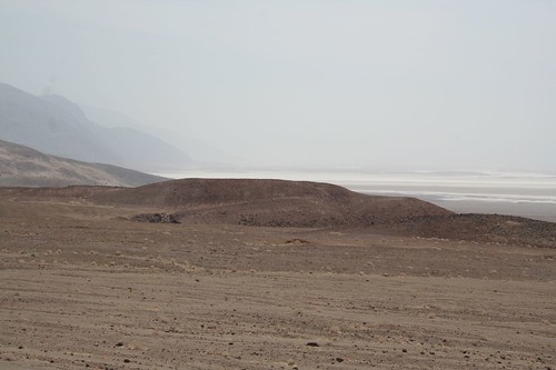
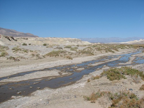
Spring in the desert, as we’ve learned recently, can be really windy. All that wind kicks up lots of dust and can lead to horrendous visibility.
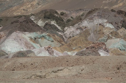
Next, we drove the scenic Artist’s Drive loop. This drive passes badlands with even more beautifully colored rock than what we’d seen at Golden Canyon.
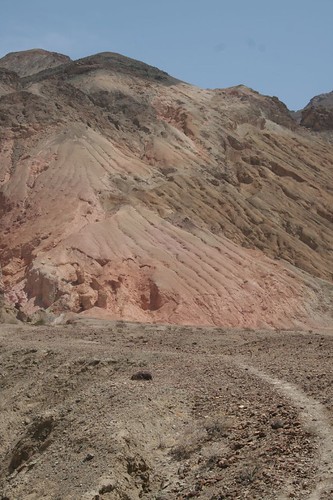
One spot along the drive, aptly named “Artist’s Palette,” was especially brilliant:
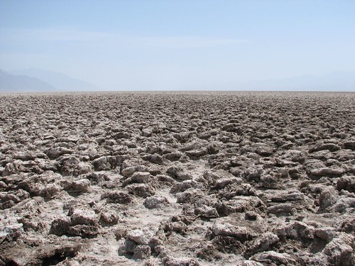
After finishing the drive, we considered going back to our campsite to just chill for awhile, since the day was heating up. We found out later that it hit a high of 105 degrees! It was hot, hot, hot. After some debate, we decided to continue along and see a few more sites before heading back. The next stop along the road was the Devil’s Golf Course. This was really a vast expanse of eroded rock salt. The rocks were so sharp that someone once remarked “only the devil could play golf on such rough links” and thus the name was born. We didn’t see much resemblance to a golf course, but the salt formations made for a unique view.
Given that this is just one site of many in the park with a name that refers to the devil, it seemed quite appropriate that our California guidebook had coverage of Death Valley starting on page 666…
Further down the road, we stopped for more salt flats at a place called Badwater. At 282’ below sea level, Badwater is the lowest point in the Western Hemisphere. Of course, Brian had to pose with the sign proving we’d been there.
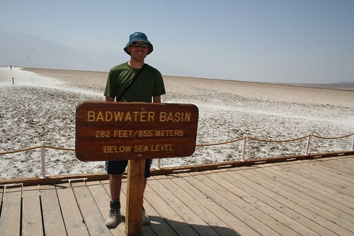
In addition to being the lowest point, Badwater at one point had the distinction of being the location where the highest temperature on earth was recorded. One day in July 1913, it was 134 degrees – and that was in the shade! Apparently, thermometers in the sun actually burst in those types of temperatures.
Badwater was named by an early traveler, who passing through the area was pleased to find water for his horse. Water is very rare on the valley floor, but the horse refused to drink the water because it contained so much salt. The traveler, not understanding the reason for his horse’s refusal, dubbed the place “Badwater”. Here’s the pool that gave the place its name.
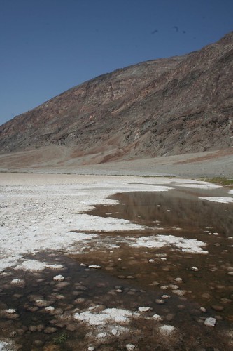
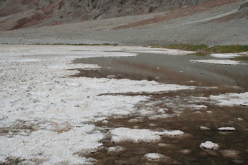
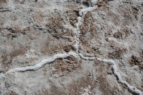
We walked out a ways on the salt flats. The salt made a variety of patterns as it pushed up through the ground.
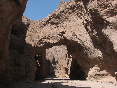
Our last sightseeing stop of the day was a short hike to a natural bridge. The hike followed a canyon until reaching this bridge.
We stopped at the Furnace Creek Ranch and got a pint of Ben & Jerry’s ice cream to split, which we ate while sitting on the porch in the shade. Ice cream sure tastes good when you are in the desert and it’s hot.
We returned to our campsite and had a peaceful spell before the wind kicked up. Once it started, it didn’t stop. It was just howling. It was even strong enough to knock over a full beer bottle. It’s hard to have a relaxing evening at camp when the wind is that strong. Unfortunately, the wind continued well into the night. Those trees that had seemed so nice for providing shade earlier in the day were now creaking and cracking and generally making disconcerting noises as they thrashed in the wind.
Thursday, it was a bit cooler than it had been the day before. We packed up our tent and started toward the Stovepipe Wells area of the park, where we planned to do some more hiking.
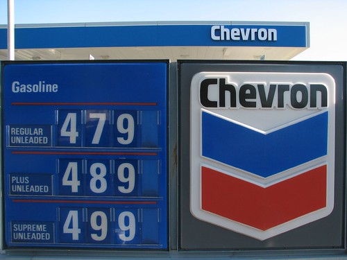
First, we stopped at the Furnace Creek gas station to photograph the gas sign. At $4.79 a gallon, we were really glad we had bought gas before we entered the park.
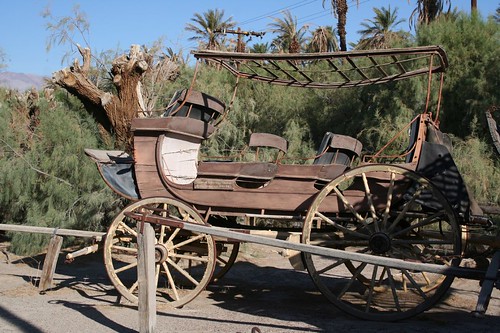
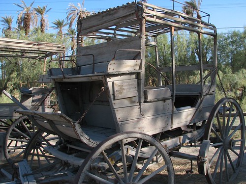
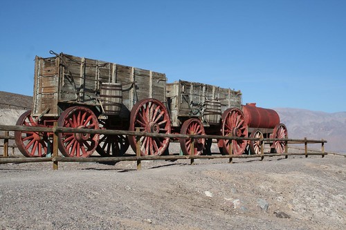
We also got sidetracked briefly by the Borax Museum, which was at the Furnace Creek Ranch. Borax mining in the valley started in the 1880s. The soil was rich in borax, but getting the borax out of the valley was difficult at best. It took a team of 20 mules to pull borax (as well as 5 tons of water per trip) out of the canyon. Borax today still often bears the “20-mule team” brand. Eventually, the borax mining operations were shuttered in favor of other locations where transportation wasn‘t so prohibitive.
The Borax museum had a surprising number of artifacts outside. There were a number of carriages and buggies:
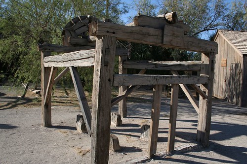
This contraption was used to shoe oxen that helped with the operations. It hoisted the ox up so it could be shod.
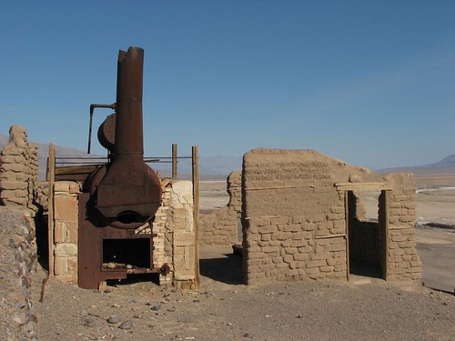
After the museum, we stopped at what remained of a nearby borax mill. Most of the mill was gone, but there was an intact borax cart and water tank that had been used by the 20-mule teams.
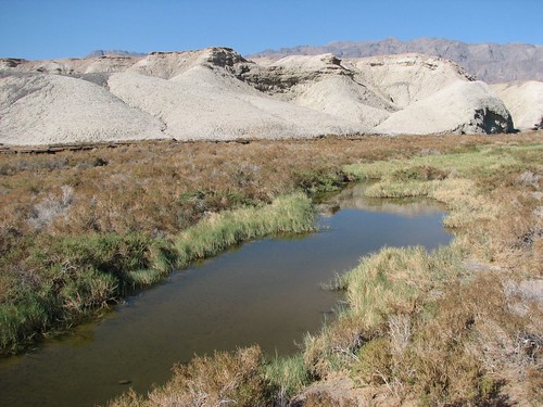
Further down the road, we stopped to walk out the boardwalk at Salt Creek. Salt Creek is home to the rare desert pupfish. We didn’t see any pupfish, but we did have a nice stroll through the marshy area.
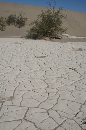
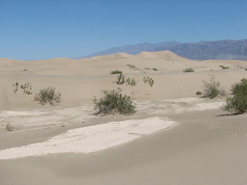
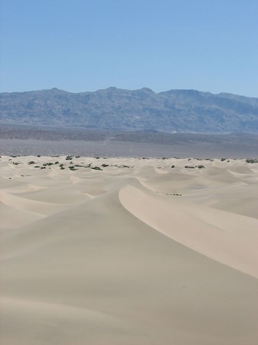
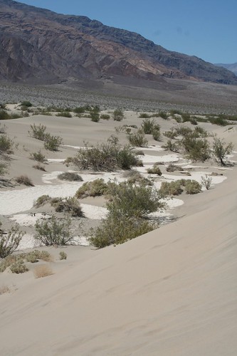
Our first real hike of the day was out on the sand dunes at Mesquite Flat. The dunes rise about 100 feet above the valley floor and are an inviting place to explore. In the dips between dunes, there were places where the sand was baked like pottery.
Sarah briefly tried to take off her shoes to hike, but the sand was way too hot. We climbed to the top of the highest dune.
After the dune hike, we stopped at the Stovepipe Wells store to eat lunch. We also discovered that the small lodge across the drive had wireless. There’s virtually no cell phone reception in Death Valley, but oddly there were several places where we found wireless.
After an extended lunch break, we drove up to Mosaic Canyon for another hike.
Hiking in canyons with walls towering on both sides is much different than hiking in the mountains where you get broad vistas.
The first part of the canyon was quite narrow, but then the hike opened up a bit.
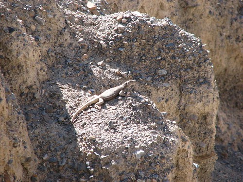
Here we saw the largest lizard we’d seen yet.
These are some good examples of the mosaic walls and polished marble the canyon is known for.
Eventually, after a couple of wrong turns (which you’d think would be hard to do in a canyon…) we reached a headwall that signaled the end of our hike.
We took a few more photos on the way out, including this one which gives a good perspective of how narrow the canyon is.
At this point, we’d had a full day. We were planning to camp at one of the campgrounds at higher elevations, where it would be cooler. We decided to drive to the highest campground, which is at about 8000’. The drive out there was pretty, with a surprising number of wildflowers lining the road. It was quite a change from the lower elevations. As we were driving, the road got increasingly narrower and windier. Eventually, we were on a narrow dirt road for the last several miles to the campground.
A couple miles from the end of the road, we were stopped by a ranger and told to turn around. Apparently, a tractor trailer had gotten lost and ended up stuck on this road, which it was now blocking. The road was barely wider than Caroline, with a number of overhanging trees, so it’s hard to imagine how the tractor trailer even got that far. There was a tow truck trying to help him get out, but it didn’t look like the road would be unblocked this evening. We got turned around and went back down the road a few hundred feet to the Thorndike camp and stayed there instead.
No comments:
Post a Comment