Before we started our hike, curiosity got the best of us, and we walked up the road a bit to see if the tractor trailer was still stuck. Sure enough, it didn’t take us long to see the tractor, though it wasn’t where it had been the night before. As Brian was walking by, the driver poked his head out and started talking to us. He had gotten stuck about 36 hours before, when he claims he was following a Mapquest printout and verbal directions to get to a mine for a pick-up. Since the mine was on the other side of the valley and there are no roads over the mountains in that area, I have no idea how he ended up where he was. He’d spent the entire previous day trying to get out, including having help from a tow truck, but the ranger finally sent the tow truck home at dusk. The poor driver seemed starved for company and leaned out of the cab of his truck chattering away for as long as we’d let him. It was quite a sight, with a tree caught on the roof of the cab. We really wanted to take a photo, but he seemed quite embarrassed by the ordeal and annoyed that the ranger the previous day was taking photos. We had to settle for this photo of a tow truck coming out to get him.

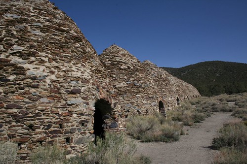
We walked back down the road to the charcoal kilns, where our hike turned off. The kilns were used in the early 1900s to create charcoal that was then moved to other parts of the park and used in various mining operations. They are very well preserved.

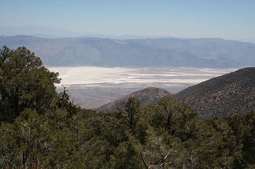
We proceeded up the mountain, enjoying the plant life and cooler weather. Once at the top, we were treated to views of the valley far below us.

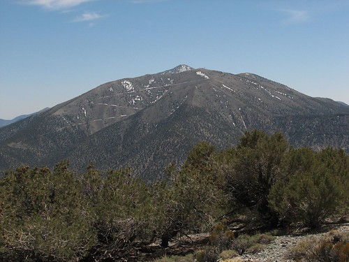
We also had a good view of Telescope Peak, which at 11,049’ is the highest peak in the Panamint Range.
By the time we got back to our camp, the tractor trailer was finally gone. We had a good hike, logging about 10 miles for the day. Caroline rejoiced as she had the entire day off.
The next morning, we packed up and drove to Beatty. Beatty is a town in Nevada, near the eastern border of the park. We needed gas and hoped to find some cell phone reception. The gas wasn’t nearly as inexpensive as we’d hoped, but we did find a cell phone signal and wireless, as well as a gas station that doubled as a candy shop.
From Beatty, we drove to the ghost town of Rhyolite. It was an odd little town. This building was supposed to be the info center, but apparently it closed long ago.

For what appeared to be a small town, Rhyolite had several large banks, including this one:

It also had a train station:

The strangest thing about the town was the Golden Open Air Museum. It had a very bizarre assortment of art, to say the least.


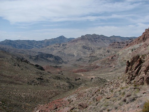
Driving back into the park, we turned off the paved road onto the gravel Titus Canyon Road. This was supposed to be a road only for high-clearance vehicles, but the ranger had assured us that our CR-V would have no problems. Here are some of the pretty views from the road:


This is looking down from Red Pass:

At Red Pass, we got out of the car to walk a short distance for better views. This snake slithered out in front of Brian. We’ve seen surprisingly few snakes on our travels and this one was by far the largest. He didn’t appear to be going anywhere, so we decided to take an alternate route.

Here is the view in the other direction from Red Pass:


Shortly, the road passed Leadfield. Leadfield is another ghost town. It existed for a grand total of about six months. The town was built on a scam and the lead soon ran out. All that is left today are several dilapidated shacks.

Nearing the end of the Titus Canyon road, we drove into the Titus Canyon Narrows. They lived up to their name:

Finished with the Titus Canyon drive, we made a quick stop at the Stovepipe Well viewpoint. This well was the only source of water along an early route to cross the canyon. As sand drifted, it became harder and harder to find. Eventually it was marked with the stovepipe you see today.

When we got back to the Furnace Creek campground, it was much fuller than it had been mid-week. Not surprising, though, since it was dinnertime on a Saturday. We drove around for a while trying to find a shaded campsite that didn’t have neighbors too close. Eventually, we settled for a walk-in tent site. It actually had a pretty nice view of the Funeral Mountains in the distance – these are the mountains, along with the Grapevine Mountains near Titus Canyon, that form the eastern border of the valley.
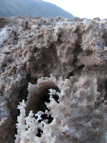
Sunday morning, we drove out of Death Valley, making one last stop to view more salt flats.

It was a long, lonely road out of the park. We saw only a couple of other cars the entire time.
Death Valley far surpassed our expectations. We were planning to stay for only a day or two, but ended up staying for five days. There was an amazing variety of terrain to explore, from the valley floor to the mountains high above. Despite, or maybe because of, its vast emptiness, the valley itself was surprisingly beautiful. All in all, we were both very glad we’d made the trip and braved the heat.
No comments:
Post a Comment