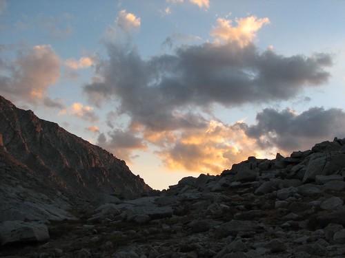
The sun started shining on the tops of the mountains as we started hiking.
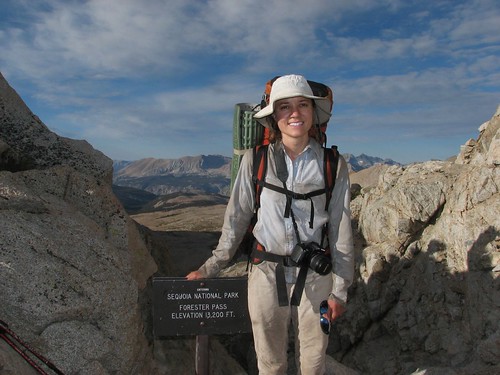
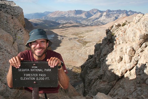
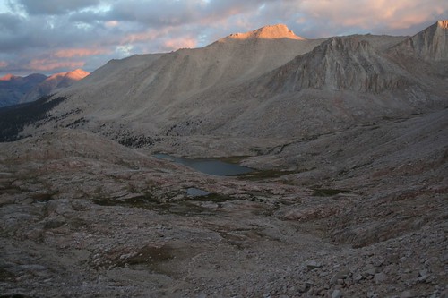
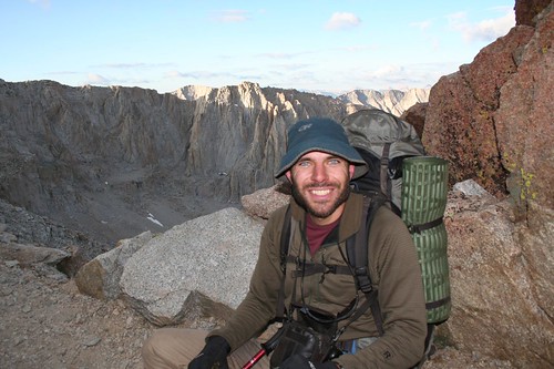
Forester Pass would be our highest point yet at 13,100’. In fact, Forester Pass would be the highest point that we’d ever hiked to. Even if you count our short hike from the top of the chairlift to the top of Peak 8 at Breckenridge, this would still be our highest hike, since Peak 8 is just under 13,000’. We’d done most of the work the previous evening to get up to Lake 12,250’, so the remainder was a piece of cake.
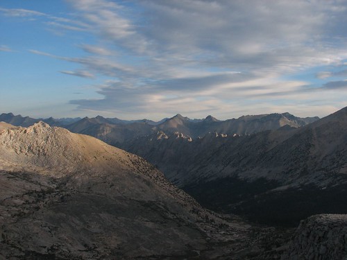
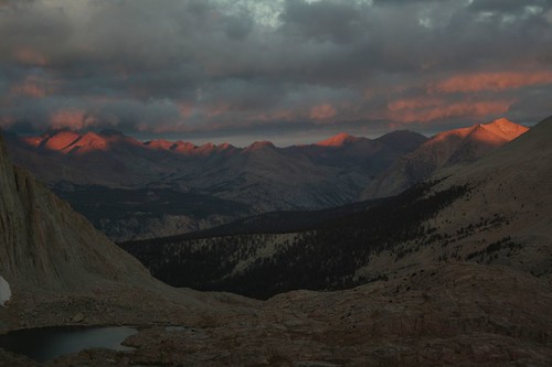
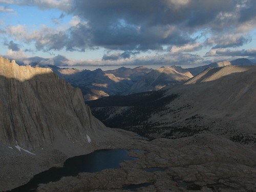
The view looking back down the valley was fantastic. We could see the Kearsarge Pinnacles in the foreground, with a couple of other mountain ranges behind.
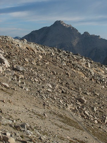
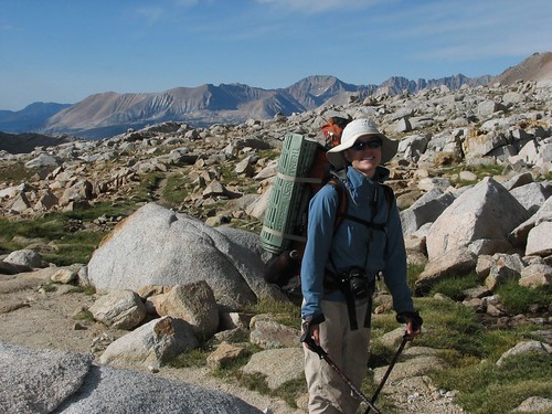
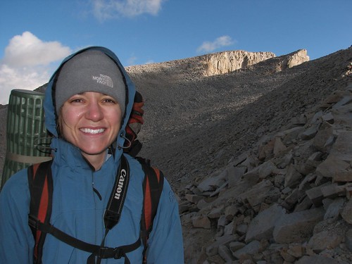
Here comes Sarah, steadily climbing the switchbacks.
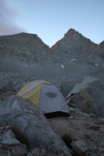
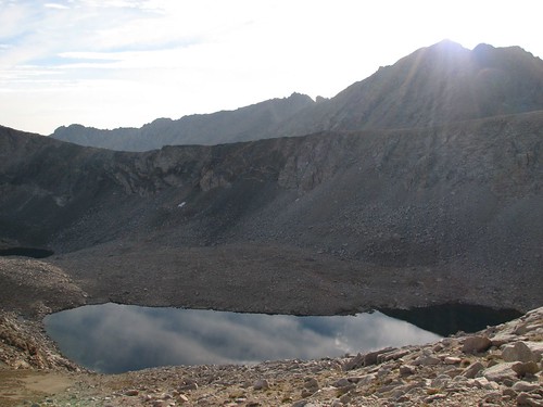
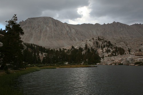
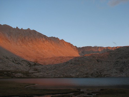
The sun finally made it up over the mountains to shine down on us and on Lake 12,250.
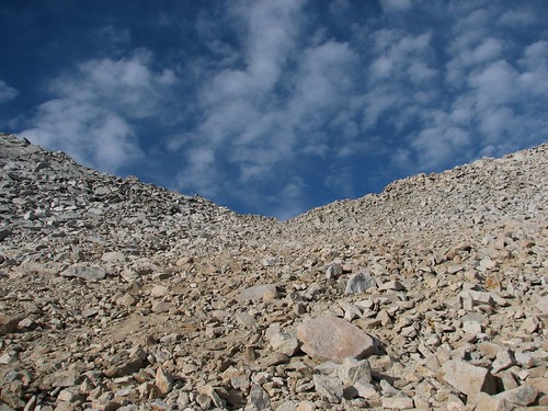
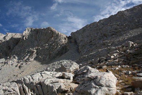
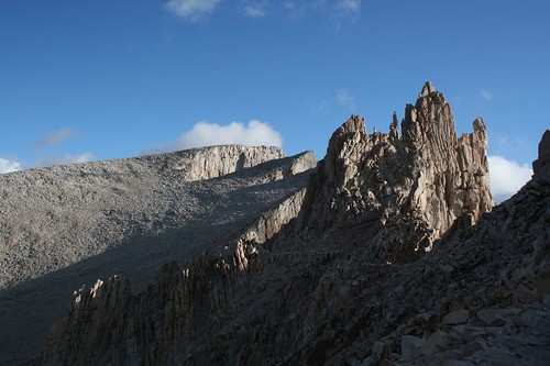
The pass wasn’t especially distinctive – just a little saddle. It’s no surprise that finding the pass is extremely difficult for hardy skiers in the winter.
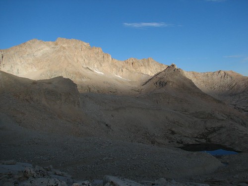
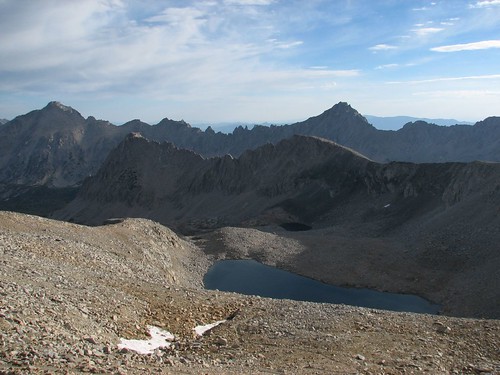
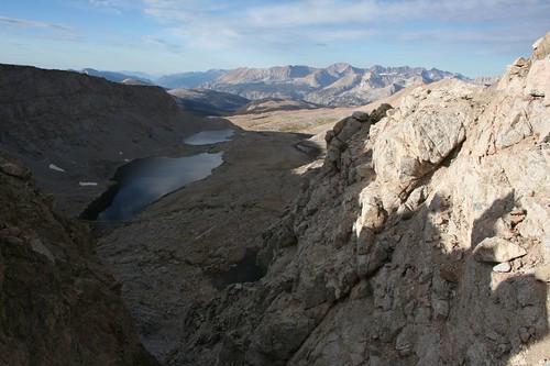
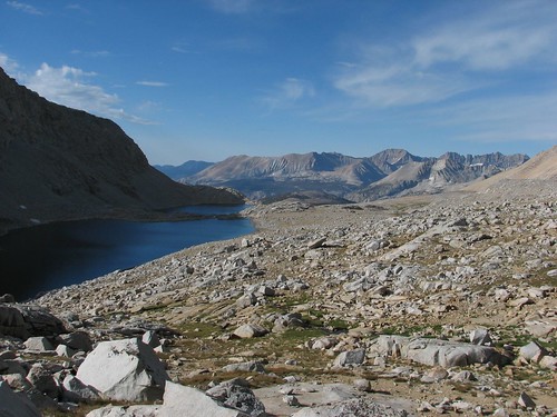
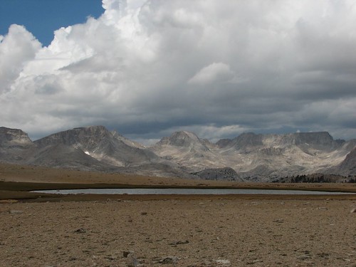
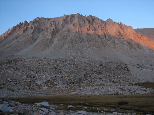
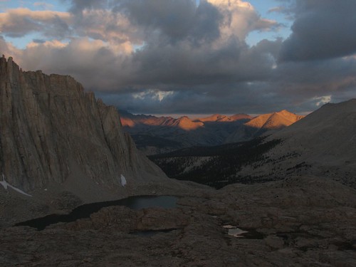
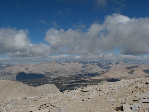
A short climb later, we were there. The view looking back was impressive, with Lake 12,250 in the foreground, Center Peak behind, and University Peak, the Center Basin Crags, and Mt. Bradley behind that.
Looking forward, we realized that even though the pass was an indistinctive saddle from the north, it was a narrow notch from the south. The views south were fantastic, but blocked by the high ridge that we were on.
In addition to being the highest point on our hike so far, Forester Pass also marked the entrance to Sequoia National Park, our third national park of the hike.
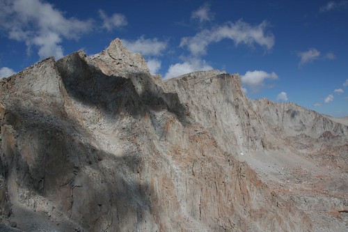
We were the only ones at the pass, so we hung out for a little while snacking before heading down a steep switchbacking route. Looking back at the pass from the south, we were amazed that there was even a trail – the area below the pass just looked like impossibly steep and crumbly rock.
As we continued to descend, views opened up of unnamed lakes and the Kaweah peaks in the distance. Diamond Mesa towers over the two lakes at the far left.
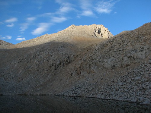
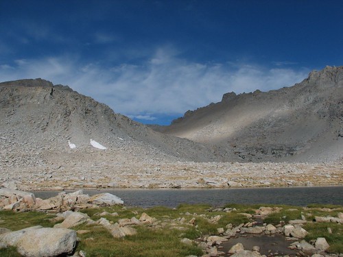
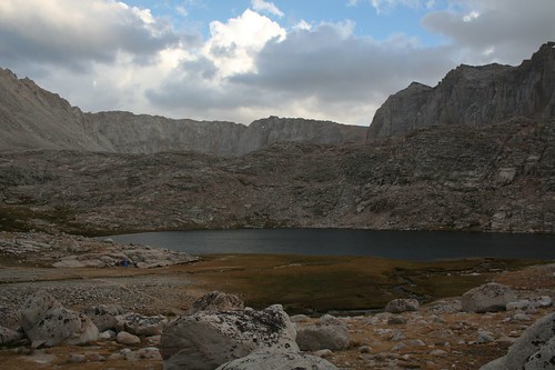
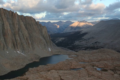
Here’s another pretty lake in the basin just below Forester Pass.
It was cool as we descended from the pass, so Sarah was still wearing her jacket.
We looked back at the pass again and noticed three people on top.
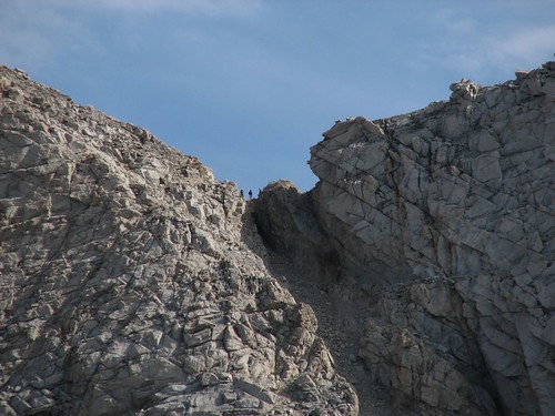
When we zoomed way in, we realized that two of the three were Doug and Mike. They’d started the day a ways back from us but had made up ground with their typical early start and fast hiking.
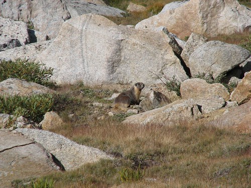
Marmots were the biggest animal that we encountered in the alpine areas on the JMT. They were a little more skittish than the marmots that we’ve encountered in Mt. Rainier National Park, but this one sat still long enough for a photo.
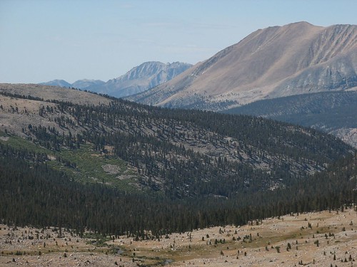
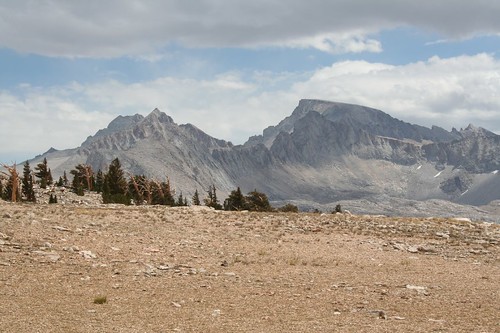
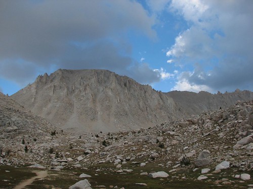
We continued hiking down from the pass, taking occasional photos of the distant mountains along the way.
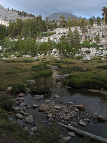
Eventually, we found a creek that would make a good water source for filtering and making our oatmeal breakfast. All in all, we liked the strategy that we’d followed the past few days: We’d camp a little ways below a pass, and in the morning quickly eat Clif Bars so we could ascend to the pass as early as possible. Then we’d snack at the pass, and at the first good water source on the other side of the pass, we’d make breakfast. This way, we were on the trail before the sun rose over the mountains, resulting in nice cool shade during most of the pass climbs as well as great views as the sun rose over the mountains. The only drawback was that it sometimes took a while before we found water on the far side of the pass.
Anyway, we enjoyed our oatmeal, and as we did, Doug and Mike passed by. Shortly after that, Trevor passed us – he was a lone hiker from the U.K. who was on a several-week trip to North America. He’d heard that the JMT was the most scenic hike in the entire world, so he was starting his trip with the JMT before heading to Alaska and the Canadian Rockies. What an amazing holiday!
As soon as we started hiking again after breakfast, we heard a loud rumble. At first, we thought it was thunder, but then it kept going – way too long to be thunder. Besides, there were just a few puffy clouds in the sky – it certainly didn’t look like a thunderstorm was imminent. After a few seconds, we realized it was a rockslide, quite nearby! We could actually see the rocks sliding, and the dust cloud that they created.

Then, just a little ways further, we reached our first sign for Mt. Whitney since Yosemite. In Yosemite, Whitney had been 211 miles away, but now we only had 16.1 miles to go!

Next we hiked down into some trees and met up with Trevor, Doug and Mike, and their friend Jeff by a creek crossing. Doug warned us that this was the last good water source for a few miles, so we decided to join them and filter some more water. They had a SteriPEN – one of their cool backcountry gadgets – so they just had to push a button to zap their water with UV light, while we invested sweat equity to pump our water through a carbon filter.
While Brian filtered, Sarah chatted with them. Given that we live in Seattle and seemed educated, they said, they guessed we worked at Microsoft. We confirmed their guess. Sarah asked how they stay in shape, and Doug said he surfs, hikes a lot, and takes care of a four-acre property – pretty impressive for a guy who’s nearly our parents’ age.
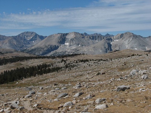
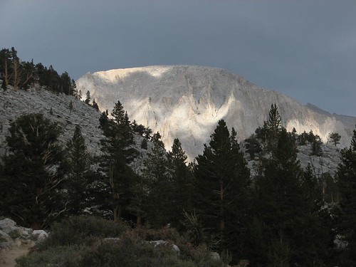
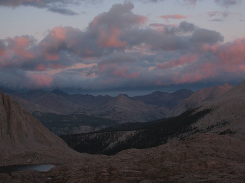
Next we hiked up to Bighorn Plateau as the thunderclouds mounted. The sunlight filtering through the clouds made for stunning patterns of light and shadow on the mountains.

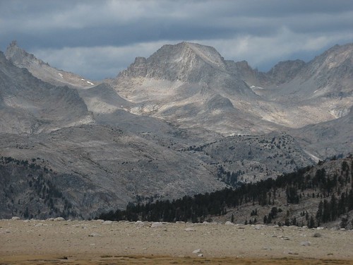
We also got some good views of Mt. Whitney, the flat-topped mountain on the right in this photo:
We’d been talking with Doug and Mike about our options for ascending Mt. Whitney. The most common way to do it is to hike to Guitar Lake the night before your ascent, leaving a relatively short hike the next morning to the top. Another option is to camp right at Trail Junction, well above treeline – it’s a more exposed and less comfortable place to camp, but it leaves just 1.9 miles to the summit. Afternoon thunderstorms are a potentially lethal threat at the top of Mt. Whitney, so it’s highly recommended to summit the mountain early and be down by early afternoon. A third option is to camp right at the top of Whitney – potentially extremely dangerous on a stormy night, but an amazing experience on a clear, calm night. The next day would be our fifth anniversary, and Doug had planted in our heads the idea that spending the night of our anniversary at the highest point in the lower 48 states would be a fantastic experience. So that was our working plan.
As was typical, Doug and Mike passed us on Bighorn Plateau, but we caught up with them when they stopped to chat with a couple who turned out to be JMT experts. They hike the JMT every year, and the man is the son of the guy who owns an outdoor gear shop in San Diego. They’d had dinner with Wayne Gregory just a week before, and he’d outfitted them with new Gregory packs to test out on their trip. Anyway, they were on the third day of a south-to-north thru-hike, so they had a relatively up-to-date weather forecast, and it didn’t sound good. The monsoonal weather – read: thunderstorms – was expected to continue for the next two days, followed by a cold front. We decided that spending the next night on top of Mt. Whitney seemed like a bad idea.
Instead, we reverted to the default option – camping at Guitar Lake and then summiting Whitney the following morning. We were still enamored with the idea of hiking to the top of the highest point in the lower 48 on our anniversary, so we decided to push on to Guitar Lake today. All factors were on our side – the trail was pretty smooth, the grade was small, the air was cool due to the cloud cover, and thunderstorms never materialized. We blazed through without taking many pictures.
We reached the Crabtree Meadow junction, where we had to pick up “wag bags”. A wag bag is a plastic bag for solid human waste. Seriously. Apparently, the Mt. Whitney area gets so much traffic that the typical way to go to the bathroom in the backcountry – digging a six-inch hole and packing out your toilet paper – isn’t good enough to keep pollution at an acceptable level, so hikers have to go in a bag and carry it out. For the next day and a half that we would be in the Whitney area, Sarah would manage to avoid using hers. Brian did use his, and thankfully managed to avoid any disastrous leaks.
We followed Whitney Creek up from Crabtree Meadow and got more nice views of Mt. Whitney under the dark skies.
Next we came to Timberline Lake, famous for its reflection views of Whitney. With the stormy, breezy skies, there was no reflection, but it was still a pretty setting.
As we hiked up from Timberline Lake, the skies started to clear up.
As the skies continued to clear and the sun got lower in the sky, the patterns of light and shadow on Whitney were beautiful.

Just a few minutes later, we made it to Guitar Lake. The area where the trail hit the lake was crowded with campers, but we hiked around to the guitar’s “neck” and found a gorgeous site that was nicely sheltered from the wind. Here’s the view across the lake from our site:
The upcoming stretch was the longest waterless stretch on the trail – from Guitar Lake to the top of Mt. Whitney to Trail Camp, the next water on the other side of Mt. Whitney, was about 10 miles. So as the sun set, Sarah filtered over a gallon of water while Brian made dinner and took more pictures.
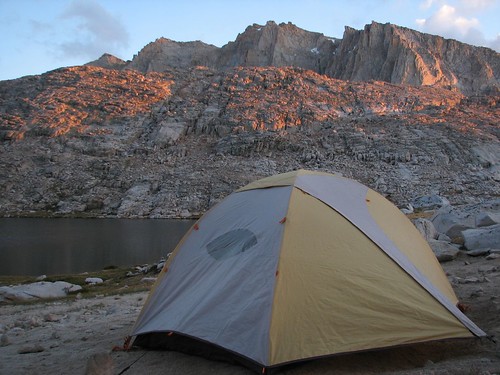
The sunset light on the rocks across the lake was a pretty orange color, and our tent had unobstructed views.

As the sun set further, the light only got better.
We ate dinner, drank a lot of water, and filtered two more liters so we’d be all set to leave bright and early in the morning. Fortunately, the wind died down right around sunset, and we got a very good night’s sleep. We’d hiked 17.6 miles this day, our longest day yet, for a total of 203.4.
Before 5 AM, we were up and moving around, and at 5:30, we were on the trail, hiking by headlamp light. By the time there was enough light to put our headlamps away, we’d made significant progress toward the summit, and the views of pinkish clouds above the Kahweahs were beautiful.
A few minutes later, the sunlight had reached the tops of the Kahweahs.
It was chilly but calm, and very comfortable for hiking. As we switchbacked up toward Trail Junction, where we would turn off for Mt. Whitney, we kept looking back at the changing sunrise light on the mountains behind us.

Then, suddenly, the orange sunrise light gave way to white daytime light. Even though the colors weren’t as pretty, the pattern of light and shadow cast by the clouds made for more good photos.
Then the wind picked up, and chilly but comfortable weather turned brutally cold. We reached Trail Junction, where many people leave their packs, but we just kept hiking. At Trail Junction, we turned left – having climbed to a high ridge, we would now follow the ridge most of the remaining way to the summit.
Battered by the wind, we took advantage of the occasional windbreaks, which were few and far between. Here’s Brian, huddled at the base of a protective rock wall.
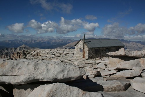
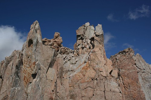
After hiking along the ridge a ways, we got our first view of the hut at the summit. In front of the summit are two pinnacles.
We met another couple who had hiked the High Sierra Trail and were also finishing their hike at the summit of Mt. Whitney. We took each other’s pictures at another windbreak.
Here’s Sarah, squinting against the wind:
As we hurried up the mountain, thinking only of getting relief from the wind, we took few pictures. The views were impressive, though – in the moments that we took to look around, we increasingly felt like we were on top of the world.

And then, after a final swift climb, we reached the summit house. Without looking around, we opened the door, jumped inside, and hefted the door shut, fighting the wind. The hut turned out to be a very tiny room that was packed with people – although we’d arrived early in the morning, we definitely weren’t the first ones there. We were starving after a steep climb with few breaks, and we spent the next minutes stuffing ourselves with granola, trail mix, M&Ms, and water. Eventually, we realized that we were still cold, so we stripped down to our underwear so we could throw on long underwear under our clothes. If the other people in the hut minded, they didn’t comment.
We spent close to an hour in the hut, enjoying our respite from the wind and refueling for the hike down. While we were there, we chatted with other people who were doing the same. We met a guy who had started hiking at 9 PM the night before from the trailhead in Whitney Portal and finished the 11-mile hike at 9 AM. He said the wind had been horrendous all night long. Another guy in the hut was from South America someplace – Chile, we think – and despite some altitude sickness on the way up, had made it. A woman had summited Mt. Whitney three times and said this was the worst weather she’d faced.
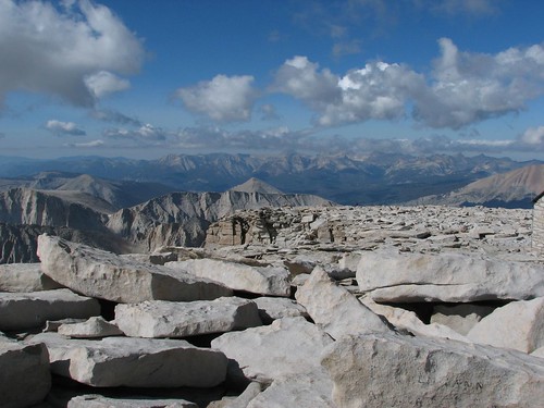
Eventually, we decided that we should check out the actual summit, only 50 feet or so from the hut through the atrocious wind. Here’s Brian, standing at the top of the continental U.S.:

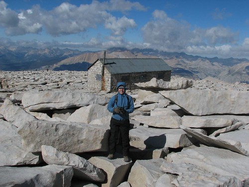
Here’s the view looking back at the hut:
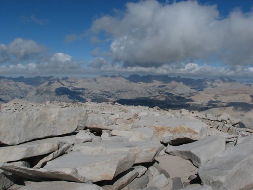
The views all around were fantastic:
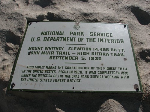
A sign commemorated the end of the JMT:
We’d made it! We’d hiked over 200 miles from Yosemite Valley to the top of Mt. Whitney and the official end of the John Muir Trail! Now we just had to hike 11 miles to the trailhead at Whitney Portal.
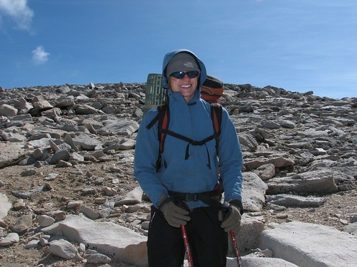
After collecting our packs from the summit house, we started down, bracing ourselves against the stiff wind. Here’s Sarah, bundled up for the descent:
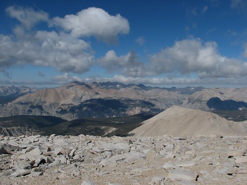
We got more amazing views as we headed down:
The Pinnacles loomed ahead:

Although the wind was insane, there was one good thing: The wind was blowing from the west, and the trail traversed just below the ridge on the west side. In other words, if the wind blew us over – which was a very real possibility – it would blow us into the mountain, and the mountain would catch us. The exception was when we passed the notches between the Pinnacles. There, we were hiking on a five-foot-wide ledge in what was essentially a wind tunnel trying to blow us through the notch and off the mountain to the east. Everywhere else, the hike to the summit was unpleasant, but in those spots it was life-threatening. We made it through without incident, although we wished we’d left our packs, which caught the wind, at the junction.
We continued to hike quickly, taking few breaks. We did take a photo looking back down at Guitar Lake on the right side of this photo. It really does look like a guitar from above.

As we were heading down, we saw Doug, Mike, Jeff, and Trevor again. After hurried hellos and goodbyes, we passed Trail junction and began the short climb toward Trail Crest, the last and highest of the 11 major passes on the JMT. If anything, the notch below Trail Crest was the worst of all, with stiff winds similar to or worse than those at the notches between the Pinnacles. Having safely passed through, we found a large crowd of people at Trail Crest, many of whom had made it that far – nine miles and 5000 feet of elevation gain – only to have to decide whether it was safe to proceed. We told them about our experience, and several people decided to turn around, which was probably a wise decision. We would find out later from a ranger that someone had measured the wind at up to 80 MPH!
Seeing all the day hikers heading up Mt. Whitney was an experience unto itself. Many of them looked like they were ill-equipped for a walk in a neighborhood park, never mind an extremely long and challenging day hike (21 miles and 6,000 feet of elevation gain and loss) at high elevation. Several groups walked by in shorts and cotton sweatshirts, carrying nothing but a bottle of water. There were some groups still heading up to Trail Crest after noon. Another couple looked like they were ready to have heart failure and weren’t even halfway up to Trail Crest. Many of these people also seemed to have no concept of how far they had to go at that point. A ranger we spoke to later said that they have a lot of problems with day hikers getting tunnel vision – they do all this planning (i.e. apply for a permit), go to the gym once or twice, and think they’re ready to summit. Despite all sorts of inclement weather, including active thunderstorms, they continue to push on.
Heading east from the pass, we had some nice views of rock formations.
But the wind just didn’t let up, so we made a beeline for treeline (well, as much of a beeline as possible given the 100 switchbacks between us and Trail Camp and more after that). We considered camping at Trail Camp, which was quite scenic, but it offered no protection from the stiff winds, so we pressed onward. We passed more people on their way up as we were heading down, mostly backpackers planning to camp at Trail Camp and summit tomorrow. One particularly noteworthy group included a guy in jeans and work boots carrying a Coleman tent still in its package. Ugh!
Finally, we made it to Outpost Camp, just below treeline, and Sarah found a nice camping spot near a gorgeous waterfall. The site was positioned right in the corner of the campground near a steep rock wall that afforded good wind protection. We sat for a long time in our gloriously sheltered campsite, overjoyed to not be battered by the wind.
Sarah’s boots, which were not in good shape when we started the hike, had definitely outlived their useful life.
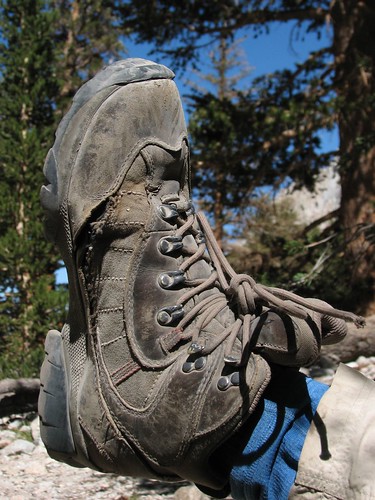
She’d had these boots for years and considered throwing them away before we started the hike, but ultimately decided to wear them for 220 more miles because they were her most comfortable option. It was a good choice – she didn’t have any foot problems on the hike, and we had great weather, so she didn’t have any issues with water flooding her boots through the gaping holes at the seams.
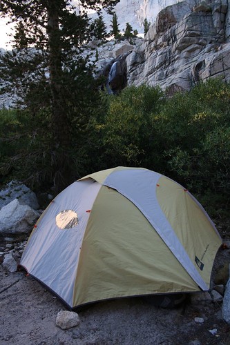
After basking in our relatively wind-free campsite, we set up our tent for the last time on the JMT.
It was a little sad to think that this was our last night – we’d had a wonderful time.
Later in the afternoon, Doug, Mike, Trevor, and Jeff appeared and staked out a campsite. Doug and Mike were pretty much out of food, so we gave them some trail mix, which they gratefully started devouring. Even so, after chatting with us for a while, they decided to hike the rest of the way down to the trailhead so they could get beer, pizza, and showers in Lone Pine. They invited us to join them, but we had already set up camp, and besides, we couldn’t pick up Caroline at the body shop until Tuesday – today was Sunday, and tomorrow was Labor Day. We had enough food, too, so we weren’t in any hurry to get off the trail. We declined and said our final goodbyes to our trail buddies.
The next morning, we got up bright and early, as usual, and started hiking down. We skipped our oatmeal breakfast because Doug had told us about 24-inch pancakes at the café at Whitney Portal, the trailhead. 24 inches had to be an exaggeration, but after 16 days of oatmeal, pancakes sounded pretty good.
We took a last picture of the pretty Sierra granite in the early morning light, which we knew we’d miss:
As we departed the wilderness, a passing hiker took our picture.
A mile later, we were at Whitney Portal. At the trailhead, we met a group of six or seven women who were beginning a two-night backpacking trip to climb Mt. Whitney. When they found out that we had hiked the JMT, they asked Brian who he was. He told them, and they asked, “Is your wife named Sarah?” When Brian said yes, they wished us a happy anniversary! We’d never seen these women before in our lives! It turned out that they had been at the Lone Pine pizza place around 9 PM the night before when Doug and Mike and the gang arrived, and had struck up a conversation.
Then the women asked Brian to take off his sunglasses, and they all oohed and ahhed – apparently, Doug had told them that they’d recognize Brian by his blue eyes, and that they should wish us a happy anniversary. How cool!
At the Whitney Portal café, there were three choices for breakfast: a single pancake, the same single pancake with eggs and bacon, and another combo that didn’t include a pancake. Having heard about the legendary pancakes but thinking that eggs and bacon sounded fantastic, too – basically, anything not cooked in a pot sounded wonderful – we ordered the pancake combo.
The JMT is full of wonderful magic. Just as the impossible-sounding legend of cold beer at Silver Pass had turned out to be true, so did the legend of the 24-inch pancake.
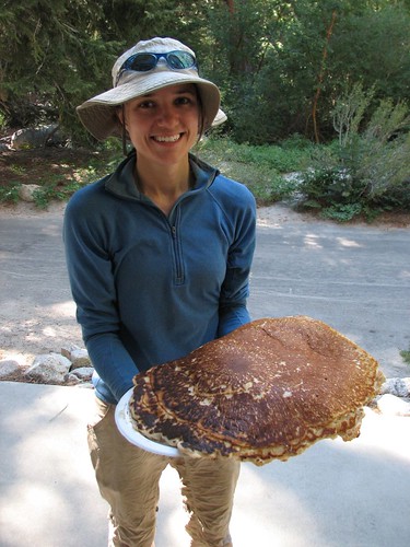
The cook served up the pancake on two plates, but even two plates weren’t enough to contain the pancake, which overflowed onto the picnic table where we ate. Keeping our syrup from flowing downhill, off the pancake and onto the table, was a special challenge. We sat with four other hikers whom we’d met the previous day, and everyone was in awe. It was bigger than a pizza. Thicker, too – it was 1.5 inches or so thick at the center. And after hiking for 17 days, it tasted amazing. A hot topic of discussion was how the heck the cook flipped such a huge pancake – we decided that he must have had one of those huge spatulas for flipping pizza crust.
Oh, but the pancake wasn’t at all. We’d ordered the combo, so on a third plate, the cook served up about seven strips of bacon and four scrambled eggs. It was an insanely glorious amount of scrumptious non-freeze-dried splendor.
After eating all the bacon, all the eggs, and at least half of the pancake, we were blissful and nearly comatose. We’d weighed ourselves on the scale in the Whitney Portal store, and decided that we’d eaten pretty well on our hike – Sarah had lost about five pounds, and Brian had maintained his weight. That was before breakfast, though – by the end of breakfast, we were each probably a few pounds heaver.
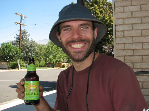
One of the couples who ate breakfast with us gave us a ride from Whitney Portal out to Lone Pine, and in Lone Pine, we bought some orange juice and newspapers. We found out that the baseball pennant races hadn’t changed much, and that Joe Biden and Sarah Palin had been chosen as the presidential running mates. Then Brian acquired a Sierra Nevada beer to commemorate the completion of our journey through the Sierras, and we settled in at the bus stop to wait for the bus that would take us to Bishop, where we’d pick up Caroline from the body shop the next morning, hopefully all patched up after being terrorized by the bear.
What a trip it had been! In all of our backpacking, this was the most amazing trip we’ve done. We were initially skeptical about a trip that was so long, but we’d do it again in a heartbeat. In the words of John Muir, “Everybody needs beauty as well as bread, places to play in and pray in where nature may heal and cheer and give strength to the body and soul.” For us, the John Muir Trail certainly fit the bill.
2 comments:
JMT - Lake 12,250 to Whitney Portal <-- that's what i was looking for
Congratulations on your past anniversary and I hope you continue adventuring. My wife and I highly recommend Antarctica where where we celebrated our 44th anniversary! Really enjoyed your blog and I'm hoping to see what you saw before I'm seventy!
Post a Comment