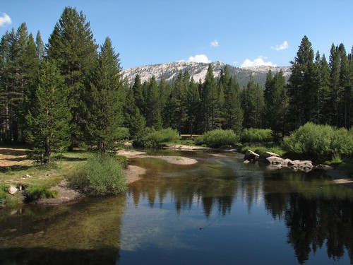
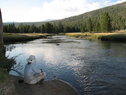
About two miles from the store and grill, we crossed the Lyell Fork of the Tuolomne River, where it passed over some granite slabs and pooled up.
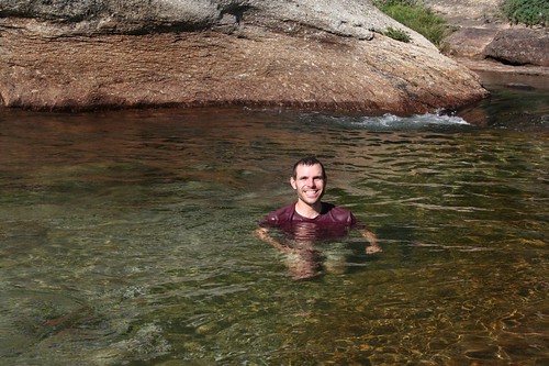
It looked perfect for a swim, and since we hadn’t taken a shower since Reno, a swim sounded awfully appealing. Brian went in fully dressed, thinking that he might get his clothes a bit cleaner at the same time.
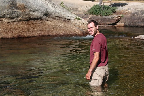
It took a little while, but he finally got up the courage to submerge himself, and although it was cold, it felt great.
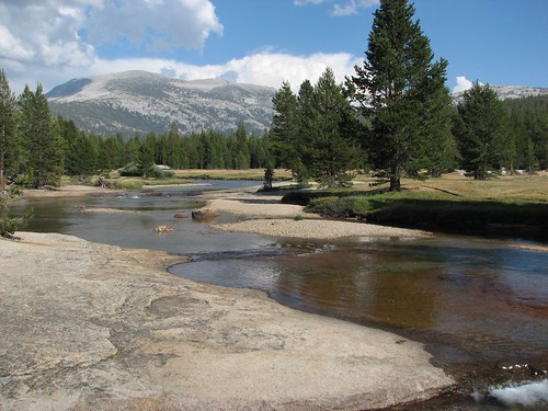
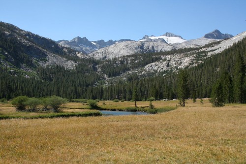
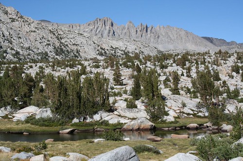
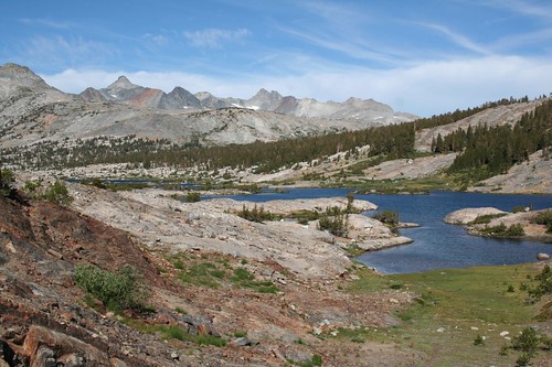
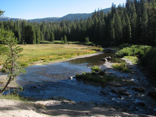
After wringing Brian’s clothes out, we continued to hike up Lyell Canyon, where we would be for many miles on our way up to Donohue Pass. Lyell Canyon is consistently beautiful, so it wasn’t hard to find a gorgeous spot to filter some water.
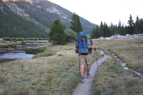
We had to hike four miles from the Tuolomne developed area to get to the beginning of legal camping. Unlike most other national parks that we’ve been to, Yosemite doesn’t have designated backcountry camping. When you get a permit, you don’t get a permit for a particular campsite, or even a particular campground. Instead, you get a permit for a trailhead and a number of days in the wilderness. Beyond that, you can camp where you want, with the one exception being in Yosemite Valley, because it’s so popular as the base camp for climbing Half Dome. The main restrictions on camping are that you have to be four miles from developed areas and 100 feet from the trail and water.
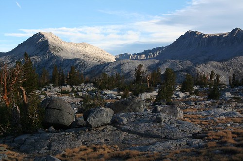
Conveniently, there’s an avalanche chute across the river from the trail that happens to be four miles from the developed area, so it marks the start of legal camping. Here’s Brian, hiking towards it as the sun sets.
The evening light in the canyon was really pretty.
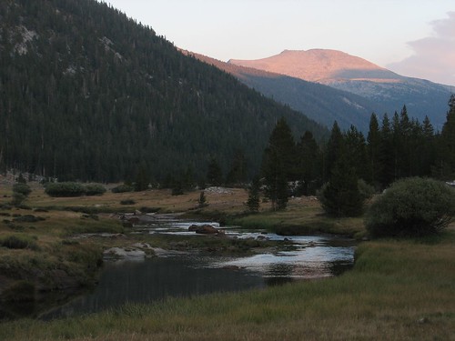
As soon as we pulled even with the avalanche chute, we hiked up onto some granite on the right side of the trail and found a couple of nice campsites. We enjoyed our view.
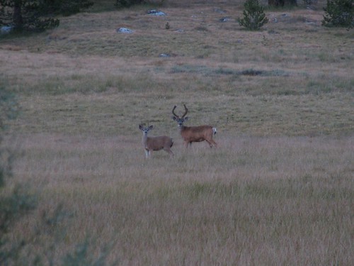
Then, across the river, we noticed a few deer. They noticed us, too.
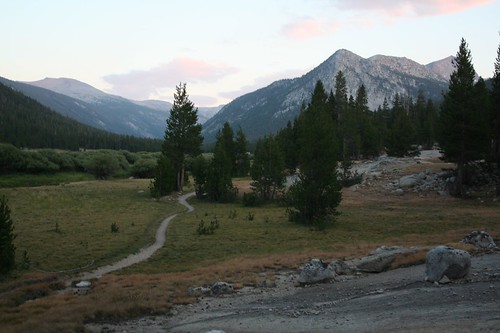
That night, we fell asleep to the sound of coyotes howling nearby. On day 2, we hiked 15.2 miles, bringing our total for the trip to 28.3 miles.
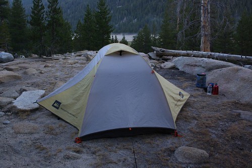
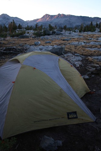
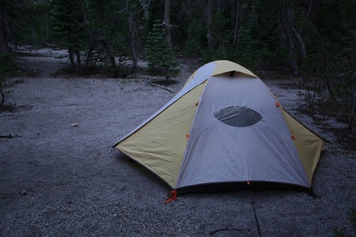
When we woke in the morning, fog was streaming off the river. We took the requisite picture of our tent, sitting in yet another beautiful spot.
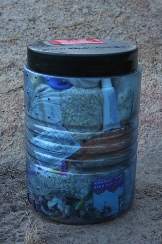
We also took a photo of our bear canister, completely filled with food and toiletries. Sarah became a master bear canister packer on this trip – she would take an enormous mound of food that looked like it could fill two bear canisters, and with a lot of creativity and some squishing, manage to fit it all into one. And minimizing bear canisters in the Sierras is a valuable skill, since each of those canisters weighs 2.5 pounds!
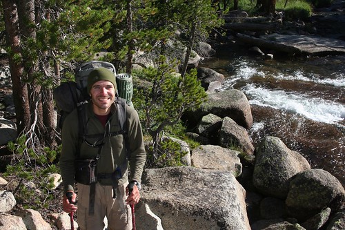
It was really cold when we got out of the tent. Although we were only camped at about 8800 feet, the bottom of the canyon was a cold air sink. Even at 8:30 AM, after we’d been hiking for a while, Brian was wearing long sleeves and a fleece hat.
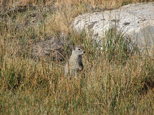
Then we met up with a more “picket pins” like we’d seen earlier in Long Meadow.
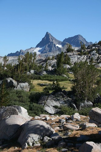
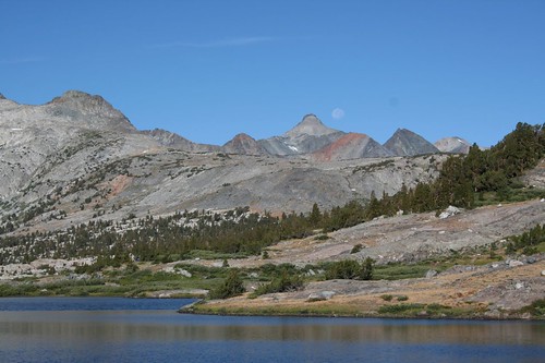
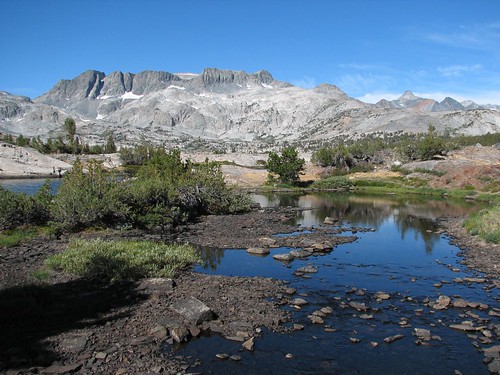
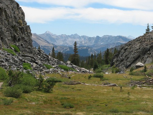
As we continued to hike upriver, we got better views of mountains toward the head of the canyon that still had some snow on them, even in mid-August. We would be hiking up to Donohue Pass today, which is over 11,000 feet, even higher that the 10,000-foot peaks we’ve hiked in the past month or two, the South Sister, Lassen Peak, and Mount Rose.
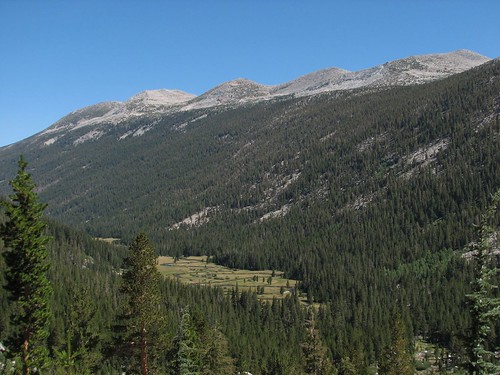
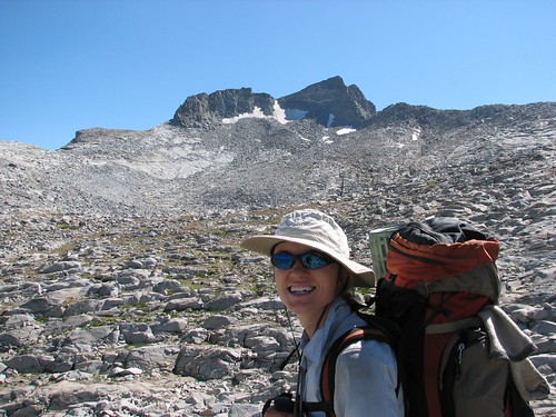
Abruptly, the gentle grade turned steep and rocky, and we were soon high above the Lyell Canyon floor and gasping for air. We’d climbed 6000 feet the previous day, but somehow the steep 2200-foot climb to Donohue Pass seemed a lot harder, perhaps because of our heavier packs. In any case, it was a good time to take a picture.
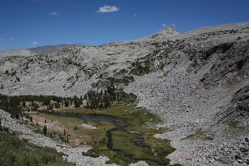
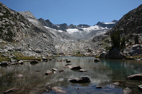
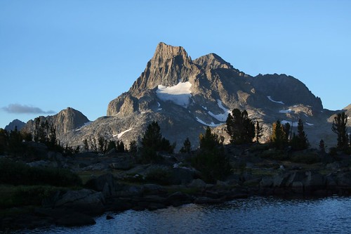
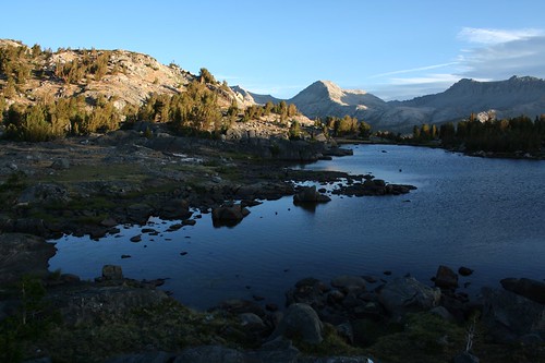
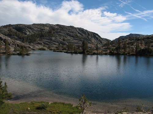
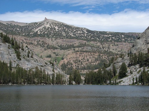
Finally, the steep climb ended at a gorgeous lake.
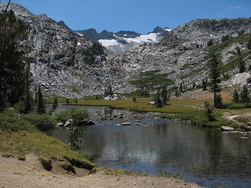
We stopped there with more than a dozen other people for a long snack break before resuming our climb. Here’s Brian, happy to have his mouth full of muesli.
And here’s Sarah, bundled up in her jacket in the cool shade.
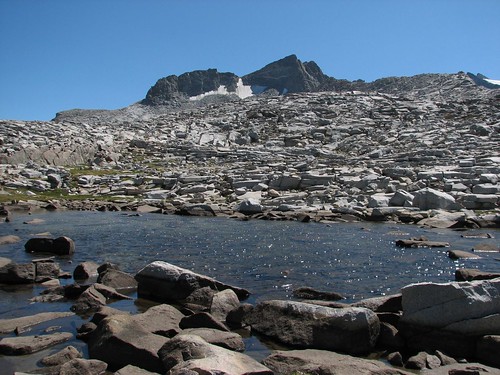
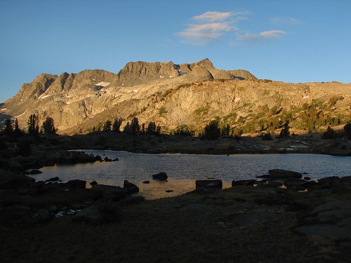
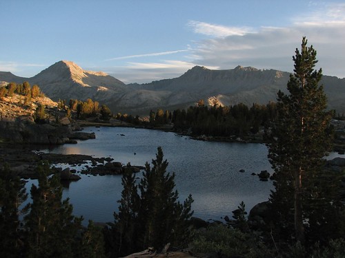
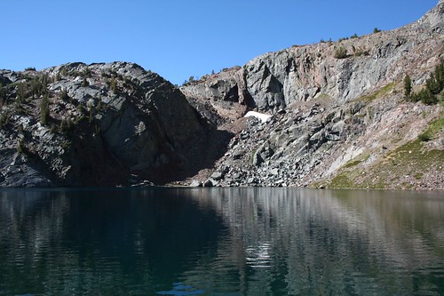
At length, we decided to continue our climb, and soon we were looking down on the pretty unnamed lake.
Here’s Sarah on the trail:
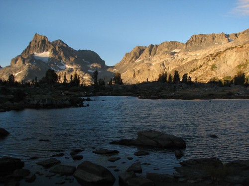
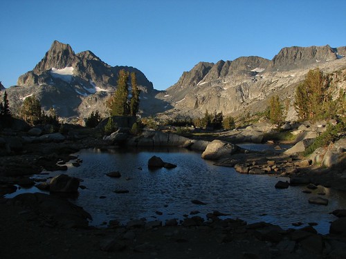
Soon we hiked around a little turquoise tarn.
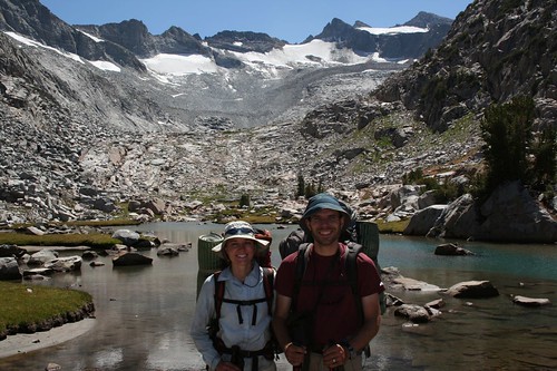
We stopped and chatted with another group of people, one of whom had the same pack as Brian and another who had his hat. They offered to take our picture.
We passed more pretty tarns.
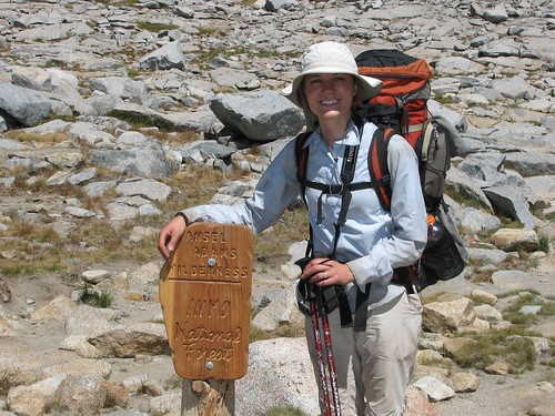
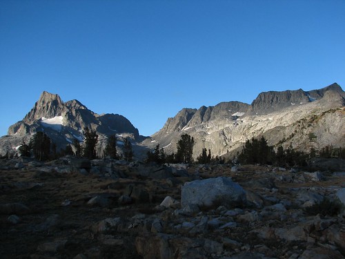
And then we were at the top! Donohue Pass marks the boundary between Yosemite National Park and the Ansel Adams Wilderness of the Inyo National Forest.
Until the climb to Muir Pass, 90 miles or so later, this would be our highest point of the journey, just over 11,000 feet. We took our packs off for a long break, and ate some M&Ms out of the bear canister.
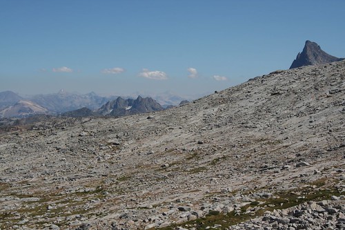
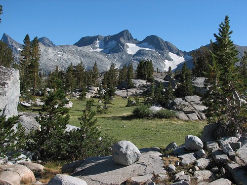
Eventually, we started moving again and took some pictures of the mountain views. The Mammoth Mountain ski area is visible off in the distance.
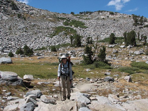
Here’s Sarah with her pack on, ready to go again.
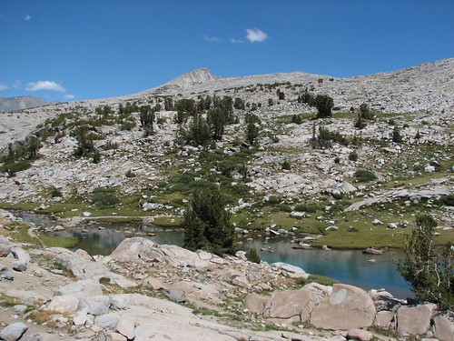
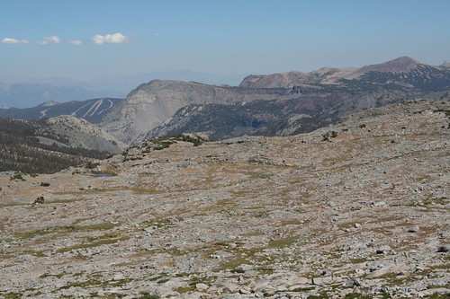
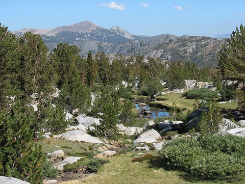
The area to the east of Donohue Pass was a wet, rocky meadow, very different from the Lyell Canyon we’d recently left.
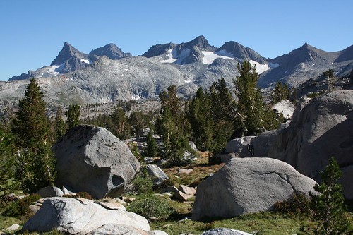
Like many other places in the Sierra, the meadow had its share of glacial erratic, large boulders left lying around by glacial activity long ago.
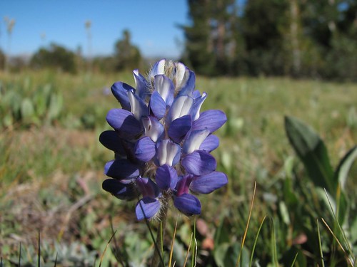
The wildflowers are at their best in the Sierras in July. Unfortunately, that’s also when the mosquitoes are at their worst, and given the late snowmelt this year, we didn’t have enough time to get in shape for a July JMT hike anyway. Although we didn’t see vast meadows packed with wildflowers, there were still plenty of pretty wildflowers here and there.
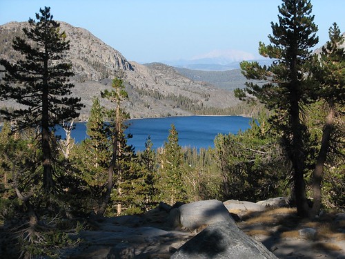
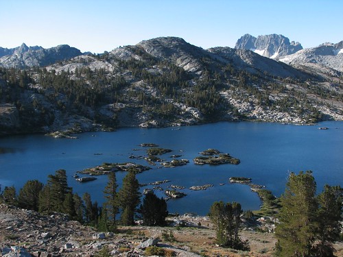
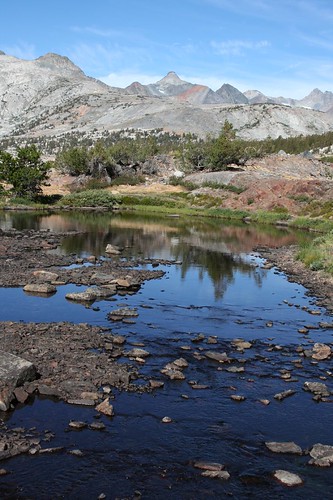
We’d read that Island Pass was pretty, so we planned to camp there for the night. If we made it, today would be the rare day when we ascended two different passes – Donohue and Island. We continued hiking out of the meadow, descending and then rising again, eventually passing Waugh Lake, a bright blue lake at some distance from the trail.
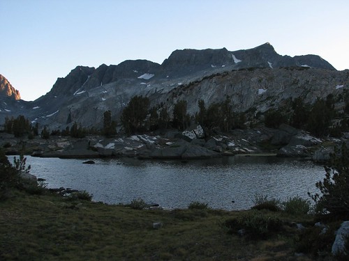
It was getting close to sunset by the time we finally arrived at Island Pass, but it was worth the effort! Most of the other passes on the JMT are what you’d imagine when you think of an alpine mountain pass – rocky areas that are just big enough to accommodate a handful of hikers. They’re nice places to hang out for a few minutes, snacking and chatting with other hikers while you enjoy awesome views in both directions, but they’re too barren and inhospitable for comfortable camping. Island Pass was entirely different. More a high (10,200’) plateau than a pass, it lacked the awesome distant views but contained several relatively large tarns backed by smaller mountains, making for gorgeous camping.
Like the other passes, though, it was extremely windy, so we wandered around for a while before finding a campsite that had enough vegetation on its windward side that we wouldn’t blow away in the night. Satisfied with our campsite choice, we took a few photos of the fading light before making dinner and going to bed.
On day 3, we hiked 13 miles, bringing our total for the trip to 41.3 miles.
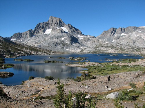
The next morning, like practically every morning, we got up before sunrise, since we’d been in bed for nine or ten hours by then. It was a gorgeous day, with few clouds in the sky, and very soon, the soft morning light hit the mountains, making for even better views than we’d gotten the night before. We spent over half an hour exploring the tarns and finding good spots for photos.
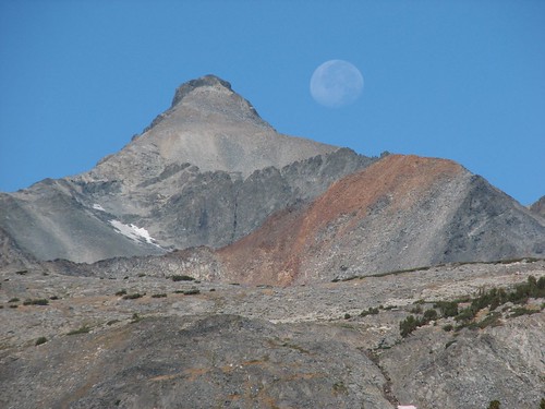
The first photos in that series were taken at 6:35 AM. By 6:58 AM, in the following photo, the golden light was gone, replaced with almost a silvery shine.
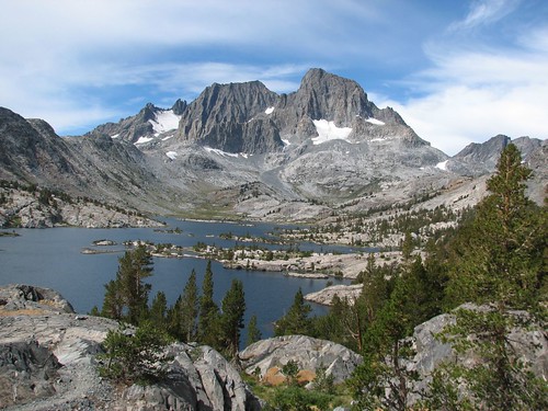
Thousand Island Lake, a large lake dotted with, you guessed it, lots of islands, was the first major attraction of the day. Ansel Adams featured Thousand Island Lake in many of his famous black and white photos, and since we were in the Ansel Adams Wilderness, this was a pretty major attraction. It wasn’t too far below the pass, so we decided to hike down and make our oatmeal breakfast on the shore of the lake.
The hike down was pretty, with nice views of granite peaks.
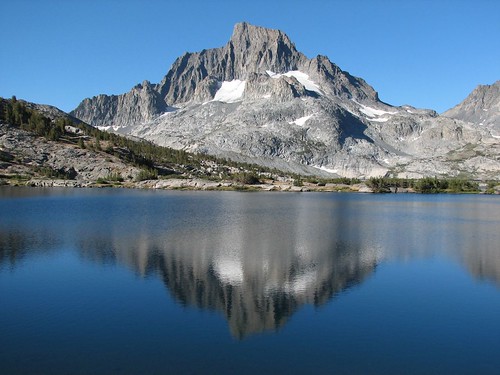
It wasn’t even an hour before we had great, unbroken views of Thousand Island Lake. Okay, so the lake doesn’t really have 1000 islands, but for a relatively small lake, it has an awful lot of islands, and they’re really pretty.
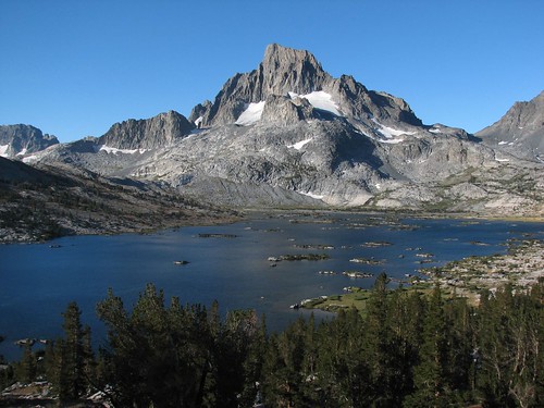
The rest of the hike down to the lake was slow – we were stopped in our tracks every few paces by the beauty of the island-dotted lake with Banner Peak in the background.
Eventually, we set up for another tasty oatmeal breakfast, deciding that this was our prettiest breakfast spot yet. The waning moon slipped behind the mountains beyond the lake as we ate.
It was just a little too breezy for a perfect reflection of Banner Peak in the lake.
After we finished breakfast, we hiked away and took a few more pictures looking back.
As it turned out, Thousand Island Lake was just the first of many lakes. Next came Emerald Lake. You can see the clouds that had been following just a bit behind us all morning. Luckily, we managed to stay just ahead of them.
And then came Ruby Lake.
It looked so inviting that we decided to take a swim and wash off days of sweat and dirt. As usual, Brian jumped in first, took a few strokes toward the center of the lake and then turned around. He pretended that it wasn’t too cold so Sarah would jump in, too. She took about two strokes before turning around, and the frigid look on her face was priceless. Brian thinks she was grateful later, when she was clean and dry, but he’s not sure.
Then we approached Garnet Lake, another island-dotted lake like Thousand Island, and nearly as beautiful. It had fewer islands, but it had not just one but two major mountains for its backdrop – Banner Peak again, but also Mt. Ritter, just left of Banner. Needless to say, we took lots of photos.
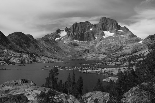
And Sarah’s attempt to evoke Ansel Adams with a black-and-white shot:
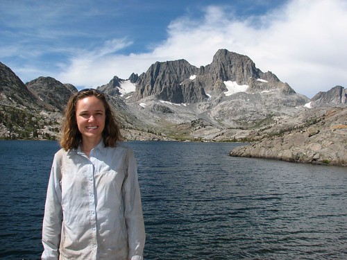
Here’s Sarah, posing by the lakeshore, now dry and cheerful again.
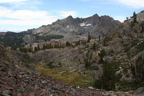
We hiked on, climbing up, up, up through some pretty scenery that nevertheless paled in comparison to the island lakes.
We passed a few relatively nondescript lakes before stopping for a while at Shadow Lake to snack.
After we climbed past more lakes to a saddle, we started heading down, down, down toward Reds Meadow and our next resupply. Somewhere along the way, the granite that we’d been hiking through changed to volcanic pumice, making for a dusty trail – easy on the feet, hard on the lungs. We found a nice campsite on flat, sandy pumice beside Minaret Creek.
On day 4, we hiked 14.2 miles, bringing our total for the trip to 55.5 miles.
The next morning, we got up and continued to hike down through forest, crossing a pretty meadow along the way.
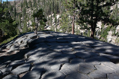
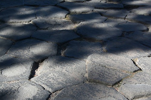
Then we entered Devil’s Postpile National Monument. Devil’s Postpile is a slight deviation from the John Muir Trail, but a worthwhile side trip since it didn’t add appreciably to the total distance. The Devil’s Postpile is the result of a mound of very slow-moving magma that cooled uniformly and therefore contracted uniformly. Contraction resulted in the magma breaking apart as it cooled into rock, and apparently it’s a law of physics that the most efficient way to break apart is at 120-degree angles. The geometric shape with 120-degree angles is the hexagon, so the magma cooled into hexagonal sections.
We first hiked up to the top of the Postpile, getting the up-close view before the broad overview.
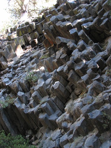
As we hiked down, we passed a wall with hexagonal pillars sticking out.
Finally, we rejoined the trail and hiked back north a short ways to see the Postpile from below.
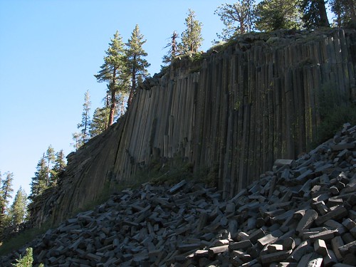
It’s pretty interesting that a national monument was created just to protect this relatively small piece of rock. On the other hand, it is a pretty darned cool piece of rock.
Anyway, that was the last of the major attractions before our next resupply, and a short hike later, we were at Reds Meadow Resort, a guest resort with cabins and horses for guided horse rides. Because it’s nearly 60 miles into the JMT and just a fraction of a mile off the trail, it’s also a very popular resupply point – we’d guess that the majority of JMT thru-hikers resupply there. Finally, it would be the last time we would see cars for over 150 miles. A road runs from the Mammoth Mountain ski resort to Reds Meadow, but the remainder of the JMT to the south is entirely roadless.
We arrived around 10:45, right between the breakfast and lunch hours at the café. We asked if we could bring our packs inside, and the lone waitress said sure, since business was slow. We couldn’t decide between breakfast and lunch, so we asked if we could order both, and after checking with the cook, the waitress said sure again. So we ordered the “packer’s special” – three pancakes that turned out to be huge, three pieces of bacon, and three eggs. And on the side, we ordered a double cheeseburger with chips.
When the food arrived, it looked so good we could photograph it, but we were too hungry to waste valuable eating time. Brian started by digging into the cheeseburger while Sarah hit the pancakes hard. Partway through, we switched. Intellectually, it seemed a little weird alternating between pancakes, cheeseburger, eggs, chips, and bacon, but our taste buds and stomachs had no complaints, and all the food was delicious. We think it would have been delicious if we hadn’t been eating oatmeal, rehydrated dinners, and trail mix for the previous four days, but of course, we couldn’t be entirely sure.
In the café, we met a guy named Isaac, who had hiked the JMT north to south with some buddies as a warm-up. Now he was returning south to north, taking lots of off-trail side trips along the way. Apparently, he lives in the Bay Area, and has hiked the JMT several times before, so this time, he decided to get off the main JMT and visit some areas near the trail that he hadn’t seen before. But off-trail hiking is much more strenuous, so he had to do a vanilla JMT thru-hike as training. We’d spent the entire summer getting in shape just to hike the JMT, and he was using the JMT as a warm-up for something more! Crazy!
Also interesting, Isaac said he only packs about 2400 calories per day of hiking, and he typically loses at least 20 pounds on a thru-hike. He was rail-thin when we met him, and he’d already been hanging out at Reds Meadow for 1.5 days, eating lots of large meals in the café. We were awfully surprised by how much weight he lost, but as we would find out by talking to other hikers, it’s not at all uncommon for JMT thru-hikers to survive on far less food than would seem ideal.
After brunch, we headed to the little store to pick up our resupply package and acquire some ice cream and beer, which Brian devoured as dessert. We started digging through our resupply, and more thru-hikers converged on the area outside the store. We met two guys who were taking their time hiking. They’d gone out to Mammoth to stay at a lodge the previous night, and they’d received a free upgrade to a suite that was, in their words, truly “awesome”. They went on and on about the Jacuzzi, the inch-thick bathrobes, and all the other features of their amazing room. They asked if we had trail names, and we said we didn’t, but one of them, who said he was keeping a trail journal, wrote down our real first names anyway. We also met a couple about our age, one of whom was “Pimo,” short for “Poetry in Motion”.
After a lot of chit-chatting, calls to our parents to let them know we’d made it through the first 60 or so miles and arrived safely at Reds Meadow, sorting of the resupply, and acquisition of a bar of soap, we were ready to hit the showers. We decided we had a bit more food than we needed, so Isaac gladly took a freeze-dried dinner and some trail mix off our hands – much better to give it to someone else who will eat it than to carry it for dozens of miles and let it go to waste.
We hadn’t planned on showering, but several people talked the showers up to us – six separate rooms, fed directly by a hot spring. The showers each had only one temperature setting – hot – but because they were arranged at increasing distances from the spring’s source, different showers had different temperatures. We decided on the third-farthest from the spring, and Sarah showered first while Brian stayed with the backpacks. Then we changed places, and Brian learned, once again, that Sarah’s tolerance for hot water is higher than his – he would jump into the water to rinse and then jump back out, seconds later, to avoid scalding himself. It wasn’t very satisfying, but it involved soap, which made it much more effective than our quick dips in cold mountain lakes and streams. Refreshed, we headed back to the trail to resume our hike.
No comments:
Post a Comment