As we drove south toward Albuquerque, we stopped in at Kasha-Katuwe Tent Rocks National Monument. It was a bit off the beaten path, but recommended as a “must” by our Lonely Planet guidebook to New Mexico, so we checked it out. Turns out that the place is almost entirely undeveloped – no visitors center, just a single trailhead on a dirt road. There are two trails, the Cave Loop Trail that starts at the trailhead and the Canyon Trail that splits off from the Cave Loop. The total was something like three miles, so we did them both.
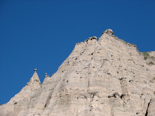
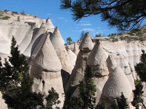
The scenery was absolutely amazing – this was our favorite hike so far. We had no idea what “tent rocks” were beforehand – turns out they’re rock formations sort of like hoodoos, but they’re conical (cone-shaped like tents – hence the name – or maybe like teepees) and oftentimes have boulders on top. From what we could figure out, the boulders are harder rock that’s more resistant to erosion, so the softer rock below eroded away but the boulder on top provided enough protection to prevent further erosion of the soft rock, so these cones of soft rock remained.
Here’s one of the first views we got as we started the hike – you can see some tent rocks along the ridgeline:
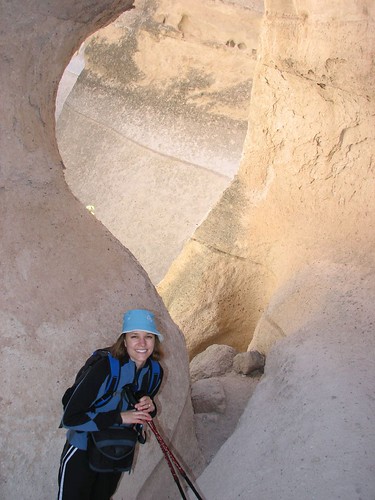
Then we went through this incredibly narrow canyon – at times, we could touch the walls on both sides:
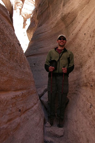
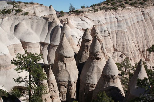
As we climbed, we were soon virtually surrounded by tent rocks:
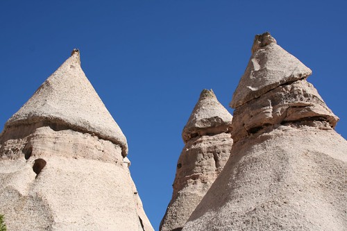
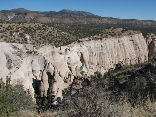
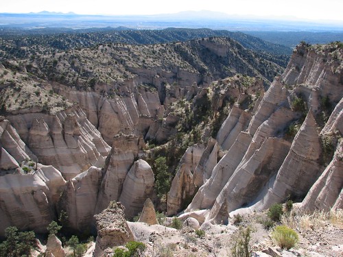
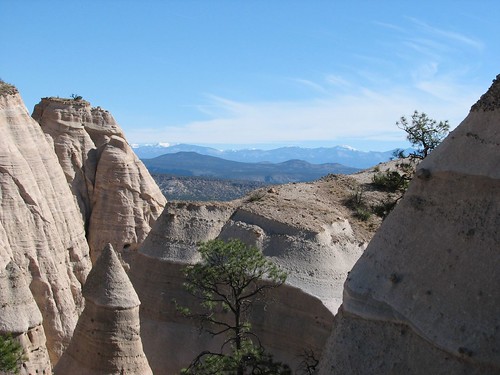
When we reached the end of the hike, we were out on a high ledge, with steep drop-offs on three sides and great views of the tent rocks:
Way off in the distance, we could see some snow-capped peaks:
It was just a fantastic hike – so much amazing scenery in just three miles!
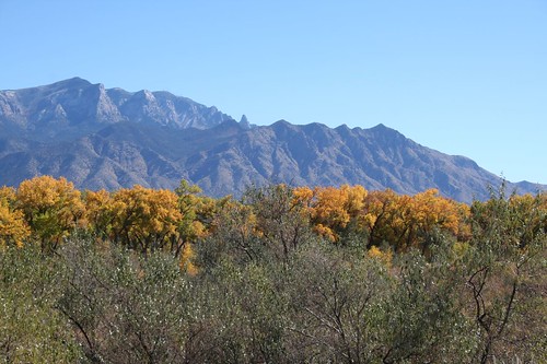
After we drove back east to I-25, it was lunchtime so we briefly visited the Coronado State Monument to look for a scenic picnic table to make our lunch. We had bought the New Mexico Culture Pass in Santa Fe, which cost $20 and got us into the museums in Santa Fe and a bunch of other museums and monuments across New Mexico, including Coronado. The monument is best-known for its kiva, but that was closed for restoration. Still, we had nice views from our lunch spot:
After that, we continued further east past the interstate because we wanted to drive up to the top of Sandia Peak, the mountain that overlooks Albuquerque. There are two approaches – from the west and from the south. Both of our guidebooks recommended the route from the south, but when we got directions from Streets & Trips on our laptop, we found out that the route from the west was 10 miles shorter. So we decided to take that one.
Bad idea! Very soon, the road changed from pavement to dirt, with many potholes and large rocks to dodge. It was no more than 10 or 15 miles of this, but because the road was so bad, it took us well over an hour of extremely attentive driving to make it to the top while preserving all of our tires. I guess we should have trusted the guidebooks!
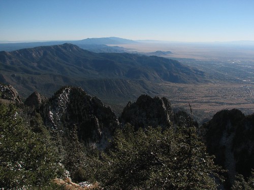
From the top, we got some good views of the nearby mountains:
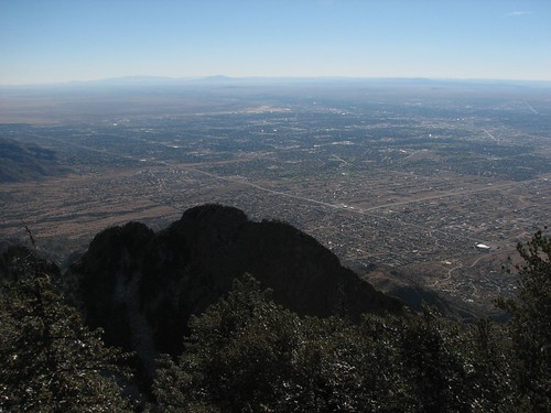
And of the city of Albuquerque:
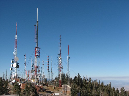
Also at the top of Sandia Crest is what they call a “steel forest” – a set of broadcast towers placed atop the mountain for maximal range:
There was no way we were getting back on that rocky road, so we drove south to I-40 and then into Albuquerque from there. We blew the fuse for our cigarette lighter on the way down, so we stopped in Albuquerque at an auto parts store to buy some replacement fuses, and then we went to Sadie’s for some authentic New Mexico food. The place is huge – they must have 100s of tables. We ordered these delicious green chile chicken enchiladas that came with chips and some really spicy salsa, sopapillas, beans, and potatoes. According to the menu, it was a dinner for one, but we split it and couldn’t have eaten another bite afterwards. The service there is great, too – we were drinking a lot of water to cut the spice, and our water glasses were refilled as soon as we emptied them! Sadie’s is a great place – we’d highly recommend it. Apparently it’s an Albuquerque institution, too – it’s been around for decades and moved several times into larger digs as its popularity grew quickly.
We finished up dinner around dusk, and then drove the 150 miles or so to the Valley of Fire Recreation Area. Like Orilla Verde, it’s managed by the BLM, and also like Orilla Verde, we found that it has showers, and they weren’t even coin-operated! We would definitely be taking showers the next morning!
2 comments:
Hi Brian, Amazing place and very good photos too !!
Thanks! :)
Post a Comment