After our walk, we packed up and continued on our way to Black Canyon of the Gunnison National Park. Again, the scenery was amazing and we made many stops along the way to take photos.
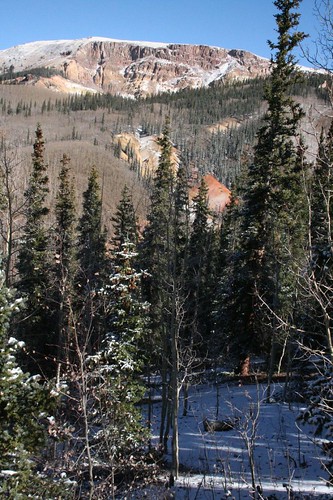
Here is the Rio Grande Pyramid with Bear Lakes in the front:
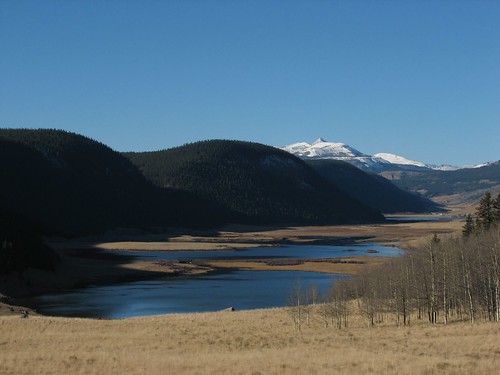
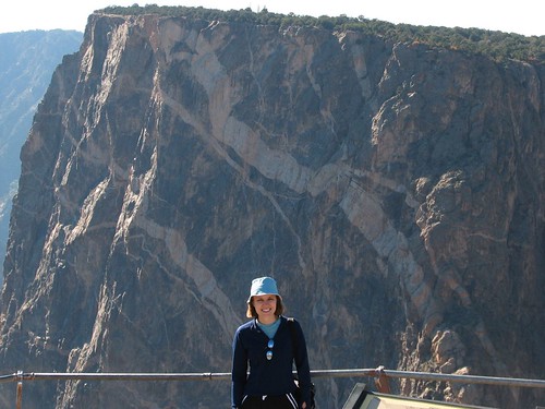
View from Windy Point Overlook:
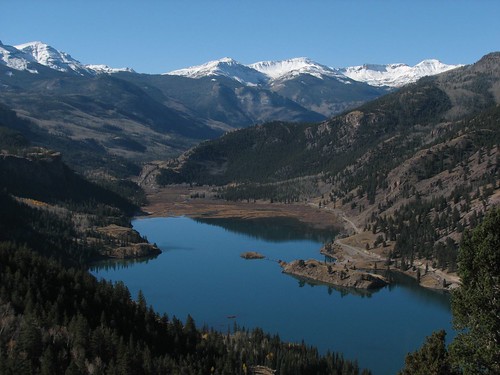
Looking down on Lake Cristobal:
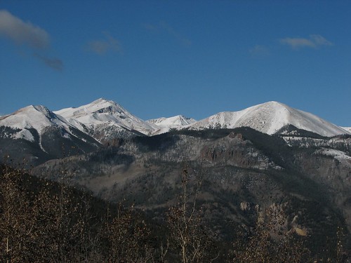
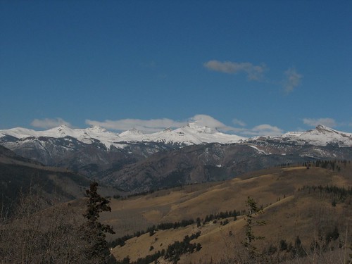
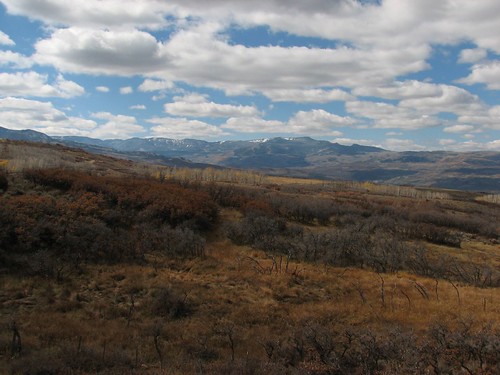
We took a gravel road called the Blue Mesa Cutoff to save a few miles and were rewarded with more astounding scenery. We met only a couple other vehicles on this road. There were a number of huge new log cabins along the way. The road is not maintained in the winter, so these must be mostly vacation homes. We also saw a fox cross the road and bound into the distance. Here are the views from the area.
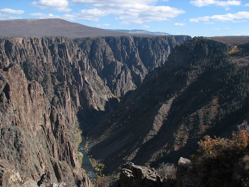
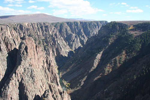
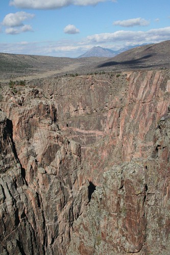
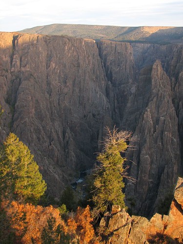
Around lunchtime, we arrived at Black Canyon of the Gunnison. It is called the Black Canyon because the walls are so steep that sunlight barely penetrates the canyon. The canyon walls are incredibly steep and the canyon floor narrow. We started at the visitor’s center watching a video on the history of the canyon, including some daring and entertaining early attempts to survey the canyon for a railroad and later an irrigation tunnel. The first pair to successfully navigate the canyon did so on what was essentially an air mattress. Crazy!
We spent the rest of the afternoon taking short walks to the various overlooks along the south rim of the canyon. Photos will never do justice to canyon, but here are a few to give you a feel for the depth of the canyon.
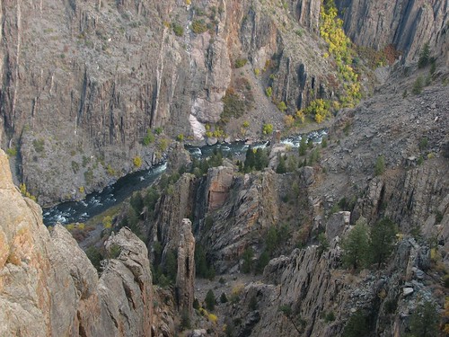
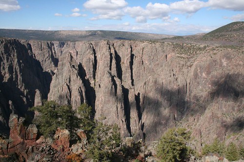

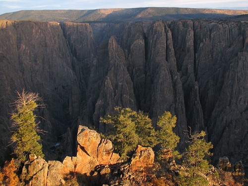
This one is of the painted wall. The lighter sections of rock are called pegmatite dikes and were formed when magma was forced up into fissures in the rock. The pegmatite is stronger than the surrounding rock and is eroding more slowly than the other sections of rock.
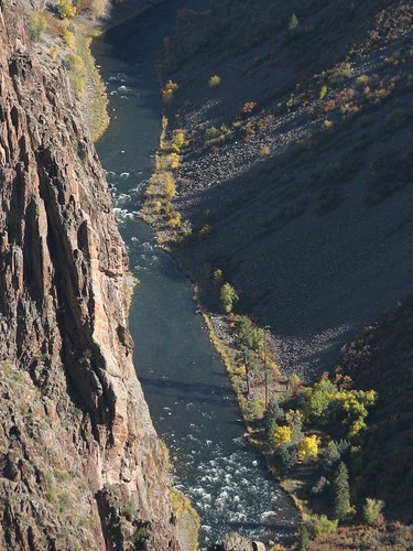
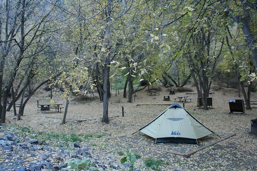
We decided to camp at the bottom of the canyon at the East Portal Campground. The road down is a narrow, two-lane road with a 16% grade and hairpin turns. Signs warn you to gear down and they mean it – all the way down to first gear! It made for an interesting drive and at the bottom we were rewarded with a peaceful campground all to ourselves in a small grove of trees by the river.
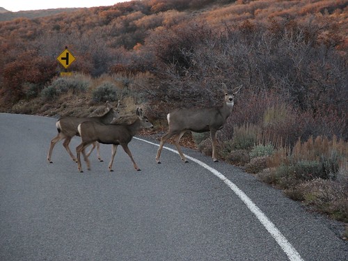
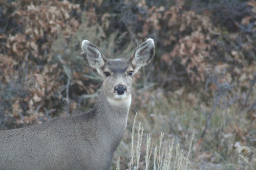
Though slightly warmer than previous nights, we were in bed early again and up early for another day’s adventures. We made it back up the crazy road to the canyon rim and were met by a half dozen or so mule deer.
We made one final stop at the visitor’s center to capture the canyon in the morning light before heading out.
Now on to the San Juan Scenic Skyway and Telluride…
No comments:
Post a Comment