In the road atlas, Brian found a national forest campground called Angel Creek that was just a few miles off I-70 and seemed like a good place to stop for the night. After a few hours of driving, we got off the highway and followed Streets & Trips’ recommended route to the campground. The forest road that the software said to follow for five miles turned out to be just a tire track through grazing land. The route was level, though, and easily passable by Caroline, so we kept going. We got to a closed gate, and in hindsight, that’s where we should have turned around. But we didn’t. We opened the gate, which we assumed was there just to fence off grazing land, rather than to demarcate private property, and drove on through. We went through several more gates, and then the road started getting worse. The tire tracks got deeper, to the point where the middle of the road was a foot to two feet above the bottoms of the ruts. Caroline doesn’t have that kind of ground clearance, but still we pressed onward, driving with Caroline’s left wheels in the middle of the road and her right wheels on the “shoulder,” if you could call it that, on the right of the road, so she was straddling the right tire track.
Of course, a track like this doesn’t really have a “shoulder,” so really, Caroline’s right side was off in the weeds. The plants in the desert of Colorado are quite a bit hardier than those in, say, the forests in the Northwest, and every so often, we’d hear this piercing screech as some spiny or thorny plant raked Caroline’s right side.
After driving about four miles, we started to lose track of the road. We had driven into a more fertile area, and our track just seemed to dead-end in a grassy field. By now, the sun was long past set, and we couldn’t see anything beyond our headlight beams, but after some searching, we found a faint track through the field. We followed that and quickly found the reason that the vegetation had changed: a creek bed that ran straight across the road. The good news: It was dry. The bad news: It looked like about a two-foot sheer drop-off to get down into the creek bed, and we couldn’t see the opposite side in the dark.
At this point, we were only a mile away from the end of this crazy road, so we really wanted to get past this creek bed. Brian got out of the car with his headlamp and scouted for a route. As it turned out, the drop-off into the creek bed wasn’t as severe as it looked on our initial approach. And after some careful navigation through large rocks at the bottom of the creek bed, it looked like the climb out on the opposite side wasn’t too bad. So Brian took the wheel and managed to successfully navigate the creek bed without bottoming out. A few more scrapes of the right side of the car and one scrape of Caroline’s undercarriage, and we made it to the end of the track. Our directions told us to turn right onto another forest road, which didn’t look appreciably different in Streets & Trips but turned out to be a paved highway! After the first five miles took us over an hour, the last two to the campground took less than five minutes.
Surveying the damage proved difficult because Caroline was so covered in dust. She had lots of lines on her right side, but many of those were just lines through the dust, while others were scratches through the clearcoat. After our next carwash, we would do another survey and discover that Caroline had quite a few new scratches. Her abusive parents force her to lead a tough life. At least her brand-new driver’s door came out unscathed.
After a pleasant night, we headed out the next morning. The route back to the interstate took us further east and was entirely on paved roads – we definitely should have taken that route into the campground. It would have been five miles longer, at least half an hour faster, and way less painful for Caroline.
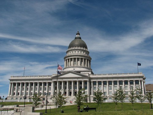
In any case, we continued east to Salt Lake City, where we’d gotten a deal for another three-night hotel stay in Draper, Utah, a little ways south of Salt Lake. We figured we’d enjoy being indoors for a few more days, catch up further on our blog, run errands, etc. On Friday, we visited the SLC farmers market and then headed to a visitor information center, which happened to be right across from the capitol building.
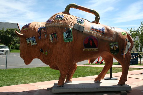
On the front steps of the visitor information building was a bison with cartoons of various Utah sights plastered all over it and a bizarre handle on top.
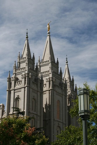
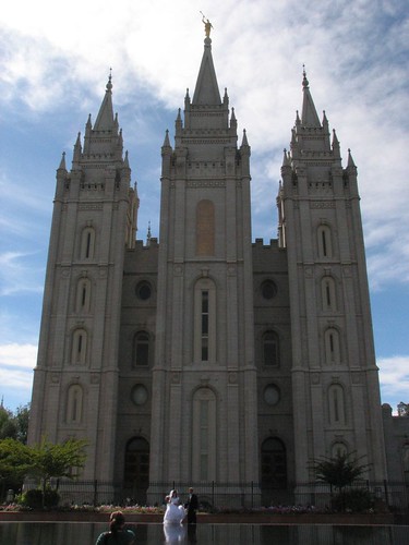
After that, we headed to Temple Square to take in the sights there. The Mormon Temple was very photogenic, with the gold statue of the angel Moroni on top.

We went into the Mormon Tabernacle, where the famous choir performs every Sunday. The organ, with its 11,623 pipes, was impressive.

While we were in the tabernacle, they did an acoustics demonstration. Even though the building was huge, we could clearly hear a person speaking in a normal voice. Amazing!
Our hotel was the Ramada Limited, which turned out to be an older hotel with fantastic amenities: free wireless internet, a refrigerator and microwave in our room, HBO, and a continental breakfast with Belgian waffles, bagels, yogurt, fruit, and lots more. But the best feature for Sarah was the bed – weeks later, she was still talking about how comfortable the bed was. It was a great place to stay for three nights.
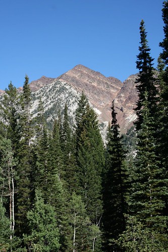
Draper turned out to be a great base for outdoor recreation, since a lot of the good hiking is to the southeast of Salt Lake. On Sunday, we headed up the Little Cottonwood Canyon Road to hike up to the Red Pine Lakes. It was quite a pretty hike, and just a short drive from the city.
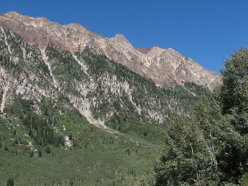
After we’d ascended a ways, we took a photo looking back down the canyon.

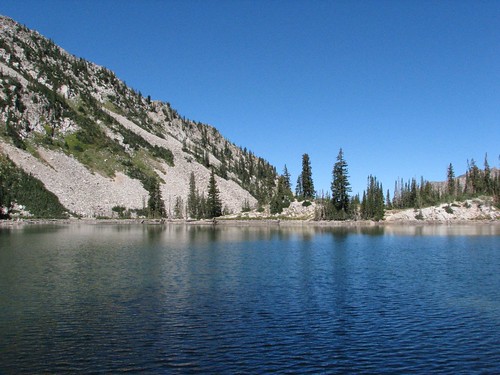
Lower Red Pine Lake provided a nice stopping point for a snack.
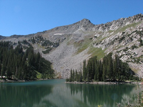

The trail continued past the lake but quickly became steep and then hard-to-follow as it led over a big boulder field to Upper Red Pine Lake. We got good views looking back at the lower lake.
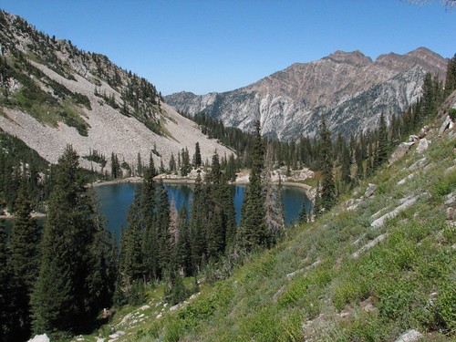
The surrounding reddish peaks completed the landscape.
After the hike, we went to a discount movie theater in Sandy and watched Iron Man, which Brian was excited to see. Sarah was indifferent, but she admitted afterwards that she’d really liked it. We agreed that it was far better than the Indiana Jones movie.
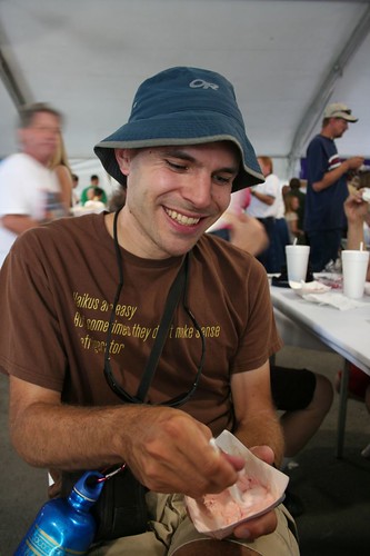
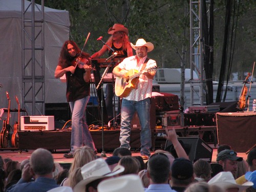
The next day, we went to the Utah State Fair, which is surprisingly right by downtown Salt Lake City. We decided to go because Chris Cagle, a popular country singer was performing in the evening, but then we found out that the fair also had all-you-can-eat ice cream! We arrived at the ice-cream tent around 3:30, and it was already jam-packed with people – apparently, the all-you-can-eat ice cream isn’t a secret. It’s sponsored by the dairy farmers of Utah, and half a dozen or more different ice cream makers had 5-10 different varieties each that we could sample. So it was nearly impossible to try them all, but Brian, an ice cream aficionado, did his best – he ate 18 scoops! Here he is, far along in gorging himself but still smiling:
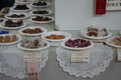
The competitions in state fairs are always fun – you can win a blue ribbon in everything from hog raising to needlework to pickle canning. The homemade candies looked especially enticing, but sampling was prohibited.
Passing time until the Chris Cagle show and letting our ice cream settle, we also checked out the photography competition and watched a cooking exhibition where we learned how to make a tasty breakfast from Malt-o-Meal.
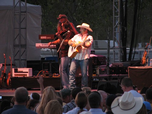
Chris Cagle put on an enjoyable show. He actually got choked up during one of his songs, stopped the music, and explained that he was thinking about his dog, which he really missed after nearly a month on the road. Then he started singing again. He seemed like a very genuine guy, and the crowd loved him.
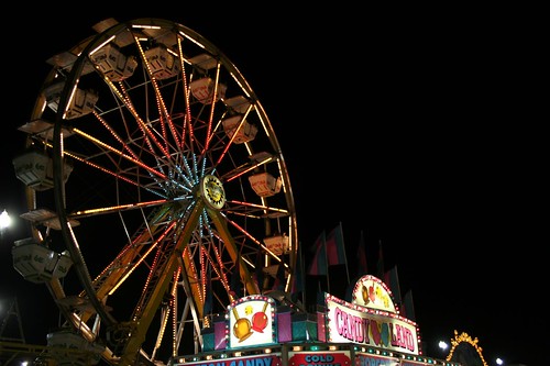
After the concert, we walked around the rides and ate some fried dough, a state fair staple, now that five hours had passed since our colossal ice cream binge.


The next morning, we left Salt Lake City and headed east to Dinosaur National Monument.
1 comment:
Wow - what an adventure.
I love my Garmin - but I too question some of the "roads" they map me through.
Enjoy!
Post a Comment