On Tuesday, we camped at Daroga State Park, which was described by a guidebook as being more scenic and quieter than Lake Chelan State Park. We chose to stay in one of the tent sites, a half-mile walk from the parking lot. The guidebook turned out to be right – the tent sites were gorgeously situated on an island in the Columbia River, and on this night, we had the entire island to ourselves! The only problem was the wind – our tent almost got blown away. But we had learned from our Boulder, Utah, experience, and we not only staked the tent down but placed big rocks on top of the stakes to better secure them. At one point, a gust of wind inverted one of the poles so that it was bowed into the tent, but when the gust died down, the pole popped right back out. What a great tent we have.
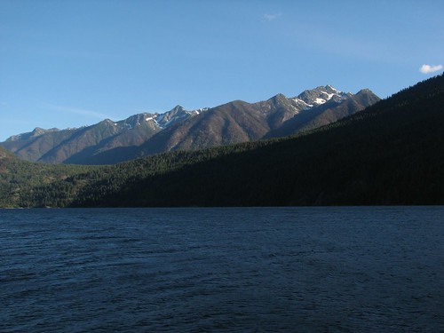
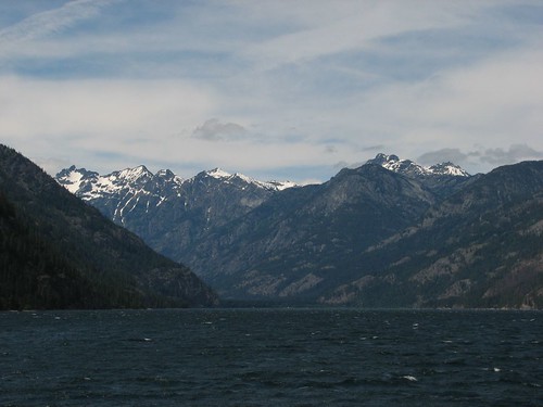
The next morning, we drove to Fields Point Landing, where we would get on the Lady of the Lake II, a passenger ferry for a ride partway up Lake Chelan. The ferry would take us to Prince Creek, which is where the 18-mile Chelan Lakeshore Trail begins. It was a nice warm day, perfect for a ferry ride, and the views of the North Cascades mountains at the head of the lake piqued our excitement for our trip.
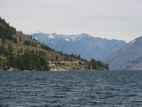
Lake Chelan is most notable for its depth – over 1400 feet! That makes it the third-deepest lake in the United States, behind only Crater Lake and Lake Tahoe. But America’s lakes pale in comparison to a lake called Baikal in Siberia, which is over a mile deep!
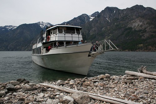
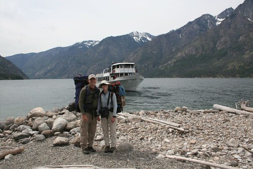
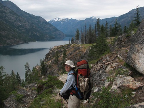
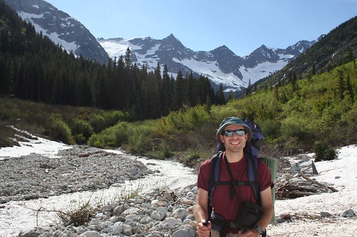
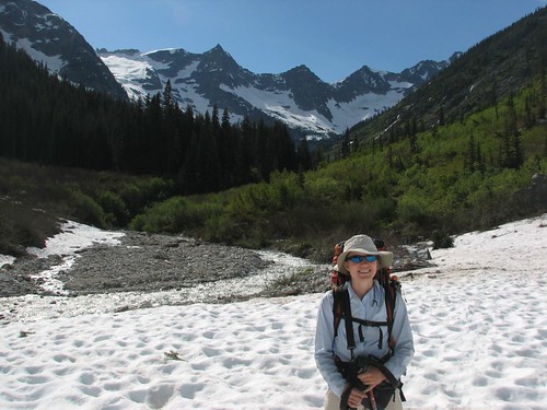
Before too long, we had arrived at Prince Creek. The boat dropped us off along with two other guys who were also hiking the Lakeshore Trail. We watched the boat leave – our last brush with civilization for a while – to continue on its route up the lake to Stehekin, the remote village at the lake’s northern end. Then one of the other guys offered to take our picture.
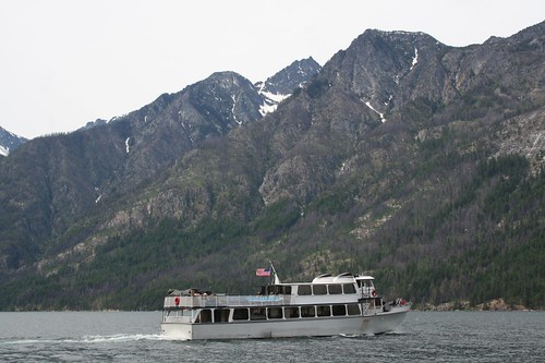
Then we started the hike. It was a pretty spectacular walk, following the east side of Lake Chelan the entire way. The trail had some elevation changes, bringing us right down to the lakeshore and then up to gorgeous overlooks. A little after noon, we saw the Lady Express, a high-speed catamaran, making its return trip back to Chelan.
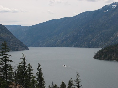
The views continued to impress, and the sky got clearer as the day progressed.
After about 10 miles of hiking, we decided to call it quits for the day, and we stopped at a campground called Moore Point. Some loud boaters with coolers of beer had unfortunately taken over one side of the campground and were subjecting us to an unrequested concert of “Free Fallin’” at the top of their lungs. That’s the problem with lakeside camping – it’s not just you and other backpackers, all of whom worked hard to get there and will call it a night early and get up early. But we managed to find a little site tucked into a little treed area right on the lakeshore. The wind was strong enough to drown out the boaters, and the site was sheltered enough that our tent was in no danger. Perfect!
After we set up camp, we started to make dinner. We’re working on building up our ability to carry heavy packs, in preparation for longer backpacking trips later in the summer, so we didn’t skimp on provisions. We even brought wine!
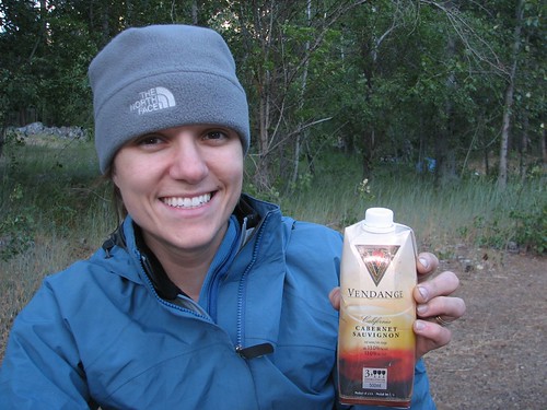
Sarah tended to dinner…
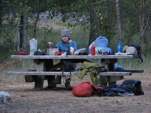
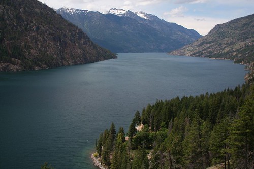
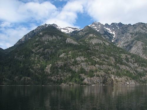
while Brian took some photos of the beautiful scenery across the lake from camp.
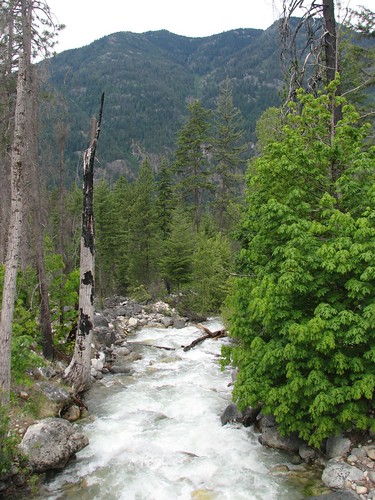
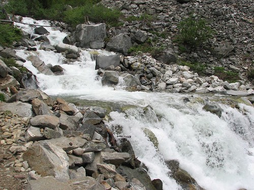
The next day, we resumed our hike up the lakeshore. We crossed some pretty creeks that were running hard with the snowmelt.
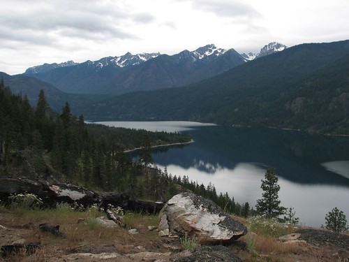
And, of course, we got still more beautiful views.
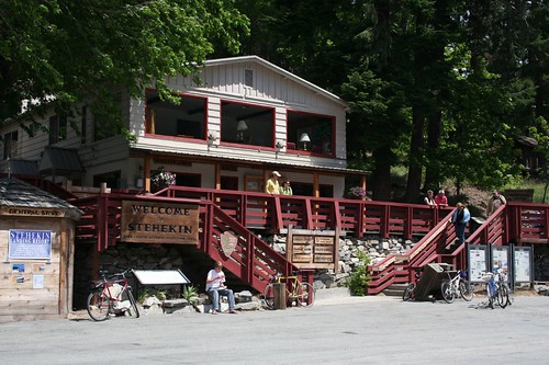
Around noon, we arrived at Stehekin. Stehekin is a remarkable little town, accessible by boat or floatplane. It does have a few miles of roads, and some residents have vehicles that were barged up the lake years ago. But the roads don’t connect up with anything – the main road ends pretty much at the North Cascades National Park boundary, ten miles from town.
Our first stop in Stehekin was the national park ranger station to plan the rest of our trip. As we expected, there was still plenty of snow even at relatively low elevations of 3500 or 4000 feet, due to the heavy winter snowfall. But it seemed like there was still plenty of hikeable terrain to keep us busy for three more days, so we picked out some backcountry campsites and got a permit.
After that, we got ice cream and beer at the town’s general store – what a treat! We made lunch, too, and then realized to our horror that Sarah’s Therm-a-rest sleeping mat was missing! It either got stolen when we left her pack outside the ranger station or fell off while we were hiking. Both possibilities seemed unlikely, but nevertheless, the Therm-a-rest was gone. We briefly debated hiking back down the lake to see if it was lying beside the trail, but decided instead to proceed with our trip. Sleeping on the hard ground wouldn’t be comfortable, but it wasn’t a deal-breaker.
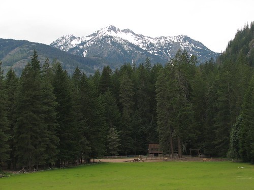
So we boarded the 2:00 shuttle bus. Actually an old, out-of-commission school bus, the shuttle takes an hour to run the length of the 10-mile road, including allowing generous time to stop at the Stehekin Pastry Company, where we got a delicious piece of strawberry-rhubarb coffee cake. The bus also made a brief stop at a guest ranch with gorgeous mountain views.
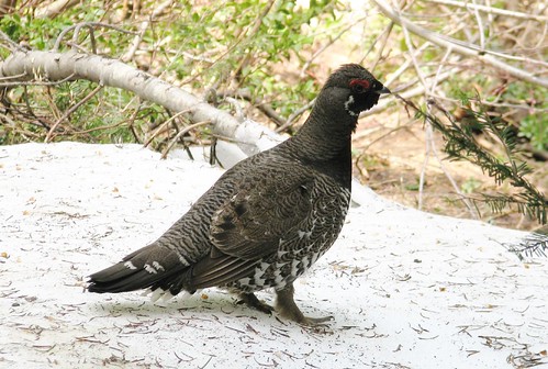
At 3:00, we got off the bus and headed out on the next phase of our hike. Along the way, we solved a mystery that had faced us on previous backpacking trips. We’d heard this peculiar whoomping sound before, and had no idea what kind of animal made it. Well, on this hike, we finally saw the culprit as it was making the noise – a large bird. We found the bird later in a guidebook – it was a blue grouse.
We only hiked about four miles up to a campground called Bridge Creek, where we would spend the night. We saw lots of bear signs along the way, but never encountered a bear. We did have a visitor, though – a curious deer.
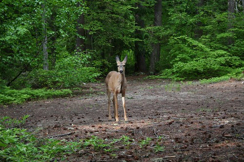
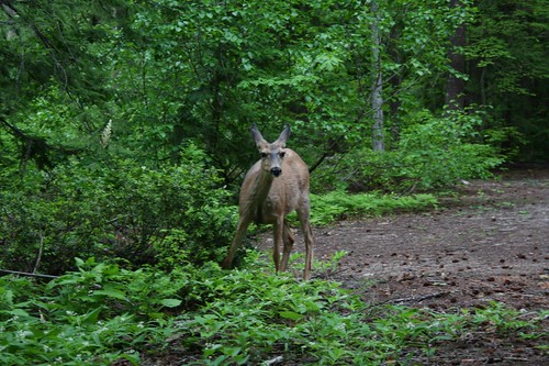
It came closer and closer before burying its head in some apparently tasty vegetation that fronted our campsite.
The site turned out to be pretty mosquito-ridden, but in this area, we were allowed to gather downed, dead wood to make a campfire, so we quickly got a fire going that did a pretty good job of keeping the bugs at bay.
After it got dark, Brian went to get a pot of water to put out the campfire, and his headlamp fell out of his pocket and into the creek! As we’d learned already, what are called “creeks” are really rivers at this time of year, and the spot where Brian dipped his pot into the water was running especially hard. The headlamp was probably well on its way downriver before he even knew it was gone. What an unlucky day – a Therm-a-rest and a headlamp lost!
The next day, we planned to hike the North Fork trail. The confluence of the North Fork and Bridge Creek was especially scenic.
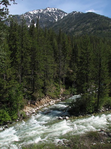

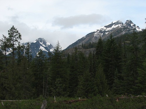
We hiked up the North Fork trail, with occasional great views of rocky peaks.
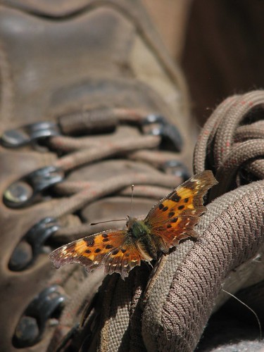
At one rest break, a butterfly chose to land on Sarah’s boot and pose for a picture.
We also saw another grouse-like bird.
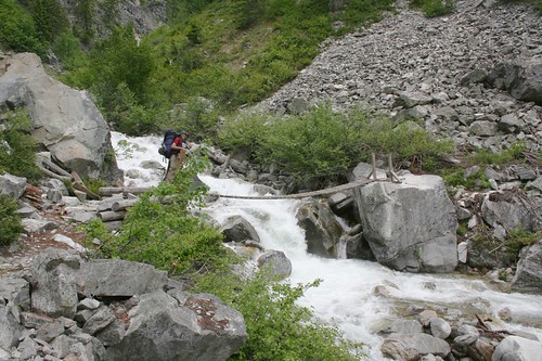
Grizzly Creek was an especially hard-flowing river that dumped into the North Fork, but the ranger had explained to us how to cross safely. We were supposed to look for a logjam and walk across it. We found the logjam, and it was sketchy-looking enough that we unbuckled our packs (so our packs wouldn’t sink us if we fell into the river). We crossed it pretty easily, though, and continued up the trail.
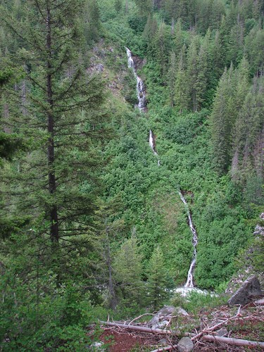
Beyond Grizzly Creek, the trail hadn’t had any maintenance yet this year, so we had to struggle over or under a few down trees. But as we gained elevation, we saw one waterfall after another on the slopes above, and the struggle was worthwhile.
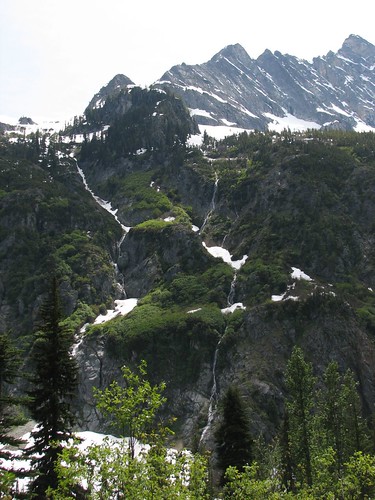
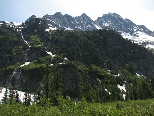
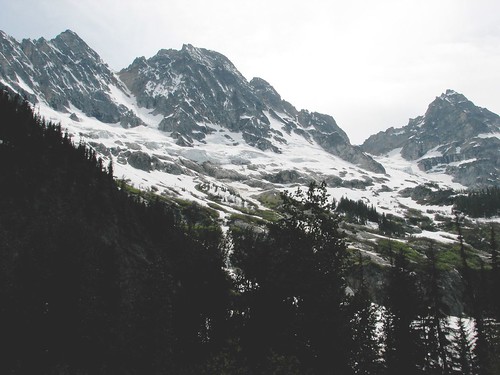
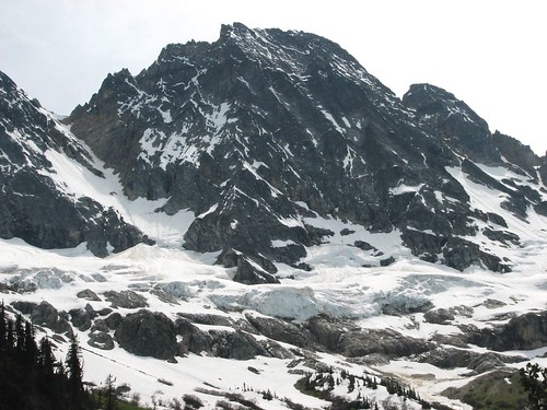
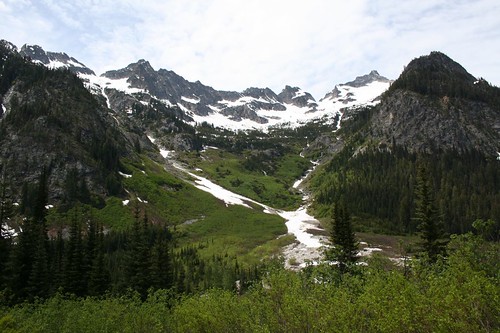
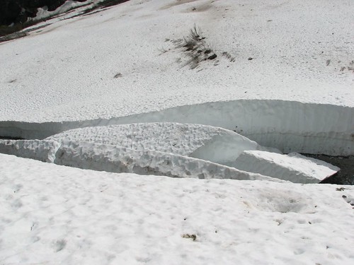
Finally, we arrived at the North Fork Meadows. Around 3800’ of elevation, the meadow was a huge, open, snow-covered area that afforded fantastic 360-degree views. The trail went on a ways after the meadow, but we decided to end our hike right here, and we sat down for an hour and enjoyed the views as we read the books we had brought along.
As we got up to go, we took each other’s pictures.
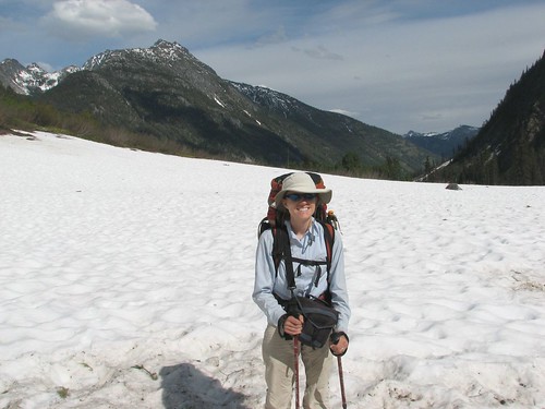
Walking across the snowfield, we decided to give the river a wide birth, lest we fall in.
That night, we camped at Walker Park campground. We had a great view, and the bugs weren’t so bad, so we didn’t bother with a fire.
Saturday was the only day that had rain in the forecast, and sure enough, we awoke to gray skies. Our plan for the day was to hike back down the trail a little ways to the confluence of the North Fork and Bridge Creek, and then follow the Pacific Crest Trail a ways along Bridge Creek, before turning back around. During our visit to the Stehekin ranger station, we learned that there are several great multi-day loop trails in the area, but unfortunately, all of them were still pretty snowbound in mid-June. So our backpacking trip amounted to a few out-and-back hikes. Not ideal, but so far it was working out just fine.
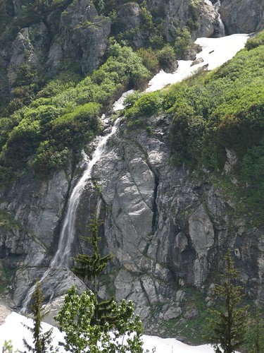
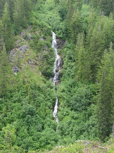
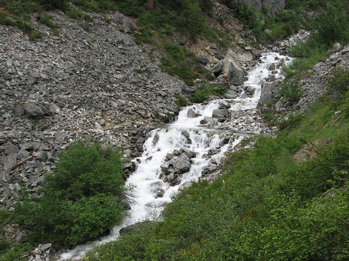
Shortly after turning onto the PCT, we saw an amazing waterfall across Bridge Creek.
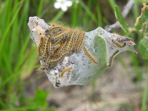
A trailside cocoon was positively teeming with caterpillars.
Maple Creek was the most inappropriately-named “creek” yet – it was a raging river today.
Apparently a more permanent bridge had been washed out a few years back, and the replacement bridge looked a bit precarious. Brian bravely crossed while Sarah took his picture.
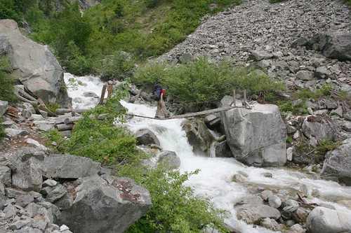
A split-second after Sarah took the second picture, Brian had a major wobble and had to catch the steel cables on either side of the bridge to brace himself. Whew – that set his heart racing!
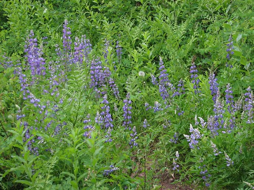
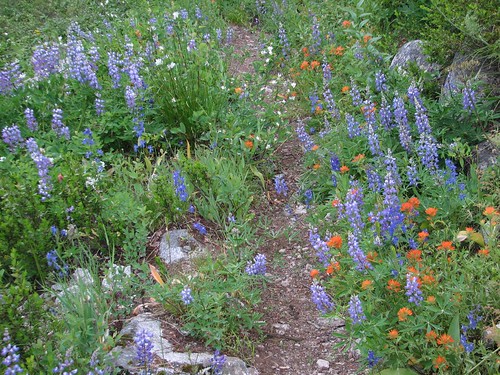
After Maple Creek, the trail was pretty overgrown with some downed trees blocking our path – apparently, the trail maintenance crews hadn’t made it beyond Maple Creek yet. The wildflowers were quite pretty, though.
We hiked almost out to Fireweed campground, but we were stopped when the trail crossed Bridge Creek which, ironically, lacked a bridge and was totally unfordable. Many of the trail bridges are removed every winter to avoid damage and then put back in place in the spring, and this one hadn’t yet been replaced. It was just as well – as we sat at the side of Bridge Creek eating a snack, it started raining. Time to head back.
We got another picture of Maple Creek on the way back, this time from the opposite side.
And one more waterfall shot.
That night, we found a lovely campsite on an outcrop along the North Fork Bridge Creek. The river flowing around the outcrop chilled the site, though, so we decided to make another campfire. We chatted briefly with another couple who was staying in the campground, and they wished us happy solstice. Was it really the beginning of summer already? Where has the time gone?
The next day, we hiked out from the North Fork campground. We moved pretty quickly, since we had to hike seven miles to make it back to the shuttle stop for the 12:15 shuttle. It was a pretty day, though – no threat of rain.
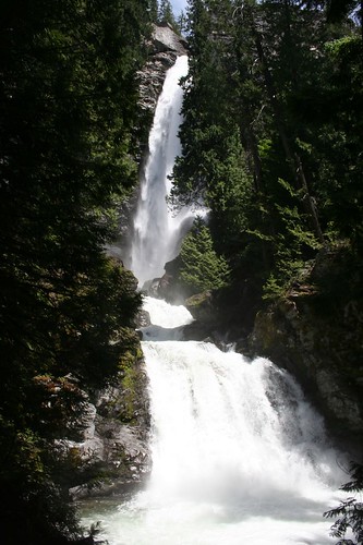
On the way back to Stehekin, the shuttle stopped at Rainbow Falls, a beautiful waterfall a short ways off the road.
We were in Stehekin in plenty of time for the Lady of the Lake’s return trip to Chelan, so we stopped in at the ranger station. Lo and behold, Sarah’s Therm-a-rest had been found! Apparently, a man stopped into the ranger station one morning, dropped off the Therm-a-rest, said, “Need coffee,” and left. Sarah was quite happy to have it back. Sleeping on the ground hadn’t been so bad – she was able to cushion the ground a little bit with spare clothing – but the inflatable mat is still highly preferable.
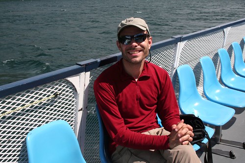
We celebrated the reunion with the Therm-a-rest with another round of ice cream and took a photo looking back before boarding the ferry.
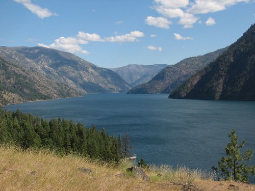
We’d hiked 53 miles in five days – or really four full days, since we started and ended at noon. Not too bad. Brian was happy as he rode back on the ferry.
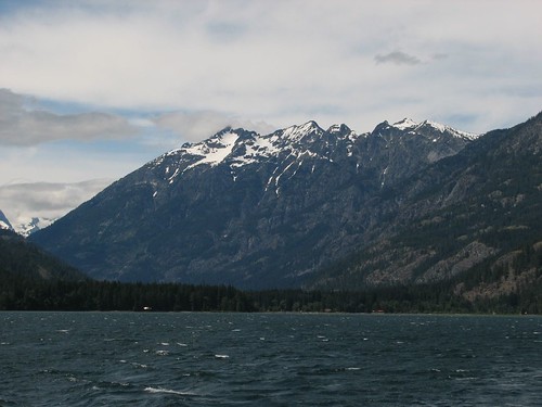
It was another pretty day with gorgeous mountain views back up the lake.
After we got back to the dock, we set out for I-90. The highway route went quite a ways southwest – out of the way, in other words, since we needed to go east. So Brian found an alternate route along local roads, but it turned out to be closed. At this point, maybe we should have taken the highway route, but instead, Brian found an alternate to the alternate route. This one, according to our mapping software, was 20 miles shorter and two minutes faster than the highway route, so we tried it. Very quickly, it turned into a gravel road, and it only got worse from there. Twice, we had to turn onto roads that had signs saying, “PRIVATE ROAD” and “DEAD END,” and the road got progressively more potholed as we climbed and climbed. But after six or seven miles of this, we saw a sign for traffic in the opposite direction that said, “NO THRU TRAFFIC,” which led us to believe that we were nearing a major road. When we turned off the potholed road, though, we were then driving on a sand surface on what seemed like someone’s farm. Another few miles of that, though, and we finally reached a paved road. Brian’s special talent is finding questionable shortcuts. At least this one took about the predicted time – 55 minutes or so – and really did save us 20 miles.
We eventually made it to I-90, and some more driving got us to Sun Lakes State Park, where we decided to stay for the night. We’d had a lovely hike along Lake Chelan and in the North Cascades, but now it was time to head toward Glacier to meet Brian’s parents!
1 comment:
Great Trip. Glad you got the mat back!
Post a Comment